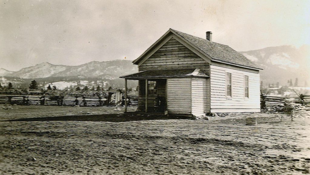
Pine Creek, circa 1914. It sholuld be noted that John Spalding’s original homestead was on the north side of Pine Creek. Courtesy of Wyn Wachhorst
From time to time, I am asked about the spelling of Spaulding Tract, as the Spalding name does not contain a “u.” This no doubt is an issue of property title. There were two separate Spalding subdivisions. First one done in 1914, and the second the Spaulding Tract we know today was subdivided in 1924. A portion of the two subdivisions are identical, hence the need for clarification.
Yesterday, I made reference to the town of Richmond where the local Masonic lodge was organized. After all, for many people they are just aware of a road and school of the same name.
Richmond came into prominence with gold being discovered along the base of Diamond Mountain. By 1859, a nucelus of a town was in earnest with a hotel as well as houses built. The following year the region’s first newspaper, the Richmond Times, made its debut. In 1861, the townsite was surveyed and plotted, a first in the Honey Lake Valley. In 1862, things were rather bleak and the town nearly abandoned. Years later, E.R. Dodge wrote, “Richmond had gone up like a rocket and came down like a stick and Susanville had been left to glory over her rival.”
In a 1878 traveler on his way to visit Lassen’s Monument, described what was left of the abandoned town: “This was formerly a populous town with its stores, saloons and busy life, now nothing is left but a dilapidated hotel to mark the spot; and this with its windows gone, its sides warped and uncouth, is fast giving way to time’s relentless hand. A schoolhouse has been erected since the demise of the town, and Mr. Bantley and family are now the only inhabitants of this once busy place.”
On a final note, the abandoned hotel was converted into barn and on March 24, 1908, it fell down during a windstorm.
On March 21, 1861, the local Masonic Lodge was organized. When this event occured it was not in Susanville, as many would presume, but in the town of Richmond, a few miles to the south. The charter was granted in 1862 and the lodge placed into formal operation on June 24, 1862. In October of the same year the lodge relocated to Susanville, where it still is in existence—the area’s old fraternal organization.
Some may recall an article I wrote about Meet the Masons back in September 2017. There is a collection of about 35 photographs of individual Masons taken in the early 1900s. It is an interesting study. I just need to prod a certain some one to provide the scans. Stay tuned.
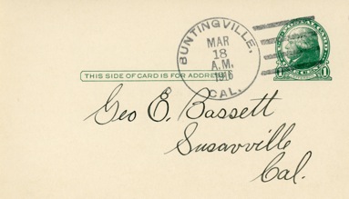
The Buntingville Post Office operated from 1883 to 1920
Today, Buntingville, a few miles south of Janesville, is just a mere wide spot in the road. Yet, back in the day it was strategically located at the intersection of the Alturas and Reno Stage Road. Today, it is part of the focal point of the cut-off of Highway 395 from Buntingville to Standish, i.e. County A-3, for those traveling north or vice versa.
In the early 1870s, Alexander J. Bunting (1836-1903) located there and operated a stage station to accommodate travelers. Bunting only had a squatters claim to the land that he occupied. In 1883, Bunting moved to Lake County, Oregon, where he spent the remainder of his life. In 1878, Edward A.Weed, editor of the Lassen Advocate, while visiting Buntingville, humorously suggested that the name be changed to Catville, “There being more cats and kittens to the square rod than any other place we visited.” In the late 1870s and early 1880s Buntingville flourished, and gave serious competition to its rival Janesville. Serious debate was held as to where to build a new flour mill for the region—Buntingville or Janesville? In 1882, Janesville became the victor. While Buntingville lost out on the flourmill proposal, it continued to thrive for some time. In 1900, the small community could boast of its own newspaper, the Buntingville Breeze. The paper was short-lived, for after two months, its editor and publisher, Mike Phillips, who also operated the town’s general store, moved his enterprises to Standish.
Buntingville’s claim to fame, that it was the headquarters for the Honey Lake Valley’s first telephone company. On July 10, 1911, the Honey Lake Valley Mutual Telephone Association incorporated as a co-operative. In 1924, the group had over 200 subscribers from Standish, Janesville, Milford, and Richmond. Plagued with financial problems, it was taken over by the Lassen Telephone Company on July 21, 1924.
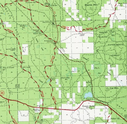
While the proposed Lassen Park/Western Pacific Railroad did not pan out, the Western Pacific did not abandon Halls Flat. In 1931, when the Western Pacific constructed its Highline route between Keddie, Plumas County to Bieber, Lassen County, they constructed a depot at Halls Flat. This is rather peculiar since not a single person resided for miles in the vicinity of Halls Flat. Little did any one know at the time, that this would suddenly change in a few years and then for the next fifteen years it would be a hub of activity.
The next installment is that of the Halls Flat CCC camp that operated from 1933 to 1942.
The Lassen County Free Library was established in 1915, through the efforts of Susanville’s Monticola Club, with Charlotte C. Cahlan, one of the leading figures.
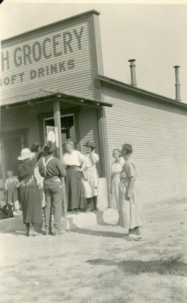
In 1917, Lenala A. Martin was hired as the county librarian a position she would hold for forty years! Under her guidance by the early 1920s she had an ambitious campaign to establish branch libraries in every known outpost in Lassen County. During the summer months, even the logging camps had library branch. Where ever a library branch was established, a distinctive metal sign with an orange background with white lettering was placed on the outside entrance. She even made sure that books were available at the county jail for those incarcerated.
In future we will explore the many facets of the library over the years, until its demise by the County of Lassen, who deemed it not worthy.
Great Northern’s Tracklayer entering Big Valley. Courtesy of Orville Watkins
In 1893, The Great Northern Railroad reached Seattle, Washington, from its origins in Minnesota. Its founder, James J. Hill, known as the “Empire Builder” wanted more. He wanted to extend his line south to tap into the lucrative California market. During the early 1900s over a half dozen railroad surveys were made in the Lassen-Modoc region. Speculation was rampant. In 1909, it was rumored that the Great Northern would purchase the region’s NCO Railroad which would provide Hill a link into California. It never materialized, and Hill retired from the railroad in 1912, and passed away in 1917.
In the late 1920s, Hill’s dream would become a reality with the construction of the Inside Gateway, where a 200 mile railroad construction project would connect the Great Northern and Western Pacific Railroads. The Interstate Commerce Commission approved the project in 1929.The Great Northern would build an 88 mile rail line from Klamath Falls, Oregon to Bieber where it would connect with the Western Pacific, as they would extend a branch line from Keddie to Bieber.
Recently, a subscriber sent me a link to a You Tube video with various historic film clips of railroad logging. For those so inclined you can watch it here. However, it should be duly noted for the record, the clip of the cookhouse scene of Fruit Growers Supply Company is wrong. The film notes that it was Fruit Growers operation at Hilt, but in reality it was Fruit Growers Lassen Operation at Camp B, located north of McCoy Flat Reservoir. The cement foundation of the building was still intact the last time I was there, along with railroad service pits, etc. I do have a copy of the 1925 film of the entire operations on the Lassen that includes logging scenes, and the entire sawmill process. The opening scenes are of interest since it shows the current Susanville Ranch Park back in 1919, then goes to Eagle Lake during its high water era.
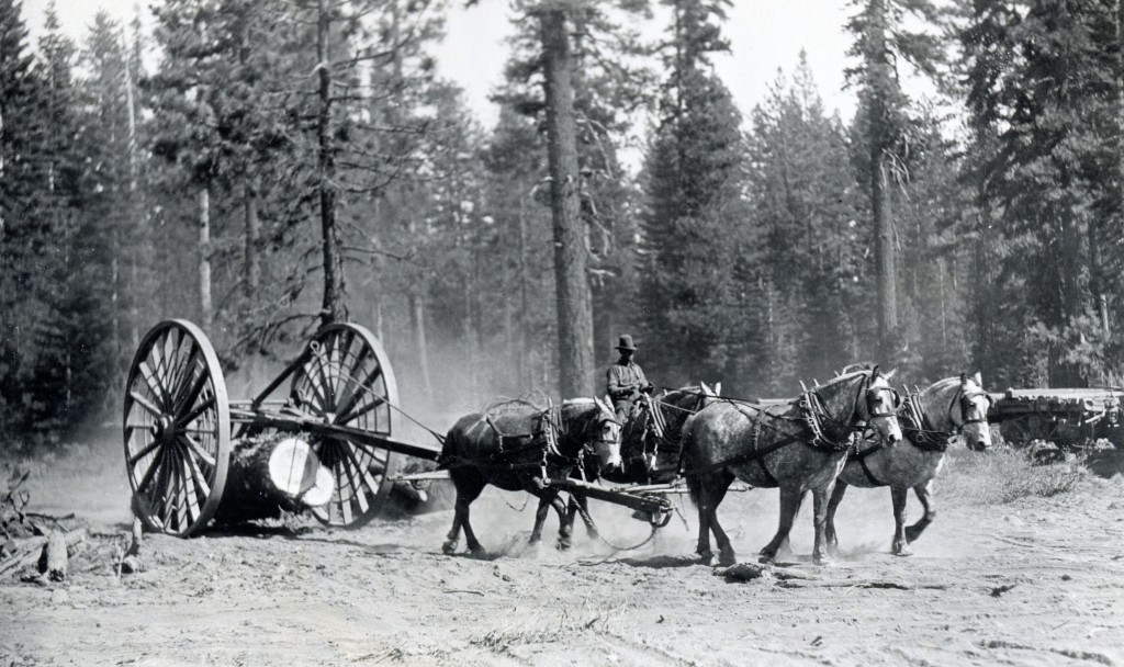
Horse logging with big wheels, at Fruit Growers Camp B, north of McCoy Flat Reservoir.
In the spring of 1925, Fruit Growers Supply Company announced a major change in their logging operations. In April, the company sold some seventy logging horses, thus a major phase out utilizing horses and Michigan Big Wheels. The company replaced the horses with six Catepillar tractors, after having two in operation the previous year. The tractors were more efficient, as they could go in terrain the horses could not. Horse logging also required additional workers known as “swampers.” Their job was to remove any debris or vegetation that could result in an injury to the horses legs.
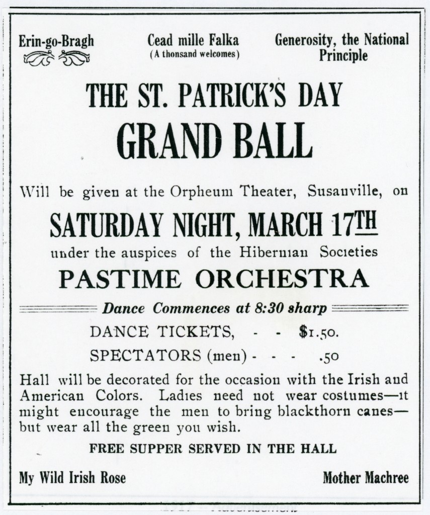
1917 Advertisement for the first St. Patrick’s Dinner sponsored by the Sacred Heart Church
Over the last two decades numerous organizations in the area now hold St. Patrick’s dinners. However, none can compare to the one sponsored by Sacred Heart Church. It was first held in 1917 and is the longest continous event in Susanville. Not even the Native American’s annnul bear dance can beat that.
This year the event will be held on Saturday evening, March 16 beginning at 4 p.m. at Monsignor Moran Hall on North Weatherlow Street. The menu, of course, has evolved over the years. For decades the traditional corned beef and cabbage was never served. In 1974, Father William Storan was appointed the parish priest. In 1975, he requested that corned beef and cabbage be placed on the menu and that the church would slowly phase out spaghetti and roast beef.