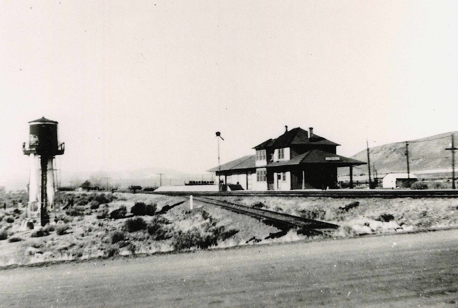
Litchfield Depot of the Fernley & Lassen Railroad, 1947. Courtesy of Camilla Moody
The Russian Thistle, (Salsola tragus), is best known too many as the iconic “tumbling tumbleweed.” Ironically, it became a symbol of the American West, yet it is a non-native plant. As its common name indicates it origins are from eastern Russia. Some sources indicate it was accidentally introduced in 1873 by Russian emigrates to South Dakota. The seeds from the plant are initially disbursed by wind. It is believed that many a railroad stockcar were imbedded with seeds, that allowed for them to be scattered throughout the west.
The plant did not make its appearance in Lassen County until 1914. While the Fernley & Lassen Railroad bought prosperity to the region, it also introduced this noxious invasive weed. The first plants were spotted along the railroad right-of-way. For the next two years, major efforts were undertaken to eradicate it, but it was a lost cause.
On Sunday, December 28, 2025 at 4:41 p.m. a 4.7 magnitude earthquake centered at Round Valley struck. For those not familiar with Round Valley, it is due north of Susanville, as the crow flies about nine miles and is privately owned. Then on Tuesday night, December 30 at 9:49 p.m. a second 4.9 earthquake occurred there.
It should be noted that east side of Eagle Lake a consist of fault blocks namely Mahogany and Blacks Mountain. You can read about the 1889 Eagle Lake earthquake here. There was a notable quake in 1921, though not as strong.
Personally, I really felt the first one (2025) since, I was preparing dinner (garlic noodles) when it struck. My milk bottle collection rattled and my mantle clock stopped. The second one, I was in bed, but I heard things rattle.
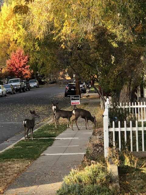
Deer grazing along Maple Street, Susanville-Courtesy of Jim Chapman
There was a time that to spot a deer in Susanville was a rarity. Those days are long gone. The deer population in the community is plentiful is an understatement. Some attribute the deer population with the passage in 1990 of the California Wildlife Protection Act. This law protects mountain lions from being hunted etc. With the increased mountain lion population, it would only make sense for deer to seek refuge inside the city from this predator. With that in mind the following is an account of a deer sighting years ago, that certain residents might find quaint.
Lassen Advocate, 16 February 1917 – It isn’t very often that deer wander into Susanville from our surrounding country, but a beautiful doe came in to see the sights last Wednesday. The animal was first seen in the Taylor fields north of town, and various persons living on North Street had a glimpse of it as made its way west to the hills.
Initially, how the local wild horse population came to be was in the mid1800s. At that time, the Honey Lake Valley had few fences and the settlers allowed their livestock, both cattle and horses, to roam freely during the winter months. Annual spring round ups, that became the origin of today’s rodeos were to capture and brand the animals. There were always some stray horses escaped from being caught, thus began the local wild horse population.
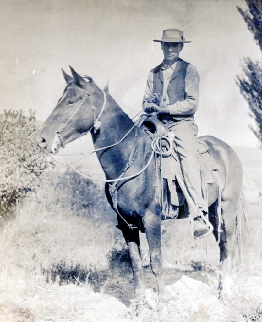
George Wrede’s winter homestead remain at Bull Flat, where he would catch and break wild horses., June 1977
Yet, back then the wild horse population was kept under control by out of work wranglers. During the winter months, it was not unusual for ranches to let go extra help, especially single men. A number of these men, would take up a 160 acre desert homestead to make a home, especially properties with unclaimed springs. To make some extra money, they would catch wild horses and break them. By spring they would sell the horses, and pocket the money.
The Marr Brothers of the Madeline Plains turned that into a fine art of rounding up wild horses. In the 1930s, they would gather wild horses to be used in rodeos, which made for wild times. By 1940, the demand for horses dramatically decreased, thus allowing for the wild horse population to grow unchecked. More about. that later.
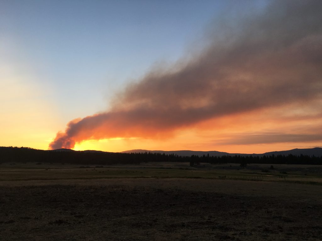
Hog Fire on the evening of July 18, 2020 as seen from the Hulsman Ranch—-Courtesy of Hulsman Ranch
Prior to 1900, a typical forest fire would burn with no one to fight it. The fire would eventually burn itself out, or Mother Nature would step in and douse it with rain. For Honey Lake Valley residents the biggest annoyance was smoke. The Lassen Advocate of September 14, 1899 reported of such fires:
“The atmosphere has been surcharged with smoke the past week, and a fire on the western side of Diamond Mountain range and another in the thick timberland near Eagle Lake are principally responsible for this condition.”
The above is an Eastman Studios postcard that I happen to like. September is one of my favorite months of the year. The weather is normally ideal, warm days and cool nights.
It also a harbinger of of upcoming fall colors. The most notable is when rabbit brush (Ericameria nauseosa) starts bloom. For me it is a visual delight. However, for others with allergies it is not pleasant experience.
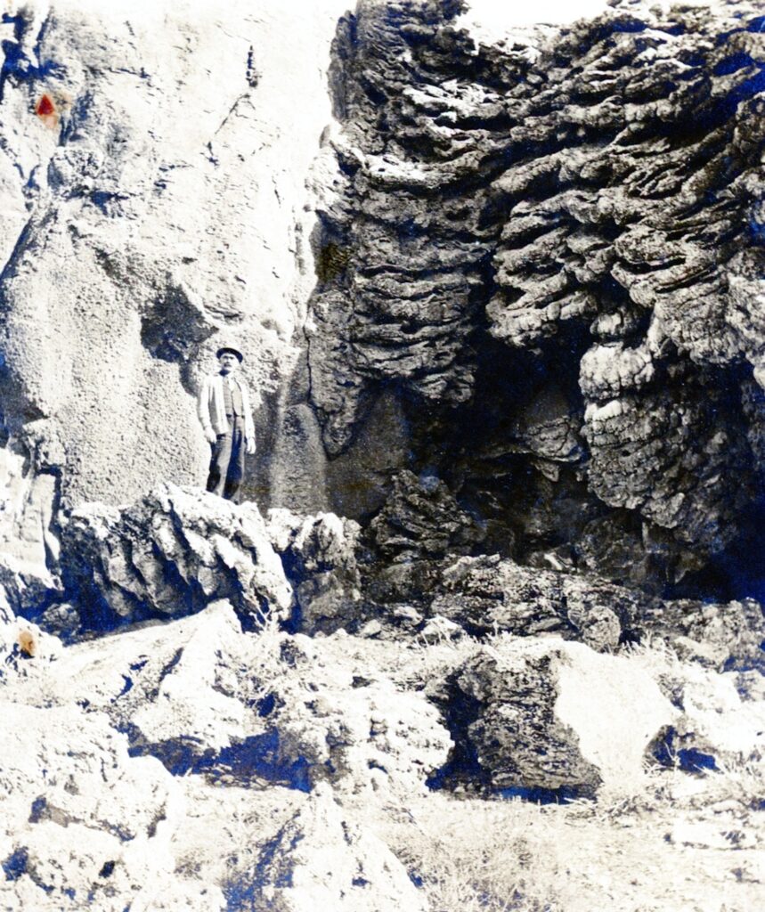
Amedee merchant, J.H. Pelfley at tufa formations, Pyramid Lake, 1906–Marie H. Gould
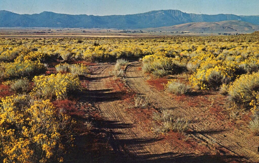
When you are exploring the eastern Honey Lake Valley, Pyramid Lake and Smoke Creek desert you might encountered tufa rock formations. There are numerous tufa formations in the Wendel vicinity.
Tufa formations, Wendel Hot Springs, February 7, 2016
The tufa is composed of calcium carbonate that accumulates from an underwater springs, for an extended period of time. In this case, it was the ancient Lake Lahontan that allowed for the perfect condition for the tufa to form. When the lake receded, then the deposits were revealed.
The average resident may not be aware of Susanville’s unique geographical settings. The Susan River is the natural dividing line of the Sierra Nevada and Cascade. It should be noted, that there is a slop over of Sierra and Cascade. This was confirmed by U.S.G.S. as Gallatin Peak, near the south east shore of Eagle Lake, is of granite composition, a typical Sierra trait.
The same is true of Cascade, the Modoc Plateau. and Great Basin. Secret Valley is a prime example as it is intermingled with characteristics of those three geological regions. Of course, lest we forget the Skedaddle Mountains are located on the western edge of the Great Basin For those that reside here we are fortunate enough to experience this unique and diverse topography.
These springs in eastern Honey Lake Valley and near the Nevada border are quite unique. They are an ancient spring dating back to the time when the area was covered by Lake Lahontan in the Pleistocene epoch.
The second reason is it is a warm water spring with a constant temperature of 86F. The springs supports two kinds of fish. First is the Lahontan tui chubs. This, of course, is rather remarkable that the fish have adapted over the years to thrive in constant warm water in a confined space. Water from the spring then goes underground and re-surfaces 100 yards distant, maintaining a constant cooler temperature at 76F. At this point, again, which is also unusual, is found the Lahontan speckle dace, that was to be on the endangered species list. The Lahontan speckle dace in this spring is no more. In the 1990s, the spring used as a fish farm. Some one planted exotic fish in the springs channel, thus caused the speckle dace there to be extinct.
I found the newspaper article of interest from the Lassen Advocate May, 15, 1914 – Here From High Rock. Jas. Mapes and Jas. Dudley were there from High Rock last Monday. Mr. Mapes was proving up on his desert land claim before the officers of the land office. Jimmie is very enthusiastic over prospects down there, and is a very busy man. He says he has the dandy water system of the county, and the water problem is one which will not be a great worry him in the future. He has a chain of three dams, and these, by giving out their waters one at a time as needed, will probably prove sufficient for all purposes. In addition, however, he is contemplating building a dam to impound the waters of the one spring, which will be a valuable addition to his water supply.
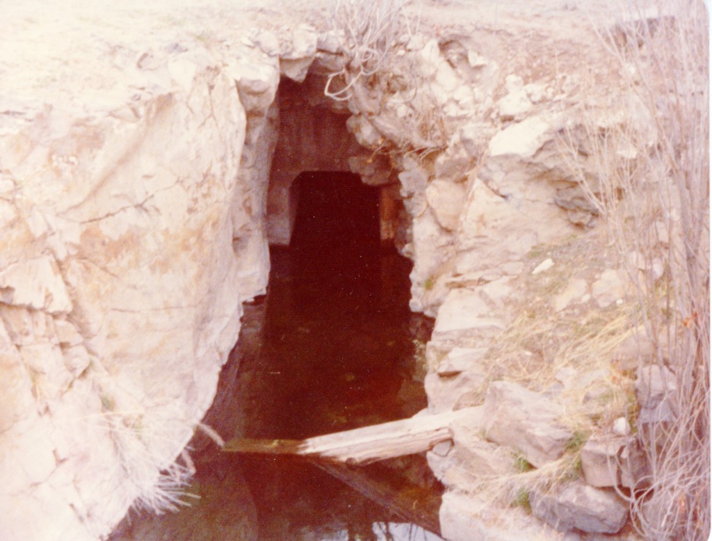
A portion of the tunnel outlet of High Rock Springs. April, 1975
It should be noted that in the 1920s, William Dicting was hired by the Rees Jenkins to develop the springs. He spent eight years to hand drill through the rock to develop the water tunnel to increase water flow.
1944 distribution map of Antelope in Northeastern California.
Prior to the 1849 California Gold Rush the pronghorn antelope could be spotted throughout most of California, especially in the Sacramento and San Joaquin Valleys. Fencing and agricultural development in those regions forced them of that habitat. By 1920, some thought the antelope were on the verge of extinction with a population of 13,000 in North America. One of the largest concentrations of antelope were located in Lassen and Modoc Counties. .
A herd of antelope near Secret Valley, 1938.
Antelope are noted for their speed. They are latest mammal in the Western Hemisphere. They are also known for their curiosity. In 1944, Donald C. McLean of the California Fish and Game wrote: “On the Madeline Plains east of Ravendale, four antelope does ran along beside the car for about one-half mile at 42 miles an hour, suddenly put on a burst of speed and tossed directly in front, then raced along just ahead of the car for another one-half mile at about the same speed when they crossed over in front again and stopped about 100 yards from the road. These animals were certainly not particularly frightened. In fact, I think it was curiosity and the joy of a race that prompted them to stay the car for such a distance.”
In McClean’s report he noted that there was 4,504 antelope in Lassen County. The largest concentration was in the Skedaddle Mountain country. In Modoc, the count was 1,167. McClean’s report included a detailed account of census methods. The first two paragraphs are rather informative.
“Formerly antelope were estimated or counted by crews of picked men working from horseback or on foot. About six or seven generally made up a crew, working in twos orthrees in most areas. Occasionally, however, all joined to form one crew in places where large numbers of antelope in a limited area had to be counted one time to avoid the possible duplication that might occur if they were not all counted in one day. Because of soft ground and rocky terrain, most of the counting had to be done on foot. In order to count the two counties, Modoc and Lassen, properly each man of a six-man crew had to walk or ride about 600 miles–about 26 days of effort per man.
“The extensive use of the airplane was started in the late winter of 1941-42. This first airplane census was carried under the Federal Aid in Wildlife Restoration Act as part of Project California 12-R, “Aerial Survey of Big Game in Northeastern California and in the Owens Valley.” James D. Stokes of the Division of Fish and Game was the observer and. A.L. Reese the pilot during the 1941-42 survey. The 1943 and 1944 censuses were made with regular Division of Fish and Game funds, with D.D. McLean as observer and John Allen as pilot. This method is far superior to the old from the standpoint of speed, accuracy and expense.”