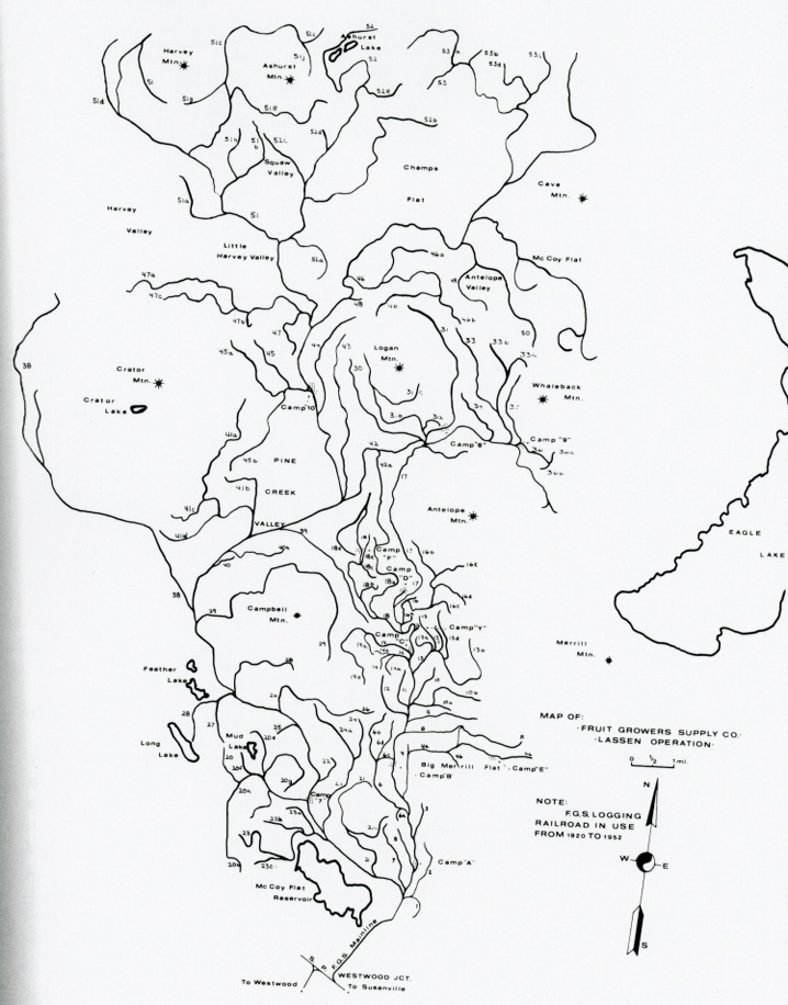
After the logging season of 1952 ended, Fruit Growers discontinued railroad logging. In the Hazard Reduction of the Pine Creek Unit timber sale with the forest service in 1936, stated that all existing railroad grades be converted into roads, once the steel and ties were removed. In 1952 Fruit Growers had 48 miles of railroad line. A total conversion would be excessive. To rectify the difference Fruit Growers and the Forest Service conducted a joint field survey–the parties agreed upon the conversion of fifteen miles instead of the original 48. Fruit Growers agreed to maintain the roads for ten years after the timber sale.
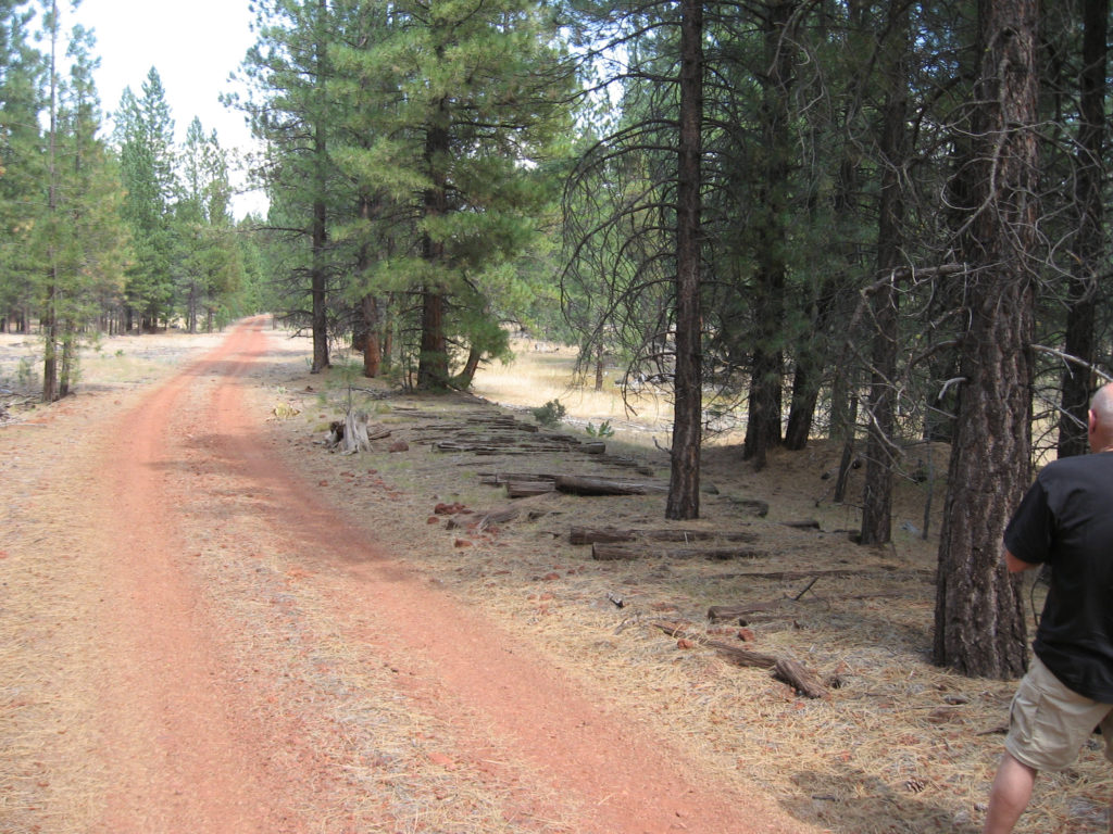
It was one of those days, that I had a lapse of better judgment should have, but did not take a picture of Shay’s Hole. However, about a mile down the road, we stopped to take pictures of these old railroad ties still in place.
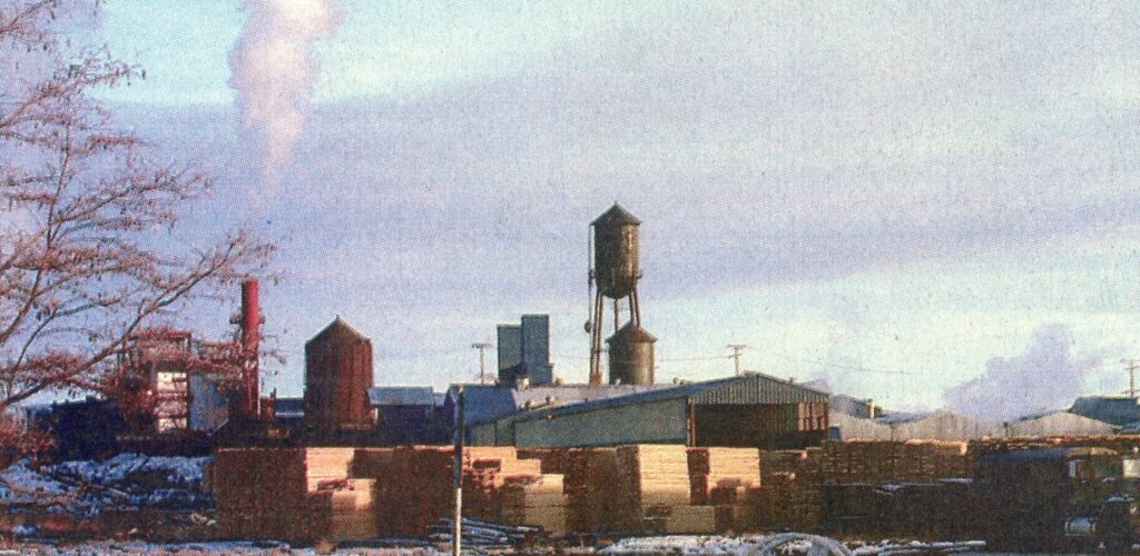
Sierra Pacific Mill—Lassen County Times, December 18, 2003.
On December 11, 2003, Ed Bond, spokesman for the Sierra Pacific Industries announced the Susanville mill would close some time in early 2004. Bond stated a number of issues that led to the closure. One, of course, was a lack of available timber. It was noted that in 1990 the Lassen National Forest sold 108 million board feet of timber and by 2002 that number had dropped to 17.9 million board feet. Those who have an affiliation in this industry, were not surprised by the closure. Actually, many and my self included were amazed that it had not happened years earlier.
The community reaction was all doom and gloom. Fast forward nearly twenty years later, with the closure of the California Correctional Center and the commentary is the same. Guess what, the town has not shriveled up and blown away.
Tim
Note for the record: The mill closed down on May 3, 2004 and portions of the mill dismantled. One of the features that still remain is the water tower, which found a new life as a cell tower.
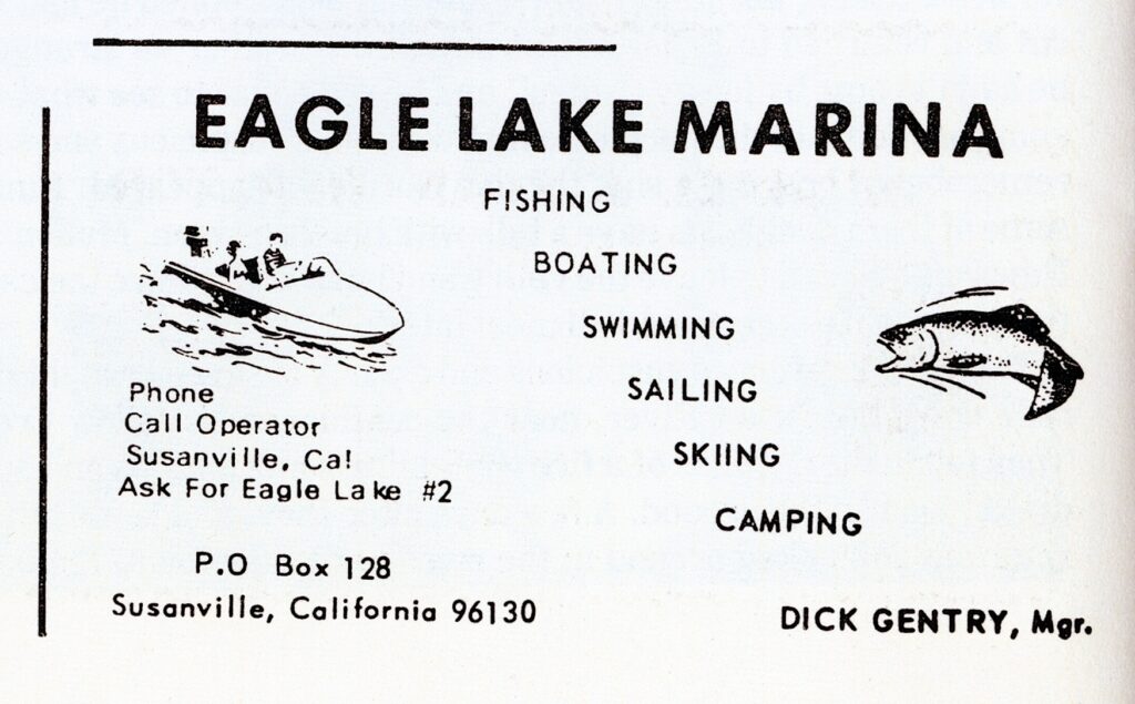
Gentry’s business card advertisement, High Sierra, 1972
In the late 1950s, Lassen County officials working with the Lassen National Forest began implementation of development of campgrounds and a marina at the south shore of Eagle Lake. The county leased the property from the forest service for a marina and in was completed in 1961. The following year, the county sub-leased the marina operation to Richard “Dick” Gentry. In 1970, due to the rising level of the lake, the boat harbor was revamped. Upon completion it was named the William W. White boat harbor, for former Lassen County Planning Director who was an ardent supporter of the project. In an 1971 article in the Sacramento Bee, Gentry complained about the rising water levels of the lake and went on to the state that there was too much water in the lake.
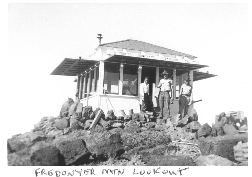
Courtesy of California Division of Forestry, Lassen-Modoc Unit
In the spring of 1937, the Lassen County Board of Supervisors were in communication with the California Division of Forestry to have a fire lookout placed on Fredonyer Peak, just north of Eagle Lake. While, M.B. Pratt of the forestry was supportive and deemed it a worthwhile project, they did not have the funds. However, as a possible alternative, Pratt contacted Chester Hunt, Regional Manager of the Emergency Conservation Work. Thus, the wheels were moving in a cooperative effort to make the Fredonyer Peak Lookout a reality. Hunt stated if the State Forestry and Lassen National Forest would provide the building materials, the Secret Valley CCC Camp would provide the labor. Everyone agreed. The CCC men had a lot of work to accomplish. First, they had a build a road from Horse Lake to the summit. (This is not the road used today.) A telephone line from Long Ranch at Horse Lake would also be extended to the summit. Finally, there was the construction of the lookout itself. Needless to say, the job got done.
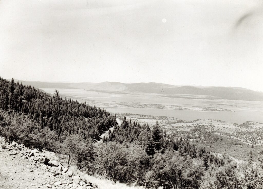
View of Eagle Lake from Fredonyer Peak, circa 1960
This lookout is still manned. At an elevation of 7943’ provides stunning views of the region.
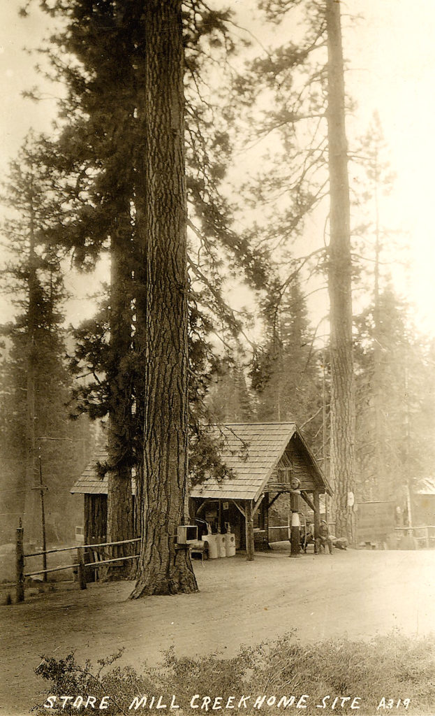
Once upon a time, Highway 36, took a long windy route to make the ascent over Morgan Summit—though one can still travel the old route, which is now Highway 172. If you do, one comes across the Mill Creek Store and restaurant. The community and resort originated as the Mill Creek Campsite by the Lassen National Forest. In 1924 the forest service surveyed for a planned 25 summer homesites, a store and resort. E.J. Foster and Leon Cordy of Cottonwood (Shasta County) leased the store and resort site, and built a store and several cabins. The forest service would expand the summer homesites to 118.
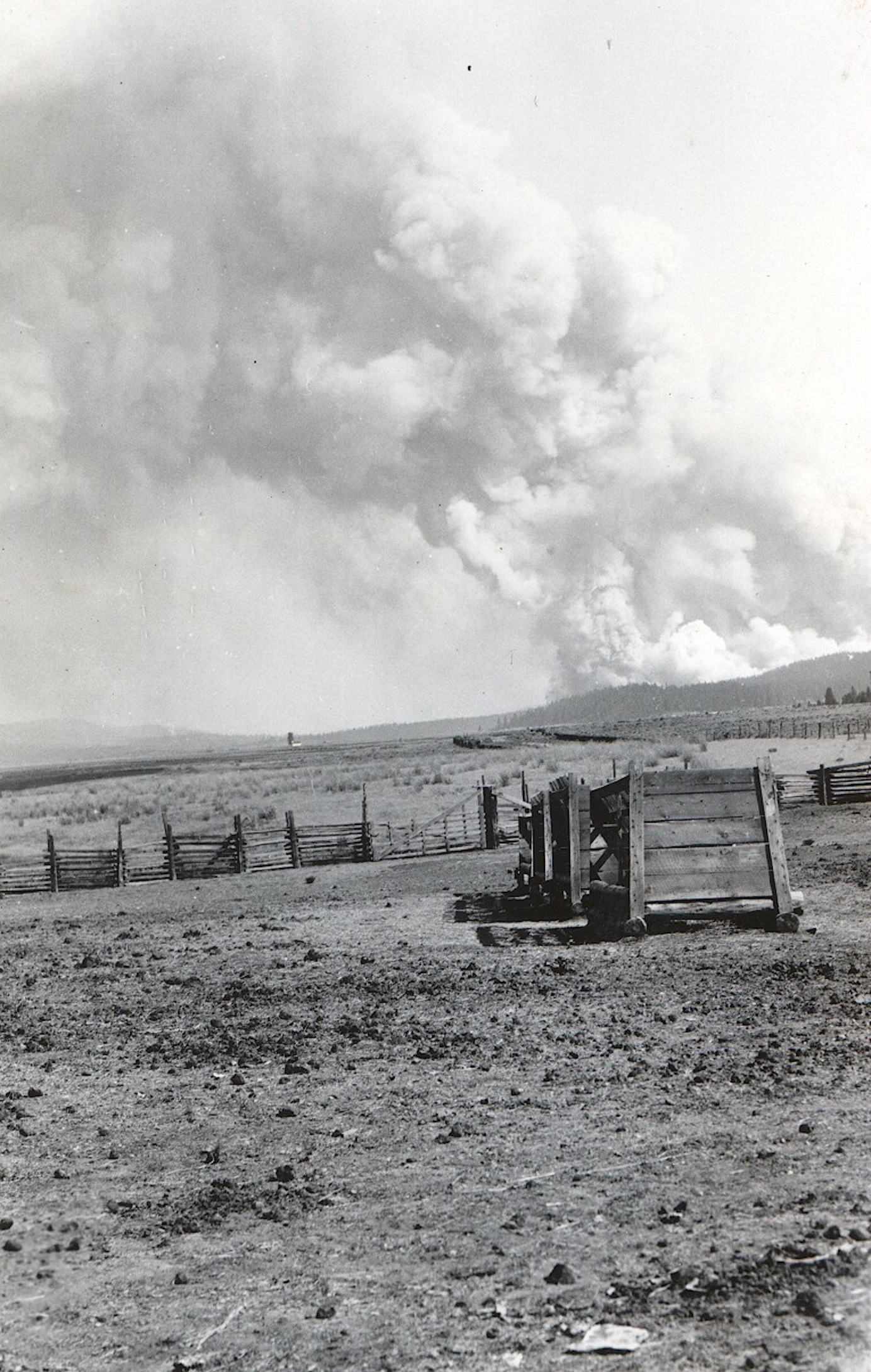
The 1926 Antelope Fire as seen from Willow Creek Valley. Courtesy of Lola L. Tanner
In the late 1800s and early 1900s forest fires did not cause a great deal of alarm or concern. Most of the fires were small in size—twenty acres or less. Some times they were fought and most often left to burn to extinguish themselves. The following is an interesting example from the Lassen Advocate of July 26, 1907:
“The forest fires are late in starting this season. There was a blaze up the river, west of Susanville Thursday and smoke and resinous odor of burning pine were very percipible. Whether extinguished or burnt out, the atmosphere is clear and smokeless today.”
What happened. Locally, saw the establishment of large timber companies and their subsequent sawmills. This produced industrial l scale logging, unknown to the region. Some of the mechanical equipment were known to spark fires, and in some cases large fires were created in logged off areas. At the same time, the national forest service gained prominence and one of its main objectives was fire prevention. Another consideration—weather. From 1860-1916 was an extremely wet weather cycle, followed by a twenty year dry cycle.
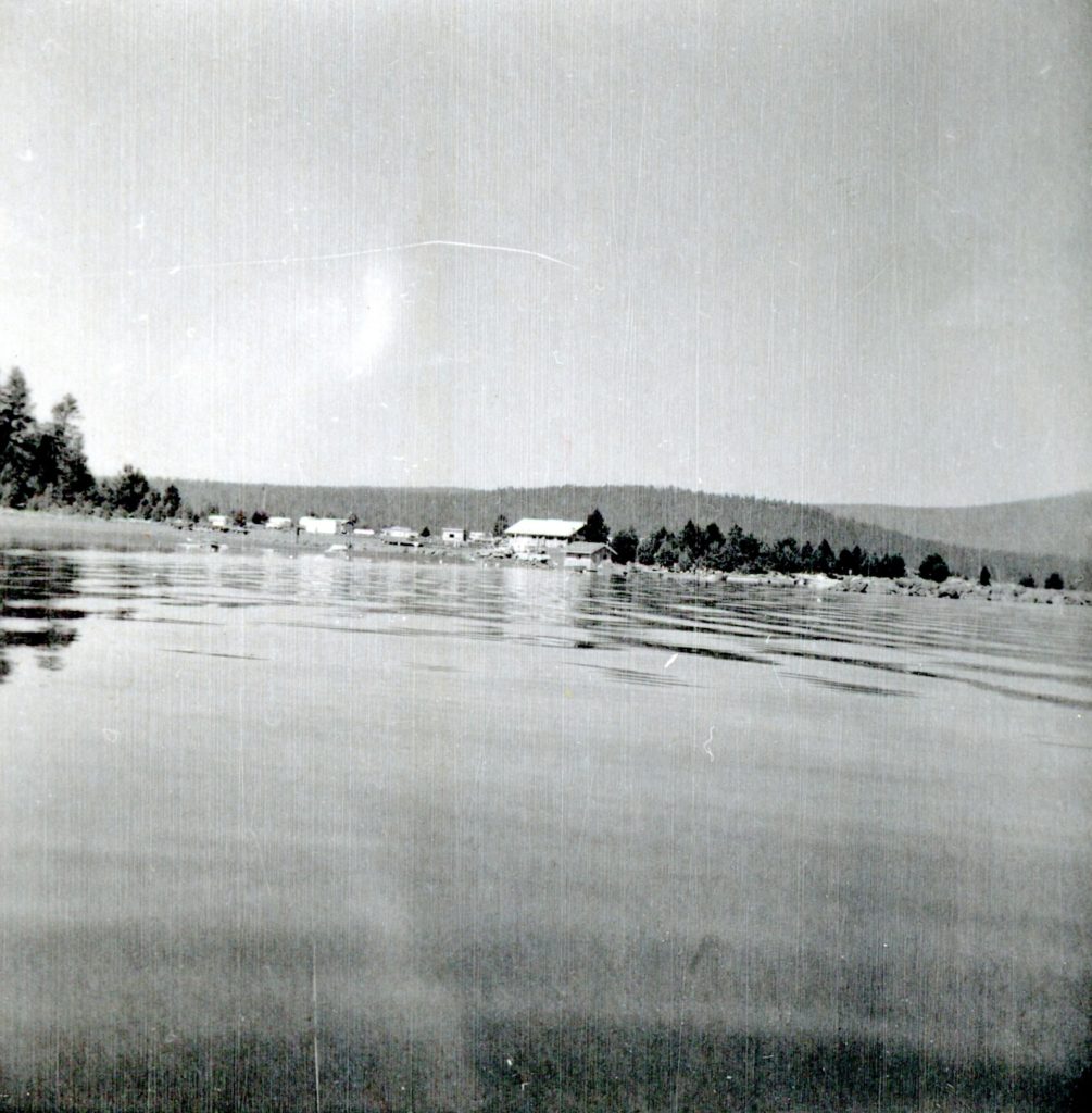
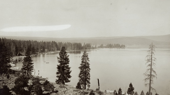
South shore of Eagle Lake, circa 1920—Wyn Wachhorst
This is, in essence, is more like a plea for information. For a time the California. Division of Forestry operated a fire station at the south shore of Eagle Lake. Unfortunately, the information CDF has and as well as my own is rather sketchy.
It was established sometime in the 1950s and what is unique the first station was located on Fruit Growers Supply Company land near their Sunkist cabin. Unfortunately, Fruit Growers is in such a disarray that avenue to locate an agreement is not going to happen.
In the mid 1950s the County of Lassen urged the Lassen National Forest to make recreational improvements at the south shore of Eagle Lake. By 1958, the Eagle Campground was established and so too was the CDF station. At the end of the 1952 logging season Fruit Growers closed its last remaining logging camp—Camp 10—thus eliminating a resource for fire fighting. Between the Gallatin Peak fire of 1951 and the Merrill Fire of 1955 might have been impetuous to establish the fire station. Later on the CDF relocated the station adjacent to County Road A1, near the intersection of the turn. off to the marina and Gallatin Beach.
If anyone can shed some enlightenment on this topic, it would certainly be appreciated.
In the fall of 1928, Lassen National Forest Supervisor W.G. Durbin came up with an ingenious plan for fire trails. He spent considerable examining old livestock trails and abandoned early day roads which could be put to another use as fire trails. Work began making improvements to these old routes that Durbin thought would be ideal in transporting fire fighters and equipment. There was the added benefit once the trails were cleared they would also act as fire breaks.
Caribou Lake, and nearby Silver Lake is the upper watershed of the Susan River. The lake is also a jumping off point for the Caribou Wilderness Area. When gold was discovered in British Columbia in 1858, a number of miners, including some Honey Lakers, rushed there. It was known as the Cariboo. It should be noted that early records spelled lake’s name the same. One of the mining enterprises there was named the Neversweat.
On August 11, 1883, J.H. Slater filed for the water rights to both Caribou and Silver Lakes, along with the right to install dams and gates. In September 1883, Slater hired 12 men working at Caribou Lake to install the first headgate. It should be noted Slater owned what is today the Fleming Unit, of Honey Lake Wildlife Refuge, and was a civil engineer.
As to the Stella Stiles divorce she was married to Harry Cain. While many may not be familiar with the Stiles name, there are several Stiles descendants who subscribe to this site. Where Monsignor Moran Hall is located in Susanville was purchased from the Stiles family. Willard Hill and the Willards are part of the Stiles clan. One of my favorite Stiles descendants was Philip Hall.
Anyhow back to Harry Cain, Stella’s ex. In the summer 1905, Harry Cain, along with James Wallin and Hi Skadan went on their annual summer excursion to camp and fish at Silver Lake. A couple days out, things went wrong. On the morning of July 7, Cain went over to fish Caribou Lake. He had a small folding canvass boat. Wallin and Skadan remained at Silver. That evening Wallin began to prepare dinner, but Cain was not there. The two men went over to Caribou, and found Cain’s boat adrift, but no sight of him. Since it was nearly dark, Wallin and Skadan returned to camp. The next morning, they were back to Caribou, where they found Cain’s body at the bottom of the lake, about twenty feet from shore. The body was retrieved taken to Susanville for an Coroner’s Inquest, and later interred in the Susanville Cemetery.
On June 8, 1906, President Theodore Roosevelt signed into law the Antiquities Act. In its initial conceptual form was to protect to prevent looting of archaeological sites. It was later revised to include historical sites and also landmarks of scientific importance. Once a site designated it became a National Monument.
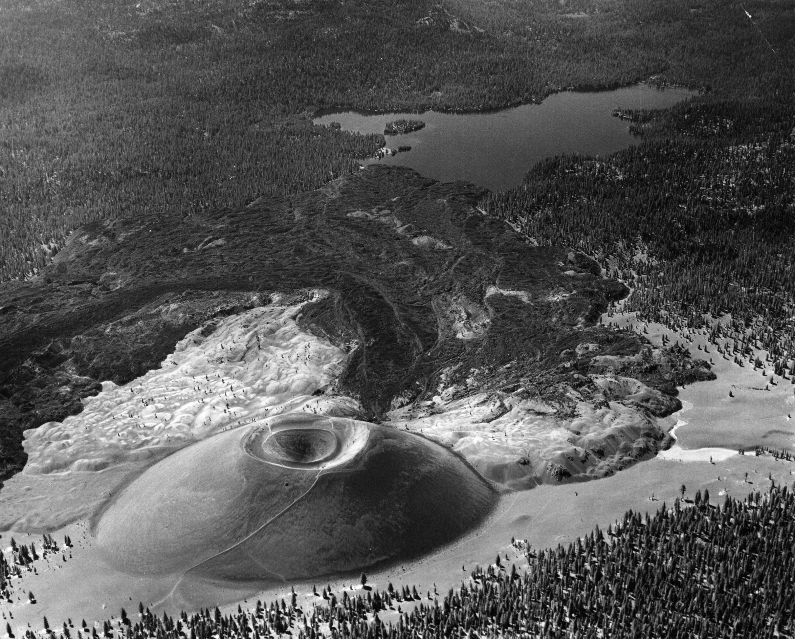
Louis Barrett of the Lassen National Forest was concerned about two sites within its jurisdiction that could be developed into commercial tourist attractions—Cinder Cone and Lassen Peak. In the spring of 1906, in an effort to ward off future claimants he started a petition to make Cinder Cone and Lassen Peak into a national park. This did not gain the traction Barrett desired.
For Barrett, the passage of the Antiquities Act came at an opportune moment. It provided him with another way to protect the features of Cinder Cone and Lassen Peak. He surmised the opposition to make them National Monuments would be minimal, for less than 10,000 acres of public land would be withdrawn, versus 100,000 acres for a Lassen Peak National Park. At the same time, the national monument designation would not interfere with the establishment of a national park at a later date.
In early 1907, Barrett submitted the necessary paperwork for the creation of two national monuments—Cinder Cone and Lassen Peak. U.S. Secretary of Interior James Garfield liked the concept of two smaller national monuments better than a proposed national park. Of course, the maintenance of national monuments would be nominal compared to a national park. With no opposition, proclamations were prepared and submitted to President Roosevelt. On May 6, 1907, Roosevelt established the Cinder Cone National Monument (5,120 acres) and Lassen Peak National Monument (1,280 acres). They became the six and seventh national monuments established under the Antiquities Act.
The movement, however, to create a Lassen Peak National Park did not fade away. One of the biggest obstacles was it was not well known, even in a regional sense. That all changed on May 30, 1914, when Lassen Peak erupted, and with it nation wide publicity. On August 9, 1916, Lassen County lost its only national monument, when it was incorporated into the newly created Lassen Volcanic National Park.