One would not think that Stanford University and Lassen County would be associated in any way, but that was not case. Leland Stanford had many interests. In 1881 he purchased Rancho Bosquejo at Vina, Tehama County. It should be duly noted, that this was Peter Lassen’s original Spanish Land Grant.
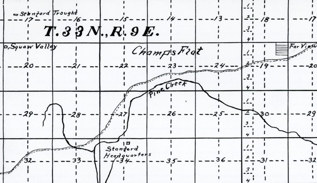
On May 26, 1899, Stanford’s widow, Jane, purchased 2,114 acres west of Eagle Lake from Champlin and Boggs for $8,000. This allowed for additional summer pasture for the Vina property. Ten days after the purchase, Jane transferred the title to Stanford University. In February 1924, the University sold its Lassen County Summer Range to J.J. Flemining at $10 an acre.
Spread the word, and encourage a friend to subscribe
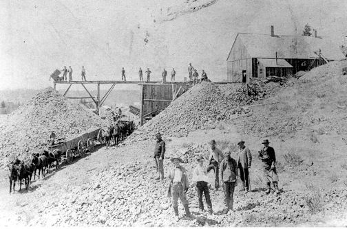
Golden Eagle Mine, Hayden Hill, 1894. Courtesy of Del & Diane Poole
Just as you can not believe everything on the internet, its true with various published accounts in all forms—past and present. The following article about Lassen County mines appeared in the San Francisco Chronicle, May 24, 1892. Two items struck me, one which is obvious the mines of Hayden Hill were located on a spur of the Sierra Nevada Mountain, which is not the case. The other which was unusual was the mining activity at Eagle Lake which usually is never mentioned.
”Lassen County, bordering on one of the best mining counties of California, being separated from Plumas county by a spur of the Sierra Nevada, has so far developed little mineral wealth, a few claims having been prospected on Diamond Mountain, near Susanville, the county seat, have yielded some gold. Veins of silver and gold ores have also been found on the southeast side of Eagle Lake, but mining as a regular business has only been prosecuted in the extreme north of the county, sixty miles north of Susanville and nine miles south of Modoc county line in what is known as the Hayden Hill Mining District. This hill, named after one of the first locators who is buried there, is one of the highest points of a spur running out of the Eastern slope of the Sierra Nevada; its altitude is given at 7500 feet. The mines were discovered nearly twenty years ago, since which time they have been more or less continuously worked yielding to the world’s gold supply. a little over $1,000,000.”
In 1875, William Dow located on the northwest side of Eagle Lake. He remained there until 1886 and the following year he sold 465 acres in that region to Albert Gallatin.
Dow Flat and Wells is located a short distance north of Spalding Tract. In the distance is Dow Butte. In 1994, the Dow Butte Lookout was removed and relocated next to the Eagle Lake Marina.
Spread the word, and encourage a friend to subscribe
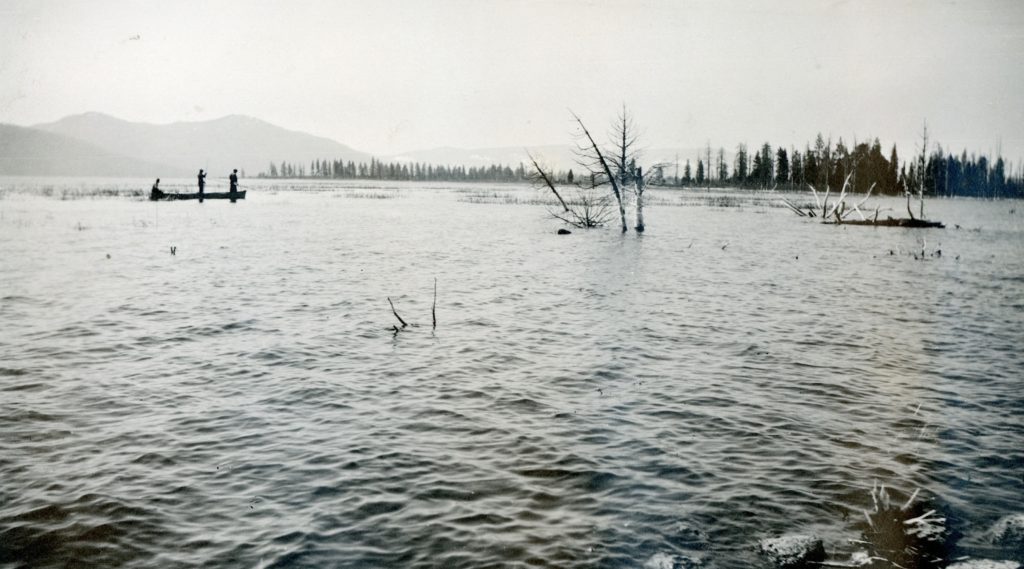
An east side Eagle Lake view above the narrows i.e. Pelican Point, when the water was high in 1921–Lola Murrer Tanner
In 1971, Susanville dentist, Robert “Bob” Amesbury had a book published about Eagle Lake. In the book’s dedication is to the pioneers there, which he includes Alfred Murrer. On page six Amesbury wrote about the lake level. He includes this sentence, “The narrows was shallow enough during the 1940’s to permit Alfred Murrer to swim his horse across.”
There is a slight problem. The east side of the lake that Amesbury refers is quite rocky, one would have problem with that condition with a horse. Even if you and the horse could overcome that, once you reached the other side, the horse would sink in a muck of. mud/water combination.
I do have some inside scoop about this. Amesbury never approached Alfred Murrer, or any Murrer family about his research of Eagle Lake. While the Murrers resided and still do in Willow Creek Valley, events at the lake were front center. After all, the two tunnel outlets are adjacent to Murrer property, among other things. The reason I happen to have first hand knowledge about this Amesbury tale about Alfred Murrer, stems from the fact I knew Alfred well—he being my grandmother Lola Murrer Tanner’s youngest brother.
Fast forward to 1988, when my book on Eagle Lake was published. That summer, by chance, I encountered Bob at The Galley, a bar and restaurant at the north shore of Eagle Lake. Bob congratulated me on my book and then stated, “You have all the facts, I had all the bullshit.”
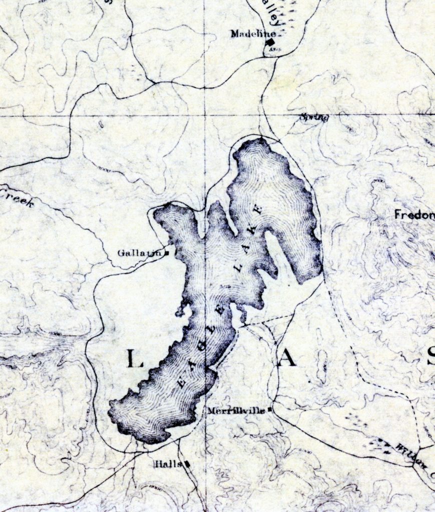
Some might be interested in this map of Eagle Lake. No doubt, there might be a few folks, who think that the cartographer had gone mad. I can rest assure you that was not the case. In the modern era, the Gallatin name has always been synonymous with the south shore of the lake. As one can see from the map, the south shore was referred to as Halls in the late 1800s. It was so designated as Wright P. Hall, a Susanville resident and well known Lassen County public figure, owned Papoose Meadows since 1876. Albert Gallatin’s, ranch manager Byron Bell had a sheep camp near what is known today’s as Spaldings. Prior to this, there had no designation for that locale. In 1914, things suddenly changed. Malvena Gallatin had a built summer home at the south end of the Lake. It was in 1914, the first Spalding subdivision was plotted on the west side of the lake.
Another interesting note, is Madeline located in Grasshopper Valley. The first Madeline was established in 1870s as a stage stop to accommodate travelers to Hayden Hill and other points north. The Madeline we know today on the Madeline Plains came into existence 1902 with the arrival of the NCO Railroad, which was formally known as Van Loans.
Spread the word, and encourage a friend to subscribe
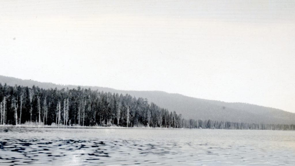
A view of Eagle Lake, looking towards Spaldings, 1921. Courtesy of Lola L. Tanner
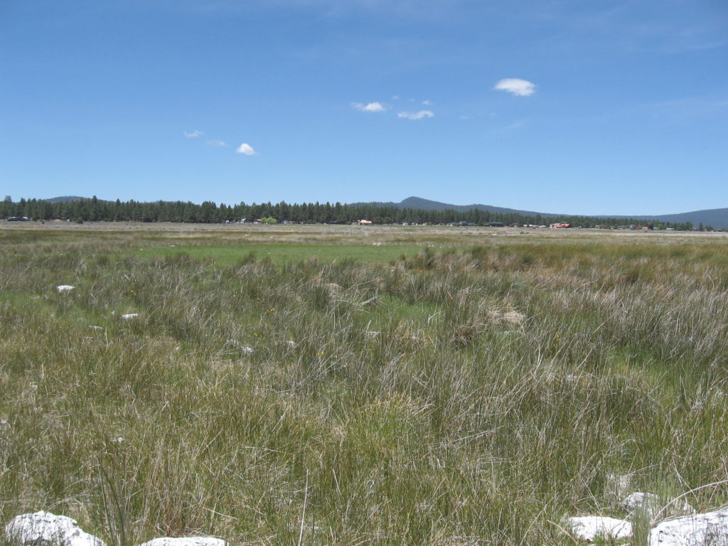
This is a simple minded post. It should be noted that there are a number of Eagle Lake affeciendos on this site, so they may get more enjoyment from today’s post, than others. When Spalding Tract was subdivided in 1914, the lake was approaching its highest water level. “The Strand” the town’s lakefront boulevard, was truly lakefront. Fast forward to 2020, the lake is far, far away as seen from the below photograph taken along the shoreline looking towards Spalding Tract.
A view of Spalding Tract from the Eag;le Lake shoreline,June 21, 2020.
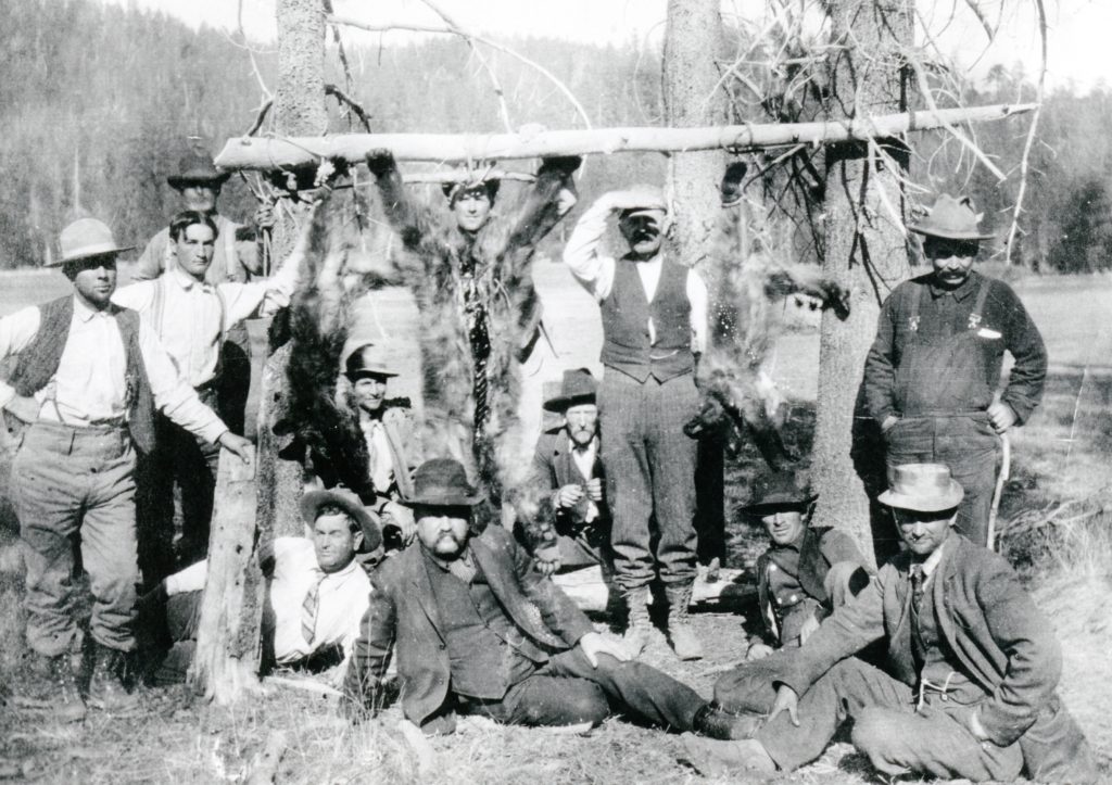
Pacific Coast Bear Club at Grizzly Valley, Plumas County,,1907. Courtesy of Ted Johnson
In 1917, California reclassified the black bear as fur-bearers, from which they were formerly game animals. The designation prohibited the hunting of bears. This, however, did not prevent the killing of bears if they were deemed predatory.
For local sportsmen this was not good news. The two prime hunting areas were the southeastern area of Eagle Lake and the west slope of the Diamond Mountain Range, such as Last Chance, Murdock Crossing etc.
In time, it was Plumas County officials who sought for a reclassification of the black bear to game animals to restore hunting, the bears being plentiful in that area. They succeeded. On November 1, 1935 bear season opened for a two month period.
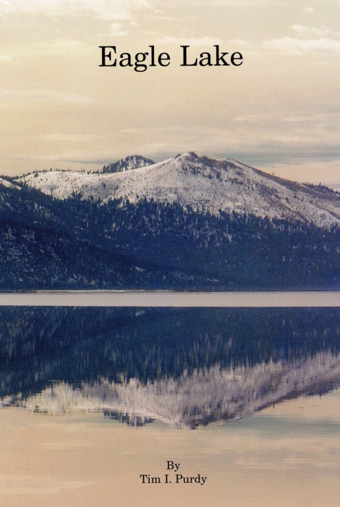
In a strange twist of events, a box containing thirty-two copies of my Eagle Lake book surfaced. So for a short time, the popular out-of-print book is once again available while the limited supply last. To learn more about book and to order see books.
The 1919 Federal Migratory Bird Treaty Act, allowed the California Department of Fish & Game to create a large number of game refuges. It should be noted, California led the nation in wildlife conservation. Many may not realize that in 1869, Lake Merritt in Oakland was declared a game refuge, a first in the nation.
By the early 1920s there was a proliferation of state game refuges. Locally, one of the best known was Blacks Mountain. Another was Skedaddle which extended from that mountain range north to Shinn Peaks. There was a quirk in these refuges because they included private property. One of the lesser known was the Brockman Flat Lava Beds region on the west side of Eagle Lake. In the fall of 1924, Fish and Game Warden, C.O. Fisher announced duck hunting along the west shore of Eagle Lake from Christie’s Eagle Lake Resort to Spaulding Tract was prohibited, it in essence being a part of the Eagle Lake Game Refuge.
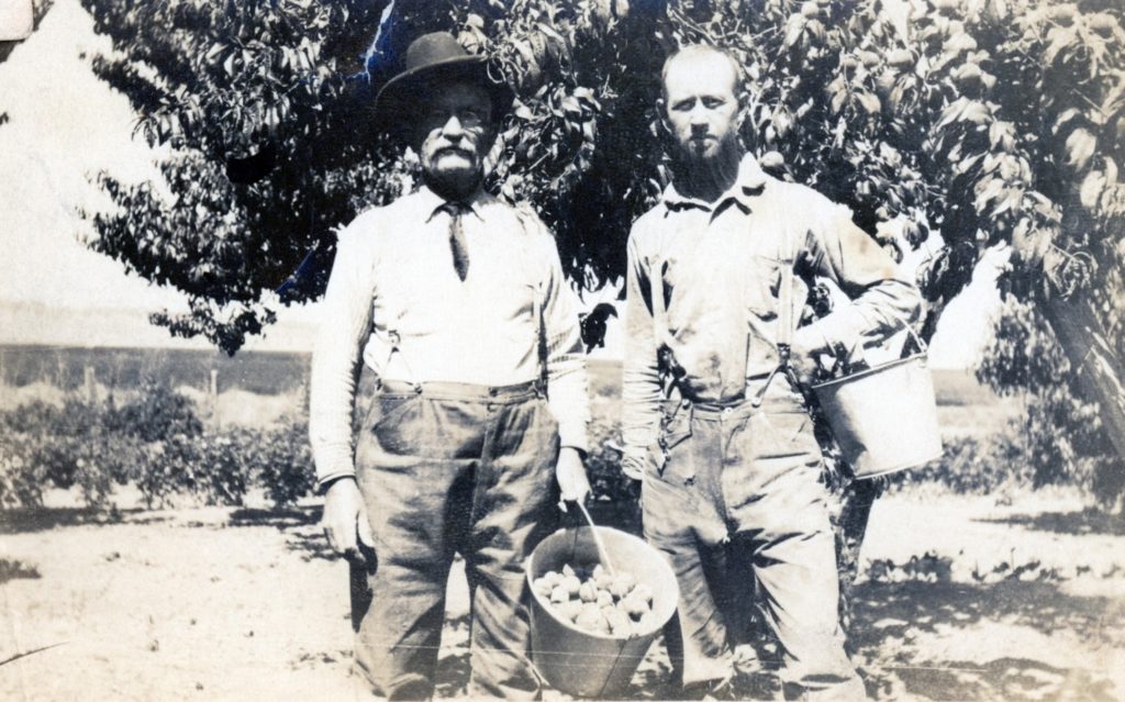
J.W. Fritter (left) and John Hamilton (right) at Fritter’s peach orchard, Eagle Lake—-Rev. C.R. Fritter
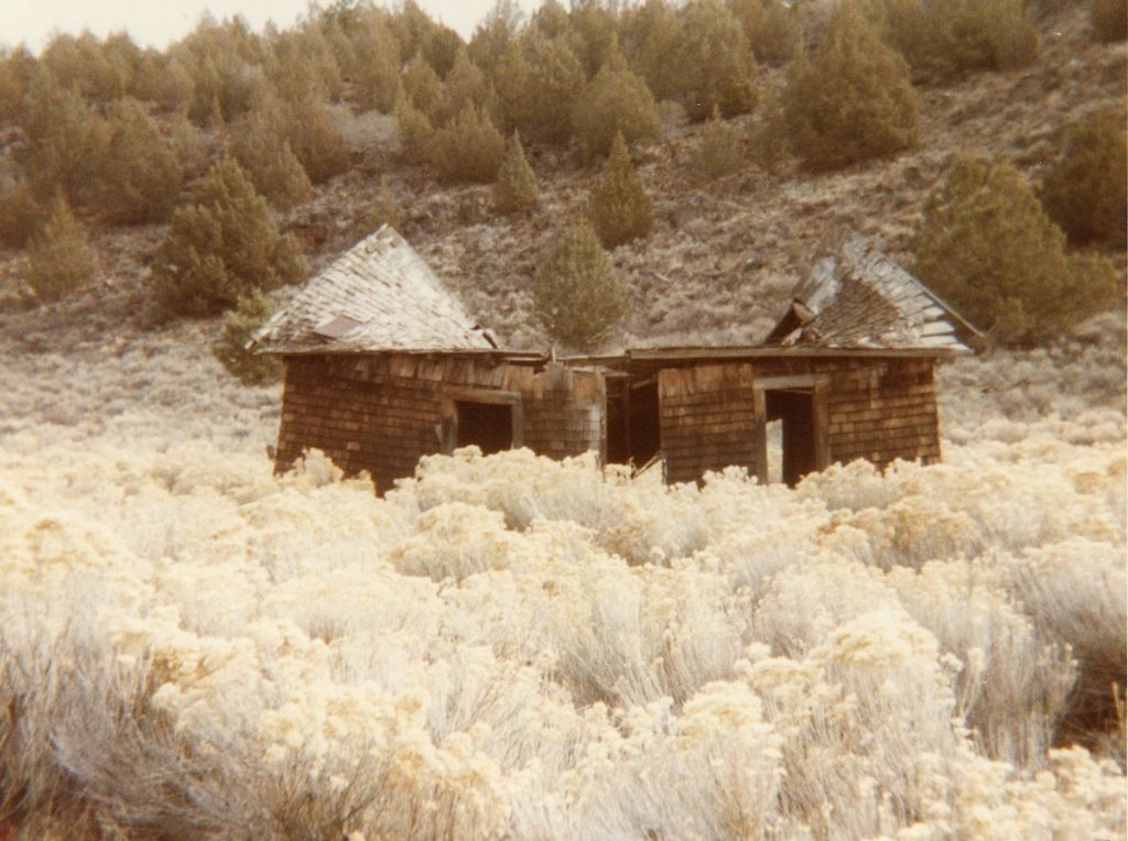
One never knows what I stumble across in my research. While reviewing the Lassen County Board of Supervisor’s minutes in regards to a topic on Westwood, I came across a rather unusual bill submitted to the county. Shortly after the death of her father, J.W. Fritter, Mrs. S. Pinola of 130 18th Street, Pacific Grove submitted a bill to the county to help defray her father’s funeral expenses. It should be noted that Fritter resided at Eagle Lake from 1884 to 1932, at which time he moved to Pacific Grove. Fritter did serve a term as a Lassen County Board of Supervisor from 1902-1906. The Board of Supervisors at their September 3, 1935 obliged and instructed the County Auditor to issue a warrant to Mrs. Pinola for $40. I have never come across a particular incident like this. What makes it even more bizarre was the Fritter and his daughter were not even Lassen County residents!
Remains of the Fritter ranch house at Eagle Lake, 1984
Spread the word, and encourage a friend to subscribe