There were several journalists endeavors in Susanville over the years. They were usually short-lived. One of theses the Susanville Daily News that made its debut on June 9, 1936. It was actually the reincarnation of the Daily Reminder. The Reminder was a mimeographed publication while the Daily News introduced readers to lithography.Percy Dunkle was the publisher and Richard Long, the editor. Dunkle was formerly associated with Lassen Mail newspaper and he had the financial backing of Ike Knoch.
There are some interesting articles and advertisements which we will explore. Of course, there was a customary golf articles, as golfing was all the rage that the local press called them the divot diggers..
For years, Susanville residents wanted two amenities, a public park and a municipal swimming pool. While there was a greater Susanville, the Milwood Tract and the Lassen Lumber district, they were outside the city’s boundaries and county was reluctant to provide basic services, let alone contribute a park or pool.
It was Frank O’Kelly who worked diligently for a municipal swimming pool. It should be noted he operated Lassen Dairy on property leased from Fruit Growers, north of town, which is now known Susanville Ranch Park. In 1934 O’Kelly approached the City to convert the Fruit Growers ranch property into a recreational facility. It would include a swimming pool, golf course, picnic area and playgrounds. Since Bagwell Springs was located on the property, there was ample water supply. The Susanville Rotary Club liked the idea and passed a resolution for the park’s development. Construction of the facilities could be done with labor from the State Emergency Relief Administration (SERA) crew. There was one problem with the proposal. Fruit Growers owned the property and it was not interested in leasing or donating.
O’Kelly, undaunted by that setback continued with his quest for a community pool. It was finally suggested to submit this project to the Works Projects Administration (WPA). In January 1936, City Engineer, Harry S. Riddell was instructed to draft plans for the WPA for a municipal pool. The WPA approved the project with an estimated cost of $28,433. It was decided to construct the pool behind Roosevelt Elementary School on Richmond Road. On October 30, 1936, groundbreaking ceremonies were held. It would take longer than the 1937 date anticipated for completion, due to the lack of eligible WPA workers. The Roosevelt Pool officially opened on April 17, 1938. Many years later. on December 22,2004, the City condemned it, due to structural concerns about the building it was demolished in 2015.
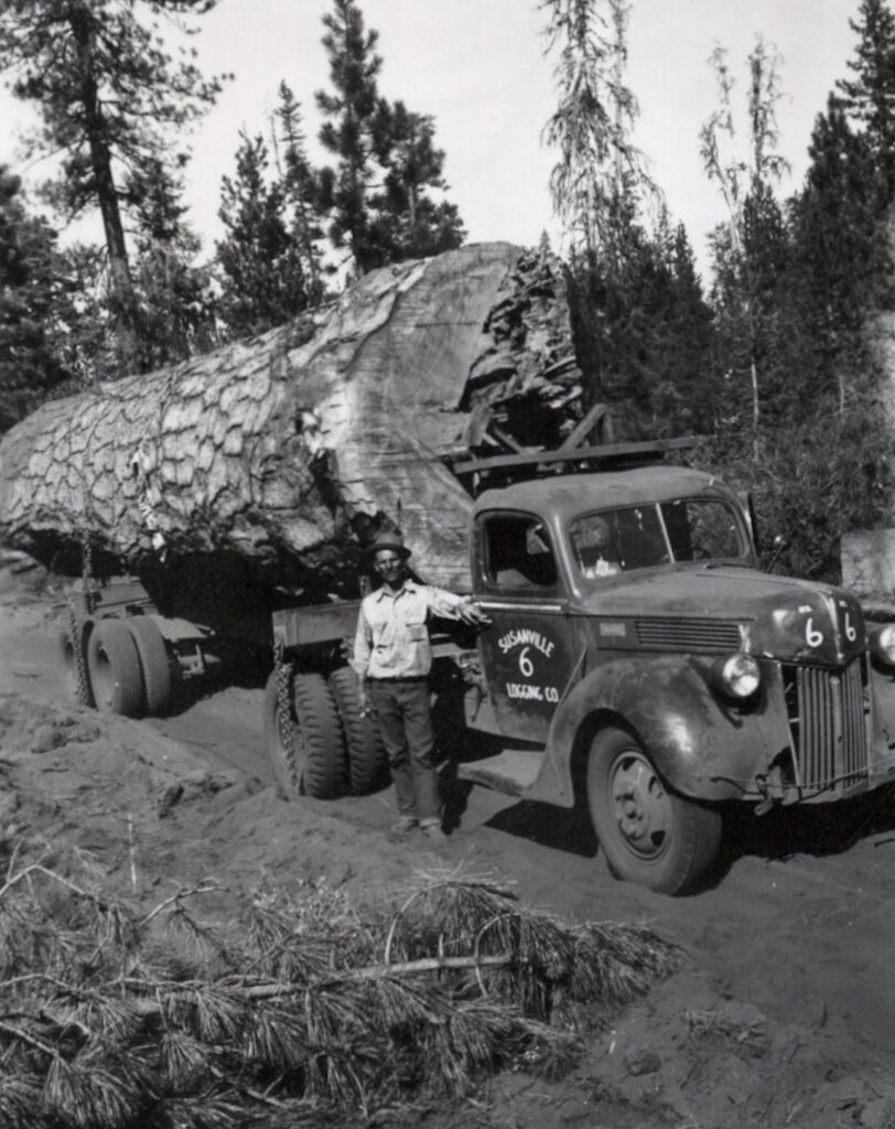
Norman Germain of Susanville Logging, the driver of this one-log load, 1951
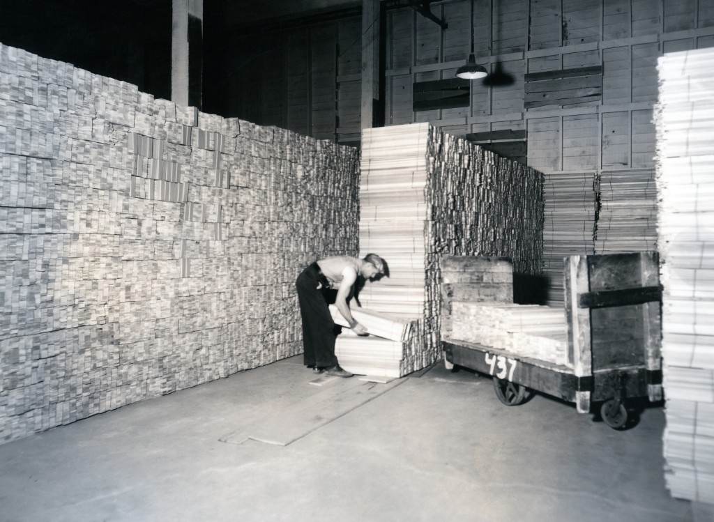
The Susanville Logging Company formed in 1941, was the last large lumber mill to be built in the Susanville area. The mill was located on Johnstonville Road. In 1958 it underwent a major ownership, that’did not last long. In the mid=1960s it became known as Coin Lumber and in turn would later became Jeld-Wen when it closed 1993.
Tim
Note: This photograph is featured in the September 2026 Calendar.
In 1890, Honey Lake Valley resident invented a new yew type of windmill. In 1891, he went t check out the new NCO railroad town called Amedee on the east side of Honey Lake. It was a bustling in activity and promoters stated that was tip of iceberg of things to come. With that promising of prosperous time, he decided to became an entrepreneur and established a saloon near the hot springs. It should be noted the hot springs offered unique facet-a small geyser, Lane devised a clocked to measure time of the spurts from the geyser. The geyser rose and fell at intervals of 38 second and on occasions the water would shoot up as high as eight feet. The natural wonder disappeared in May 1893, when the ground around the hot springs cracked open, allowing the steam to escape before the eruption. Of the many hats Lane wore, he became the justice of peace for the town and surrounding area.
By the late 1893 the boomtown era of Amedee had peaked, and Lane like so many others made his departure in search of the proverbial greener pastures.
Having a bit fun at Eagle Lake’s north shore, 1923. Lola is to the left. The other two women were school teachers at Eagle Lake and Willow Creek.
September 11, 1899 is special day for me. It was on the date my grandmother Lola Lily Murrer was born in Willow Creek Valley, the eldest child of Edward and Mary (Knoch). Murrer. She had special affinity for photography. I am grateful for the photographs she took of Eagle Lake during its high water levels of the mid 1910s and of the Bly Tunnel construction. The Murrer Ranch was great hub activity during the tunnel construction. The tunnel outlet abutted the Murrer ranch. According to family lore, my grandfather, John Tanner, briefly worked as a teamster hauling supplies to the tunnel works and is how the two met. He had a ranch in the Standish district where they raised their family.
Lola, January 1925
The family sold the ranch in 2025. While going through ranch house prior to the sale, her great-great grandson located three boxes of her photographs. Most of thee are from the 1930s onward and I have not had an opportunity to inspect them. Whether there are early day Eagle Lake photographs I do not know. Whatever the case may be, if there are any interesting photographs, I will let the readers know.
Yesterday’s post when Fletcher Walker criticized Fruit Growers increasing logging camp board, here is another side of the story.
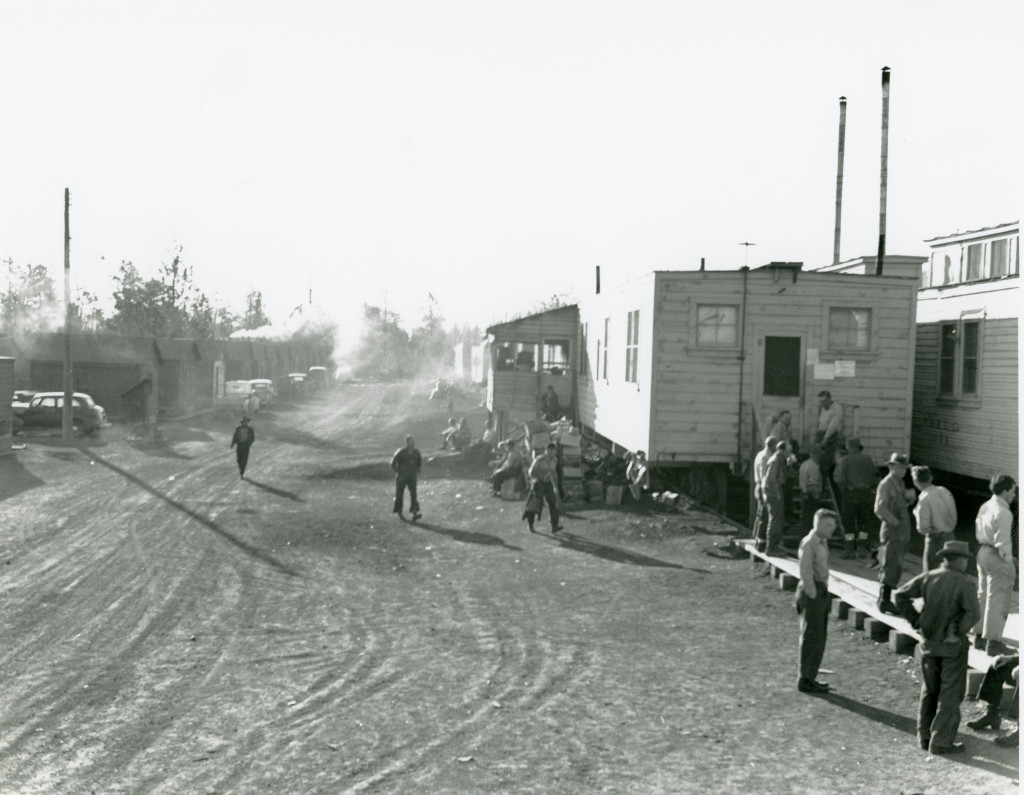
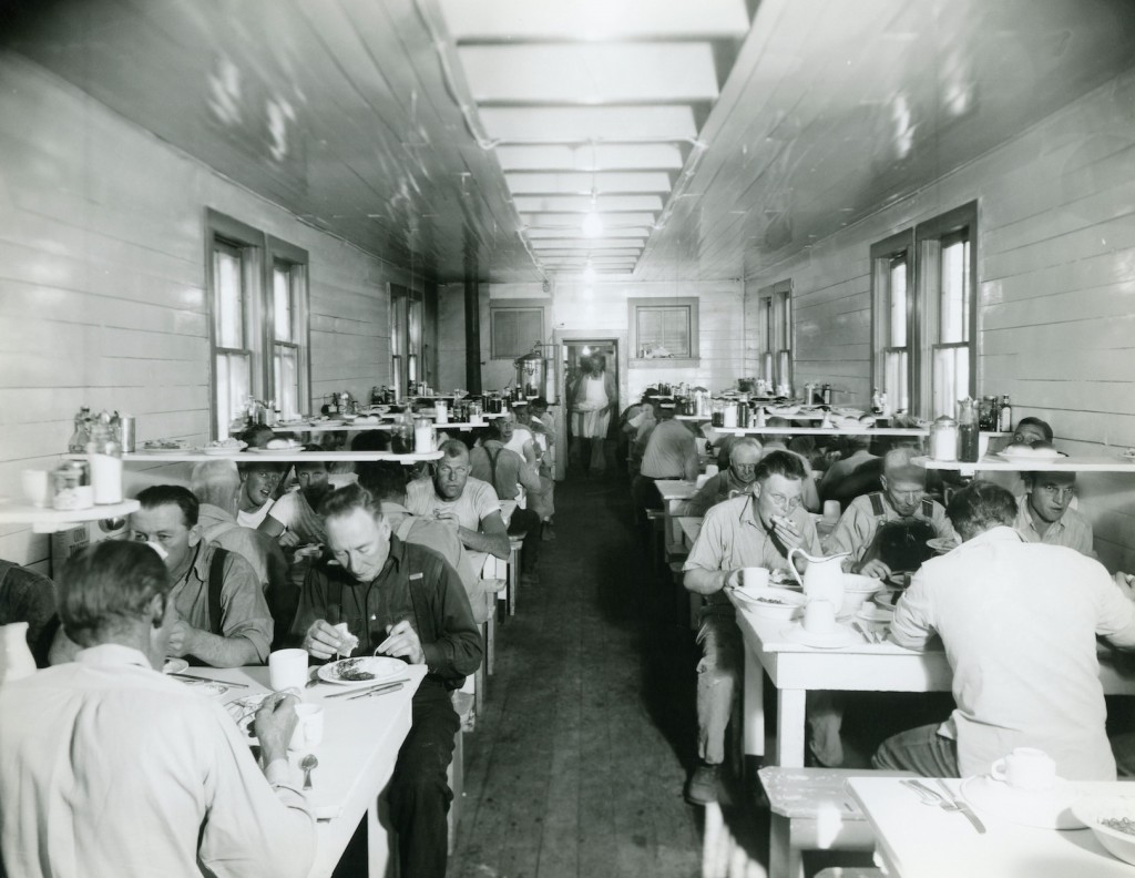
The cookhouse in logging camps operated at significant losses.In 1948, when logging camps of Fruit Growers Harvey line opened, raised the price of a meal to one dollar. Complaints were loud and long. But now, instead of losing thirty-six cents per meal, they only lost eight cents. That’s still substantial. At the end 1948 Fruit Growers’s losses for operating those cookouses was $63,500.
On May 2, 1949, Camps Harvey and Stanford opened for another season. In an effort to further reduce expenses, Fruit Growers leased the cookhouses and commisarries to the H.S. Anderson Company for one dollar. Fruit Growers thought perhaps an outside company could handle the meals more efficiently. They would never find the answer.
Camp Harvey Dining Car
Just threes into the logging season all operations on the Harvey line shut down. The cookhouse crews, represented by Local 768 of the Bartenders and Culinary Workers Union, walked off the job in a wage and hour dispute with H.S. Anderson Company. Logging came to a standstill. As the weeks passed with no end of the strike, Fruit Growers abandoned all logging operations on the Harvey line.
There are certain people that they get. attached to something, that they hard a hard time moving on. Fletcher Walker, Red River’s Resident Manager of Westwood resided there since 1913 and he remained in that community when it was solo Fruit Growers in 1944.. It should be noted that Fletcher was instrumental in the planing and the construction of Westwood Some residents have fond memories of Fletcher, similar to that of the patriachal figure.
So it was no surprise Fletcher game his opinion freely to Fruit Growers concerning the operations.In a letter dated September 17, 1948 to Fruit Growers criticize the company on many fronts. There was of course, the uncertainty of Westwood, however, that situations known throughout the community before Fruit Growers purchase. Fletcher was critical of Fruit Growers who raised the logging camp board, though in reality logging camps were expensive operation. Fletcher also questioned “cutting $300.00 lumber into $80.00 shook.
Box Shook at Westwood
Fletcher finally wrote: “If this plant were run to capacity there were would be a profit very close to $1,000,000.00 per month, which is quite a lot of folding money.”
First of all, I hope everyone has relaxing Labor Day.. Some one posted this comment about the 1927 Milford Rabbit Drive: “Is there is going to be a 100 year anniversary run for this event.” This I thought is an interesting concept for a centennial event and with some creativity’s some intersting potential. Anyone, up to challenge to organize it? I would be willing to assist where I can.
For those interested, I am working on the John Jay Casey article. It may be awhile, since my future post pile has a way increasing day by day.
Pine Creek, circa 1914. It sholuld be noted that John Spalding’s original homestead was on the north side of Pine Creek. Courtesy of Wyn Wachhorst
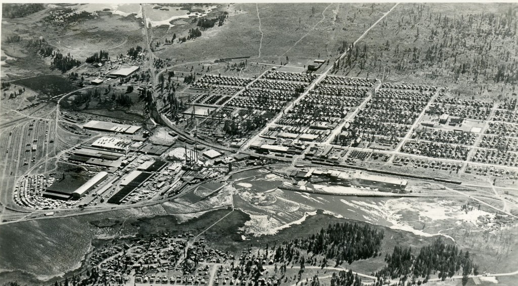
In 1919, Fruit Growers Supply Company purchased the Collins Tract west of Eagle Lake the contained an estimated a billion board feet of timber. Lassen National Forest officials suggested a mill site on Pine Creek near Eagle. Lake. Fruit Growers examined two sites, in the region what is known as Spalding Tract. They were informed that Eagle Lake had dropped from 3 to 4 feet during 1917-18. There was also the uncertainty where Leon Bly had obtained water rights to the lake for irrigation in the Honey Lake Valley. It was suggested that Fruit Growers place a dam at the Pine Creek estuary for a millpond and in the worst case scenario drill wells for a water supply. After a short debate Fruit Growers decided to locate the sawmill at Susanville.
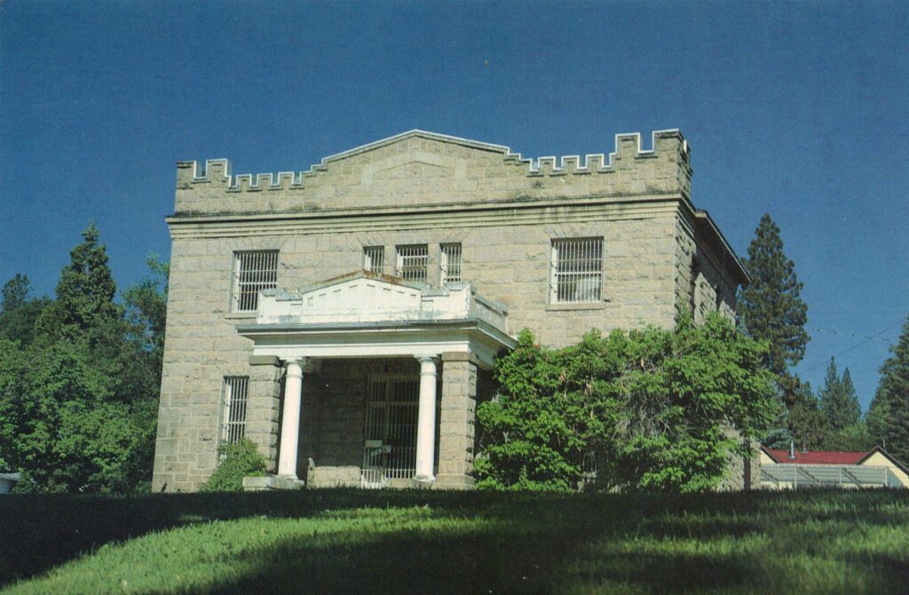
Yesterday, we explored this building’s counterpart, the Lassen County Courthouse. The old Lassen County Jail was built in 1911 at a cost of $30,000. Noted architect Frederick deLongchamp designed the building. It should noted deLongchamp was the architect of the St. Francis Hotel, now a thing the past and the original Susanville City Hall. One of my favorite deLongchamp buildings is the Modoc County Courthouse.
This jail closed its doors in 1971, when a new jail was constructed behind it. That jail no longer exists and that’s another story. The old jail has been nearly vacant as long as it was in use. The roof of the building has partially collapsed, so how much long will it stand remains to be seen. In the future we will explore one proposal to restore it.
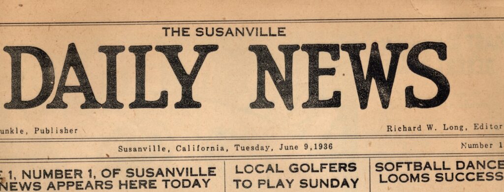 There were several journalists endeavors in Susanville over the years. They were usually short-lived. One of theses the Susanville Daily News that made its debut on June 9, 1936. It was actually the reincarnation of the Daily Reminder. The Reminder was a mimeographed publication while the Daily News introduced readers to lithography.Percy Dunkle was the publisher and Richard Long, the editor. Dunkle was formerly associated with Lassen Mail newspaper and he had the financial backing of Ike Knoch.