Category Archives: History

Termo Post Office

The landmark Termo Store.
Termo came into existence with the arrival of the NCO Railroad. The post office was first established on September 18, 1900, with Edmund Welch as postmaster. The post office then was discontinued on August 1, 1908, because the small community suffered from illusion of grandeur that never prevailed. With the arrival of new homesteaders, the post office was once again re-established on September 2, 1915. On January 31, 1989, postal officials from Reno, Nevada inspected the premises. They feared that due to the snow and ice accumulations on the building that it might collapse, creating not only hazard to the postmaster, but to the patrons as well. On February 2, 1989, the post office was officially closed.

Support!

Gallatin Beach – Then & Now

A view of Gallatin Beach circa 1918. Courtesy of Wyn Wachhorst
This was not an attempt to take a photograph from the exact area 100 years ago. It is just that one day in June, I was coming down Gallatin Peak, and there was a break in the trees to take a photograph. While the lake did come up several feet this winter, one can see it is no where near its all time high.

Support!

South shore, June 9, 2017

Poison Lake Revisited

Poison Lake
Poison Lake, 1916
I originally posted this back on March 27, 2015 and it received a number of comments. The original post: A shallow lake with water that was found to be unfit to drink by the emigrants on the Lassen Trail. The travelers also found that Lassen’s Trail was not “fit” for travel either. In 1916, it was part of the Honey Lake Valley Irrigation District’s scheme to tap into this and other lakes and small streams, to transport it all the way to the east side of Honey Lake for reclamation purposes.

On October 21, 2015 Jake Martin an archaeologist for the Eagle Lake Ranger District wrote: I use your Lassen County Almanac all the time to supplement my report writing with historical information! In the past I have run across an interesting note about the etymology of Poison Lake. This was found within the journal of Gorham Gates Kimball who was driving sheep to Idaho [in 1865], annotated by Edward N. Wentworth. It mentioned that Poison Lake ‘was so named from the effect of the bites of small red spiders which frequented the surface of the water.’ Apparently, merely washing your face and hands was enough to receive bites and experience red inflammation.

Unfortunately, my copy of that sheep drive has no reference to Poison Lake. It does make reference to being attacked by horse flies along Pine Creek.

Support!

Pike’s Point – Eagle Lake

A view of Pike’s Point, Eagle Lake, circa 1917. Courtesy of Wyn Wachhorst
Thought many might enjoy this photograph of the south end of Eagle Lake during its high water mark of 1917-18. This is a part of the Gallatin/Wachhorst collection that I am slowly scanning. As to the origin of the name of Pike’s Point, is unknown to me, but documents indicate that it was so named prior to 1920. The 1979 Pikes Point Archaeological Report did not shed any light on the topic. Now is there any willing takers that want to locate approximately and take photograph of what the view looks like today?

Subscribe!

How high is Honey Lake?

Honey Lake, 1984
Honey Lake, February 1984. To the right is the Hartson Sand Ridge. Photograph courtesy of Bob Sorvaag
There is no question that there is a lot of water in Honey Lake. For some it might seem something like a novelty, since the lake has been dry for so long. While levels of Eagle Lake are taken on a monthly basis, that is not the case with Honey. Anyhow, Honey Lake has been a lot higher, than it is presently.

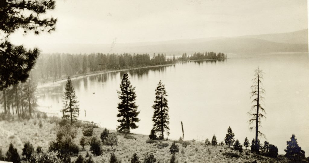
The winter of 1906-07 ushered in a notorious wet cycle. March of 1907 was rather dramatic with over 12 inches precipitation—sometimes in the form and rain, and other times as snow. In January 1911, witnessed the first of two “big snows” wherein Susanville received 8 feet; Standish five feet, Wendel 8 feet. The lake flooded vast sections of land past Standish. This prompted B.F. Gibson of Litchfield to propose a canal from Honey Lake to Pyramid Lake as way to rid the area of excess water.

Support!

That Can Do Spirit!

Convention delegates arriving at the Susanville Depot. Courtesy of Nellygrace Stoll.
The old time Honey Lakers were a resourceful lot. When they made up their minds to do something, they did it. In the near future, we will examine some of things they had taken on. One of the “biggies” was how a local bunch of legionnaires with the community support was able to land the California American Legion Convention in Susanville. This was no small feat and the competition was fierce. To this day, one can see many of the legacy’s from that 1926 convention.

Support!

The founding of Five Dot Ranch

Five Dot Ranch, Willow Creek Valley, 1958. Courtesy of Wendell Loughead
Headquartered in Willow Creek Valley, this ranch, like so many others has a storied past. For the most part of the twentieth century it was known as the Lonkey Ranch. In 1939, the Lonkey’s found a buyer, W.C. Anderson, a banker from Galt, California. The ranch would change ownership several times and in the spring of 1949, two cousins, Ben Dyer and Arlyn Hughes from Gridley, California purchased the Lonkey Ranch. The two men needed financial assistance and brought in three partners: Marvin Kirk, Jack Hughes, and B.B. Hughes. They named their new enterprise the Five Dot Land & Cattle Company, with Arlyn Hughes operating the ranch. The partnership was brief and the ranch was placed on the market in 1958. In 1959, the Swickard Brothers, Jack and Tom of San Jose, purchased the Five Dot Land & Cattle Company for a reported $300,000.

Support!

Eagle Lake, 1915

An Eagle Lake ice cave, circa 1916. Courtesy of Wyn Wachhorst
This spring I wrote about the pamphlet entitled Lucky Land of Lassen that was produced and distributed at the Panama Pacific International Exposition that was held in San Francisco during 1915. At that time, I mentioned that we examine the material, and with that in mind, here is the first of two installments concerning Eagle Lake. The following is the earliest account concerning the lava beds and ice caves.
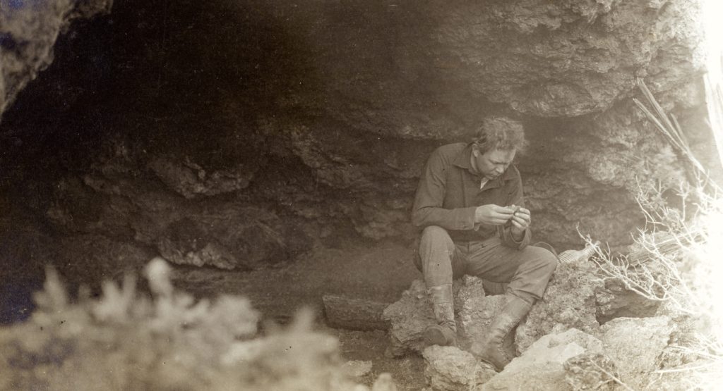
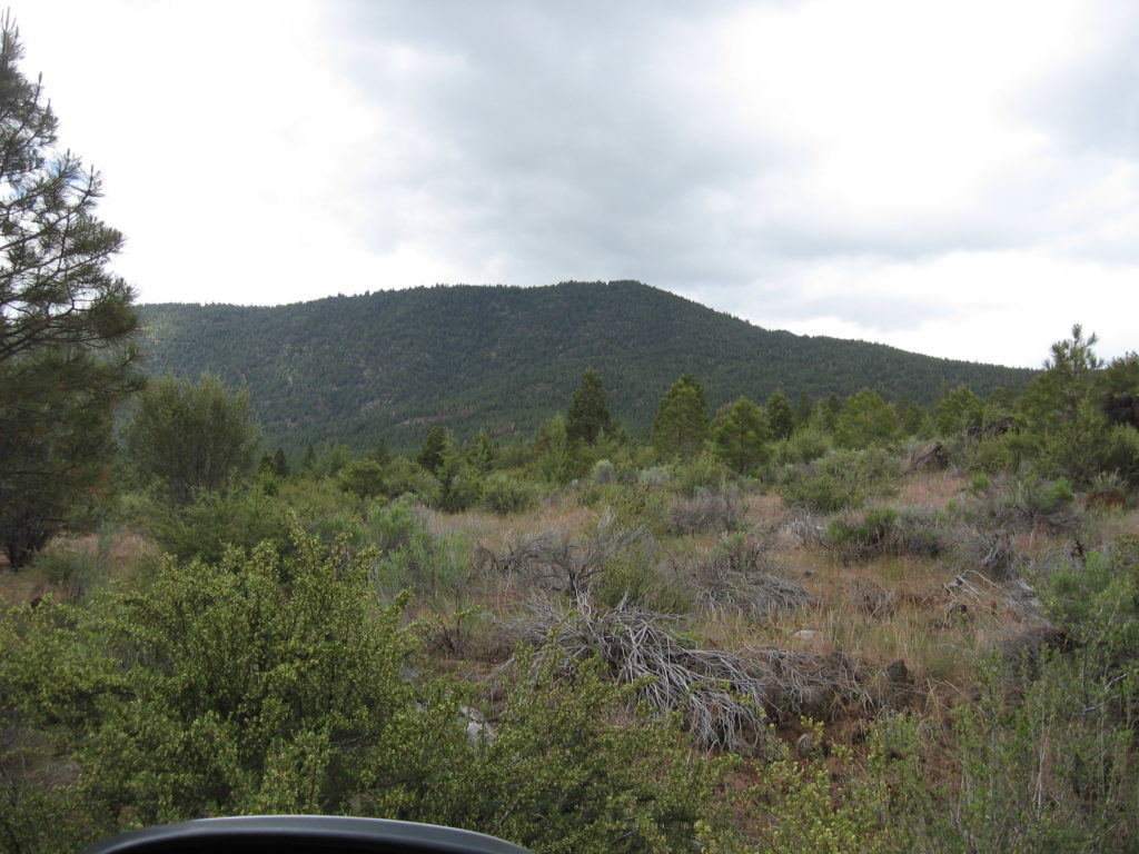
“To the west of Spalding lies what is known as the ‘Lava Bed county,” about seven miles long and three or four miles wide. This is the wildest region in this section, and excepting the vegetation, it is almost as when the lava first cooled. It is full of caverns, wells and cracks, one of the latter being five miles long and three to twenty feet wide. In one place it has been sounded to a depth of 160 feet and no bottom found. In this crack there is an ice cave where plenty of ice may be obtained any year until August and some years throughout the entire summer.”

Support!