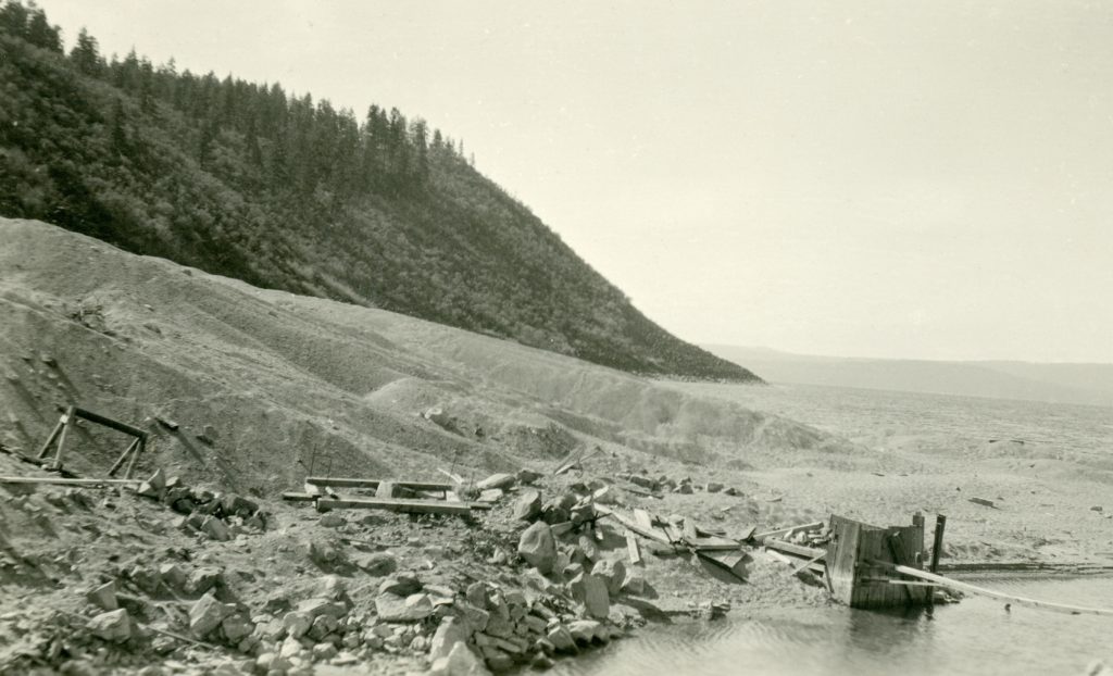
My grandmother, Lola Murrer Tanner, 1899-1973, referred to this east side landmark as Cove Point, which is just south of Bly Tunnel. While, it has no official designation as such, it is not unusual for some one to give a prominent spot a name for reference. This is more a photographic essay of the fluctuation of the water level at this particular spot over a span of nearly a century. The above photograph not only shows the point submerged but the tailing pile of the Bly Tunnel.
Cove Point, 1925
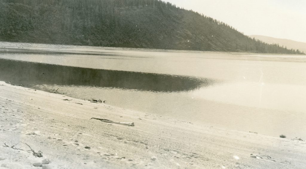
While not taken at the same angle, what a difference four years make with the drop of the lake level.
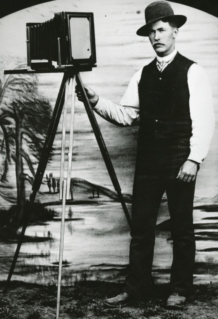
Alexander Howell, a professional photographer who operated a studio in Susanville during the early 1890s.courtesy of Donna Howell
There have been so many changes that have occurred in this digital age. This, of course, brings us today’s topic. Awhile back a friend and I were discussing cameras—the ancient kind that use film. We both have 35mm cameras. The question the both of us have, what do you do with these old cameras? As the readers of this site are a knowledgable lot, we look forward to anyone’s feed back.
In certain ways, Red River Lumber Company’s logging Camp 57, was in one sense one of the best known, and least known. Why the paradox? It was located adjacent to Chester, though many in the region were not familiar with its initial designation. It was established in 1922 and was one of the longest operating logging camps of Red River. Many logging camps of the era had a life span of one or two years. In addition, Camp 57 remained opened in the winter, even though logging had been suspended. During the 1920s, Westwood had a constant housing shortage, so the camp provided for additional housing in the winter months.
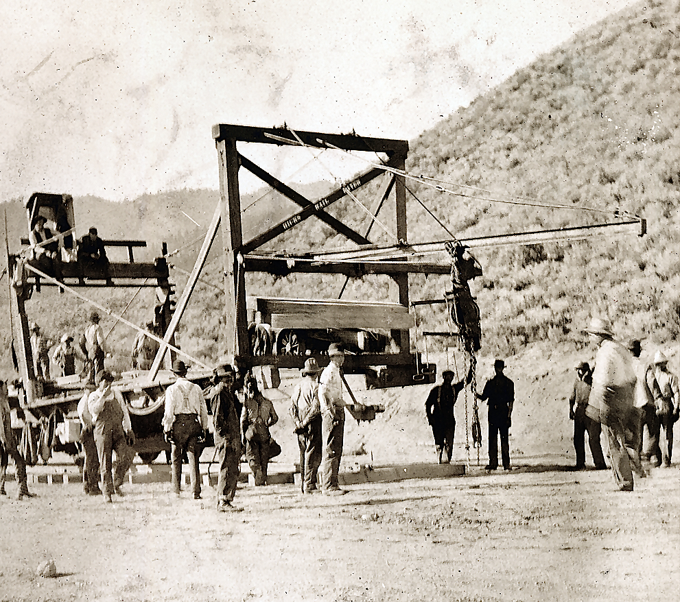
Construction of the Western Pacific Railroad near Constantia. Courtesy of Marie H. Gould
In 1907 the Lassen Advocate provided some interesting statistics concerning the construction of the Western Pacific Railroad (WP). The paper’s editor/publisher, E.W. Hayden, was fascinated that there were to be 75 bridges, most of which were west of Wells, Nevada. The aggregate length of these bridges was estimated at three miles, that would require 20,000 tons of steel to construct. Then there was the staggering amount of tunnels to be constructed. In a bit of tongue and cheek, Hayden suggested the WP should change its name to the B&T—Bridge and Tunnel Railroad.
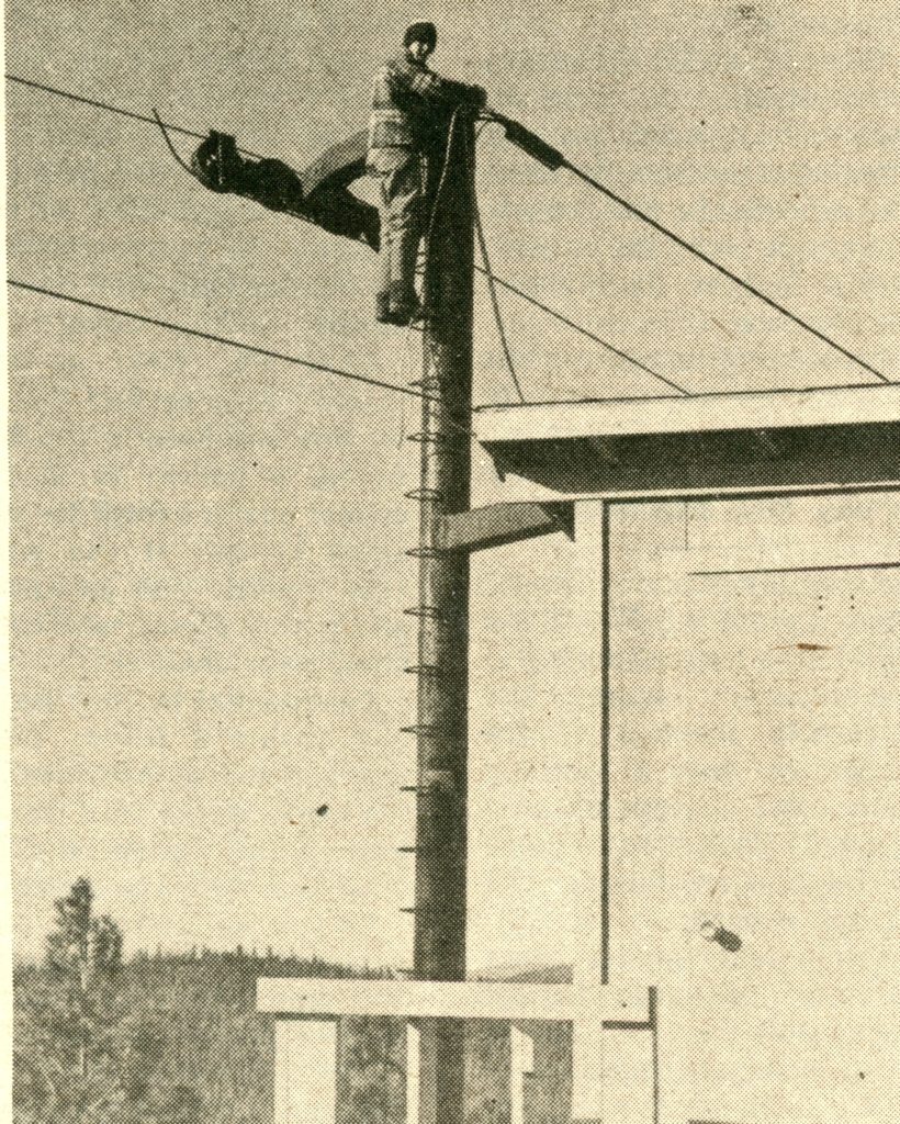
Mike Johnson, Lassen College student, checks a pulley atop the last post at the top of the mountain.
“This was our dream 30 years ago; to get a lift that would go clear to the top of the mountain, and where you didn’t have to hold onto a rope all the way.” Those were the sentiments expressed by Maurice Hertzig, Westwood’s Fire Chief and Harold Powell, Lassen College professor in December 1976 when nearing the completion of the Pomo lift at Coppervale. The new lift powered by a 60 horsepower electric motor, will rise 1,560 vertical feet up the mountain and have a capacity to move 550 people per hour. The three month construction project cost $29,000.
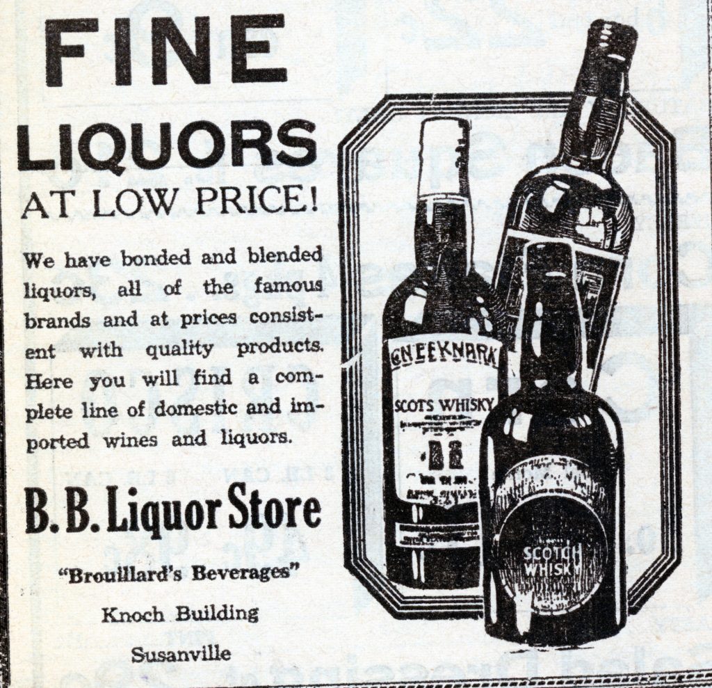
Seasoned residents will remember with fond memories of the B&B, a fine restaurant and bar located in the Knoch building. Before it became the B&B it as the B.B. Liquor Store. The B.B. stood for Brouillard’s Beverages, after the owner, E.H. Brouillard.
Some may recall in the banquet room, there was a rather large canvas mural 6’ x 20’ of Mount Lassen. It was painted by J.E. Lane, and the mural still exist, it being in storage. It should be noted that two other works of Lane have graced the walls of the Lassen County Courthouse since 1917. One is of Susanville as it appeared in 1864. The other is of Warner Valley, with Lassen Peak in the background. Why the County Board of Supervisors selected the latter has always confused me. First Warner Valley is in Plumas County. And, secondly, Lassen Peak is in Shasta County.
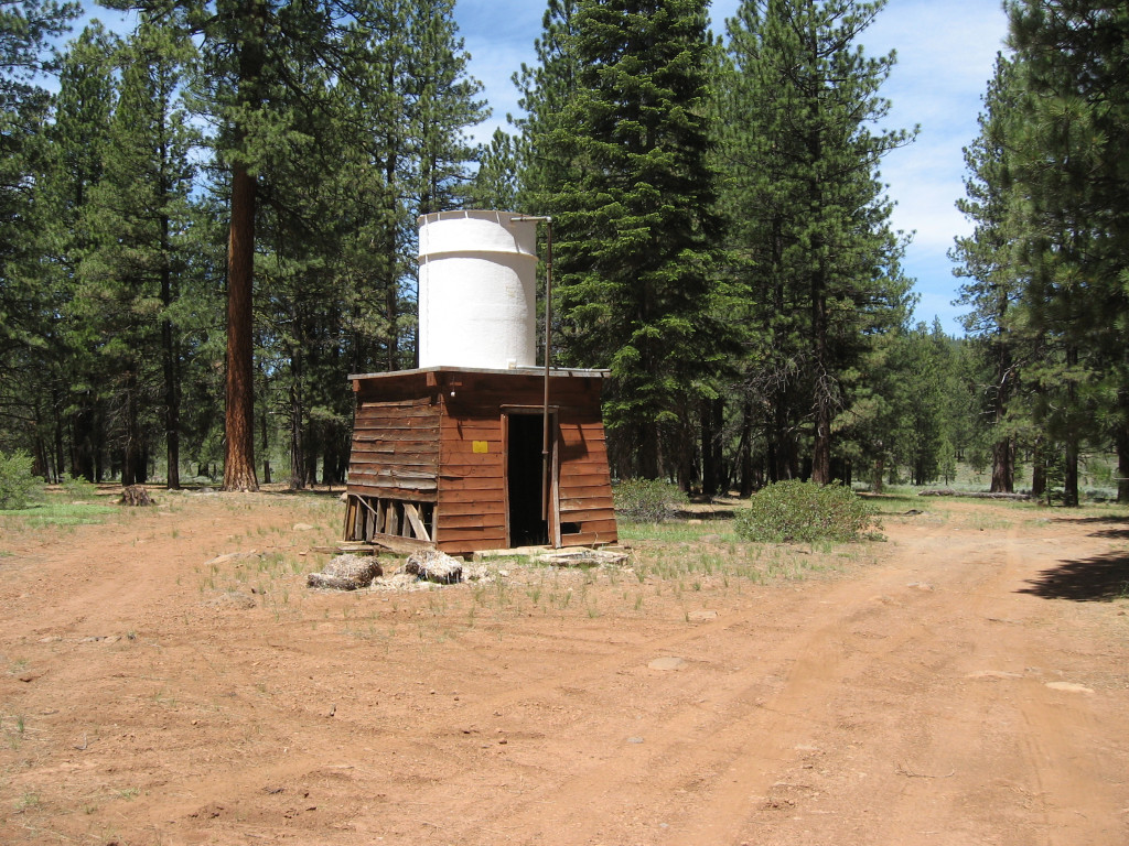
This old water tank is the last remnant of Camp 8, Photo taken June 18, 2015
On a quarterly basis, I ask you the reader, if there is something you would like to learn more about or maybe its something you heard, but question its validity. So here is an opportunity to participate. I will do my best to answer any questions. It should be noted, it may take awhile for the answer to appear as a post. The primary reason, many of the daily posts are done nearly a month in advance. So by the time you read this I am already working on posts for the middle of February, or at least I should be. Whatever the case may be, I look forward to hearing from you. Of course, it should be noted that paid subscribers requests receive priority. In addition, you can always send a request at any time.
P.S. – I have not forgetten about Halls Flat. In search of a contemporary photograph for an introduction.
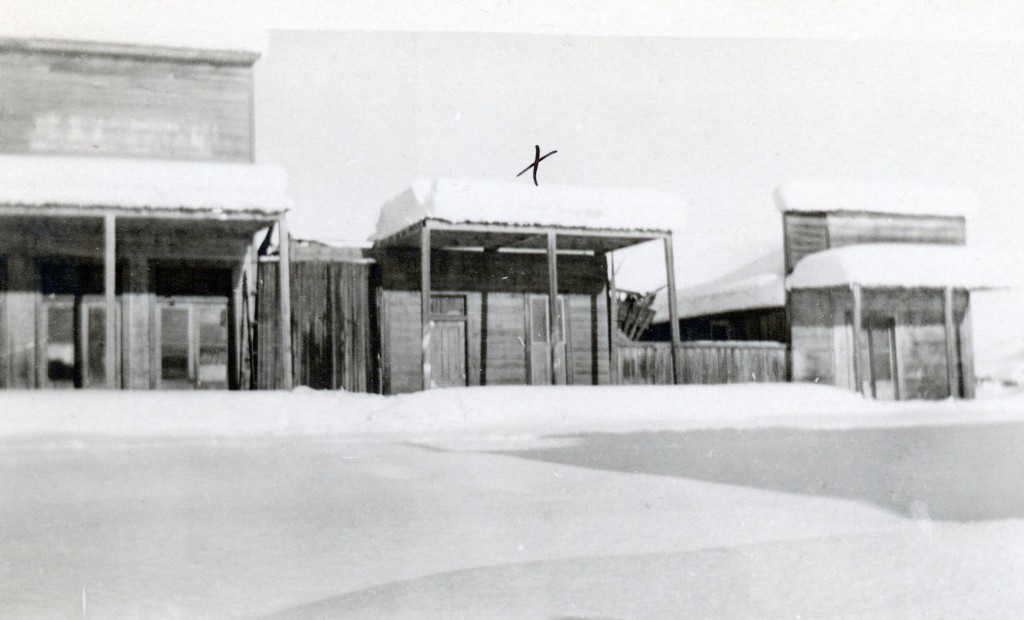
Amedee, January, 1911. The “x” indicates the town’s old dance hall. Courtesy of Madelyn Mapes Dahlstrom
According to the weather gurus, this week we may experience a decent storm. January, typically, is when some of the record breaking storms occur. Take for instance in 1911, when in one storm Susanville received eight feet of snow. What was truly remarkable was Amedee, on the desert east side of Honey Lake received the same amount. Johnstonville resident, Robert E. Trussell, who was fourteen at the time, recalled you could not see a single fence post in the valley.
Construction of the Fernley & Lassen Railroad, west of Susanville in eight feet of snow.
In January 1914, snow pummeled the region. This caught Southern Pacific Railroad officials off guard. Talk about panic mode, and they recruited 1,000 men to shovel eight feet of snow, so as to not hinder the construction of the railroad to Westwood, to honor the contract with the Red River Lumber Company.
North Pine Street, Susanville, January 1916
In January 1916, single storm dumped four feet of snow in Susanville. Westwood on the other hand had eight feet of snow. This storm was followed with bitter sub-zero temperatures. The snowstorm paralyzed the NCO railroad in eastern Lassen County that resulted in a twenty-one day blockade.
Last summer I had good intentions to visit various sites to take photographs of what they look like today. The Eagle Lake Golf Course of the late 1920s was one of them, but I never made it. However, the Whaleback Fire did hinder some expeditions. John “Burt” Christie, one of the early operaters of the Eagle Lake Resort, was an interesting figure at the lake’s south shore. Besides the resort, he eventually became the caretaker of Gallatin House and the Gallatin properties at the lake. Continue reading The Eagle Lake Golf Course→
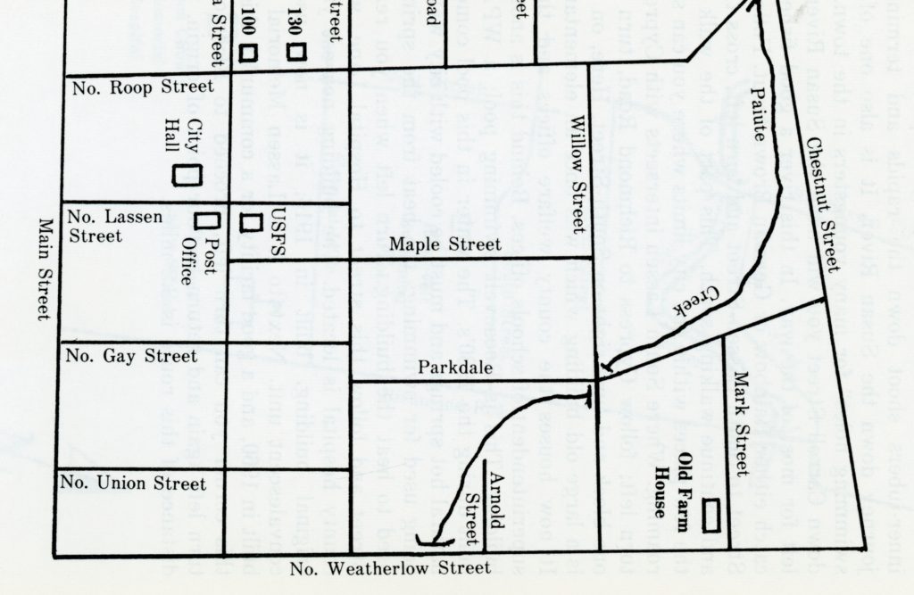
A sample map from Susanville Strolls. I might need some assistance to draft new ones.
First of all, I want to thank those for such wonderful feedback. Folks, I think we are not exploring Susanville’s neighborhoods, but all the wonderful regional trails and other kinds of self guided tours to be created. I am excited, and the possibilities are endless It will be my goal to create separate page for these self guided tours, so they will be easy to find. In addition, unlike print format, updates can be made, such if a walker sees something of interest, that could be included.
445 North Roop Street is the oldest “house” still standing and part of the red light district prior to the railroad. November 7, 2015
One route I have already plotted out mentally. Using the intersection of North Roop and North Streets as a starting point. It is interesting to note that the 200-300 blocks of North Roop contain a wide variety of architecture—bungalow, craftsman, Italianate, Queen Anne to post World War II residences, and a hodepodge in between. Continuing further down street, then making a turn onto Chestnut, overlooking what was once known as Vallejo Meadows. Thence from Chestnut, a right at Parkdale, which was created in 1947 and either to North or a detour to Maple Streets. This particular stroll is approximately one mile.
Roop Street Remains, September 3, 2018
Finally, those who want to join me while I do a preliminary runs, on any given route, let me know. My schedule is flexible, so I can accommodate.