The Round Barn, Little Valley, Lassen County, prior to it being moved to Fall River Mills. Courtesy of Tom Glunt
Shird Eldridge (1857-1937) was a long time resident of Little Valley, before moving over to McArthur. In 1924, Shird was reminiscing with the editor of the Fall River Tidings the newspaper that focused on the events of the Fall River Valley, Shasta County.
Shird remarked, “This year reminds of times nearly forty years ago—when such conditions prevailed—but the people were better off then than they are now. In those days the farmers raised all they needed, went about with horses and buggies—had just as good times as now, and all they cared to raise, besides crops, was their tax money. Some of them had hard scratching, mortgaged their ranches and being unable to pay off their mortgage, lost their places. But today—it takes so much money to buy gas and oil and to keep up payments on automobiles. Living costs are higher and the farmers are living a swifter pace, endeavoring to keep up with the extravagant ways of the people of this age.”
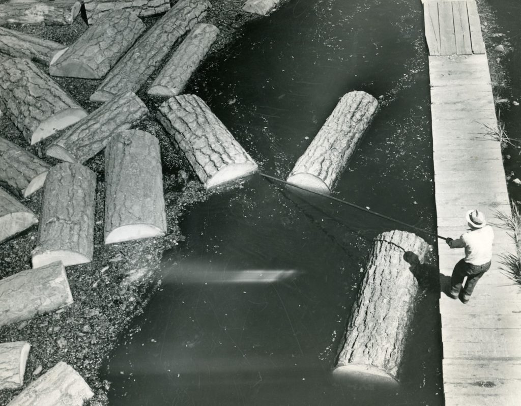
Some times I find it strange to write about the lumber industry that is non-existent in area, with the exception of Collins Pine at Chester. The above photograph are real premium peeler logs. These logs were literally peeled into sheets of plywood. Unlike regular logs that went through the sawmill, these logs were cut into eight foot lengths, unlike the standard thirty-two foot log. In 1924, Red River Lumber Company invested a half-million dollars to add a veneer plant at its Westwood facility. Red River used the trademark Paul Bunyan’s Pine Plywood for its final product. Red River, like so many other lumber companies, did not allow anything to go to waste. The peeler cores were made into railroad ties.
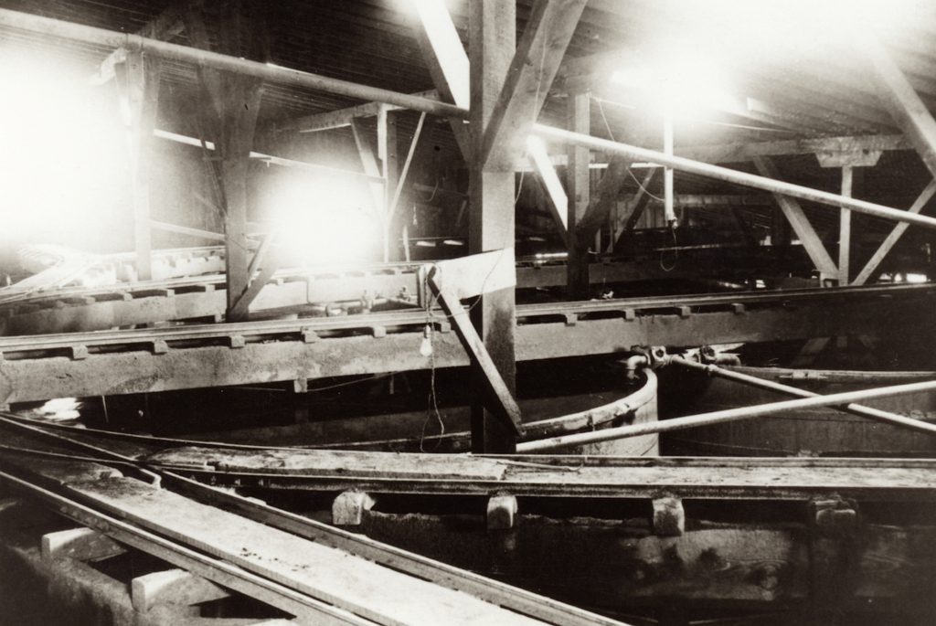
Cyanide tanks at Hayden Hill, 1903–Lassen County Historical Society
Some of Hayden Hill’s history is fairly well documented, and others aspect hardly nothing. One of the Hill’s most important operations were the cyanide tanks, used to leach the gold from the crushed rock. It was such an integral part of the mines, yet references are almost non-existant, and then quite void of hardly information. It is interesting to note the cyanide tanks from the early mining days were still there in 1962.
During the 1990s, when Lassen Gold revived mining at Hayden Hill, cyanide was also used. Even though Lassen Gold shut down in 1997, the wells there are monitored for any cyanide leakage.
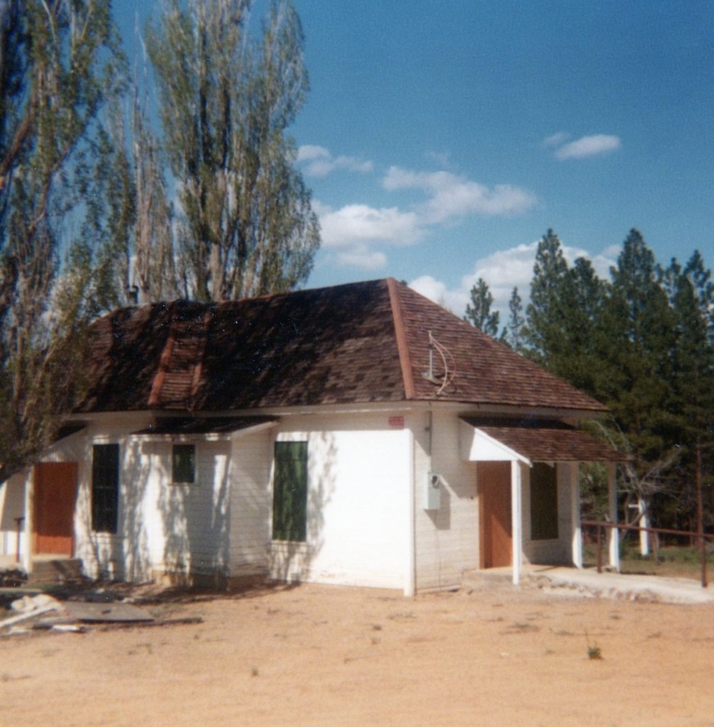
The abandoned CDF Station, Willow Creek Valley, May 1978
In 1935, the Lassen County Board of Supervisors passed a resolution for the establishment of Civilian Conservation Corp camps (CCC) throughout the county, including one at the upper end of the Willow Creek Valley, between Susanville and Eagle Lake. The resolution stated would have “great value” to protect the timber. In addition, the men employed could aid the region with soil erosion and related issues. The resolution was sent to M.B. Pratt, forester for the California State Division of Forestry. Pratt informed the board it could not assist with CCC camps at that time, due to Congress failure to pass a funding bill.
The Lassen County Board of Supervisors were persistent in their efforts to have fire camps established. In July 1937, State Ranger J.W. Nevius announced the established of four fire camps for Lassen County. One was for Willow Creek Valley and it was agreed the county would donate 2.5 acres to the State Division of Forestry that included the former home of C.E. Hurlbut. The initial Willow Creek workforce consisted of Charles Windamier, foreman, Harry Fox, cook, and crew members John Patten, Max Reedy, George Ross and Arthur Dixon. John Webb who worked there in 1945 recalled, “My first assignment was at the Willow Creek CDF camp. I recall there was one permanent building used as a office and mess hall. Sleeping quarters were in tents erected on wooden platforms.”
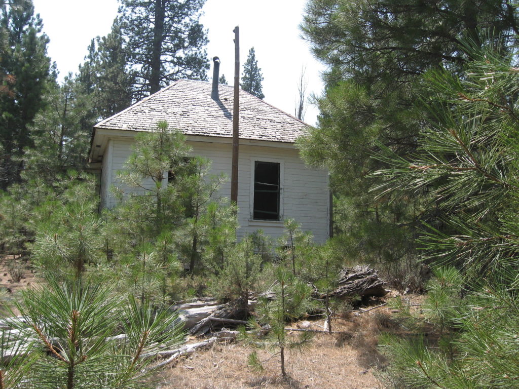
As it appeared on August 9, 2018
In 1948, a fire station was established further north near Grasshopper Valley and the Willow Creek camp was subsequently closed. In 1974, the state donated this parcel to Lassen Community College.
For those readers out of the area, many of the evacuation warnings including portions of Susanville and to the south of town have been lifted as of Sunday afternoon. Westwood and Clear Creek have been reduced from mandatory to warning and now are able to return to their homes. Janesville and Milford, along with Genesee and Taylorsville are still the major hot spots. With cooler temperatures and lighter winds will help with the containment.
While researching Granite Creek Station, I came across some correspondence with Jesse Horn. He was a grandnephew of Andrew Litch, one of the proprietors of the Station. Horn was born at Milford on May 25, 1912. On February 25, 1980 Jesse Horn, wrote: “An old Piute Indian from Nevada told me a story you might be interested in. At the time I was quite a small boy and as our custom was with the Indians, a sort of variation of a peace pipe. We cut a watermelon and ate it with him. This served two purposes for us; they didn’t steal our watermelons and they gave us their business.
This is what he said as he pointed across the lake to the Skedaddle Mountains. “See high water marks on mountain? Old Chiefs say many, many moons ago, no one can count. Great spirit get mad. Honey Lake that time, she big like many waters cover all valley, make Tahoe look like a pond. There was great big earthquake, thunder, lightning. Whole world shake mountains fall apart. Honey Lake break loose and make Pyramid Lake. All big fish go there.’”
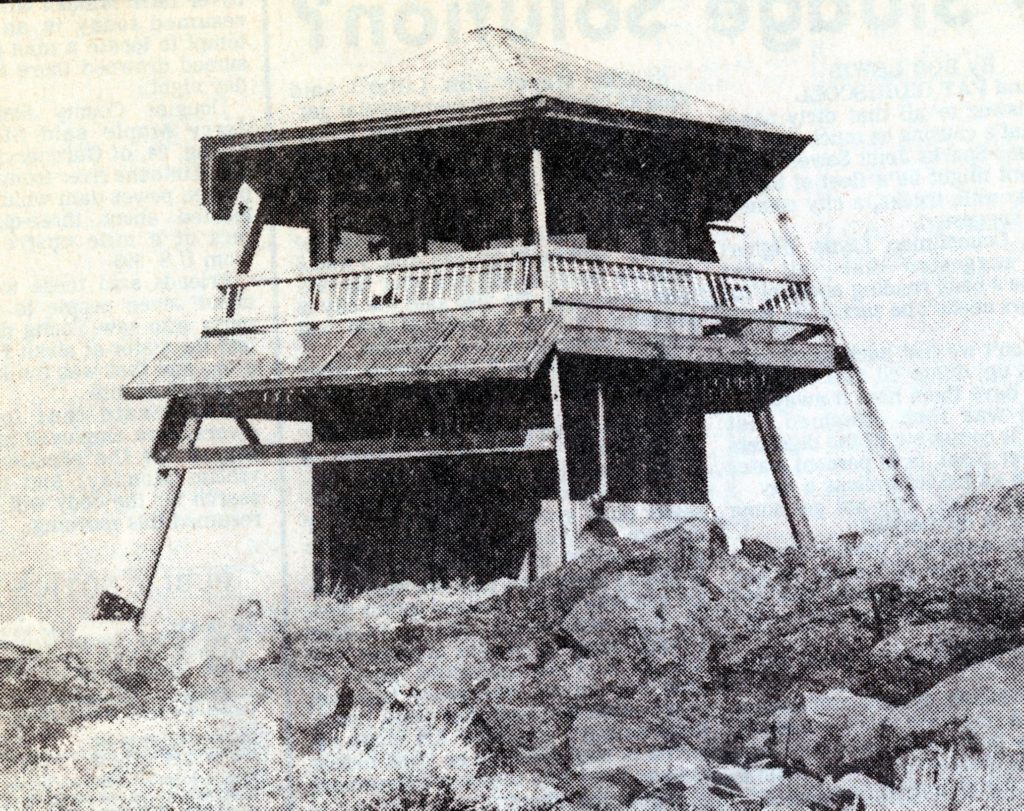
Antelope Lookout—Nevada State Journal, July 25, 1978
In a 1925 agreement between Fruit Growers Supply Company and the Lassen National Forest which came from a fire started by the company, in1924, on the west flank of Antelope Mountain, a lookout was built on that mountain was part of the settlement.
In 1978, it was a replaced by a two-story six-sided structure, which was dubbed the “world’s first solar-powered forest fire lookout.” Officials believed that the solar power could deliver power more cheaply in the long run, than utilizing gas or diesel generators. The lookout was funded by the U.S. Department of Energy and the development work was done by the National Aeronautics and Space Administration’s Lewis Research Center. A similar lookout was schedule to be built at Pilot Peak in Plumas County.
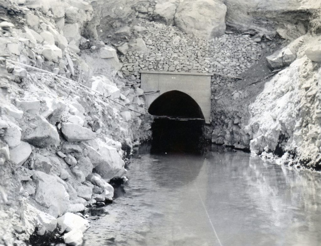
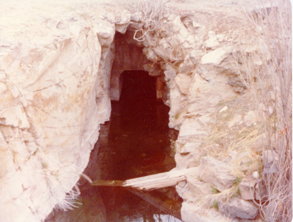
Bly tunnel inlet, July 1924. Courtesy of Wyn Wachhorst
Over the years I have fielded a wide variety of research requests and still do. With that in mind, we explore two different inquiries one dealing with the Bly Tunnel and the other at High Rock Springs.
In August 1990, Peter Moyle of the University of California, Davis wrote, “I spent four weeks this summer at the Eagle Lake Field Station teaching a field course in fish biology. One of our class expeditions was to the tunnel, to check out rumors that it contained “blind cave fish.” To our surprise, it did have fish although they were the same species found in Willow Creek. We also found that the chemistry of the water is the same as that of Eagle Lake, so the tunnel is still a chain on the lake.”
High Rock Spring, April 1975
In February 2021, Zachary Bess, wrote, “I am a fish biologist with the University of Nevada Reno. I am currently working on a multi-year publication project concerning all of the native fish species in Nevada. Your webpage is the only page on the internet where I have ever seen an actual picture of High Rock Springs!
“To my understanding, High Rock Springs tui chub went extinct in 1989 when tilapia were accidentally introduced to the spring in an attempt to begin a fish farming enterprise. This is mentioned in several agency documents from the 1990s. It was a genetically unique type of tui chub and was actually a candidate for listing with the US Fish and Wildlife Service prior to its extinction. I was interested in going out there to see if the speckled dace are still in there just out of curiosity.
“Eagle Lake is the only place on the eastern side of the Sierra where rainbow trout are found naturally. The Pit River and Lost River have several species that are only found in these water bodies. The fish in High Rock Springs were similarly unique considering that they got in there by means of Lake Lahontan.”
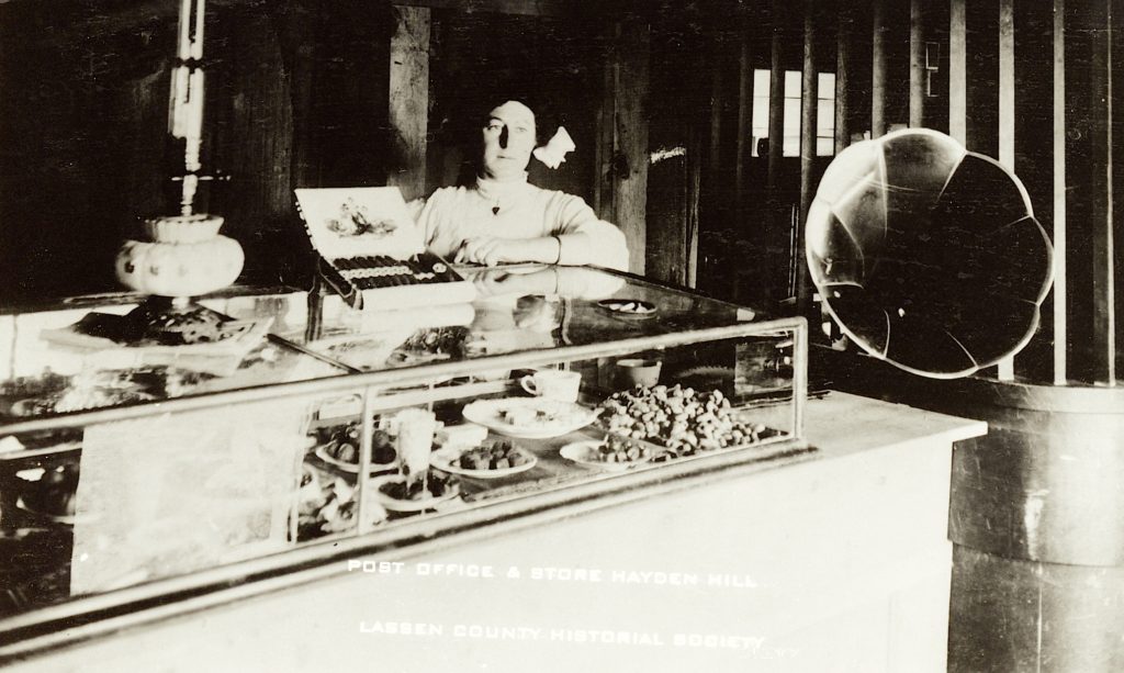
Hayden Hill Post Office & Store, 1903–Lassen County Historical Society
What a better way to gauge Hayden Hill’s mining boom and bust cycles with its frequent opening and closure of its post office. On April 13, 1871 the post office was established with Augustine W. Blair serving as the first postmaster. Blair’s tenure there was brief and would later have a interesting career in Nevada’s legal community. However, before Blair’s departure he left an enduring the legacy to the region. Blair was the first person to come up with the idea to tap Eagle Lake for irrigation.
On October 15, 1875 the post office was discontinued. It then operated from 1878-1887; 1888-1912 and revived in 1915 and on July 31, 1919 it closed for the last time..
On the east side of Hayden Hill was Letterbox Canyon. It was so named when the post office was not in operation, a mailbox was nailed to a tree at the bottom of the canyon along Willow Creek. The mail contractor would then pick and leave mail at this location, during the times when Hayden Hill’s post office was closed.
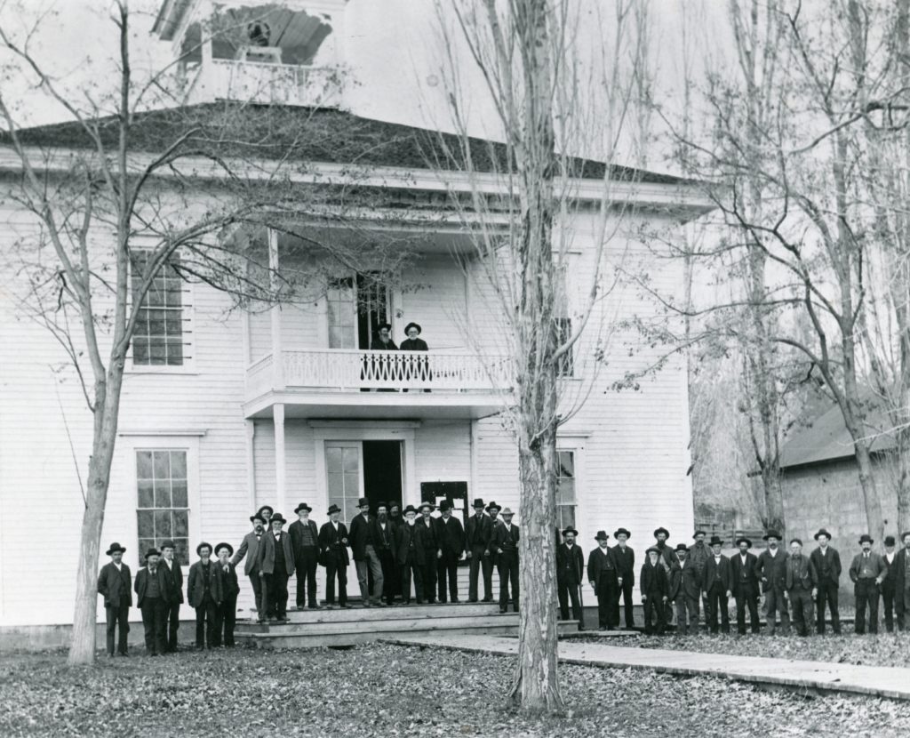
Lassen County Courthouse, circa 1890s. Assembled are county officials, along with the grand jury.
While watching the ongoing renovation/restoration process the Lassen County Courthouse, I thought I would share a bit of trivia, about the first courthouse, located on the same site. In February 1867, William R. Williams was awarded a contract, per specifications, of a courthouse at a cost of $9,850. It was accepted as completed on October 28, 1867. Not many people are aware, there is a small stream named for him—Williams Creek that flows into the Susan River at Devils Corral.
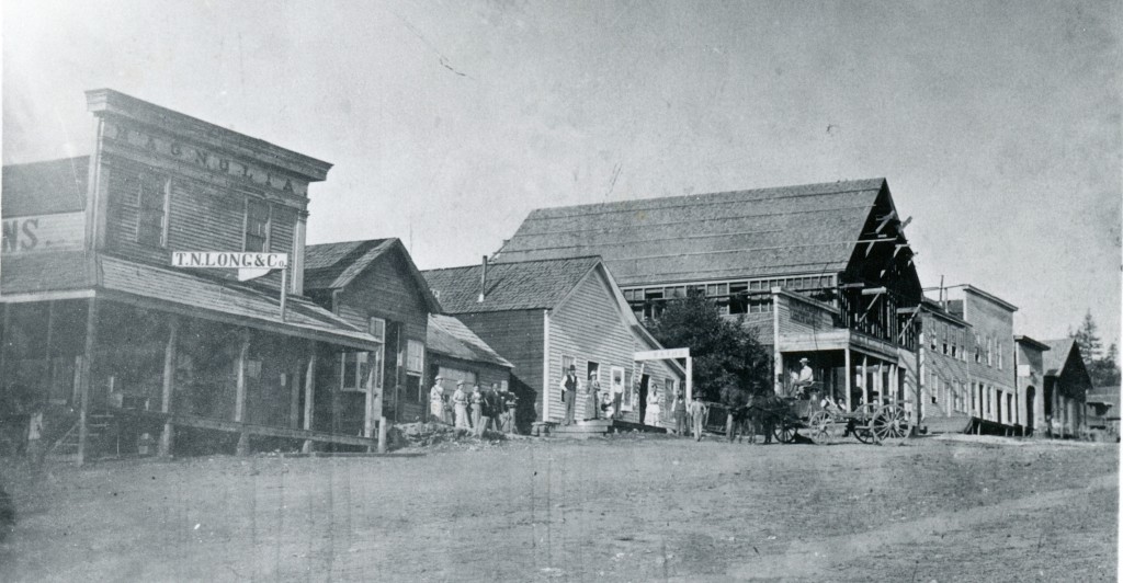
Susanville’s 800 block as it appeared in 1870s, with the Magnolia to the far left. Courtesy of Verna M. Wood
It should be noted prior to the construction of the courthouse the county rented several places to conduct county business. The courtroom and board of supervisors meetings were held in the Magnolia Saloon building, current site of the St. Francis Hotel.