Susanville’s The Big Store as it appeared in 1916. It is now the home of Margie’s Book Nook. Photograph courtesy of the Worley family
Mark your calendars for April 1 when Margie’s Book Nook celebrates forty years in business. The store had its humble beginning at 28 North Lassen Street, next to Fred’s Barbershop. Several years later, the store needed to expand and moved a block away to 35 North Gay Street. After several years passed, the store again needed more room. Another move, not quite a block away to the current location at 722 Main Street, next to The Pioneer.
I am not sure all the festivities planned for Saturday, April 1 but will be a lot of fun. More information and some of the store’s history can be found their Facebook page.
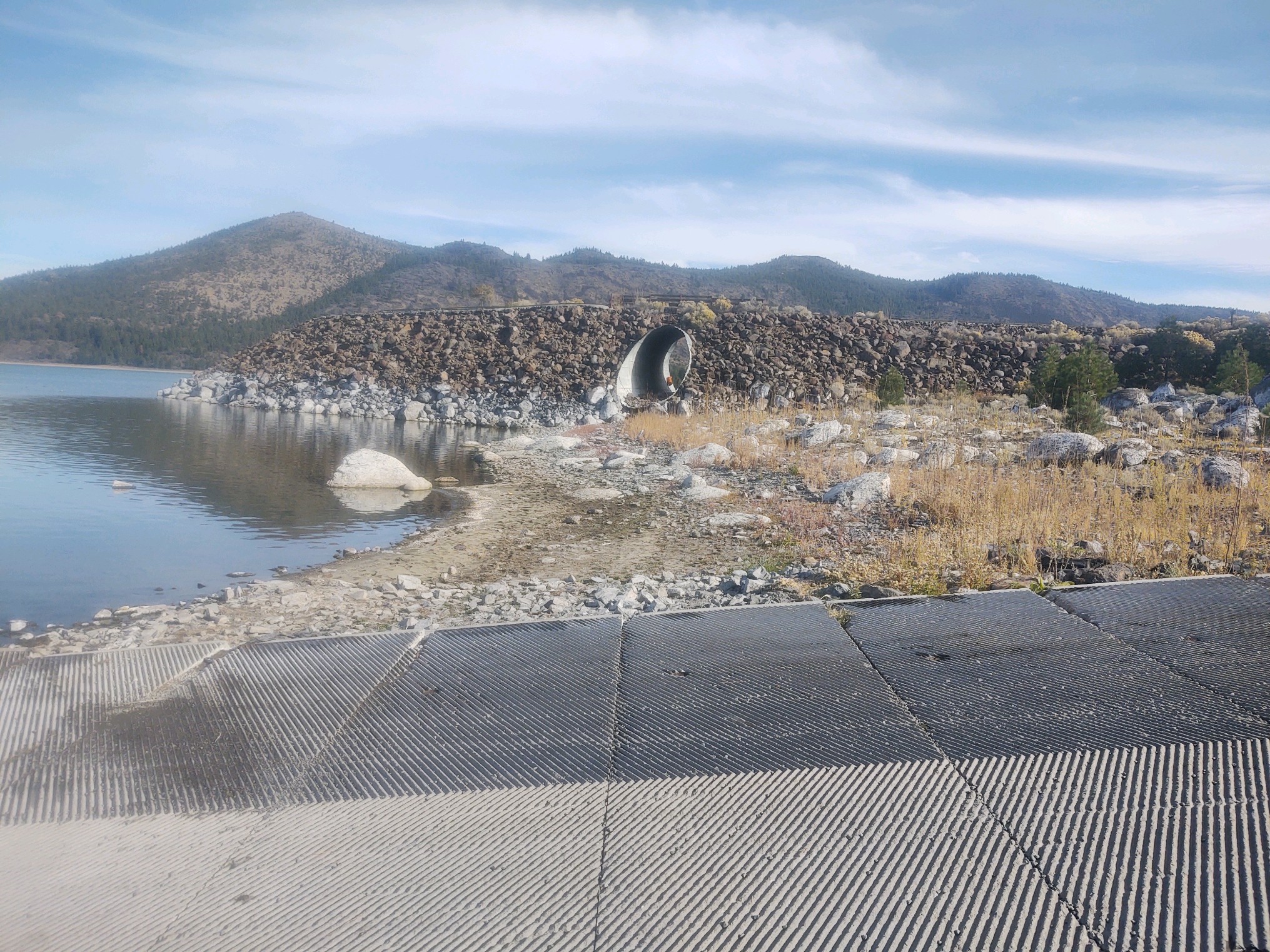
Notice the lime deposits on the rocks at Gallatin boat ramp, October 31, 2022–D. Willis
One of the interesting issues to surface in 1928 regarding the inlet problem of Bly Tunnel was the alkalinity effects of water used from Eagle Lake on lands in the Honey Lake Valley. There had been lots of speculation but no scientific proof. In the fall of 1928 Professor P.H. Hibbard of the University of California, Berkeley well versed in soil and water analysis arrived on the scene to examine the situation.
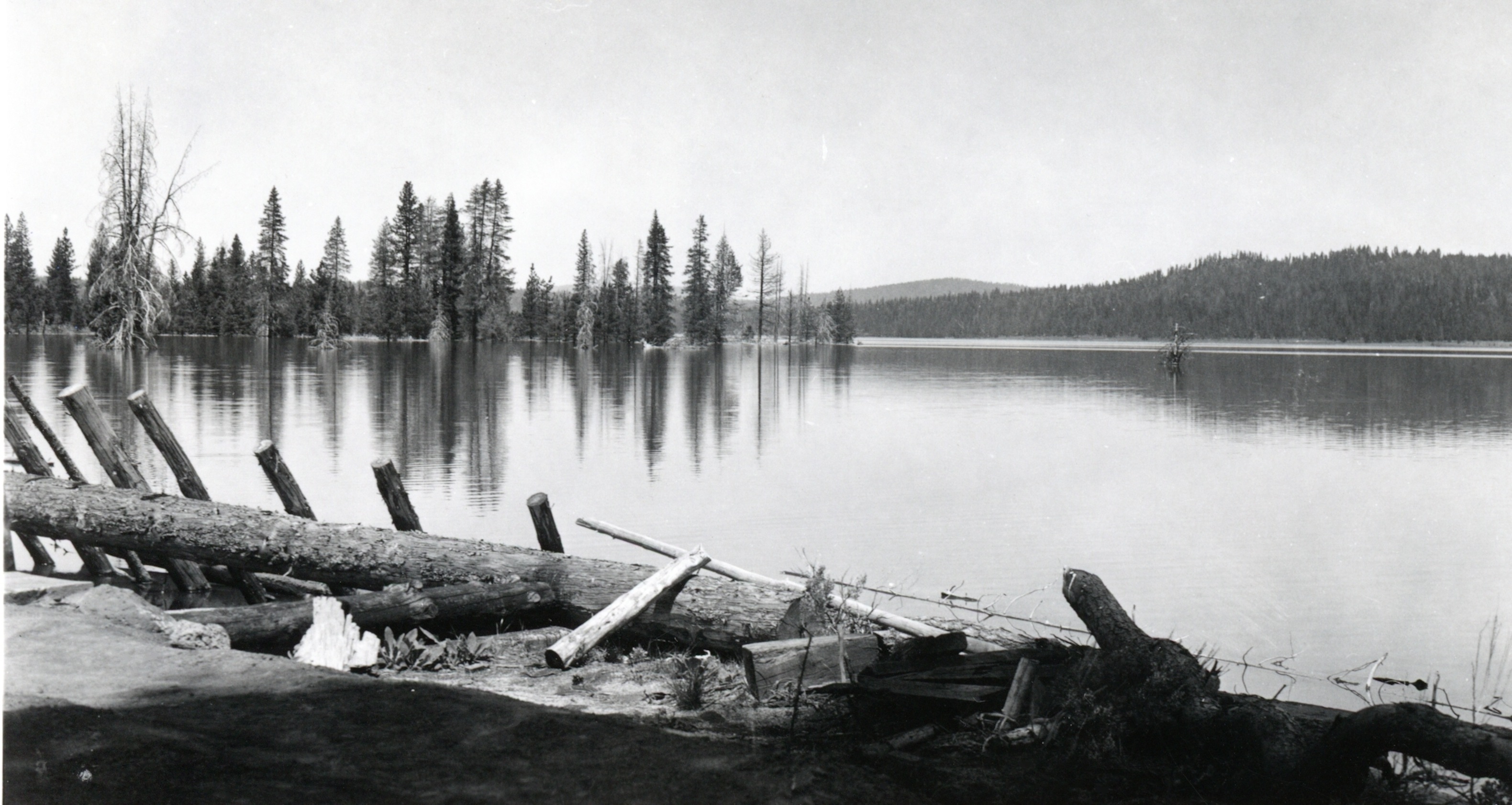
In Hibbard’s findings the Eagle Lake water was not a detriment to the irrigated lands in Honey Lake Valley. The lands affected there already had alkali in the soil, and the issue from irrigation was compounded by the fact of poor drainage on those lands. Hibbard noted that lakes without outlets tend to have a higher mineral content. He went on to state that the rocks along the shoreline at Eagle Lake that had a white layer on them when the lake receded were lime deposits.
In the summer of 1955, Fruit Growers Supply Company announced it would close their mill at Westwood. Another important event happened that year when in December the region experienced severe flooding, causing tremendous damage to the railroad tracks between Susanville and Westwood. The Southern Pacific deemed it too costly to make the repairs to that section of the railroad with the pending mill closure.
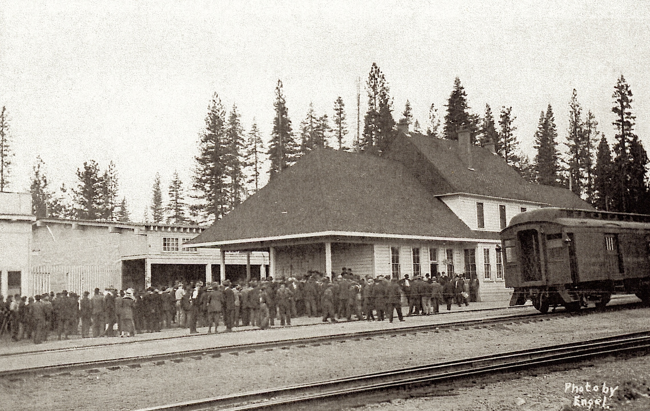
However, with all this bad news, Westwood Depot had some salvation. It should be noted, the depot was utilized by the Western Pacific on its Highline route between Keddie and Klamath Falls. Oregon. Thus, the Westwood Depot remained opened, how long was any one’s guess.
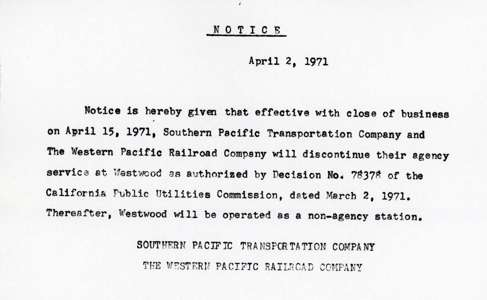
Westwood Depot closure notice—David B. Martin
In the spring of 1971, it was announced that the Westwood Depot would close on April 15, 1971. Just by happenstance, two Lassen College students, Roy Lopez and David Martin, paid a visit to the depot late that afternoon of the final day. One of the duo’s first encounter was to witness the Southern Pacific’s trainmaster from Redding to remove the station’s clock. The remainder of time was spent visiting with the Depot’s agent, J.C. Hoxie. When Hoxie escorted them out, the door was locked for good from the public.
On a follow up, the Southern Pacific transferred Hoxie to Wendel. The depot stood vacant for several years and was finally dismantled in either 1975 or 1976, as I have conflicting data. If anyone has more information on that event, please let me know, so I can update this post.
McCoy Flat Reservoir dam, 1915. Courtesy of Alphozene Terrill, granddaughter of Ben H. Leavitt
Note: This originally appeared on December 19, 2019. With all the flooding issues around California, I thought it would be worth while to visit the topic locally.
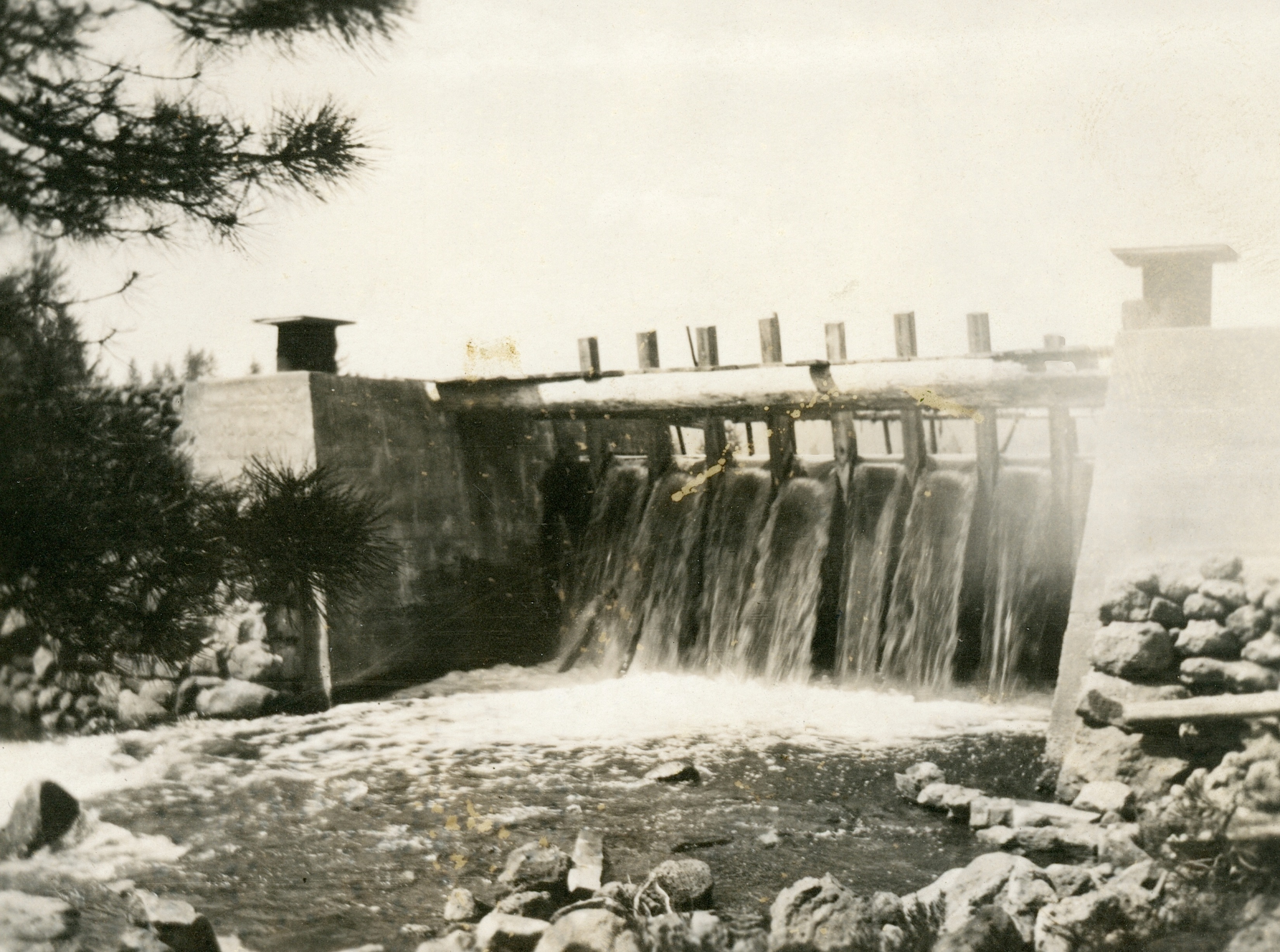
The winter of 1937-38 was one for the record books. There was a lot of wide spread flooding in the spring, including the breach of the Said Valley Reservoir. By mid-April 1938, Susanville attorney and a Director of the Lassen Irrigation District Hardin Barry released a statement that regarding the rumors circulating that McCoy Flat and Hogs Flat reservoirs were on the brink of collapse. As to Hogs Flat, Barry stated that it was so constructed that when full, surplus waters will flow through a natural depression in the direction of Worley Ranch. As to McCoy Flat it was pointed out that only nine feet of the thirteen feet of flash boards were installed and there was no imminent danger to the dam. Yet, to ease everyone’s fears the district hired a watchman at McCoy. It should be noted that Lassen Irrigation District owned the two reservoirs. Barry concluded that in 1932 that the State Water Resources Board had inspected the dams and deemed they were safe to use.
Hog Flat Reservoir, April 1940. Courtesy of Lola L. Tanner
This is. a most unusual post, where I am thinking out loud, where may be some one might provide a provocative perspective or suggestion.
First, I realize it was just a matter of time when my old computer equipment would reach a point of no return. So here is my dilemma. I use my old MacBook Pro (2009) with an old Epson (2007) scanner to scan the old photographs. However, I can no longer transfer the photographs from the MacBook via email attachments to my IPad which I use to maintain the website and compose the daily posts. Since I am not a tech person, it makes that more challenging. I am not sure for a short term to fix if there is an IPad adapter to use a USB drive to transfer photographs?
Of course the long term to replace everything would be spendy if done all once,, and this site does not generate those kinds of funds. All points to ponder. Is there an alternative I am overlooking? Equally important, there will not be any disruptions since I have posts scheduled through mid June, which should provide enough time to right the port. It should be noted, that first and foremost, I am not soliciting donations, but solutions.
In the meantime, I will muddle through it and some how a solution will transpire. Thank you for your understanding.
Tim
On the bright side I came across an 1892 photograph of the Susan River that has calendar potential. However, that is problematic as MacBook and the Epson printer are not longer communicating at the moment. This is a necessity for the initial calendar layout. I guess this this falls under the old time category “when it rains, it pours.”
It may be odd to some about printer quandary, let me explain, after all there are some who do not want a computer. Last September a dear friend of mine Karen B. Martin passed away. For many years she was a gracious host at Aspen Campground at Eagle Lake among other things. She wanted me to reprint my Eagle Lake, which was not going to happen, another story. Anyhow, I put together a binder of Eagle Lake material, which included all my posts about Eagle Lake, which I would provide updated printed copies of posts when they made their debut. Those went into the binder. Karen then shared the binder with fellow campers who had an interest and brought joy to many.
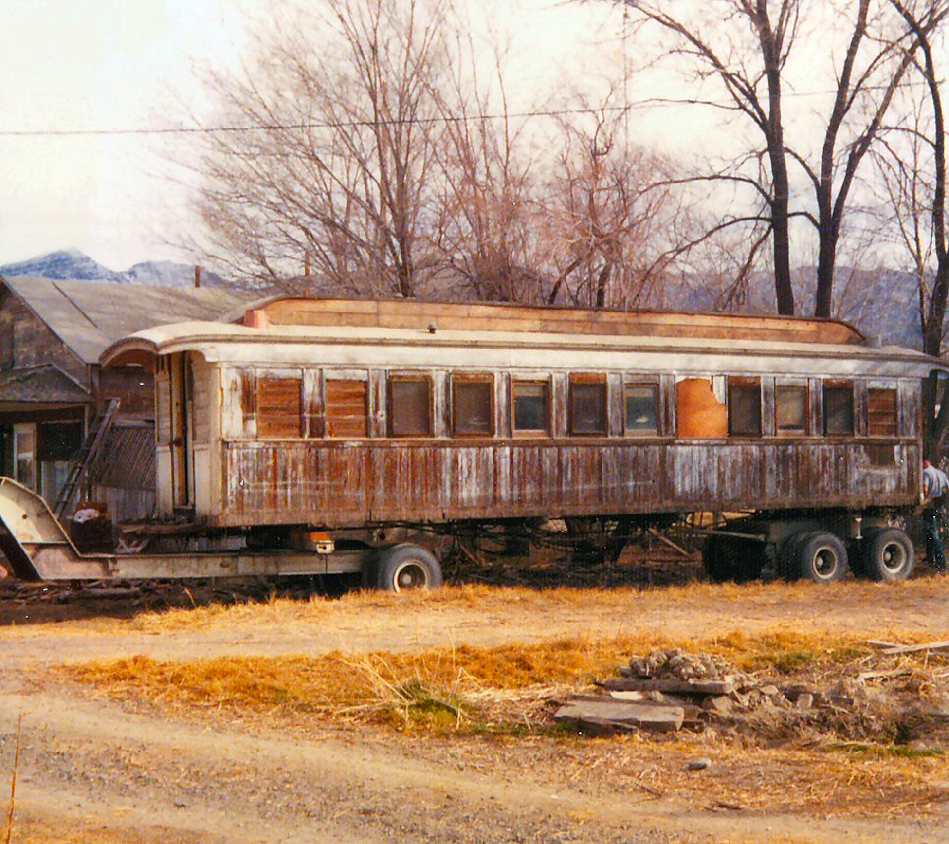
An NCO passenger car at Wendel being prepared to move, 1974—Tom Armstrong
Another example is David Martin, a Bay area resident, who like Karen, and no relation to her, has no computer and no desire. A Lassen College graduate he became interested in the area’s history and that especially of the NCO Railroad. When I sent him a print out about the NCO’s Lakeview car, he wrote me letter with information that I did not have. In addition, Dave also sent me letter in which Tom Armstrong provided him information about the NCO passenger car at Wendel. I will provide that material in a future post.
In the meantime, enjoy the weekend, whatever kind of weather will transpire.
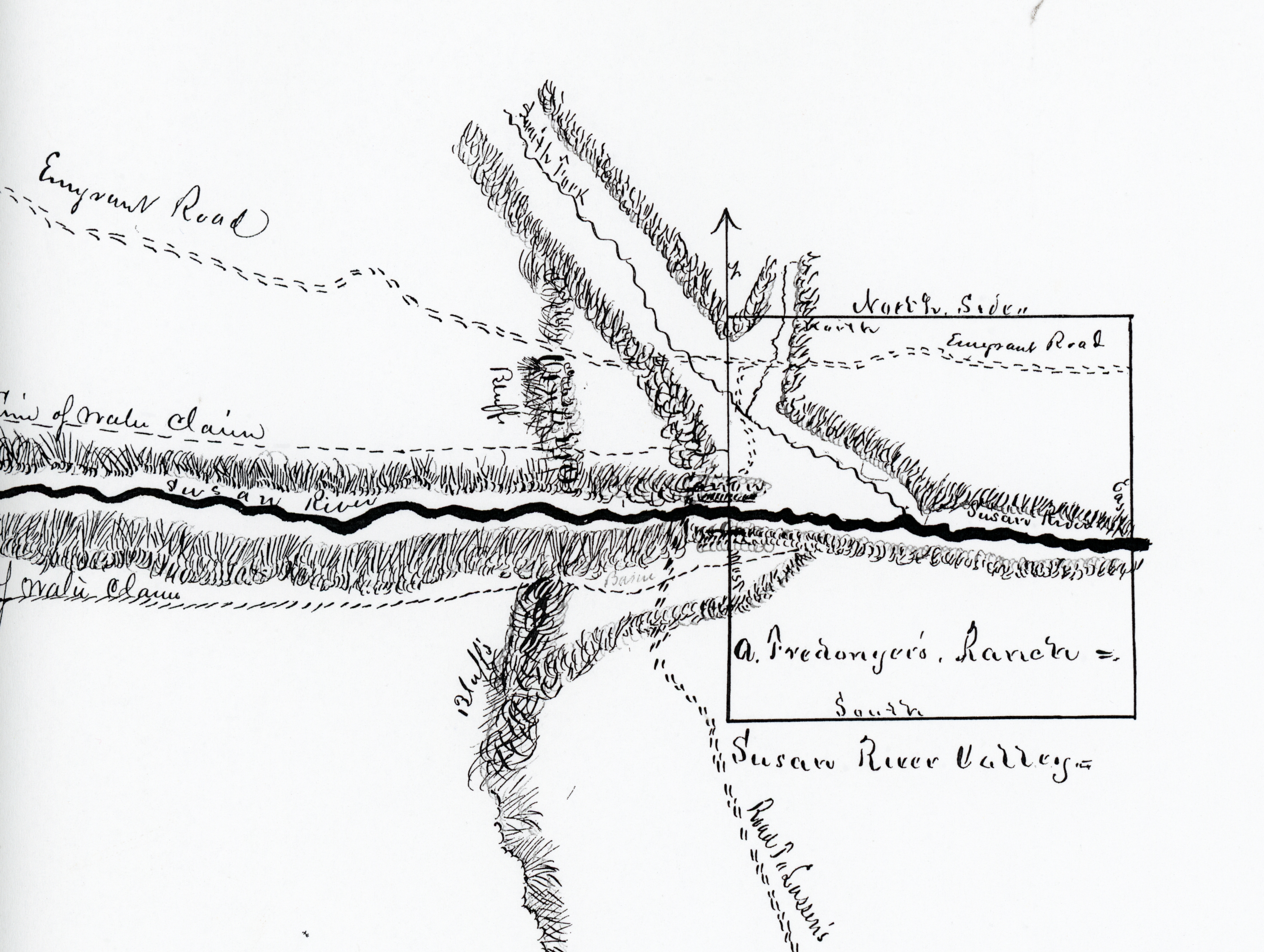
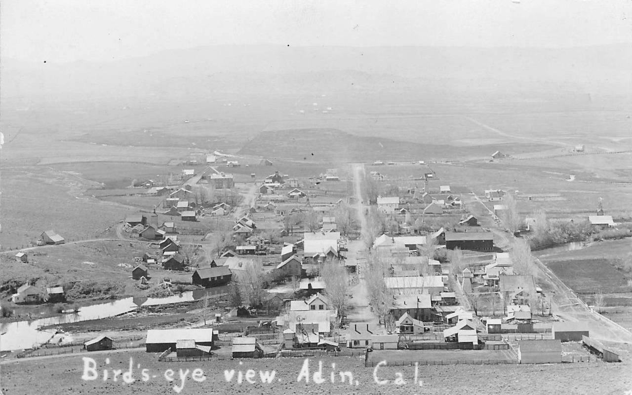
Fredonyer’s Claim to what would become Susanville.
In the spring of 1857, there were only two cabins in what would be latter known as Susanville. By summer a nucleus of a hamlet had developed and some thought it should have name. In August 1857, two names were proposed for the settlement around Roop’s trading post—Natauga and Fredonyer City. The Red Bluff Beacon reported: “The citizens of Honey Lake Valley are divided in opinion as to which names shall be given to their new town at the west end of the valley. Natauga in the Piutah tongue signifies woman and Fredonyer is the name of the gentleman who claims to be the first white man that ever beheld the beautiful valley. A gentleman who arrived here on Sunday last had in his possession an instrument in writing signed by fifty men declaring their preference for Natauga. An equal number are said to be as enthusiastic for Fredonyer. Simple and unimportant as this question is it said is to be creating quite a jealous feeling between the two rival names. They have no politics at Honey Lake and must have something to cavil about.”
Fredonyer City was the chosen name. However, it was more or less ignored and the place simply referred to as Roops. It should be noted that Fredonyer on April 11, 1857 filed a claim to property occupied by Roop with the Plumas County Recorder.
E Clampus Vitus, is not your ordinary run of the mill fraternal organization. Its origins began back in the gold rush days of California. It was in a sense a spoof of the more “high faltunin” fraternal organizations like the Masons. A somewhat rowdy and rambunctious group the new members were fleeced to pay for food and drinks for all in attendance. Tee-totalers they were not.
A strange development happened along the way, E Clampus Vitus invasion into Modoc County, far from any. of California’s goldfields—especially Modoc’s mining history is somewhat meager. Whatever the case may be, by the late 1870s, E Clampus Vitus was one of the most popular lodges in Modoc, beating out the Masons and the Oddfellows. By 1880, there were E Clampus Vitus lodges in Adin, Alturas, Cedarville, Fort Bidwell and Lake City. In 1878 the Modoc Independent newspaper reported the E Clampus Vitus lodge “were holding trials and issuing occasional threats to tar and feather vile characters if they did not leave town by sun down.”
Members of the organization were and still are referred to as Clampers. As quickly they rose in Modoc, their demise was fast. Some blame it on a temperance organization known as the Young Ladies Independent Association. Whatever the case may be, the Modoc Clampers quickly disappeared. However, the entire E Clampus. Vitus organization was slowly going into oblivion. and by 1900 no longer existed. Unlike other fraternal organizations, the Clampers were an independent group, with no core headquarters.
By 1930, there was a revival of the organization, which now has Chapters instead Lodges across the Western United States. On a final note during the 1930 revival in Alturas witnessed the formation of Captain Jack Chapter No. 7, E Clampus Vitus..
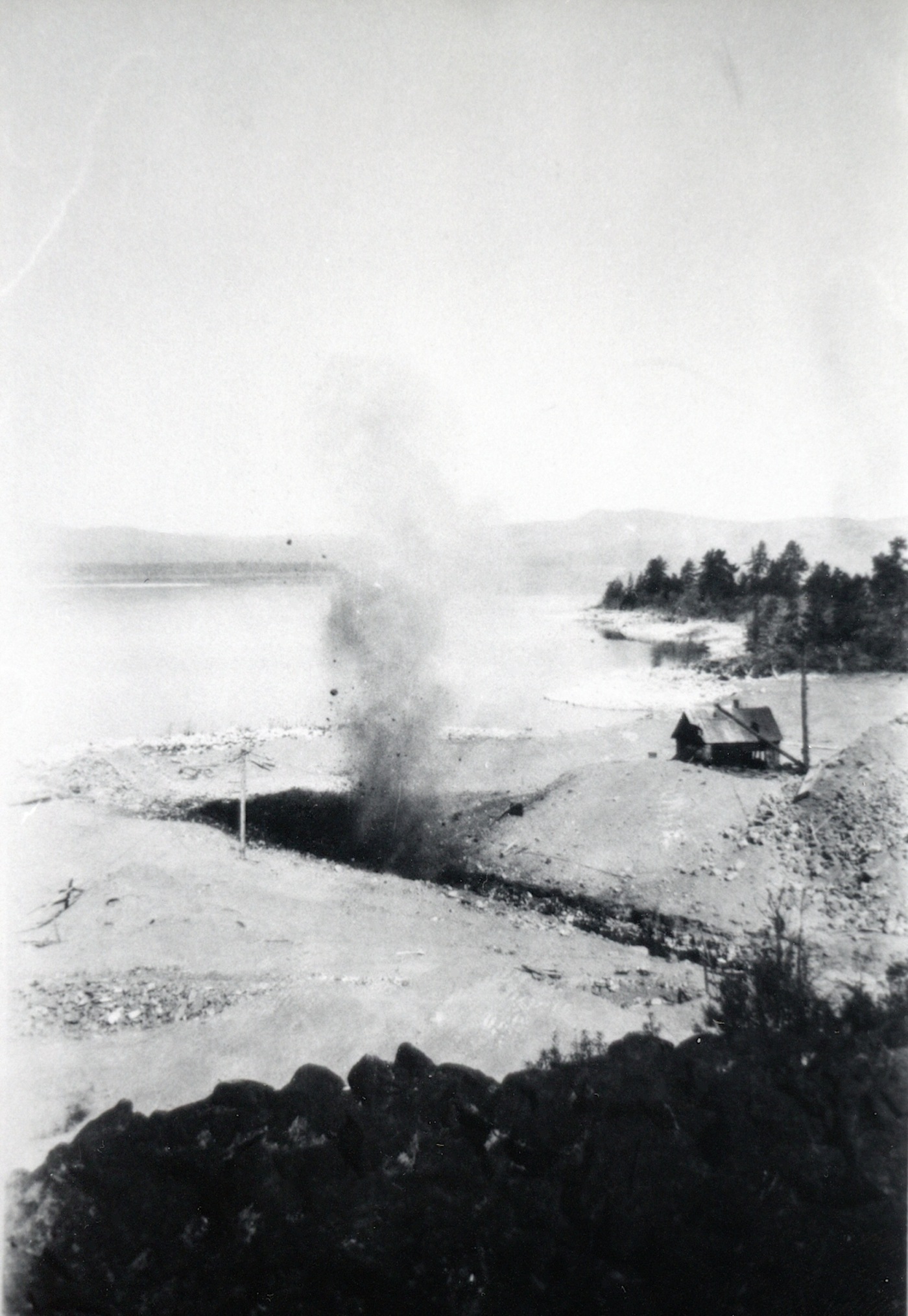
Blasting the inlet at Bly Tunnel, 1928–Francis Riddell
Last week on ongoing Eagle Lake’s Bly Tunnel saga of 1928, the Tule and Baxter Creek Irrigation Districts needed to raise some $50,000 to correct the defective inlet as suggested by the consultation with Engineer Wise. On August 12, 1928 a special meeting of the Lassen County Chamber of Commerce was held for the sole purpose to devise ways and means obtaining money urgently needed by the irrigation districts. It was important to have the work done as quickly possible to assure that water would be available for next year’s crops. Chamber President A.J. Mathews stressed without the water there would be a loss of some $60,000 in crops and some 3,000 acres would be fallow. Mathews continued it was a vital interest to every taxpayer in Lassen County. Without the water, these land would be abandoned, thus a loss on tax roll. The ripple effect the county would probably have raise taxes elsewhere to make up for the deficit. It was decided to have a subscription drive to raise the funds, in the similar manner how the community did to attract the Fruit Growers Supply Company to locate its sawmill in Susanville.
After delays, work commenced on the Bly tunnel on October 15, 1928, when the assembled supplies, equipment and work force were in place. Dynamite blasting was the first priority. Work progressed better than anticipated, especially with the weather cooperating. By Christmas the work was completed and under budget, too.
Amedee, January, 1916 courtesy of Marie Herring Gould
Recently, I received an inquiry concerning the railroad trackage of the NCO & Western Pacific Railroads as it especially relates to Long Valley. Even in the best of times, the NCO struggled financially, but for decades it did not have competition. That changed in 1909 with the completion of the Western Pacific Railroad through southern Lassen County that siphoned off business. In 1914, the Southern Pacific’s Fernley & Lassen Branch added more financial distress to the NCO.
Western Pacific had its own financial problems as well. It had hoped to build feeder lines to increase its freight tonnage. One market that WP had its sight on was Reno, Nevada. Yet, the WP did not want to build a duplicate line with that of the NCO. Negotiations between the NCO & WP began and in certain ways it was the best of both worlds for the two railroads. The NCO needed a major cash infusiion to pay bond debt and the WP would get its Reno connection. On June 11, 1917 the NCO not only sold a 64 mile segment of its line from Rayl (now Herlong) to Reno, but also its Sierra Valley Railway to Clio, Plumas County. The transaction cost WP $700,000. Since the WP did not need the segment of NCO’s line from Plumas Junction to Rayl, it was pulled up and scrapped. Trivia, for some, the Hackstaff Road from Doyle to Herlong is the old NCO railroad bed.
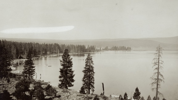
South shore of Eagle Lake, circa 1920—Wyn Wachhorst
This is, in essence, is more like a plea for information. For a time the California. Division of Forestry operated a fire station at the south shore of Eagle Lake. Unfortunately, the information CDF has and as well as my own is rather sketchy.
It was established sometime in the 1950s and what is unique the first station was located on Fruit Growers Supply Company land near their Sunkist cabin. Unfortunately, Fruit Growers is in such a disarray that avenue to locate an agreement is not going to happen.
In the mid 1950s the County of Lassen urged the Lassen National Forest to make recreational improvements at the south shore of Eagle Lake. By 1958, the Eagle Campground was established and so too was the CDF station. At the end of the 1952 logging season Fruit Growers closed its last remaining logging camp—Camp 10—thus eliminating a resource for fire fighting. Between the Gallatin Peak fire of 1951 and the Merrill Fire of 1955 might have been impetuous to establish the fire station. Later on the CDF relocated the station adjacent to County Road A1, near the intersection of the turn. off to the marina and Gallatin Beach.
If anyone can shed some enlightenment on this topic, it would certainly be appreciated.