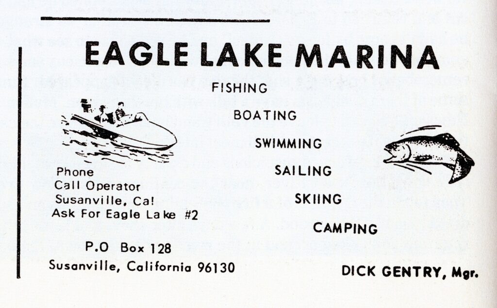
Gentry’s business card advertisement, High Sierra, 1972
In the late 1950s, Lassen County officials working with the Lassen National Forest began implementation of development of campgrounds and a marina at the south shore of Eagle Lake. The county leased the property from the forest service for a marina and in was completed in 1961. The following year, the county sub-leased the marina operation to Richard “Dick” Gentry. In 1970, due to the rising level of the lake, the boat harbor was revamped. Upon completion it was named the William W. White boat harbor, for former Lassen County Planning Director who was an ardent supporter of the project. In an 1971 article in the Sacramento Bee, Gentry complained about the rising water levels of the lake and went on to the state that there was too much water in the lake.
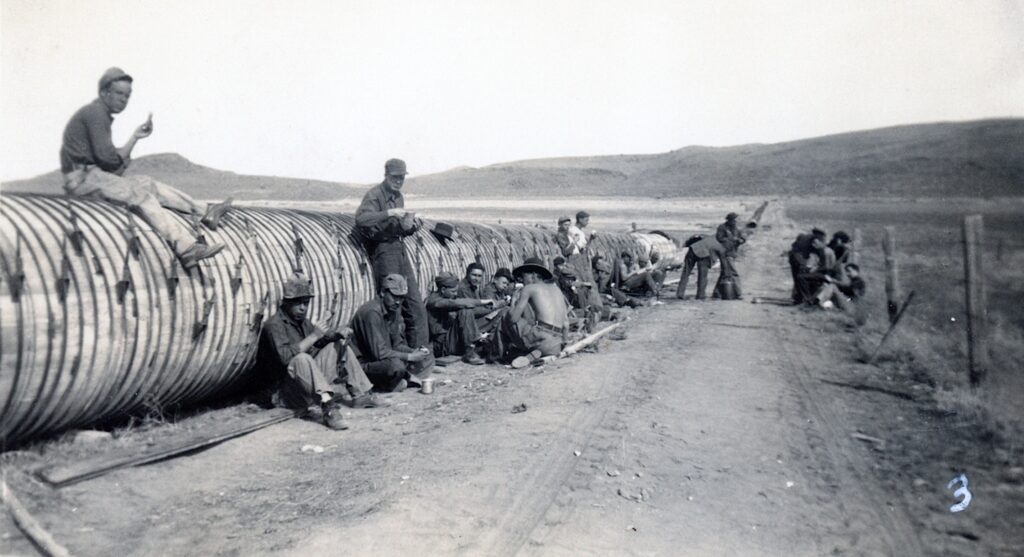
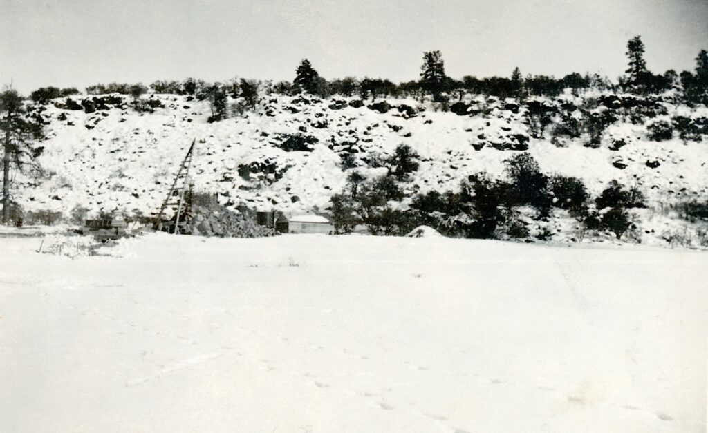
Secret Valley CCC’s doing repair work on the Baxter Creek siphon, 1936—C.H. Bennett Collection
Last year, I briefly wrote about the Baxter Creek Siphon. Since then I do have some additional information. First a little background. The siphon was portion of the Baxter Creek & Tule Irrigation district’s distribution of water from the Bly Tunnel at Eagle Lake. A siphon was needed to convey water over the Susan River, then to a canal along Bald Mountain to Baxter Creek.
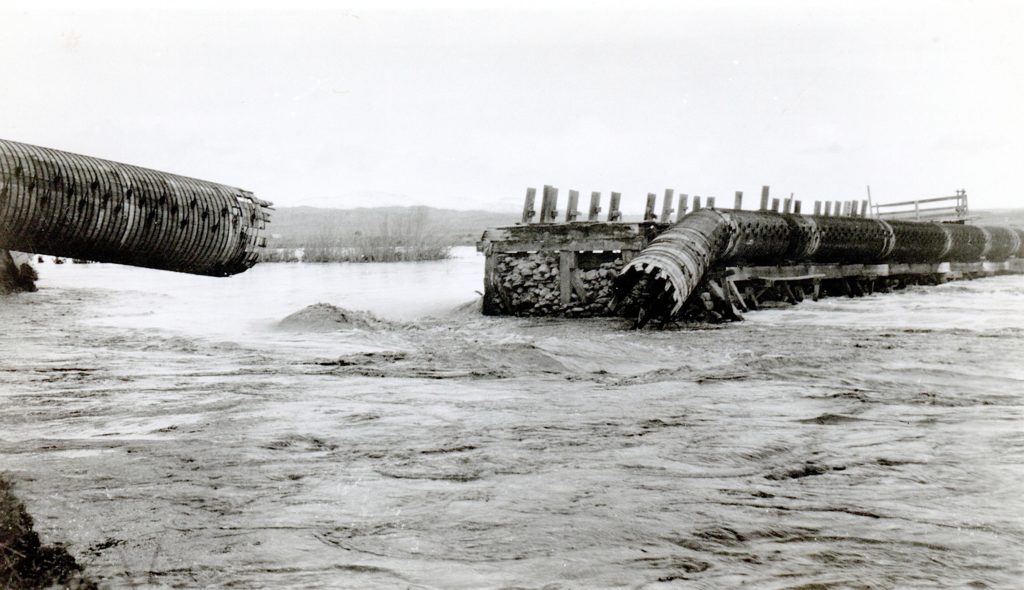
The siphon made of redwood and a diameter of 52 inches. The main siphon was three miles in length. In 1935, a flood damaged a portion of siphon where it crossed Susan River.
Susan River, 1935 — Lola L. Tanner
What is puzzling about the first photograph is why CCC’s were working on repairs to the siphon, as Bly Tunnel had been abandoned due to low water levels in 1935. May be some one was optimistic that water would flow again from Eagle Lake.
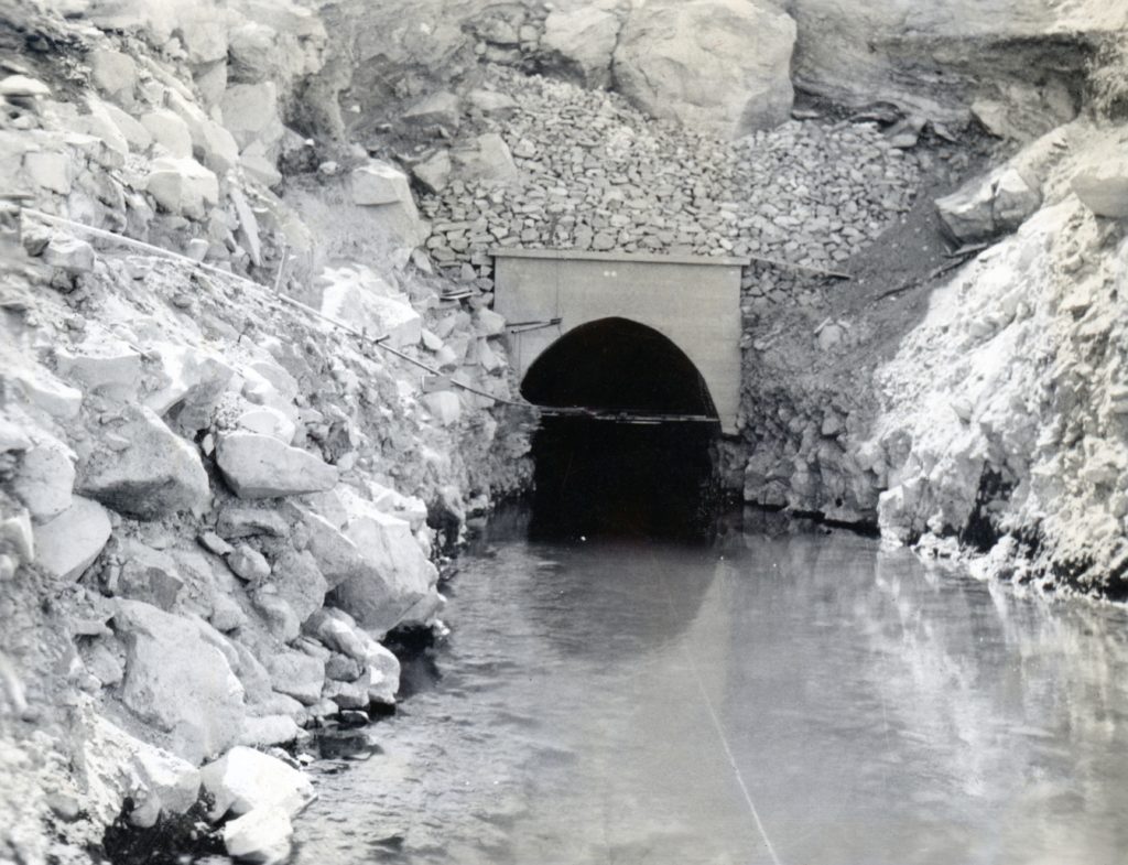
Bly tunnel inlet, July 1924. Courtesy of Wyn Wachhorst
It was 100 years ago today, with no fan fare, that 50 cubic feet per second of water was released through the Bly Tunnel at Eagle Lake. The $1.25 million project conclusion was bittersweet. Earlier, in May, some 5,000 people gathered at Litchfield for a grand barbecue to celebrate the completion of the tunnel. What the public was not aware was Grant Smith Company, the contractor to build the tunnel, only built three foot below the lake level at the inlet, versus the eight feet agreed upon with the irrigation districts. The company refused to allow water through the tunnel,, until an agreement was reached. The legal wrangling went on all summer until a settlement was made. In the short and long term the Baxter Creek and Tule Irrigation District were big losers. First, they lost the 1923 irrigation season. They would spend a decade trying to correct the inlet problem, and finally gave up.
In 1937, twenty years after Eagle Lake reached its historic high of 5125 feet it witnessed its historic low of 5091. That low water level happened again in 1950. Then, many may not realize but in December 2015 the lake reached a new historic low of 5090.54 and was repeated again in December 2022. What is interesting in each of these instances they were followed extremely wet winters.
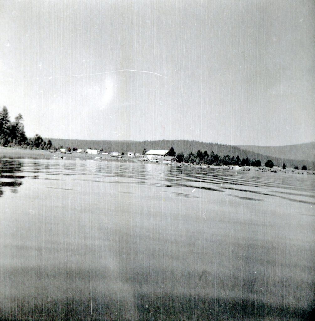
South shore Eagle Lake, August 7, 1936—C.H. Bennett Collection
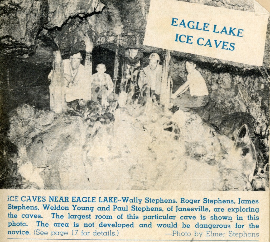
The ice caves was featured on the cover of Susanville’s weekly TV guide, August, 1965
Well, it is the middle of summer, and there have been a lot of searches about the ice caves at Eagle Lake. Without further ado, here is a prior post on that topic for your Tuesday Tidbit.
Exploring lava beds, which there is plenty around Northeastern California, there is no telling what a person might find. The Brockman Flat Lava Beds on the west side of Eagle Lake is no exception.
In the early 1950s the Chico State Biological field study set up operations at Spaulding Tract, Eagle Lake. It was in the summer of 1951, that several students explored the lava beds to the south of Spauldings and made their initial discovery of a ice/lava cave.
In 1954, John Wesley Noble penned an article in Collier’s Magazine, The Lake That Time Forgot. The article featured many peculiarities found at Eagle Lake. Noble wrote: A group of Chico graduate students were exploring a huge shore side cavern where Indian tribes hid from avenging white men. Suddenly the biologists’ flashlights flickered on a buff colored insect crawling over the icy black rocks. They captured it, but neither their biology professor nor local 0ld-timers could tell what it is.
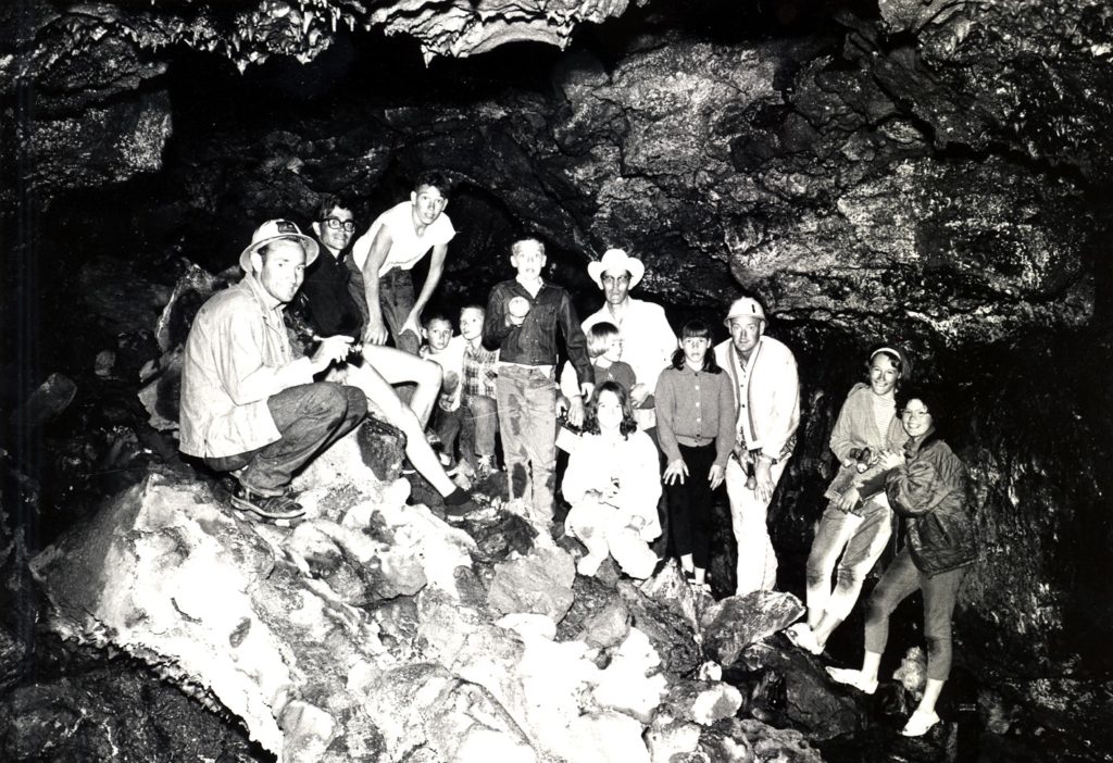
Interior view of an Eagle Lake ice cave, 1966.
“Weeks of research finally identified the insect a member of gryllobottoda, a rare ice age cricket-cockroach which lived in America when Pleistocene ice sheets covered more than half the continent. No one seems to know what the insects eat in the icy dark caverns. They should have been sensible and departed when the glaciers receded 20,000 years ago. But here they are, living their refrigerated lives in the caves near the lake.”
Albert Gallatin is one of the many intriguing figures in California history. This native New Yorker arrived in California in 1860, and the following year located at Sacramento. It was fortunate timing on his part to land a job in hardware store owned by Huntington and Hopkins. At the same time, Huntington and Hopkins would join forces with Crocker and Stanford, to become the “Big Four” and establish the Central Pacific Railroad. Gallatin, as a junior partner in the hardware business, became quite lucrative providing materials for the railroad. In 1877, he built the Gallatin House and in 1903 it became the California Governor’s Mansion.
The prosperous Gallatin began branching out into numerous endeavors including the sheep business. Gallatin needed summer range for the sheep, and discovered Eagle Lake. In a two year period in the late 1880s he purchased nearly 5,000 acres of Eagle Lake properties for $9,000. The bulk of the purchases were timberlands, with the exception of Hall’s Papoose Meadows and William Dow’s ranch near present day Spaulding Tract.
With the exception of Gallatin being Eagle Lake’s largest property owner, his influence otherwise was minor. In 1905, he passed away and his second wife, Malvena, had the lasting impact on Eagle Lake. After all she introduced Leon Bly to Eagle Lake.
South shore Eagle Lake, July 4, 1936–C.H. Bennett Collection
A Tuesday tidbit for today. Unknown parties, at least to me, built an informal wooden platform at the south shore of Eagle Lake. This was in the mid-1930s when lake was about to reach its initial historic low. The dock, if you could call it such, was ideal for small boats, i.e. canoes.
Initial work on the Bly Tunnel, Willow Creek side, December 1921—Lola L. Tanner
This being Memorial Day Weekend, it only seemed fitting for an Eagle Lake topic, since there is a lot of activity around the lake that weekend.
Leon Bly spent five years to put together a project to tap Eagle Lake to irrigate land in Honey Lake Valley. He had a lot of obstacles to contend with. First there was the initial study of lake to see if it was feasible. Then he had to convince the farmers of the Honey Lake Valley that it was indeed worthy. This was not an easy task since there had been attempts to tap the lake since 1875. Then public irrigation districts had to be formed to be able to put together a $1.25 million bond measure to finance it. Then there was all the detail work to obtain rights-of-way for the necessary canals and ditches, that would also have to be surveyed. One would of thought when the initial work began in the fall of 1921, there would be some kind of celebration, but it started off quietly with no fanfare.
Gallatin Beach has certainly evolved over the years. During the 1910s, the beach did not exist, due to the high water levels of Eagle Lake. By 1917, Eagle Lake reached its peak high water mark, and on the south shore, considerable timber was flooded, killing trees some hundreds of years old. In the 1920s, the water level of lake began to recede, in part by Bly’s Tunnel and equally important the region was in the midst of a 20-year drought.
The result was what some referred to as a stub forest of dead trees that were now a part of the beach’s landscape. Visitors to the area used them for photo ops.
In 1915, Professor S.T. Harding began studies of the water variations at Eagle Lake. Harding examined the stub forest to obtain data on the lake’s elevation. Harding studied the tree rings and the elevation of a number of trees. That provided him information concerning the levels of the lake dating back to 1420! By taking the lowest submerged trees (the oldest one was found to be a 245-year old stump at the elevation of 5,116, that was submerged in 1895), he determined the lake level had to be at 5,115 feet or less from 1650 until the time it was submerged. Another stump examined placed its initial growth between 1420 and 1520, and during that time period the lake had to be at an elevation below 5,099 continuously from 1420 to 1520. In addition, Harding also examined trees at the 5,126 foot elevation that were found to be over 400 years old that substantiated the fact that the 1917 level of 5,125.2 was the lake’s highest level.
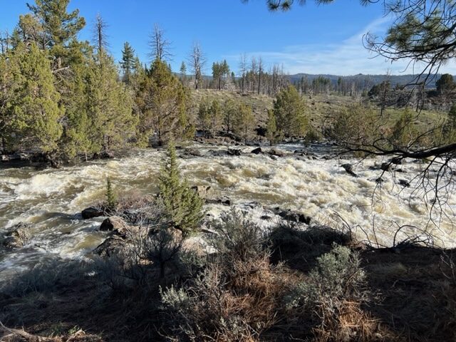
Pine Creek, April 28, 2023
As of May 1, 2023 the lake’s elevation was at 5093.62. At the time of that reading, Pine Creek was a raging torrent, so lake should see significant rise during the month of May.
The initial set up for construction of the Bly Tunnel, Inlet December 1921–Lola L. Tanner
While the photograph does not look like much, what it depicts is the initial stages of construction work of the inlet of the Bly Tunnel at Eagle Lake. It would be another year, before major work on the tunnel was started from the lakeside.
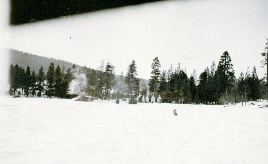
In 1962, Lassen County received some BLM land just north of Bly Tunnel. Thus, was the humble beginning of the Lassen County Youth Camp, though it take years to construct the facilities, a lot done by donations and volunteer labor.
In 1964, the Eagle Lake Biological Field Station of California State University, Chico relocated on BLM property between the Lassen County Youth Camp and the Bly Tunnel.