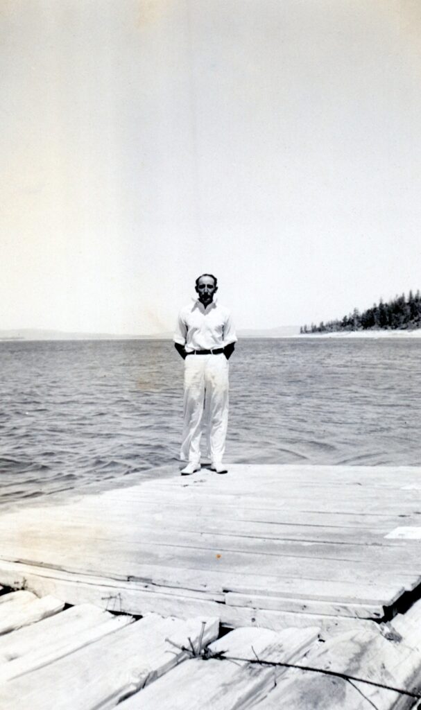
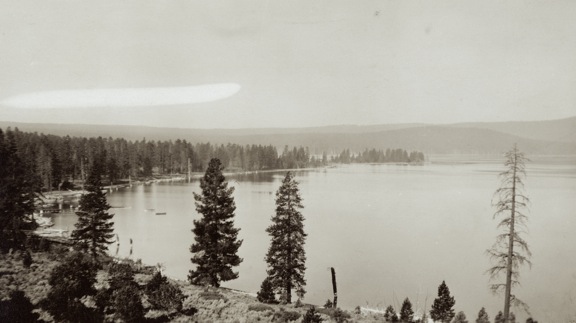
South shore Eagle Lake, July 4, 1936–C.H. Bennett Collection
A Tuesday tidbit for today. Unknown parties, at least to me, built an informal wooden platform at the south shore of Eagle Lake. This was in the mid-1930s when lake was about to reach its initial historic low. The dock, if you could call it such, was ideal for small boats, i.e. canoes.
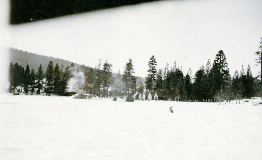
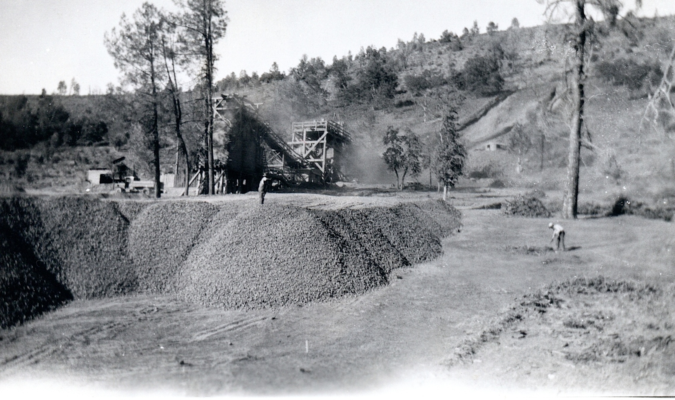
Initial work on the Bly Tunnel, Willow Creek side, December 1921—Lola L. Tanner
This being Memorial Day Weekend, it only seemed fitting for an Eagle Lake topic, since there is a lot of activity around the lake that weekend.
Leon Bly spent five years to put together a project to tap Eagle Lake to irrigate land in Honey Lake Valley. He had a lot of obstacles to contend with. First there was the initial study of lake to see if it was feasible. Then he had to convince the farmers of the Honey Lake Valley that it was indeed worthy. This was not an easy task since there had been attempts to tap the lake since 1875. Then public irrigation districts had to be formed to be able to put together a $1.25 million bond measure to finance it. Then there was all the detail work to obtain rights-of-way for the necessary canals and ditches, that would also have to be surveyed. One would of thought when the initial work began in the fall of 1921, there would be some kind of celebration, but it started off quietly with no fanfare.
Gallatin Beach has certainly evolved over the years. During the 1910s, the beach did not exist, due to the high water levels of Eagle Lake. By 1917, Eagle Lake reached its peak high water mark, and on the south shore, considerable timber was flooded, killing trees some hundreds of years old. In the 1920s, the water level of lake began to recede, in part by Bly’s Tunnel and equally important the region was in the midst of a 20-year drought.
The result was what some referred to as a stub forest of dead trees that were now a part of the beach’s landscape. Visitors to the area used them for photo ops.
In 1915, Professor S.T. Harding began studies of the water variations at Eagle Lake. Harding examined the stub forest to obtain data on the lake’s elevation. Harding studied the tree rings and the elevation of a number of trees. That provided him information concerning the levels of the lake dating back to 1420! By taking the lowest submerged trees (the oldest one was found to be a 245-year old stump at the elevation of 5,116, that was submerged in 1895), he determined the lake level had to be at 5,115 feet or less from 1650 until the time it was submerged. Another stump examined placed its initial growth between 1420 and 1520, and during that time period the lake had to be at an elevation below 5,099 continuously from 1420 to 1520. In addition, Harding also examined trees at the 5,126 foot elevation that were found to be over 400 years old that substantiated the fact that the 1917 level of 5,125.2 was the lake’s highest level.
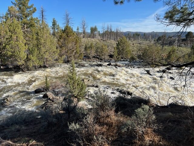
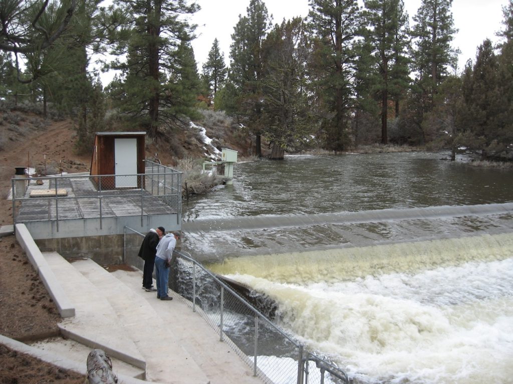
Pine Creek, April 28, 2023
As of May 1, 2023 the lake’s elevation was at 5093.62. At the time of that reading, Pine Creek was a raging torrent, so lake should see significant rise during the month of May.
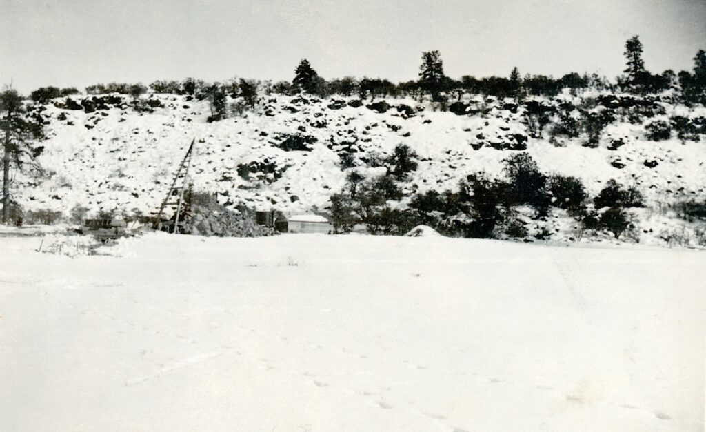
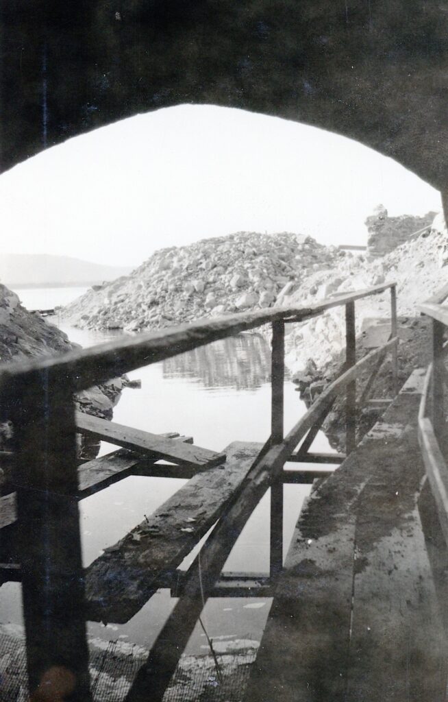
The initial set up for construction of the Bly Tunnel, Inlet December 1921–Lola L. Tanner
While the photograph does not look like much, what it depicts is the initial stages of construction work of the inlet of the Bly Tunnel at Eagle Lake. It would be another year, before major work on the tunnel was started from the lakeside.
In 1962, Lassen County received some BLM land just north of Bly Tunnel. Thus, was the humble beginning of the Lassen County Youth Camp, though it take years to construct the facilities, a lot done by donations and volunteer labor.
In 1964, the Eagle Lake Biological Field Station of California State University, Chico relocated on BLM property between the Lassen County Youth Camp and the Bly Tunnel.
I want to thank Larry Doss of Spaulding Tract to alert me that as of yesterday evening, Pine Creek has finally thawed out and is now flowing. For those not familiar, Pine Creek is the main tributary to Eagle Lake, California’s second largest natural lake. While Lake Tahoe is larger than Clear and Eagle, it spreads across the California and Nevada border. The spring thaw has finally begun.
1935 was a pivotal year for the Tule & Baxter Creek Irrigation Districts concerning the Bly Tunnel. Not only had they exhausted what limited funds on the annual extension of the inlet, but the level of the lake continued to go lower. The district’s engineer, Harry S. Riddell came up with last minute plan.
In 1932, President Herbert Hoover’s administration established the Reconstruction Finance Corporation (RFC). This agency was designed to facilitate economic recovery during the Great Depression. In 1935, Riddell, submitted an application on behalf of the districts for $1,465,000.
Riddell’s plan was two-fold. The bulk of the loan would be used to reach a settlement with the bondholders for fifty cents on the dollar. The second portion was to get the irrigation system in operation. Instead of proceeding with the costly work of continual digging to extend the intake channel, he proposed a pumping plant. Riddell estimated the cost of a plant at $45,000.
The application to the RFC was denied. With no solution at hand, Riddell resigned and moved to Sacramento. In the 1940s, W. Coburn Cook resurrected the project, but that is another story.
With all the effort put in during 1928 with work on the Bly Tunnel inlet, it did not make that much difference during the 1929 irrigation season. As a matter of fact to make things worse the districts doubled their rates for water from $2 to $4 per acre-foot.
For the next few years, the districts hired C.F. Staheli, a contractor to deepen the cuts and extend the inlet. It was an exercise in futility. Compounding matters was the lake in 1932, had dropped twenty-four feet since the tunnel had opened. Another tragic part of the story, the system was designed to irrigate 25,000 acres, when in reality in a good year only provided water for 5,000 acres. At the conclusion of 1934, that the project be abandoned. However, the districts engineer Harry Riddell came up with a last ditch effort to salvage the operation and account on that next week.
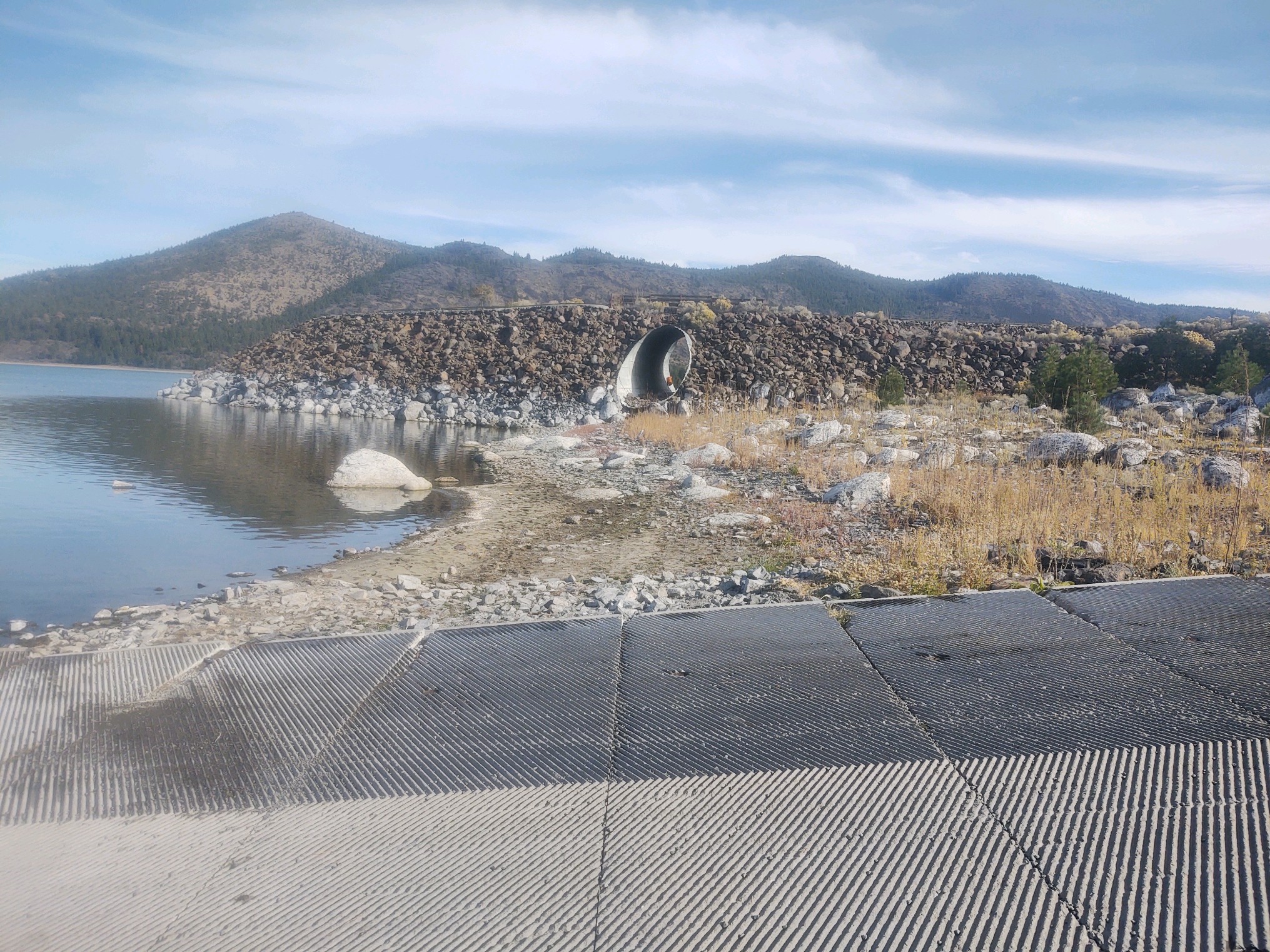
Notice the lime deposits on the rocks at Gallatin boat ramp, October 31, 2022–D. Willis
One of the interesting issues to surface in 1928 regarding the inlet problem of Bly Tunnel was the alkalinity effects of water used from Eagle Lake on lands in the Honey Lake Valley. There had been lots of speculation but no scientific proof. In the fall of 1928 Professor P.H. Hibbard of the University of California, Berkeley well versed in soil and water analysis arrived on the scene to examine the situation.
In Hibbard’s findings the Eagle Lake water was not a detriment to the irrigated lands in Honey Lake Valley. The lands affected there already had alkali in the soil, and the issue from irrigation was compounded by the fact of poor drainage on those lands. Hibbard noted that lakes without outlets tend to have a higher mineral content. He went on to state that the rocks along the shoreline at Eagle Lake that had a white layer on them when the lake receded were lime deposits.
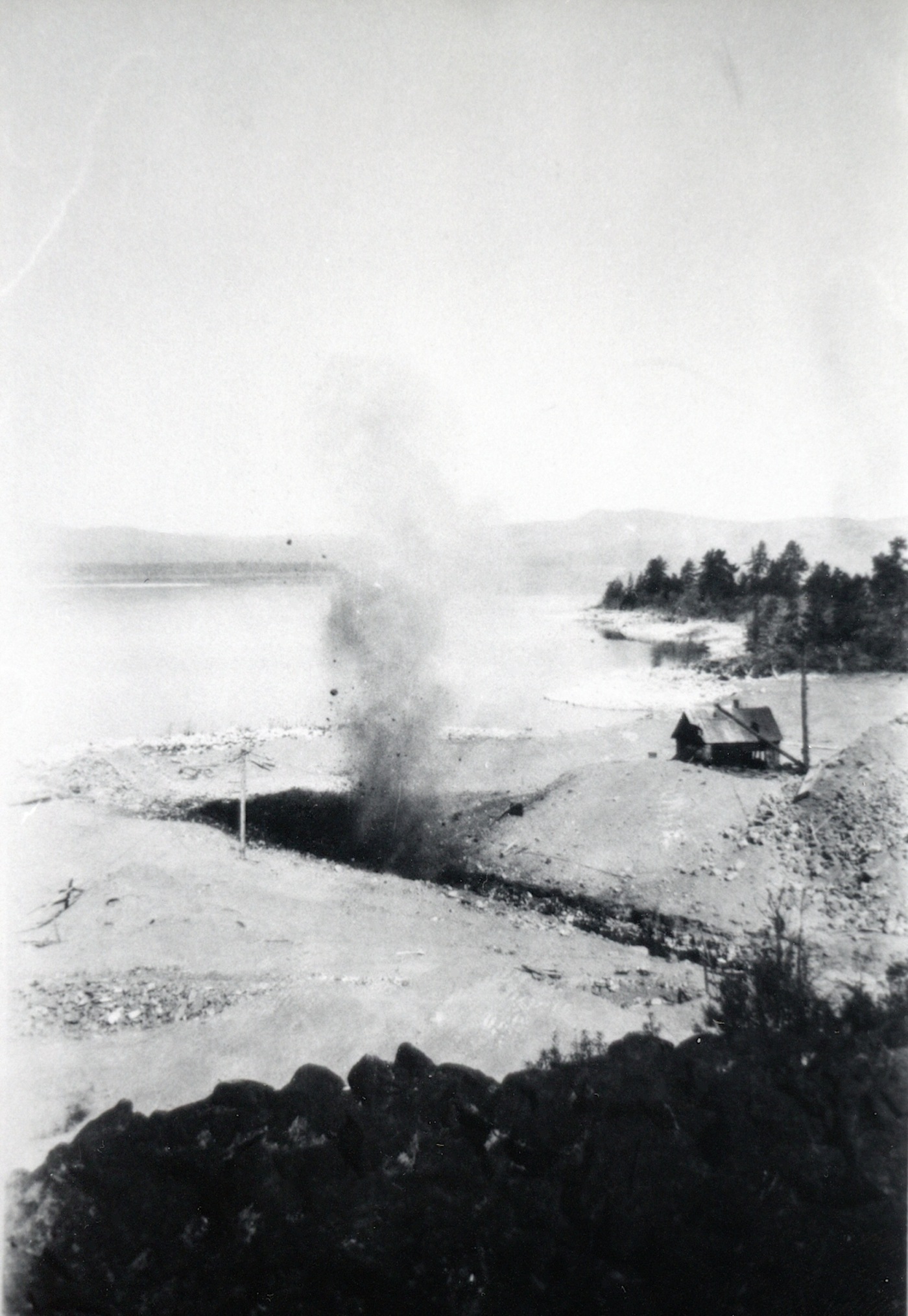
Blasting the inlet at Bly Tunnel, 1928–Francis Riddell
Last week on ongoing Eagle Lake’s Bly Tunnel saga of 1928, the Tule and Baxter Creek Irrigation Districts needed to raise some $50,000 to correct the defective inlet as suggested by the consultation with Engineer Wise. On August 12, 1928 a special meeting of the Lassen County Chamber of Commerce was held for the sole purpose to devise ways and means obtaining money urgently needed by the irrigation districts. It was important to have the work done as quickly possible to assure that water would be available for next year’s crops. Chamber President A.J. Mathews stressed without the water there would be a loss of some $60,000 in crops and some 3,000 acres would be fallow. Mathews continued it was a vital interest to every taxpayer in Lassen County. Without the water, these land would be abandoned, thus a loss on tax roll. The ripple effect the county would probably have raise taxes elsewhere to make up for the deficit. It was decided to have a subscription drive to raise the funds, in the similar manner how the community did to attract the Fruit Growers Supply Company to locate its sawmill in Susanville.
After delays, work commenced on the Bly tunnel on October 15, 1928, when the assembled supplies, equipment and work force were in place. Dynamite blasting was the first priority. Work progressed better than anticipated, especially with the weather cooperating. By Christmas the work was completed and under budget, too.
South shore of Eagle Lake, circa 1920—Wyn Wachhorst
This is, in essence, is more like a plea for information. For a time the California. Division of Forestry operated a fire station at the south shore of Eagle Lake. Unfortunately, the information CDF has and as well as my own is rather sketchy.
It was established sometime in the 1950s and what is unique the first station was located on Fruit Growers Supply Company land near their Sunkist cabin. Unfortunately, Fruit Growers is in such a disarray that avenue to locate an agreement is not going to happen.
In the mid 1950s the County of Lassen urged the Lassen National Forest to make recreational improvements at the south shore of Eagle Lake. By 1958, the Eagle Campground was established and so too was the CDF station. At the end of the 1952 logging season Fruit Growers closed its last remaining logging camp—Camp 10—thus eliminating a resource for fire fighting. Between the Gallatin Peak fire of 1951 and the Merrill Fire of 1955 might have been impetuous to establish the fire station. Later on the CDF relocated the station adjacent to County Road A1, near the intersection of the turn. off to the marina and Gallatin Beach.
If anyone can shed some enlightenment on this topic, it would certainly be appreciated.