The Lassen Flouring Mill, 1901. Courtesy of the A.J. Mathews family.
In September 1918, M.A. Taylor of Oakland purchased the old flour mill known to many as Hall & Synder. It was built in 1864 and was the center piece of Johnstonville. Taylor had no interest to operate it. Due to World War I machinery was scarce and that what was his intention for the acquisition. For the old timers seeing the landmark dismantled was one of the many changes the region experienced during its transition into a major lumber manufacturing center.
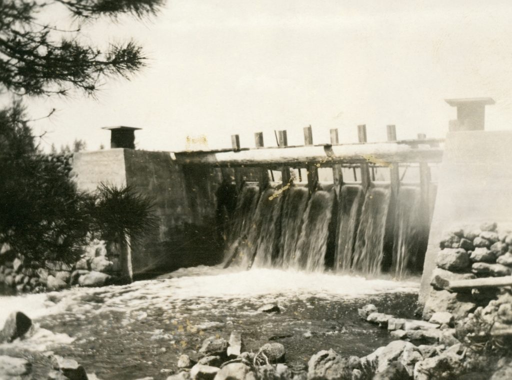
McCoy Flat Reservoir dam, 1915. Courtesy of Alphozene Terrill, granddaughter of Ben H. Leavitt
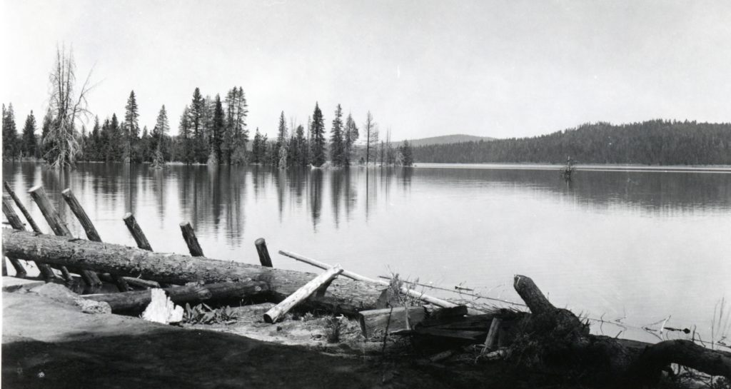
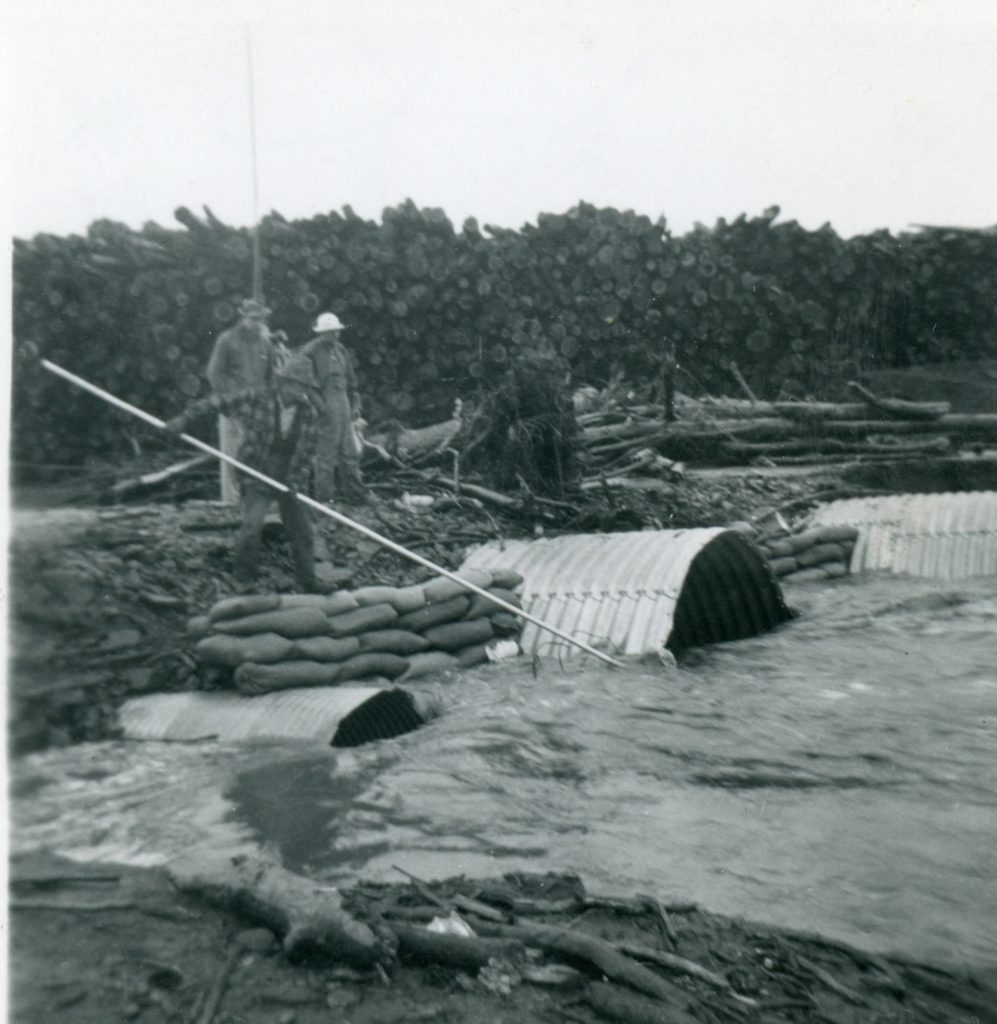
The winter of 1937-38 was one for the record books. There was a lot of wide spread flooding in the spring, including the breach of the Said Valley Reservoir. By mid-April 1938, Susanville attorney and a Director of the Lassen Irrigation District Hardin Barry released a statement that regarding the rumors circulating that McCoy Flat and Hogs Flat reservoirs were on the brink of collapse. As to Hogs Flat, Barry stated that it was so constructed that when full, surplus waters will flow through a natural depression in the direction of Worley Ranch. As to McCoy Flat it was pointed out that only nine feet of the thirteen feet of flash boards were installed and there was no imminent danger to the dam. Yet, to ease everyone’s fears the district hired a watchman at McCoy. It should be noted that Lassen Irrigation District owned the two reservoirs. Barry concluded that in 1932 that the State Water Resources Board had inspected the dams and deemed they were safe to use.
Hog Flat Reservoir, April 1940. Courtesy of Lola L. Tanner
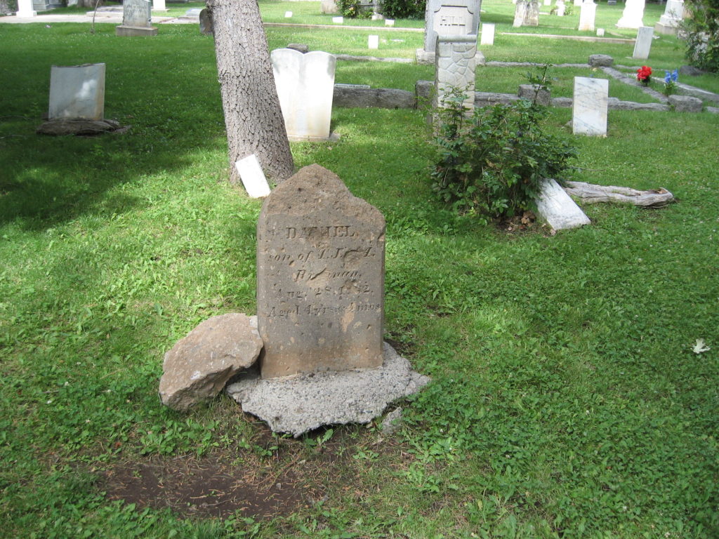
The headstone of Daniel Brannan made of rhyolite tuff has not weathered well. Susanville Cemetery, July 26, 2019
Located at the west end of Susanville is Quarry Street, so named for a stone quarry there that was discovered in 1860. The bluff at that part of town, better known as Inspiration Point, is fault block caused by volcanic upheaval. That upheaval created a deposit of rhyolite tuff. This was an ideal material in which was used in many of town’s native stone buildings.
However, during the mid-1860s the rhyolite tuff was used to make headstones. It appears that H.F. Thompson was the only stone mason to make the headstones. Some are quite elaborate such as Capt. William Weatherlow’s monument and others quite modest such as John Anderson. Thompson also made stones that are found in the Janesville and Long Valley cemeteries.
The City of Susanville, even before it became a municipality, always sought ways to alert the residents of a disaster. In the late 1800s, the most effective means was the ringing of the bell at the Methodist Church. Fast forward to January 19, 1938 at a special meeting of the City Council to devise a new plan when disaster strikes, as what had recently happened with a surprise flood. It was members of the Thomas Tucker Post of the American Legion who sought to address the issue. After some debate, it was decided that four long blasts from the city’s fire siren would be used to alert the citizens of a disaster.
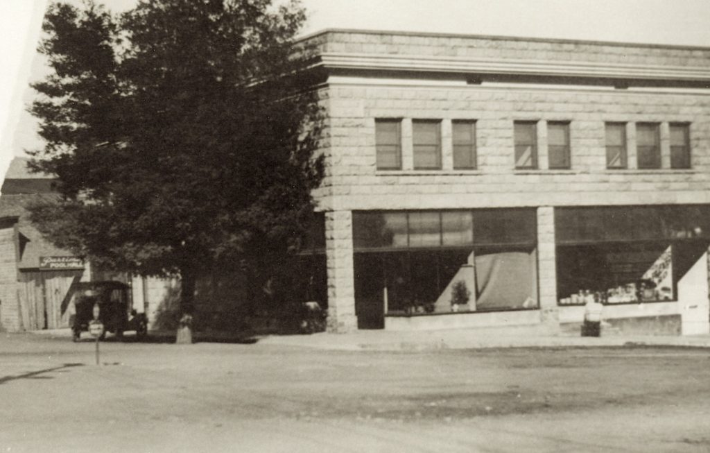
T.H. Long Building aka The Telephone Building. Courtesy of Phil Long
In the 1920s, Susanville’s retail community was undergoing many changes, due to a number of factors. Slowly creeping in where chain stores, many who thought they were a menace to the community. One of the many concerns with chain stores, that there would be a loss of individuality. Whatever the case may be, there was nothing any one could do to prevent the chain stores encroaching in the community.
It was on December 15, 1928, that Safeway opened a grocery store in Susanville. They found a place readily available in the Telephone Building, located on the northeast corner of Main and Gay Streets. It had recently been vacated by Stones Cash & Carry, another chain grocery store. To manage the store, S.F. Christensen of Carson City took over the reins and T.R. Mitchell from Sacramento was in charge of the meat department. The company made sure that it was duly noted that Skaggs’ Safeway boasted that it had 1500 stores in 15 western states, so they could stock more items than any store in town.
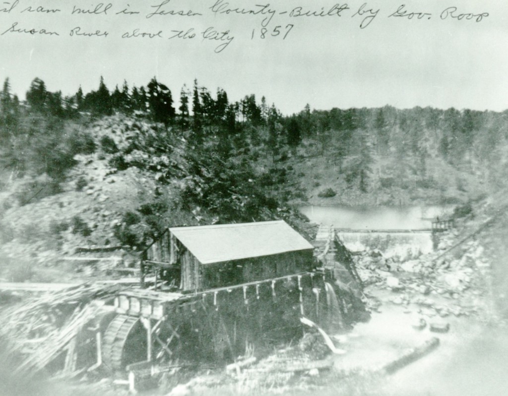
In the spring of 1857, Ephraim Roop, Isaac Roop, and William McNaull constructed the first sawmill in Lassen County, along the Susan River at a place that would later become known as Hobo Camp. In November 1860, Perry Craig fell out of a boat at the millpond and drowned. Craig was buried on top of the hillside near the river, and from that episode the Susanville Cemetery was created. (There is no marker for his grave). On August 18, 1862, Roop & Company sold the mill to Luther Spencer for $200. Spencer operated the mill until it was destroyed by fire in the spring of 1868.
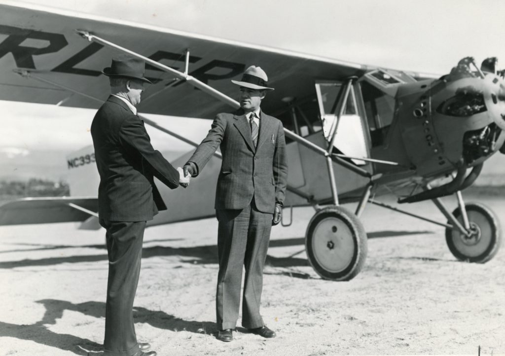
Postmaster Elmer Winchell with Ben Curler at the inagural airmail flight at the Susanville airport on May 19, 1938.
This was an interesting national promotion that was during the week of May 15-21, 1938. It commemorated the twentieth anniversary of the implementation of air mail. Citizens and communities were encouraged to participate.
Of course, Lassen County Superior Court Judge Ben F. Curler and avid flier was more than happy to participate in carrying air mail. For a brief time, when Curler served as magistrate for Lassen Volcanic National Park he would fly to Mineral to hold court. Curler’s May 1938 airmail flight went from Susanville to Reno. At Reno, he picked up his father, Washoe County District Court Judge, Ben V. Curler. The elder Curler, was a pilot, too, having obtained his license in 1935 at the age of 70. The two flying judges departed Reno and flew to various Nevada communities as part of the National Air Mail Week campaign.
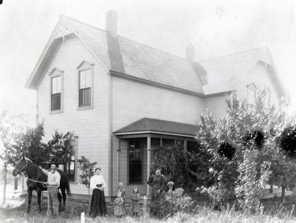
Theodore Ranch, 1892,. It was located adjacent to today’s Fleming Until, State Wildlife Refuge, Honey Lake Valley.
First of all, I am always open to suggestions. One person inquired about a possibility of a future calendar featuring historic ranch houses and homes.. I will certainly will give it some thought. However, technology has reduced the need for the old fashioned wall calendar, wherein I find that I only produce less than 100 calendars these days.
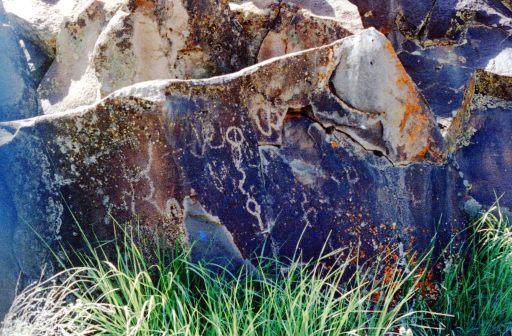
One of many glyphs to be seen along Upper Smoke Creek.
The story about Sage Hen Raviolis generated some interesting inquiries. One reader’s interest was piqued about the interest about petroglyphs near Biscar Reservoir. They can be found on the canyon walls, above the upper reservoir. It is interesting to note, that most the petroglyphs are located in a certain elevation zone. Upper Smoke Creek, for the more adventurous has nearly two-mile stretch of glyphs on both sides of the creek. Some may not realize there are petroglyphs just north and west of Susanville.
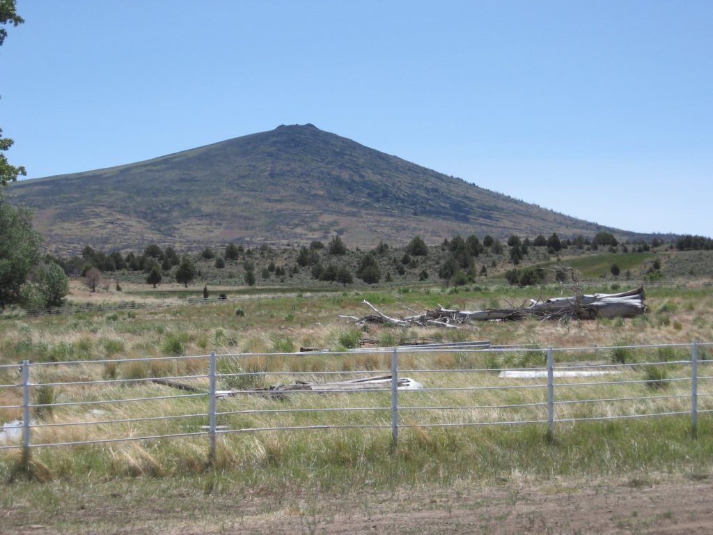
As to that lava cone in Secret Valley, Ed Allison provided me with an approximate location, but I never had the opportunity to investigate.
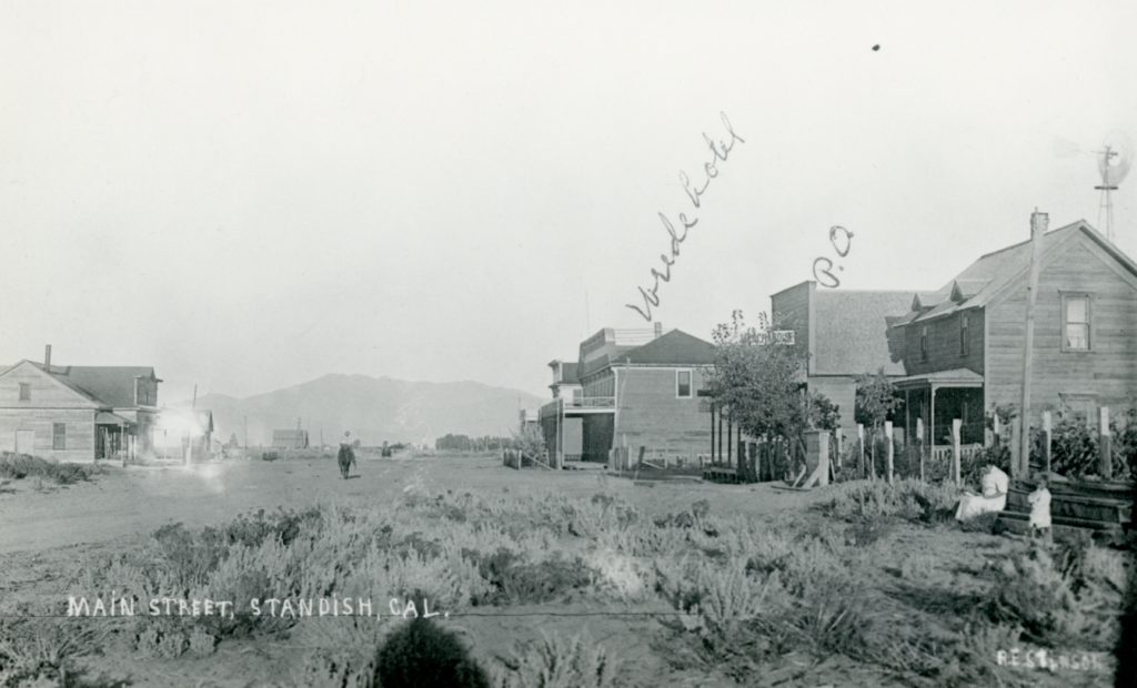
In February 1898, it was revealed that a site for the utopian community of Standish had been selected. It consisted of 240 acres and one of the main features was the main road from Susanville to Amedee would run through the center of the town. That road we know today as Highway 395. After the announcement everything was relatively quiet. One would think the promoters would be anxious to develop the new town. That was not the case, as it was just the opposite. The Associated Colonies who was behind the project took a slow and methodical approach. In July they stated their mission was to “To build, not to boom.”