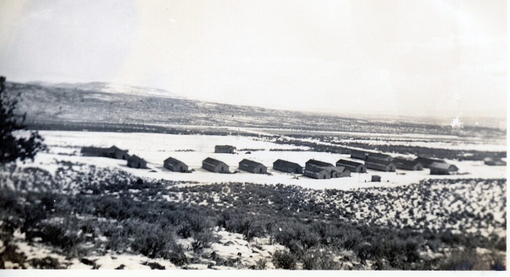
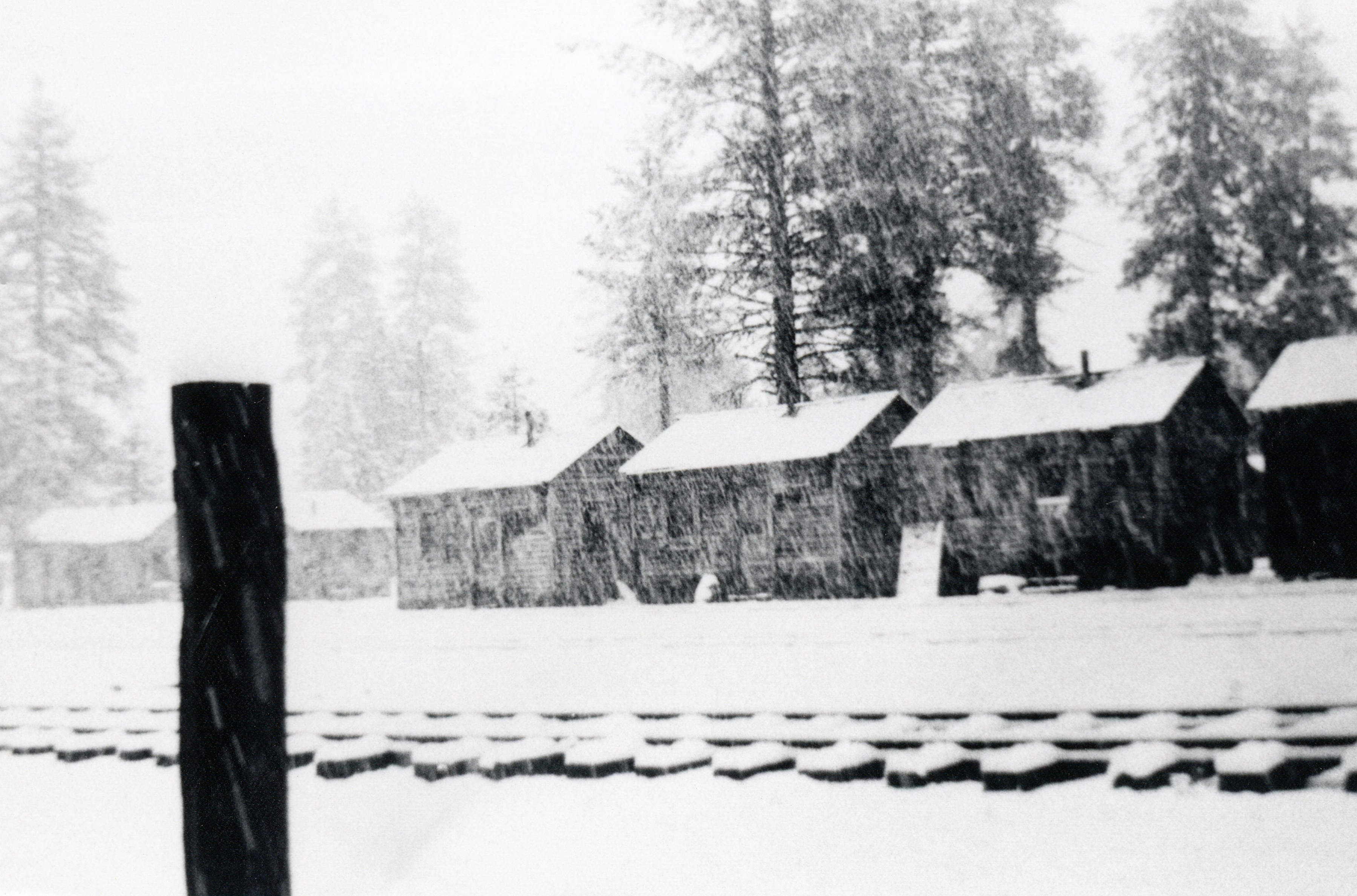
Secret Valley CCC Camp,January 1938—C.H. Bennett Collection
I am slowly scanning the photographs of Company Clerk C.H. Bennett who was stationed at Secret Valley from January 1936 to January 1938. If all goes well, in about a month, I will be posting the photographs and various work undertaken by the CCC and there is a lot. In the always learning something new category, the California Division of Forestry enlisted the aid of the Secret Valley Camp to build the road and fire lookout on Fredonyer Peak.
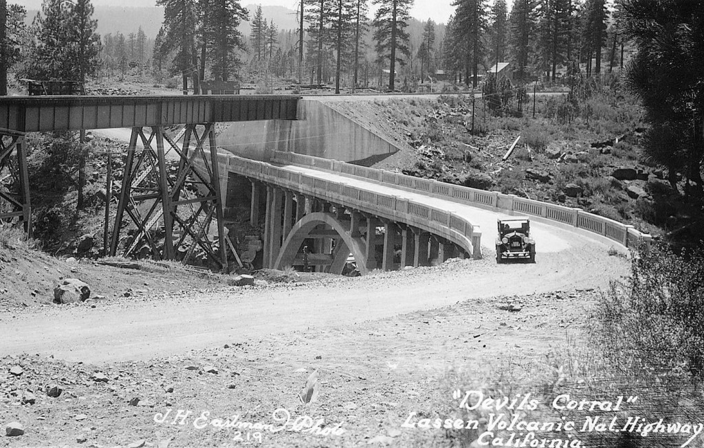
Devil’s Corral is an interesting spot along the Susan River some five miles or so west of Susanville. The circumstances leading to its name are not known. There are two possible explanations. In 1865, San Francisco journalist Lisle Lester wrote: “Late in the afternoon we crossed a weird looking place of a rock wall enclosing a little flat meadow land called Devil’s Corral. The place is historical, for in the early days a band of emigrants stopped here to feed their stock and were overtaken by disease which covered the little nook with the bones of their cattle, and added to its soil many a way-worn form. For years the bones of the cattle bleached here in rude piles.”
In 1923, when the first highway bridge to span Devil’s Corral was completed, this published version made its debut: “The name was given the curious lava rock formation on the banks of the Susan River at this point by early day wagon trains who sought to reach the Sacramento Valley by following the course of the Susan River. At this point the perpendicular rock walls of the canyon made further progress impossible and they were forced to turn back, hence the name Devils Corral.”
For those headed out to Eagle Lake for Memorial Day Wekend, don’t forget about Camp Ronald McDonald’s Annual Memorial Day Pancake Breakfast. From 7 a.m. to 11 a.m. Saturday May 27, and Sunday May 28, the public can enjoy an all you can eat breakfast; including pancakes, sausages and hot and cold beverages! The price is $5 per person. The camp located at the south shore and adjacent to the Gallatin House.
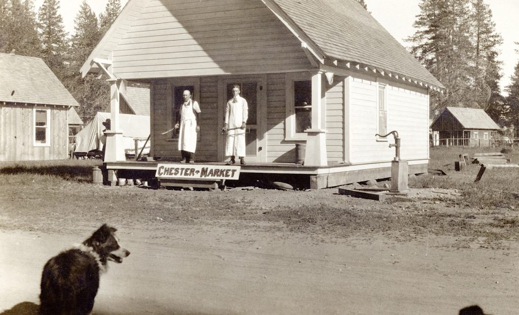
Chester Market, circa 1915. Courtesy of Hazel York Moller
Chester located near the northwest shore of Lake Almanor slowly evolved over the years. The townsite was not surveyed until 1911. In the early years, it was typical mountain summer resort town, and its population shrank during the winter season.
Camp 57, of the ed River Lumber Company courtesy of Roy Rea
In the spring of 1922, changes were on the horizon and Chester witnessed its first unofficial subdivision. The Red River Lumber Company was extending its main logging line westerly and not far from Chester proper the company established a logging camp there known as Camp 57. It was definite boost to the town’s population as the camp was home to over 200 men. The two communities did share one thing in common. Both Chester and Camp 57’s population dramatically declined in the winter.
Smoke Creek Desert looking towards Sheepshead, fall, 1977
Just across the California border lies this most interesting desert. It is a favorite of mine, so rich in history. It received its name back in 1844 when John C. Fremont explored the region. His party noted the dust storms created on the playa there cast a smokey hue.
Fremont was not the only explorer to the desert, as he was followed by William H. Nobles who created a new emigrant road that traversed Smoke Creek—it was a direct route to the Northern California mines. In 1865, the military established Fort Bidwell in Surprise Valley. The military plotted an unusual supply route that went along the west side of the Smoke Creek Desert and then followed Smoke Creek in a haphazard manner to Surprise Valley. This route was far from ideal, which was replaced by route through Buffalo Meadows. Traffic would diminish significantly when in 1890 Fort Bidwell was closed.
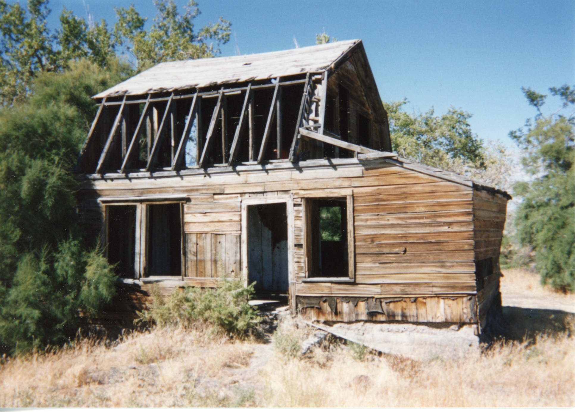
An abandoned homestead in the Smoke Creek Desert.
By the early 1900s, Smoke Creek was dotted with desert homesteaders during the dry farming experience that did not work so well to many.
The first McKinley School was built in 1920 and located on Cottage and South Gay Street, on the same lot that the former Washington School, nee Credence was located.
Yet, it was the Washington School that was built in 1900 that time had taken a toll on the structure. In 1947, the Susanville School District were concerned that it would not pass a number of safety codes. The following year the building was condemned and the district was concerned McKinley, too, would suffer the same fate. The District now had the daunting task to find funds to replace the two schools. The State of California determined that the District was “distressed” and was eligible for $341,065 in funds. It was decided to create two neighborhood schools, and McKinley was relocated to Fourth Street. The new school building opened its doors in May 1950. Of course, school campus has undergone many changes since it first opened.
In the spring of 1874, Iowa resident, Sylvester Daniels (1828-1908) left his home in Iowa to travel west, specifically near Janesville, Lassen County, California where his sister, Polly Parks resided. He was in search of a new home, with a more desirable climate for him and his family. During his ventures, he kept a daily journal, which once full of entries he sent back to his family about the findings of this unfamiliar territory. Like so many, of that era, he kept a journal most of his life.
Cedarville, 1879–Nevada Historical Society
In the fall of 1875, Daniels went north of investigate Surprise Valley, Modoc County. He spent a couple of days in Cedarville and this was his observation of that frontier community: “Cedarville is a quiet little town. There is one steam flouring mill, one store, two hotels, two harness shops one tin and stove store, one blacksmith and wagon shop and one saloon, the latter I consider no credit to any town.
”I think the land here is great deal better than the Honey Lake Valley and a great deal more of it and can be had for less money and as near as I can learn the climate is about the same. It is newer, the land is not worn out so much here..”
In the end Daniels decided to locate in Surprise Valley. In December 1875 he acquired some land at Lake City, He moved his family and would remain there the rest of his life, and descendants still reside in the region.
Golden Eagle Mine,Hayden Hill circa 1891. Courtesy of Donna Howell
Photographers, of course, is a favorite topic of mine. After all, thanks to their work we have a visual record of our past. It has been important to document the photographers of the late 1800s, so as to know the time frames when they chronicled the events. Due to a small population many photographers only remained a year or two, and even then they rode the “circuit” traveling, and in Howell’s case meant trips to Modoc and Plumas counties to drum up business.
Alexander Howell came to Susanville from Oregon where he learned the photography trade. On April 15, 1891 he opened his Susanville studio. The following year he was lured to Amedee, with the prospects afforded by this boomtown. After a two-year stint, he traveled throughout Northern California and finally settled permanently at Auburn, California. Very few of his Lassen County works remain, but there is one of the Golden Eagle Mine at Hayden Hill, which his granddaughter Donna Howell provided me with a print.
Gallatin Beach has certainly evolved over the years. During the 1910s, the beach did not exist, due to the high water levels of Eagle Lake. By 1917, Eagle Lake reached its peak high water mark, and on the south shore, considerable timber was flooded, killing trees some hundreds of years old. In the 1920s, the water level of lake began to recede, in part by Bly’s Tunnel and equally important the region was in the midst of a 20-year drought.
The result was what some referred to as a stub forest of dead trees that were now a part of the beach’s landscape. Visitors to the area used them for photo ops.
In 1915, Professor S.T. Harding began studies of the water variations at Eagle Lake. Harding examined the stub forest to obtain data on the lake’s elevation. Harding studied the tree rings and the elevation of a number of trees. That provided him information concerning the levels of the lake dating back to 1420! By taking the lowest submerged trees (the oldest one was found to be a 245-year old stump at the elevation of 5,116, that was submerged in 1895), he determined the lake level had to be at 5,115 feet or less from 1650 until the time it was submerged. Another stump examined placed its initial growth between 1420 and 1520, and during that time period the lake had to be at an elevation below 5,099 continuously from 1420 to 1520. In addition, Harding also examined trees at the 5,126 foot elevation that were found to be over 400 years old that substantiated the fact that the 1917 level of 5,125.2 was the lake’s highest level.
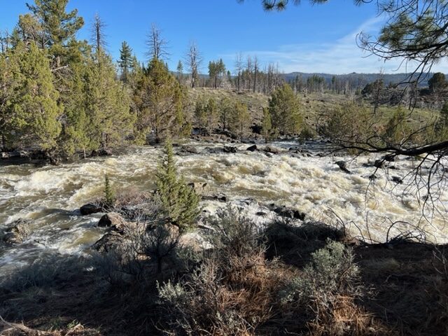
Pine Creek, April 28, 2023
As of May 1, 2023 the lake’s elevation was at 5093.62. At the time of that reading, Pine Creek was a raging torrent, so lake should see significant rise during the month of May.
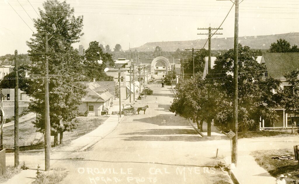
That was the headline in the Plumas National Bulletin newspaper of Quincy on October 4, 1911. Oroville city trustees raised the alarm that Great Western Power Company’s construction of a dam at Big Meadows to create what we know today as Lake Almanor. Of course, their fears were justified. On September 30, 1911, some 2,500 miles away, a concrete dam of the Bayles Pulp & Paper Company at Allen, Pennsylvania breached, killing more than 800 people. Oroville, located downstream on the Feather River, had always been apprehensive about the dam at Big Meadows, and this episode only heightened their fears.
Great Western’s Vice. President, H.H. Sinclair, issued a statement asserting that Oroville and other valley towns had nothing to fear, as the utmost care in the design of the dam had been exercised. Sinclair stressed that the company had already spent $20,000 just in investigating the site conditions on the river for the foundation. Furthermore, he stated that he hoped construction on the dam would begin on April 1, 1912 with the goal to have it complete by December. However, there would be numerous problems encountered and the dam was not complete until early 1914.