Tag Archives: Eagle Lake

Those plucky bondholders

Grant Smith’s tunnel works, Eagle Lake, 1922–Courtesy of Lola L. Tanner

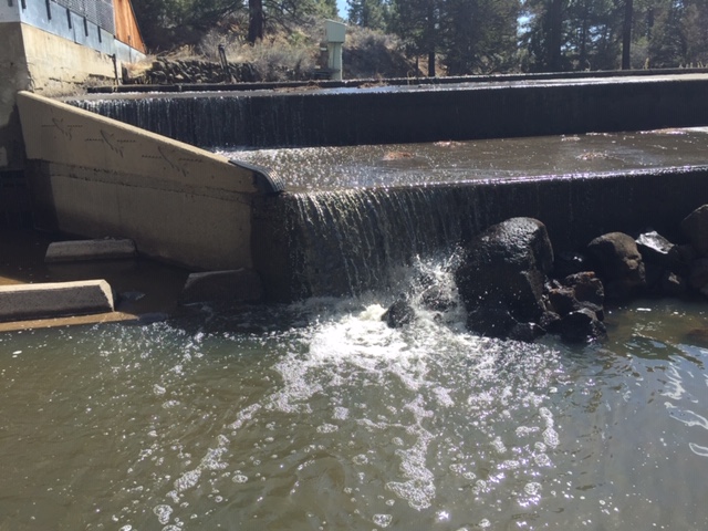
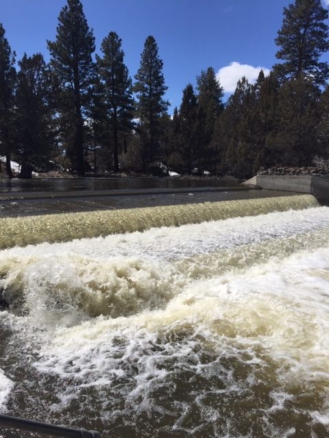
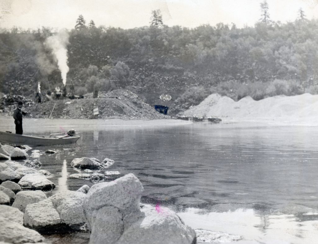
A month had not even passed since the grand celebration held at Litchfield for the completion of the Bly Tunnel at Eagle Lake, that things were not good. Grant Smith & Company of Seattle, Washington was the contractor to build the tunnel. In June 1923, the company asked for a special meeting with the Baxter Creek and Tule Irrigation Districts who financed the $1.25 million project with bonds. Grant Smith informed those gathered they experienced a number of problems during construction and requested that they leave and return in the fall after irrigation season to correct the defects. The bondholders said no. They sensed if they allowed Grant Smith to even leave temporarily, the odds of them returning were nil. The situation would turn real ugly over the next year with some startling revelations that would in part doom the whole irrigation enterprise.

Subscribe

What a Difference A Year Makes

Pine Creek Fish Trap Dam, April 10,, 2020

This is an interesting metaphor considering what and how we moved about and lived a year ago. This is a bit of diversion. Pine Creek, Eagle Lake’s main tributary, can be raging torrent or almost non-existent. The comparison of 2019 and 2020 run-off is a perfect example.

Pine Creek Fish Trap Dam, April 4, 2019

Eagle Lake’s Butte Colony

Frances Cartwright Fritter—Courtesy of Rev. C.R. Fritter

Long before the Spalding or Stones Subdivisions, the lake’s population center was on the northeast side, though no one resides there today. In the 1880s saw an influx of Butte County residents making this their new home—Cartwright, Eddy, Fritter, Sorensen and last but not least the Troxels. The Troxels, of course, purchased the W.S. Davis ranch, which place had become a well established stage stop, the property many know today as the former Stone Ranch. Jim Fritter, the family patriarch left an indelible footprint in the area’s history as a Lassen County Supervisor. It is interesting to note the Troxel name lives on two jettison points on the lake, a member of the Fritter family still retains ownership of the original family homestead.

Fritter Ranch, Eagle Lake, 1921. Courtesy of Lola L. Tanner

The so-called Butte Colony was short-lived. Within a ten year span it had dwindled down to Fritter and Troxel. Cartwright’s whose homestead located between Fritter and Troxel became a contentious issue with Udell’s proposed scheme to tap Eagle Lake, but that is a whole different story.

Spread the word, and encourage a friend to subscribe.

Meteor Mining Company

The 1902 Hanson Mining Claim

Most people may not realize that there was a lot of gold mining east of Eagle Lake extending from Gallatin Peak, Green’s Peak and Round Valley. The mining discovery occurred in the early 1870s, and Wright P. Hall had an extensive tunnel on Gallatin Peak in 1879. Many years later, my grandmother Lola Murrer Tanner (1899-1973) who grew up in nearby Willow Creek Valley made a reference of a lost valuable gold mine in that area with a reference to Gallatin Peak. There were others over the years that shared the same belief.

In the summer of 1935, two prospectors, Paul Olsen and Joe Weatherman, who had spent the last few years in that area, believed they finally found the lost mine. Among the items found was an old cabin, where there was some ore, along with an old tunnel 140 feet in length. Of course, they were sly not to reveal the exact location. They immediately formed the Meteor Mining Company. Their next obstacle was to secure a 200 acre lease from the Red River Lumber Company who owned the majority of the property in that region. Whether they succeeded is not known.

A few years back, I went in search of the Hanson Mine of the early 1900s, that fits the description of Olson and Weatherman’s find. However, between fires and logging the site may have been obliterated.

A granite outcropping common in that region.

Subscribe

Pine Creek Estuary

November 9, 1941 — Hank Martinez

It is that time of year when Pine Creek usually starts flowing again into Eagle Lake, but with this dry winter, it may not be the case. While many people see the creek at the bridge before entering Spaulding Tract or at the nearby fish trap, it still has a way to go before it reaches the lake. Thus, today’s featured photograph provides a good illustration of that fact.

Pine Creek
Pine Creek Estuary, July, 1973

Subscribe

Elusive Photographs

The July 4, 1906 parade with the city/fire hall in the background—Lola L. Tanner

Photographs of certain places and/or events just want to remain hidden. Take for instance Susanville’s combination City/Fire Hall. It was built in 1905 and destroyed by fire in 1921. A photograph of it does appear in the 1965 Lassen Advocate Centennial publication. One would think a public building, adorned with a sixty-foot tall bell tower, would appear in a variety of photographs.

Another example. My good friend, the late Hank Martinez, spent a life-time in search of a photograph of the El Centro, in Old Town, Westwood. It was a combination store and community hall. I had hoped to find one in the Red River Lumber Company’s archives but to no avail.

In May, 1923 one of the largest public events ever held at that time, occurred in Litchfield. It was a grand celebration to celebrate the completion of the Bly Tunnel at Eagle Lake, that would irrigate lands in the Honey Lake Valley. Over 5,000 people were in attendance and yet, to this day, I have never come across a single photograph. 

Interesting, however, some times rare photographs do surface on Ebay. Some times I make a purchase, and some times not, depending on price range, etc.

Never miss a story, click here to subscribe.

The Grant Smith Problem

Bly Tunnel, Eagle Lake

Okay, some people did not take kindly that they felt I left them hanging about Grant Smith Company and the bondholders of the Bly Tunnel. I should have mentioned at the conclusion that I would do a follow up. Here it is, enjoy!

What Grant Smith did not initially disclose to the bondholders was that the original plans called for the intake to tap the lake forty feet below the current surface. They only told the bondholders they did eight feet, citing the volcanic rock bottom too difficult. In addition, Leon Bly and Grant Smith agreed to the change, but it was not revealed to anyone else. Because of these problems, the irrigation districts could not use the water until they agreed to sign off its completion. Stymied, on September 8, 1923 the districts and Leon Bly agreed to accept a final settlement, and $25,000 would be withheld to correct the defects. Lo and behold in the beginning of the 1924 irrigation system, during one of the worst droughts ever experienced locally and throughout California, it was discovered Grant Smith only did three feet below the surface at the intake! The districts would need a lot more money than stipulated.

Grant Smith’s tunnel works, Eagle Lake, 1922–Courtesy of Lola L. Tanner

Subscribe

An Eagle Lake CCC Camp?

The outlet construction camp of the Bly Tunnel, 1922. Courtesy of Lola L. Tanner

In 1935, Lassen County officials requested a third Civilian Conservation Corp Camp (CCC). This would function a bit differently.  What they sought was a CCC Camp at Eagle Lake to assist with the beleaguered Bly Tunnel and the Tule and Baxter Creek Irrigation Districts. It was their contention after all that a CCC camp could provide work on the tunnel that was necessary to prevent further bankruptcies of the farmers and ranchers involved with the districts. The camp could also provide much needed labor for the canal and siphon system in the Honey Lake Valley that distributed the water. The county’s request was denied, but government officials were somewhat sympathetic and stated some limited manpower might be available from time to time from the Secret Valley CCC camp.

Never miss a story, click here to subscribe.

P.S. – For Lassen County residents, today, one can receive a free flu shot at a drive through clinic at the Lassen County Fairgrounds.

Pike’s Point Revisited

South shore of Eagle Lake, October 8, 1941 – Hank Martinez

Some may recall awhile back about this topic. A little update, since I have since received a better photograph showing the point during the low water era, which as you can tell provides a better understanding. For those you may have just tuned in Pikes Point is located at the south shore of Eagle Lake and most people know the location as the Eagle Lake Marina. The photograph shows all of Gallatin Beach to Eagle’s Next, prior that developments existence.

Donate

Lassen County Desert Land Act

The Belfast District, 1898. It was to be the center piece of Merrill’s reclamation project.

The federal land patent process often referred as homesteads worked fine until the westward expansion. After crossing the Mississippi River there were dramatic changes in geography and climate. It was President Abraham Lincoln who corrected the situation. In 1862 Lincoln was able to pass three important pieces of legislation since his opposition failed to show up in Congress. These were the creation of the Department of Agricultural, the Pacific Railroad Act and the 1862 Homestead Act. While the Homestead Act did improve matters in the west, it was not a one-size cure all fix.             The arid intermountain west presented its own challenges. A unique chain of events occurred when Captain Charles A. Merrill announced in 1873 of his reclamation plan for the Honey Lake Valley by tapping Eagle Lake as its water supply. It should be noted that Merrill was not a novice to land issues. He came to California, in 1864, from his native state of Maine. In 1870, Merrill was involved in a title dispute of a Mexican land grant near Santa Barbara. As a result of that involvement he worked ardently as a land agent for individuals who had capital to invest.             

For Merrill to move forward on his Eagle Lake project he would need federal legislation for an easier method to homestead arid lands. Merrill recruited California Congressman J.K. Lutrell to craft such legislation. On March 3, 1875 Congress approved Lutrell’s bill, the Lassen County Desert Land Act. In essence, an individual could claim up to 640 acres of government land, versus the standard 160-acre limit. A person then had two years time to reclaim the land by irrigation and they could purchase the land from the government at $1.25 per acre. The last provision was unique in that one did not have to reside on the land as a requirement. The Lassen County Desert Land Act gave birth to the much more famous Desert Land Act of 1877. The two Acts were nearly identical; expect of course the latter applied to all arid regions of the American west. There was one other major change in the fee structure. Under the Desert Land Act, “the settlers pay twenty-five cents per acre at the time of application, to have three years (versus two) for the purpose of irrigation and to pay one dollar per acre upon making the final proof, i.e. being issued a land patent to the property. The Desert Land Act was immensely popular and large swaths of land in the West were obtained under this Act.             

 It should be noted there was a dark side to it. This was from the Lassen County Desert Land Act’s non-residence provision that was included in the Desert Land Act. In the first decade there was a significant amount of fraud. It enabled land speculation companies to acquire thousands of acres of land by hiring dummy entry men to file on said land. Locally, this was particularly the case in eastern Honey Lake Valley and the Madeline Plains. Later amendments to the Act reduced the fraudulent activity. 

More tomorrow . . .

Never miss a story, click here to subscribe.