I am still sorting through varied loose documents as it is a time consuming task.. Some of them I will cover. These include a Gentlemen’s Agreement between Fruit Growers and the Susanville business community, an explanation between a California homestead and a federal one, the 1937 inspection of the Westwood Jail (which does anyone have photograph of it that was next the fire hall) and a assortment of other topics.
I have two newspaper articles from the 1980s, One is from Reno Gazette Journal about Franklyn Jeans and his Fish Springs ranch to pump water from eastern side of Honey Lake Valley to Reno. The other is an article that appeared in the Sacramento Bee about the infamous Madeline rancher, John Jay Casey. Let me know if you would like to pursue those, otherwise I will place in their respective files.
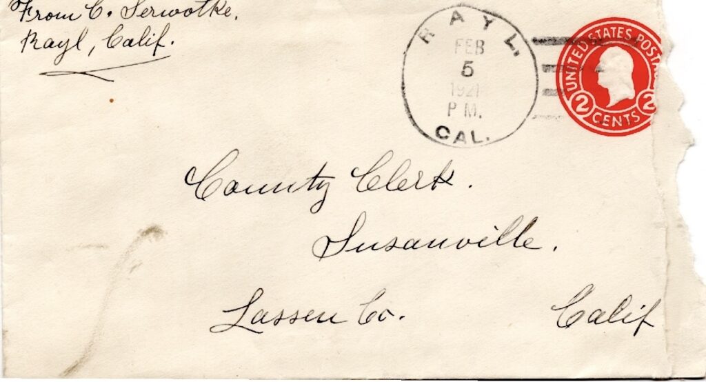
Serwoke’s cover envelope with a rare Rayl postal cancel, 1921
There were some hardy souls that were lured to eastern Honey Lake Valley with the promise that irrigation companies of plentiful water would transform the sagebrush lands into a verdant wonderland. Countless companies formed and later went, but some individuals remained. For those who remained they did not have many options and remained, at least they owned land. One of those was a man by name of Carl Serwotke who arrived in the early 1890s.
Upon his arrival, while the reclamation companies failed deliver water at least Mother Nature was cooperative. It was during this period until1917 the region experienced one its ever recorded wet cycles. While the desert homesteaders met with a lot struggles the above normal precipitation made things some what bearable.
1917 the region’s twenty year drought began. Many a desert homesteader abandoned their homesteads and sought a new life elsewhere. Serwotke was not one them. However, in 1921 he appealed to the Lassen County Board of Supervisors for property tax relief. Serwotke wrote:
“I beg pardon-I see you try to tax the dry land much higher now when their sagebrush land in this for ability is worth to tax 2 and 3 dollars per acre, then that land, where they have water and are able to to grow everything on, ought to be tax from 75 to100 per acre. Last year, I sowed 1 ton of rye for hay for my horses, but didn’t get anything and had buy $150 worth of hay, and paid about 25 dollars taxes. And this year I sowed the same amount of rye and got nothing neither, so have buy hay again. When a person can’t sell anything from the dry land to pay the present taxes with, then how can he be able to pay more. ”
From then on it was exercise in futility. He died in 1929 and is buried in the Honey Lake Cemetery (Stacy). There is no marker for his grave.
The abandoned Milford Flour Mill as it appeared in 1901. Courtesy of the A.J. Mathews family
Yesterday, we explored the origins of Honey Lake feed. There were three other flour mills in the Honey Lake Valley. The first one was built in 1861 at Milford. Since the village boasted a sawmill, and a flour mill, it was decided to name place Milford.
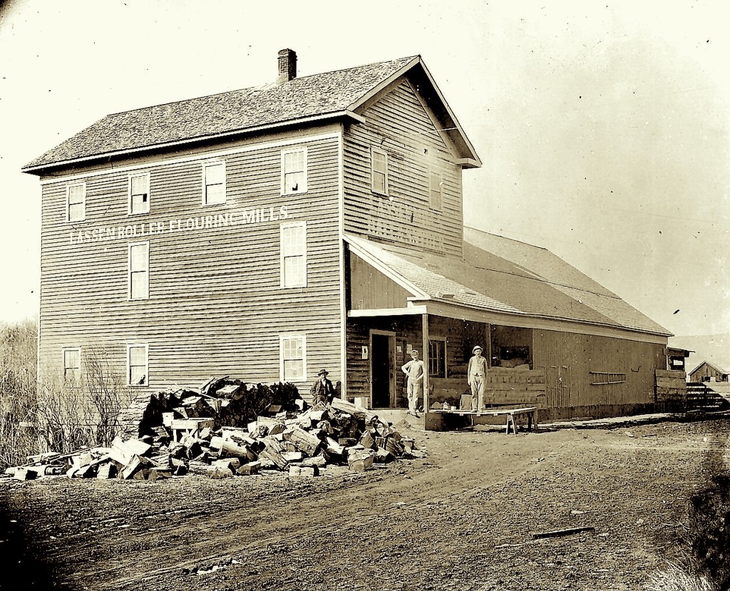
The Lassen Flouring Mill, 1901. Courtesy of the A.J. Mathews family.
The second mill was built in 1864 at Johnstonville near the location of the former Gables. For nearly its entire operation it was owned Hall & Snyder and closed by 1908.
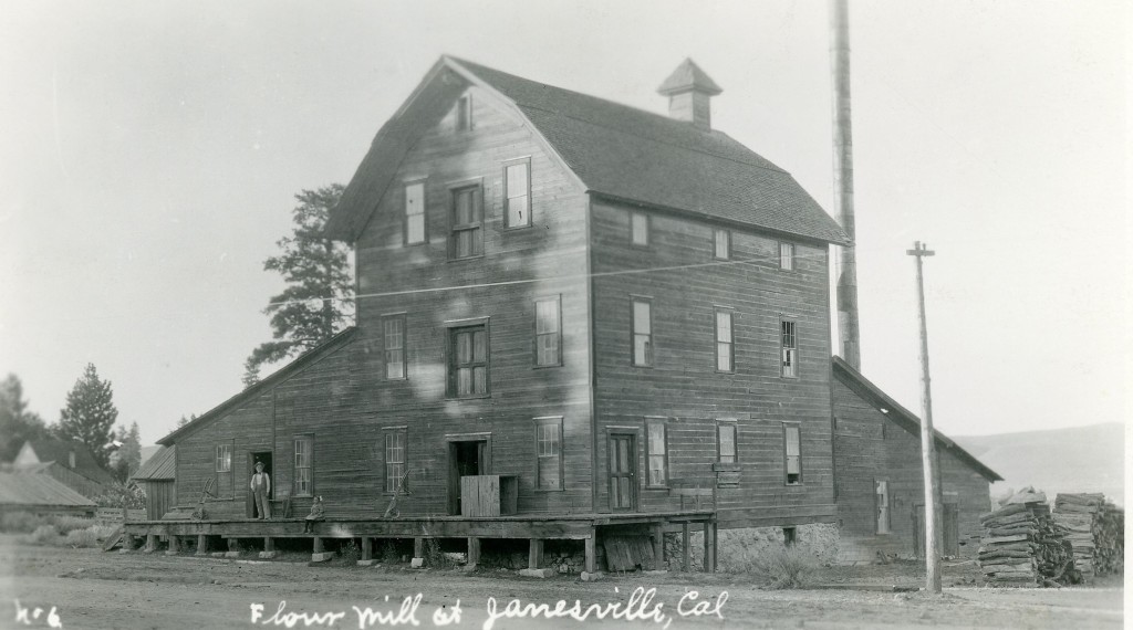
Janesville Flour Mill, 1913.
In 1882, H.H. Dakin owner of the Milford Mill wanted to expand and build a new mill. He chose Janesville. That mill was shuttered in 1918.
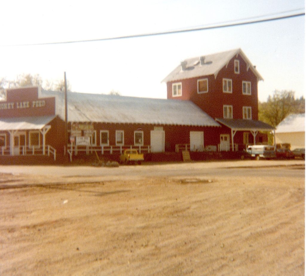
For seasoned residents this building may be familiar. It was Bronson & Doyle’s Honey Lake Feed located on Richmond Road. Susanville. It is now a vacant lot.
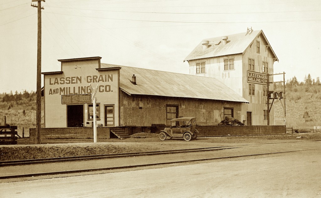
Lassen Grain & Milling Company, circa 1918. Courtesy of Dick & Helen Harrison
By 1912, with the arrival of the railroad and increased population growth, locally there was a flour drought. The Johnstonville mill had closed and the in Janesville the mill was operating at half capacity at the harvest season. In February 1917, Fred Begin organized a new company, the Lassen Grain & Milling Company to rectify the situation. When the news broke, it made the grain growers of the Honey Lake Valley rejoice.
The site selected was on Richmond Road across from the Susanville Depot. Excavation began in April with the goal of being in operation by June. However, with President Wilson’s declaration of war, changed everything. Building supplies and especially machinery was difficult to come by, and the war effort took priority. It was not until mid-November when it was placed into operation. The company’s brand name was Honey Lake Family Flour.
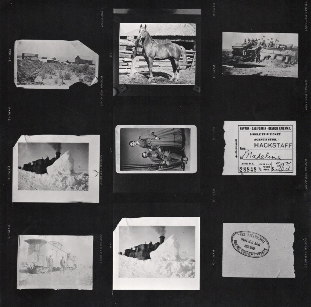
When I first started research in the 1970s, I had a heavy cast iron Remington/Rand typewriter. When I came across vintage photographs that was problematic. I would at least zero copy of them, and when I had funds, have a copy negative made. A pricey cost. In early 1980s, Tony Mindling, a photographer, moved to Susanville. One of his clients was the Nevada Historical Society, which he made reproductions. Since Tony’s copy negatives were 2 1/4 x 2 1/4 format, it was less expensive then Eastman’s 4 x 5. When I would have a large batch of work for Tony he would provide with a contact sheet shown above. It should be noted, there were two prints above, that were not NCO related–George Bangham and Frank White’s horse.
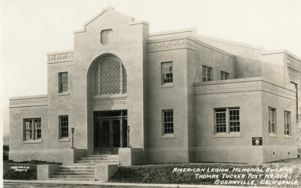
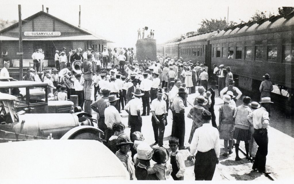
The American Legion building also known as the Veterans Memorial Hall marks its cenentinial today. The $30,000 strucuture was designed by local architect Ralph Taylor. The contractor was T.J. Rees of Fallon, Nevada who was in Susanville constructing the Hotel Mt. Lassen.
1926 American Legion Convention delegates arriving at the Susanville Depot. Courtesy of Nellygrace Stoll.
The dedication was a spectacular event. The local American Legion Post, Thomas Tucker Post 204 was hosting the California American Legion Convention. A truly amazing feat that drew 2,700 visitors to Susanville.
In 1891, the Eagle Lake Land & Irrigation Company became the latest entity to tap Eagle Lake to irrigate the sagebrush lands near Amedee. They had two propositions to do this. The long term was to finish Merrill’s tunnel. The second one involved a pumping plant to deliver the water. Like the predecessors they would utilize the channel of Willow Creek. At Belfast where Willow Creek enters the Honey Lake Valley the company constructed a twenty-one mile ditch to Amedee. In October 1892, with everything in place, water flowed from Eagle Lake to Amedee. Water would briefly flow the following year. However, the company plagued with financial problems filed for bankruptcy. The pumping plant was dismantled in 1903.
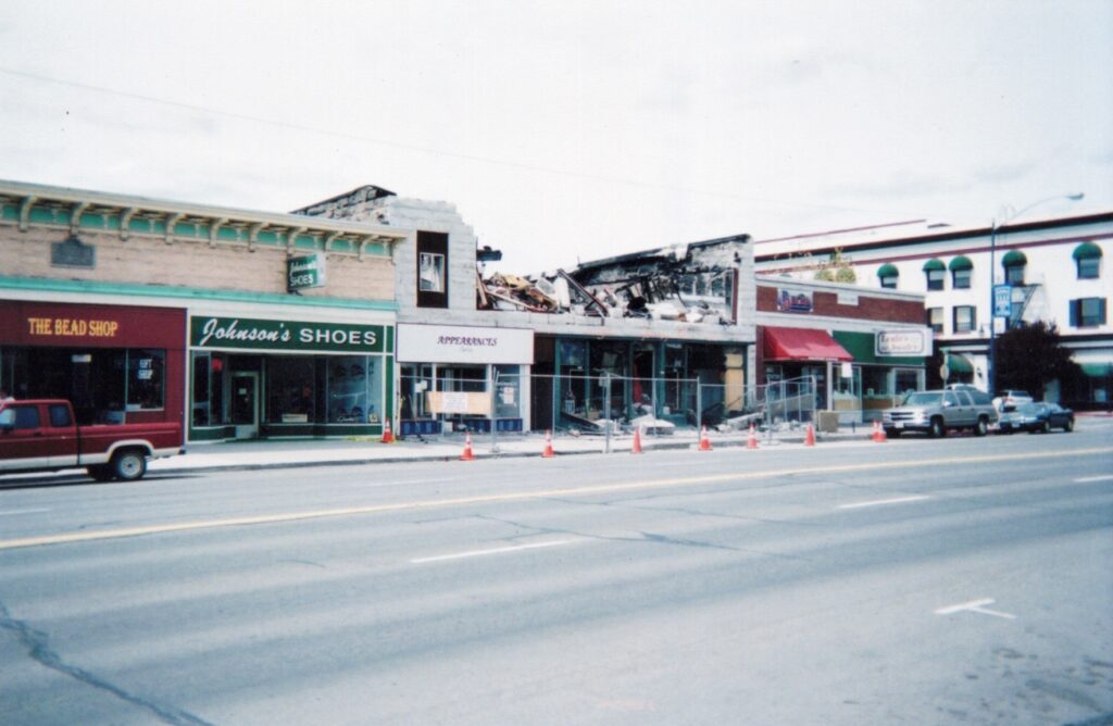
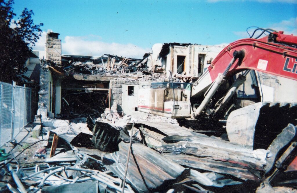
Seasoned residents will remember this as the old Spalding Drug Building. In its later years it was known as The Bootery. It was destroyed by fire on January 5, 2005. In the spring of that year the building’s remnants was bulldozed.
Since that time it has remained a vacant lot. From time to time there has been discussions as to what to do with it, but that has been the extent of it.
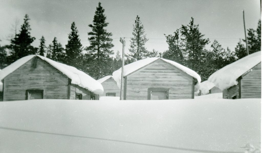
George Moore digging out a speeder at Camp 10, January 10, 1952.
Fruit Growers Supply Company’s Camp 10, located in Pine Creek Valley, west of Eagle Lake was a lively outpost from spring through fall, where over 200 people called it home. For a time it could even boast its own voting precinct. Yet, when the logging season ended, Camp 10 was de-populated, except for one lone soul. A caretaker was hired to keep an eye on everything. In the winter of 1951-52, George Moore was Camp 10 sole resident. The position would soon be eliminated as at the end of the 1952 logging season Camp 10 closed for good.
Since the 1870s there has been a lot organizations formed to promote California. Some were regional and others statewide. One in the 1890s named Made in California. It was replaced by the California Development Board which came into prominence during the Panama Pacific Exposition held in San Francisco in 1915. It was headquartered in that city’s Ferry Building, a landmark that I have never been to. In other news. the unpacking and sorting the archives from the move is a slow process and I have tortured with most difficult boxes of loose documents and photographs.


 Since that time it has remained a vacant lot. From time to time there has been discussions as to what to do with it, but that has been the extent of it.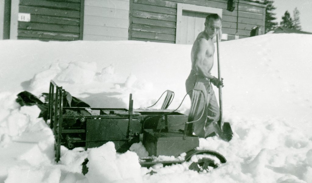
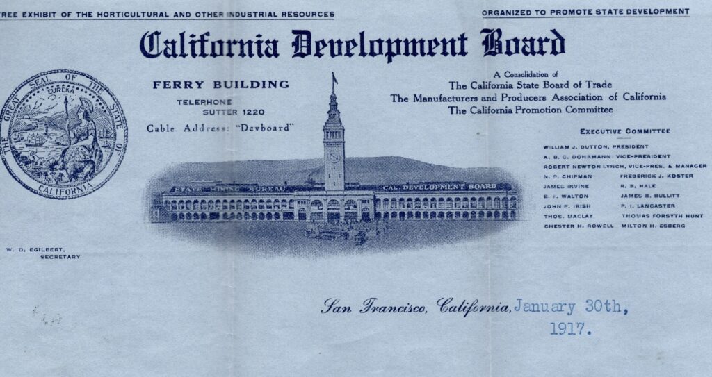 Since the 1870s there has been a lot organizations formed to promote California. Some were regional and others statewide. One in the 1890s named Made in California. It was replaced by the California Development Board which came into prominence during the Panama Pacific Exposition held in San Francisco in 1915. It was headquartered in that city’s Ferry Building, a landmark that I have never been to. In other news. the unpacking and sorting the archives from the move is a slow process and I have tortured with most difficult boxes of loose documents and photographs.