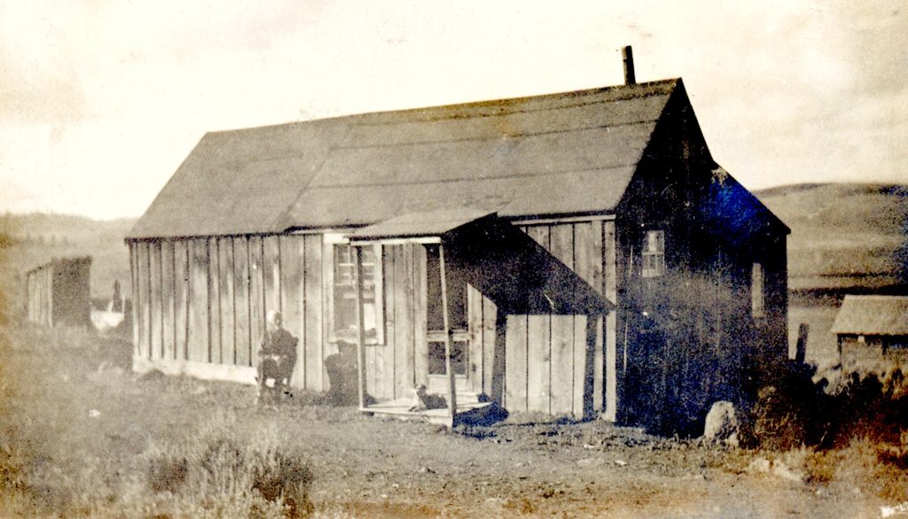
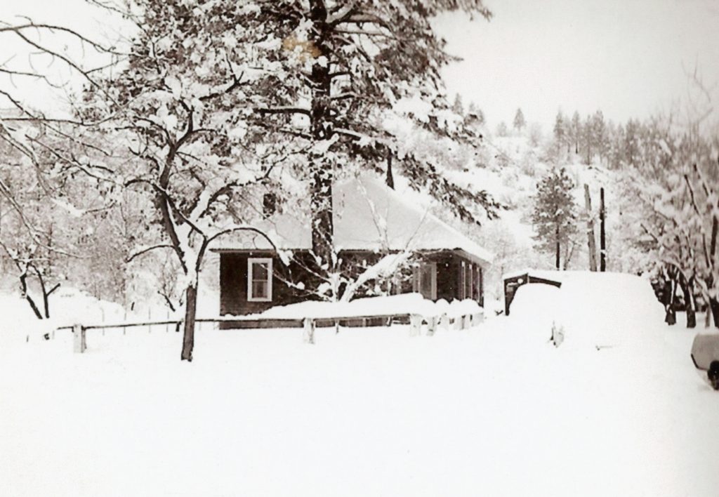
The Belle & Judson Dorsey home, Hayden Hill, 1918–Belle Dorsey Collection
In 1881, the Hayden Hill correspondent to Bieber’s Mountain Tribune wrote: “I think it quite time to write up the early history of Wood Flat and how it came to be thus named. As the unpretentious Wood Flat locality is growing in value of late by becoming a pleasure resort for promenades and picnics. Many there be who would not heard or read about the Flat, not yet minutely mapped out and sent abroad to induce tourists to come hither. I will briefly relate what I know about it.
A year ago the first cabin was built on the Flat and the owner thereof makes his living cutting wood; and at the present time he has twenty cords cut, and more engaged. His wife one day said to him, ‘We will name this place Wood Flat.’ It is less than a mile from town, and has the best spring water on the Hill. Some have called it Blue Spring, because of a bluish colored clay found there; and the water, when in the spring, has a light, clear blue caste. But the last and not least name that is been dubbed lately is Mud Springs Flat. I cannot see where the mud comes in, unless someone riles the fountain.”
Spread the word, and encourage a friend to subscribe.
Construction stalled on the gas station when Lassen Park Superintendent L.W. Collins paid Supan a visit. Collins was under the impression that Supan’s claim was no longer valid as no formal assessment work had been done, thus the property reverted to the park. Supan agreed to suspend construction until the matter was resolved.
It would be a long convoluted affair. The matter dragged on with no decision in favor or against. On June 5, 1931, park officials took matters into its own hands and filed a condemnation suit in an effort to resolve the matter. As required by law, the park placed $31,000 in escrow, the amount it deemed was the value Yellow Ochre Mine.
With no end in sight, the Supans demanded their day in court. A three day hearing was held in January 1933. In the ruling concessions were made for both sides. The southern portion of the Supan claim of sixty acres was declared non-mineral in character and the property adjudged to the park. The remaining 100 acres was deemed valid and awarded to the Supans.
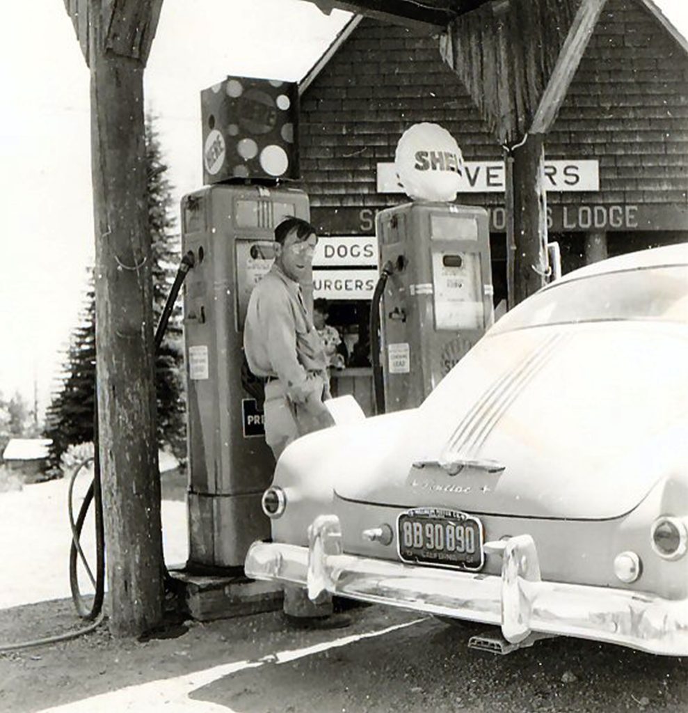
There were two major developments in 1941. First, Milton’s son, Adlai built a gas station and “lodge.” The lodge consisted of a store, that sold tourist related items such as camera film, postcards, and souvenirs, along with a lunch counter. That fall, Milton passed away leaving a wife and ten children. This was not a good omen for the park, who would have to deal with more people to negotiate with, and improvements increased the value of the property. The park was powerless with no funds to purchase the Supan property.
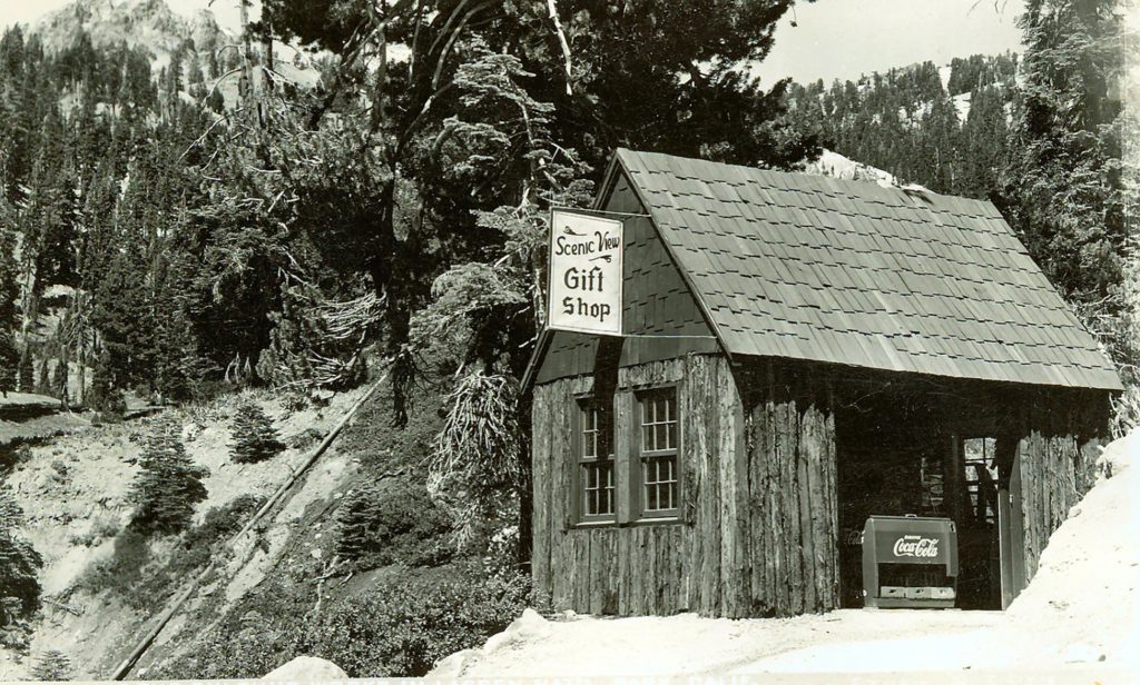
Scenic View Gift Shop—Courtesy of Don Supan
After World War II, Adlai expanded his operations to keep up with visitors needs at the park. His two sons, Don and Ed, built a small cabin dubbed the Scenic View Gift Shop. By this time, Adlai’s sister, Ada Herrick made her presence with a bathhouse, cabin rentals and a restaurant known as Sulfur Works Inn. In 1947, Adlai built a crude rope tow for winter skiing.
All of this development alarmed park officials. In 1949, the park sent letters to thirty-five Supan heirs with an offer to purchase Sulfur Works for $20,000. The family was divided, some willing to sell and others opposed. They were in complete agreement the offer was too low. It should be noted Milton Supan’s original offer was $100,000.
Discussions between the park and the heirs continued throughout most of the year. About the only thing that resulted in these talks that the value kept increasing to what the park considered “gold mine proportions”. In December 1949 with no solution on the horizon the park once again resorted to filing condemnation of the Sulfur Works and deposited $31,00 in escrow, their appraised value. The Supans immediately challenged that figure and placed the value at $525,500.
In 1952, after lengthy litigation, the court awarded the property to the park and Supans $48,950 in compensation. The park was confronted what to do with the improvements there. It was finally decided to demolish the thirteen buildings that consisted of the Sulfur Works Lodge and Inn.
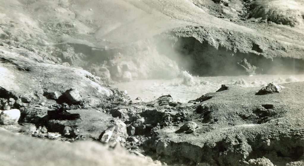
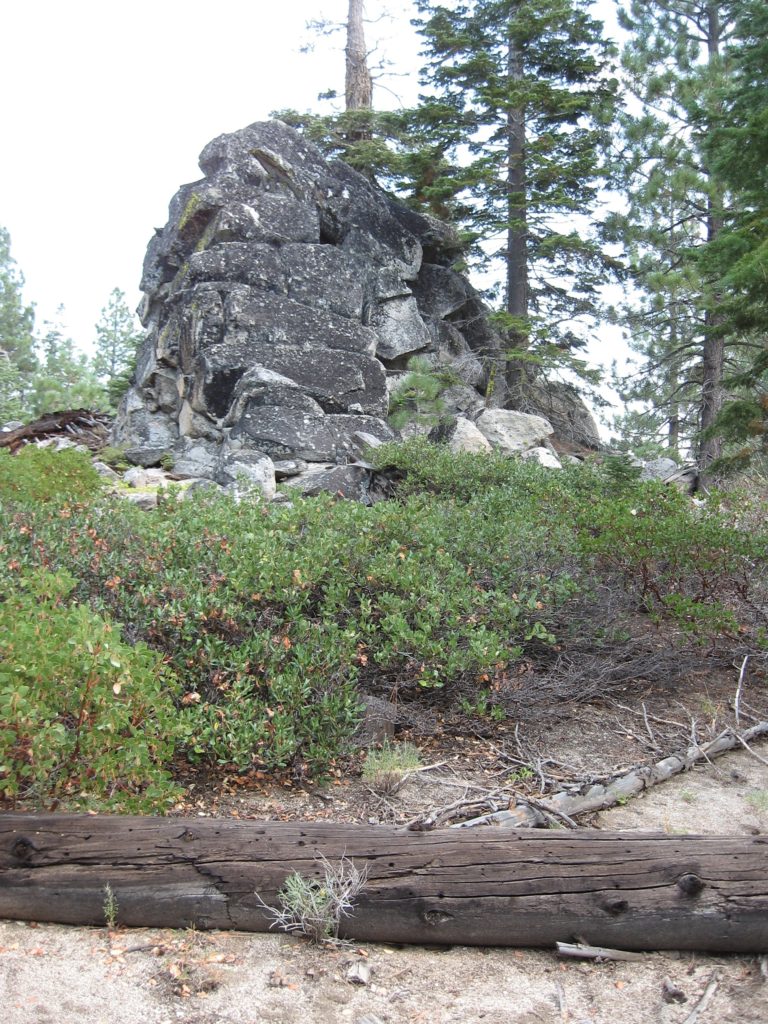
Lassen Volcanic National Park has many fascinating hydro-thermal features such as Bumpass Hell and the Sulphur Works, originally known as Supan.
On June 16, 1865, Dr. Mathis Supan, a resident of Red Bluff filed a mining claim on Sulfur Creek, two miles from Bumpass Hell. Supan spent the next twenty years during the summer months developing the property.
At the Sulphur Works he built steam bath houses for the public’s use. He also developed his own line of patent medicines that were readily available in Red Bluff—Supan’s Colic Drops, Supan’s Sour Powder, and Supan’s Rheumatic Remedy, to name a few. He even marketed his own line of bottled water from the soda springs on his claim.
1935 signage for the sulfur works
A complicated family life caused Supan in 1887 to stop working at the Sulfur works. No one in his family had any interest to carry on with his work. By the turn of the century, his son, Milton became frequent visitor there during the summer months. He utilized the surrounding property for livestock grazing.
In 1916, witnessed the creation of Lassen Volcanic National Park, though inside the park boundaries were various private properties—the Supans being one. This was a problematic issue for park officials for decades to come. Yet, when the park was created, in reality it was by name only, for funding was almost non-existent. For Milton Supan he was ambivalent about the new park that surrounded his holdings. Supan, however, re-filed the Yellow Ocrhe mining claim there, which was his father’s original claim, just a different name. It would become a contentious issue with the park.
By the mid-1920s, after a strong lobbying effort, a stingy Congress began to fund Lassen Park. One of the priorities was the so-called loop highway. The revelation caught the attention of Supan. In 1927 he began to construct a gas station there, which alarmed park officials. It was just the beginning of a long feud.
500 South Lassen Street was a focal point in Slippery Gulch. Courtesy of the Uptegrove Family.
Slippery Gulch was one of those colorful Susanville neighborhoods—one that initially was scene of houses of ill repute and later bootleg joints during prohibition. Initially, it was located along the Susan River near the Richmond Road bridge when the railroad arrived in 1912. Civic leaders were not amused, since first time visitors who arrived by train, this would be their first impression of Susanville proper. The inhabitants were moved up the river along Carroll Street in the out of sight out of mind philosophy.
As a general rule the local newspapers rarely mentioned this area by name. However, in 1935, Ash Turner in his This and That column that appeared in the Lassen Mail wrote: “News that should interest residents of Slippery Gulch comes from Salt Lake City, Utah. Salt Lake district, Utah Federation of Women’s Clubs has adopted a resolution endorsing the birth control movement as ‘of utmost importance to all Americans that the population of our country be vigorous and healthy.’”
After I had completed the above, I came across another interesting editorial piece from the Lassen Mail of December 27, 1929. The paper reported a scuffle of two Indians—Lester Evans and Ruth Gerig—at the Green Lantern in Slippery Gulch. The paper concluded, “Editorially speaking in a news column it would be a good thing for the town if ‘Slippery Gulch’ were cleaned out and kept clean. If the Indians and those who frequent the ‘Gulch’ must have a scene and setting for their carousels there are plenty of wide open spaces away from Susanville and its environs where they may have full play without annoying respectable people with their drunken and noisey coming and going.”
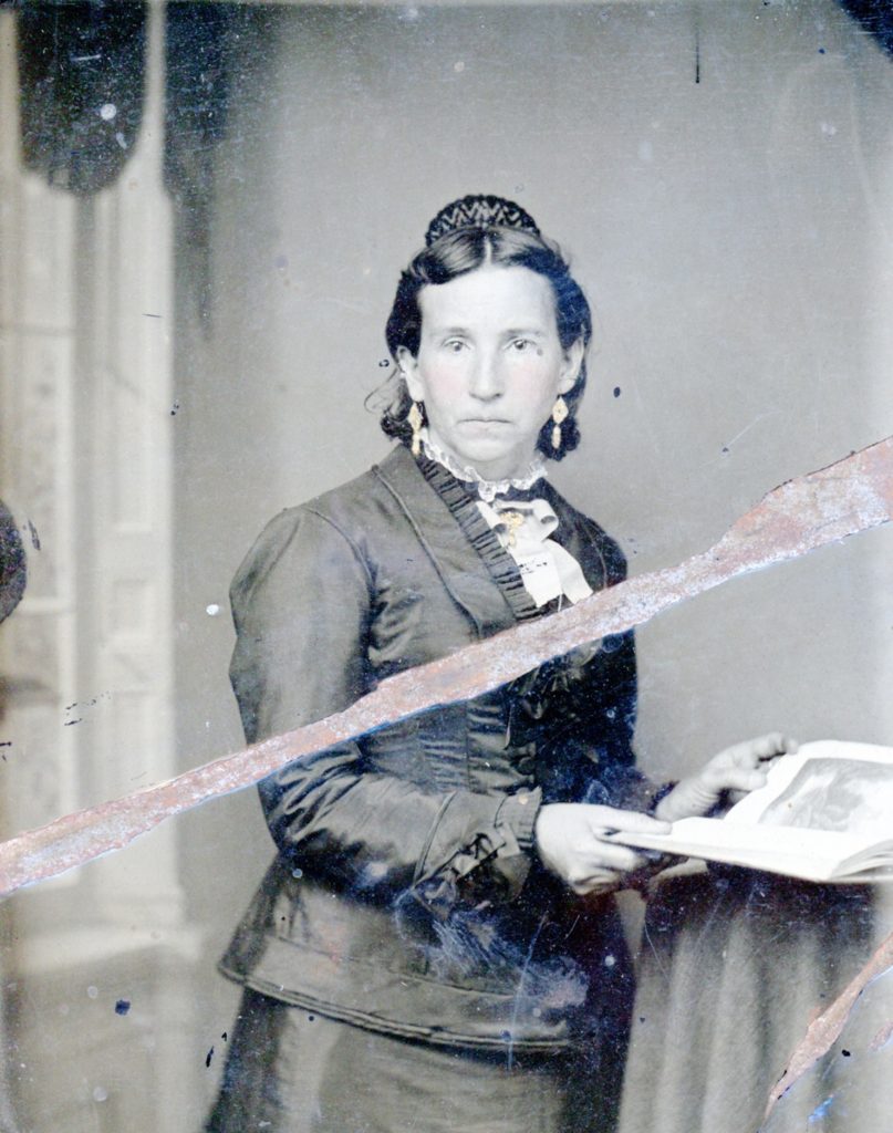
Frances Cartwright Fritter—Courtesy of Rev. C.R. Fritter
Long before the Spalding or Stones Subdivisions, the lake’s population center was on the northeast side, though no one resides there today. In the 1880s saw an influx of Butte County residents making this their new home—Cartwright, Eddy, Fritter, Sorensen and last but not least the Troxels. The Troxels, of course, purchased the W.S. Davis ranch, which place had become a well established stage stop, the property many know today as the former Stone Ranch. Jim Fritter, the family patriarch left an indelible footprint in the area’s history as a Lassen County Supervisor. It is interesting to note the Troxel name lives on two jettison points on the lake, a member of the Fritter family still retains ownership of the original family homestead.
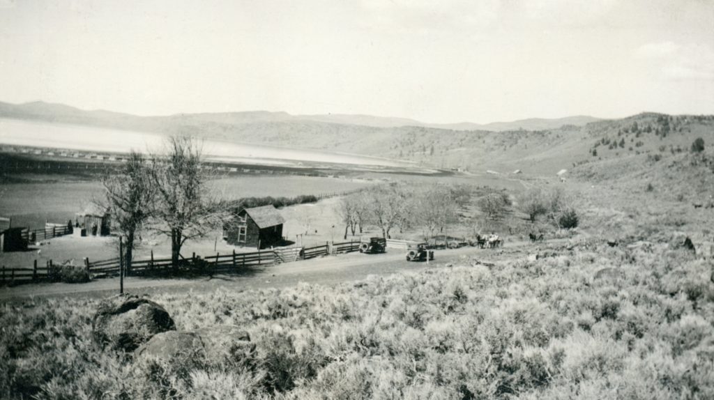
Fritter Ranch, Eagle Lake, 1921. Courtesy of Lola L. Tanner
The so-called Butte Colony was short-lived. Within a ten year span it had dwindled down to Fritter and Troxel. Cartwright’s whose homestead located between Fritter and Troxel became a contentious issue with Udell’s proposed scheme to tap Eagle Lake, but that is a whole different story.
Spread the word, and encourage a friend to subscribe.
Miller’s Construction getting ready for the demolition, of the high school, June 1968.
A question was raised concerning an article about Lassen High School’s Experimental Farm of the 1930s and its location between the school buildings and the Susan River. How the high school campus evolved is an interesting tale. In the spring of 1905, the high school board was able to use a special levy tax to construct the high school. Now, that the financial issue was resolved the next order of business was to locate a suitable site to build the new school. Three properties were offered—the Brashear property at the end of South Gay Street, an empty lot of T.W. Wilson on North Roop Street and the Blake tract on Main Street, a short distance from Weatherlow Street. It was the latter that was purchased for $2,000 and became the foundation for today’s high school campus.
A decade later the whole region was transformed with the Fernley & Lassen Railroad and the Red River Lumber Company, which two other large lumber companies would follow. Adjoining the high school to the west was the Armstrong property. In 1920, the family subdivided making the Armstrong Addition, creating the streets—Berkeley, Pacific, Pomona, Stanford and Cornell. It was Cornell Street that created a major problem. At that time the street went from Weatherlow to Alexander and dissected today’s athletic field. In the 1920s, the high school acquired property from behind the school to Cornell. As enrollments continued to increase, the school finally acquired the remaining property to the river, but the process had its moment. The high school had to go through the formal abandonment of Cornell Street through the property they acquired. Two people objected, but by the early 1930s, the issue resolved and that is how the athletic field was assembled.
Spread the word, and encourage a friend to subscribe.
Most people may not realize that there was a lot of gold mining east of Eagle Lake extending from Gallatin Peak, Green’s Peak and Round Valley. The mining discovery occurred in the early 1870s, and Wright P. Hall had an extensive tunnel on Gallatin Peak in 1879. Many years later, my grandmother Lola Murrer Tanner (1899-1973) who grew up in nearby Willow Creek Valley made a reference of a lost valuable gold mine in that area with a reference to Gallatin Peak. There were others over the years that shared the same belief.
In the summer of 1935, two prospectors, Paul Olsen and Joe Weatherman, who had spent the last few years in that area, believed they finally found the lost mine. Among the items found was an old cabin, where there was some ore, along with an old tunnel 140 feet in length. Of course, they were sly not to reveal the exact location. They immediately formed the Meteor Mining Company. Their next obstacle was to secure a 200 acre lease from the Red River Lumber Company who owned the majority of the property in that region. Whether they succeeded is not known.
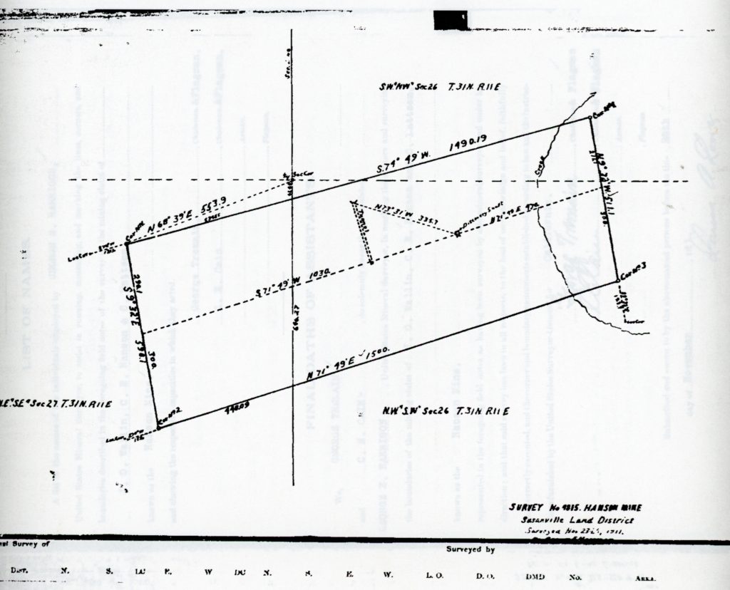
A few years back, I went in search of the Hanson Mine of the early 1900s, that fits the description of Olson and Weatherman’s find. However, between fires and logging the site may have been obliterated.
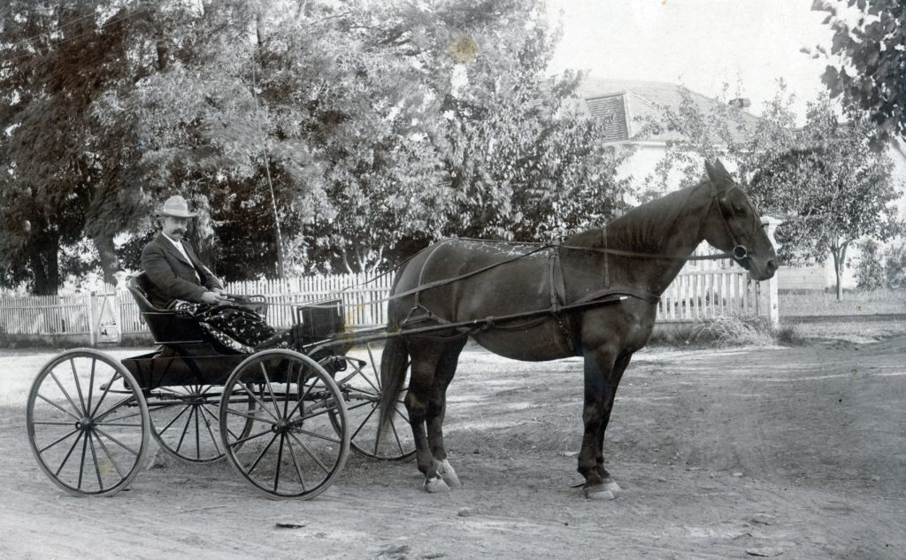
A.K. Philbrook and his new buggy in front of the Sol Nathan residence on Roop Street. Courtesy of Philip S. Hall
Long time Lassen County resident, Alonzo Kelly Philbrook, died in Susanville on April 22, 1936, at the age 76. Philbrook had moved to Susanville in 1900 where he family ties. While Philbrook was in furniture business, in that era, most assumed the occupation of undertaker, since they had everything at their disposal to make coffins.
What was extremely unusual about Philbrook’s passing was the Lassen Mail published “A Tribute” to him, something that paper, or its competitor the Lassen Advocate rarely did. The following is that published account, and third paragraph does stand out.
“With the passing of A.K. Philbrook on Wednesday of this, Susanville and Lassen County lost a valuable citizen.
“The aged ex-county official has been long known throughout this section of the state and his passing will be felt deeply by many persons. His character, integrity and personality were such that no resume need be written for them.
“In common with the majority of humanity, Alonzo Philbrook did not find life all a ‘bed of roses.’ To each of us is certain to come a certain amount of ill fortune Mr. Philbrook was no exception to the rule. However, his adversities were met with the same unfailing cheerfulness and ‘chin up’ attitude which marked his entire career.
His passing is sincerely regretted by the entire community and the Lassen Mail wishes to add its condolences on the passing of a fine old gentleman who earned his place in the hearts of his neighbors and fellow citizens.”
In 1928, the Lassen National Forest Service leased seven acres from Lassen County on Richmond Road for a tree nursery, named the Susanville Nursery. It was done under the direction William G. Durbin, the Lassen National Forest Supervisor. In 1932, C.W. Corson, a recent graduate of the University of Minnesota has hired to be in charge of it and was so for many years. Anyhow, the initial goal was to raise 750,000 of pine seedlings over a five year period. In addition, experiments were done with cedar, fir and sequoia.
The first planting from trees from the nursery was done in 1930 to assist the reforestation of the burn on Antelope Mountain west of Eagle Lake. In addition, the nursery provided seedlings to the various national forests throughout California. It was unique that it was only large Forest Service nursery in California. In 1936, after the establishment of Lassen College’s Forestry program many of those students worked at the nursery.
In 1938, after the passing of William Durbin, the nursery was renamed to Durbin in his honor. Durbin served as the Supervisor of the Lassen National Forest from 1922-32.
Unfortunately, I do not at this time, have a date when the nursery ceased operation, but it appears sometime in the early 1950s. The property is best known today as Diamond View School.
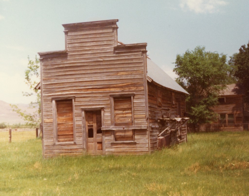
Byers’ old Baxter Creek general store that was later moved his Tule ranch and operated by his nephew, Jim McClelland, May 1975
Today, is Lassen County’s birthday, it being created on April 1, 1864. Many people may not realize but the original proposed name for Lassen County, was Byers County. So who was Byers, and why was he to be honored? In 1858, James Davis Byers (1825-1902) purchased some property along Baxter Creek near Janesville. However, he remained a Quincy resident for sometime. In February 1863, Byers served as a Plumas County Deputy Sheriff, and played a significant role in the Sagebrush War. The final result of that conflict led to the creation of Lassen County the following year. Plumas County Assemblyman Robert A. Clark introduced the legislation to create the new county. Clark proposed to name it Byers County, but Byers declined. Byers suggested that it should be named after Peter Lassen, and thus the Lassen name was applied to the new county.
More about Byers in a later post, though by 1880 he was one of the ten wealthiest people in Lassen County.