While in the past I have noted the January 1916 snowstorm, followed by a very cold spell. For the record here are the statistics for that month observed at the Susanville station.
North Pine Street, January 1916. Courtesy of Dolores Gasperoni
The average maximum temperature was 35 degrees and the average low of 12. On January 23, the record high for the month was 50 degrees and on January 30 saw a record low of -14 below zero. It was a snowy month with 104 inches and on January 2 the greatest amount of snow in one day was 32 inches.
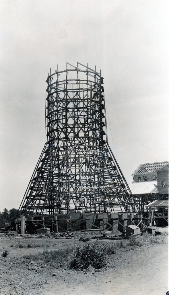
The FGS Burner under construction at the Susanville Plant, 1920–Ed Standard
The tossing of old documents takes on many forms. Believe me I witnessed a lot over the years and became an expert “dumpster diver.”
Recently, Susanville native, Edward Standard (1930-2021) passed away. Sometimes, what was intentionally destined to be destroyed gets a last minute reprieve. Ed was working for Fruit Growers Supply Company at the time the mill was being closed in Susanville back in 1964. He was assigned the task to take a number of records from the office to be disposed in the company’s burner. He carried out most of his duty, except for one packet. What he saved was about 600 commercial negatives of O.O. Winn who photographed the construction of the mill in 1920-21. He never said anything about it.
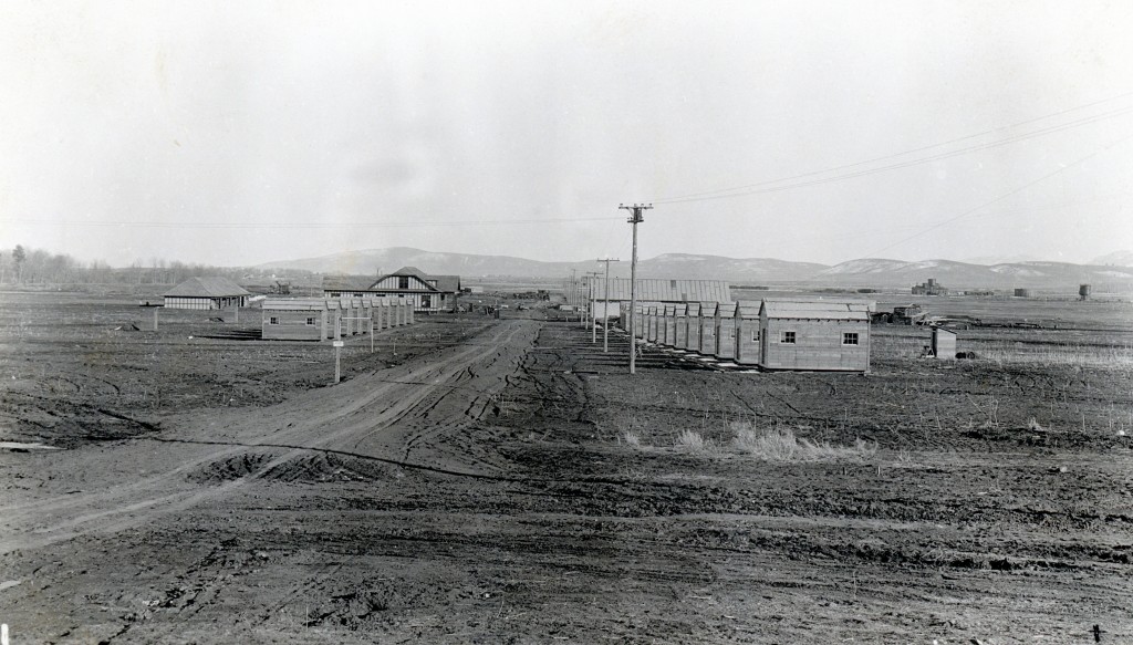
Construction of Fruit Growers housing, 1920–Ed Standard
Fast forward to the fall of 1998. It was common knowledge that I was working on the logging operations of Fruit Growers. In September I had an opportunity to go to Cornwall, England to meet my grandfather John Tanner’s only living first cousin. While I was away brought the negatives by and placed them between the screen and front door. It was quite the surprise when I returned home.
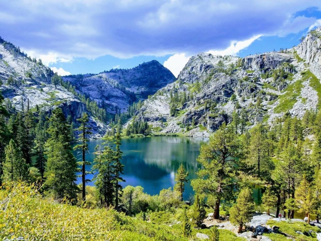
Not familiar with this Eagle Lake, even though the real estate listing purports to be in Lassen County.
This idyllic alpine lake photograph is dubbed as Eagle Lake, located near Termo. It is the featured photograph to the many wonders of the region, specifically, as the the seller points out to entice a buyer of a 20-acre ranch on the Madeline Plains. Asking price for the parcel is $18,000. The seller will even owner finance at 9% interest. So many interesting real estate offers to be found on the internet.
A number of years ago, while doing research in the Lassen County Assessor’s an interesting, yet not uncommon episode occurred. A man walked into the office, having flown all the way from London, England, to examine a parcel of land his uncle bequeathed him. Thus, the gentleman suffered from illusions of grandeur, for surely, California property must be worth gold! The staff at the Assessor’s Office attempted to explain that he inherited a twenty acre parcel on the Madeline Plains. Let’s just say the poor Brit spent more on making the overseas trip than what the property was worth.
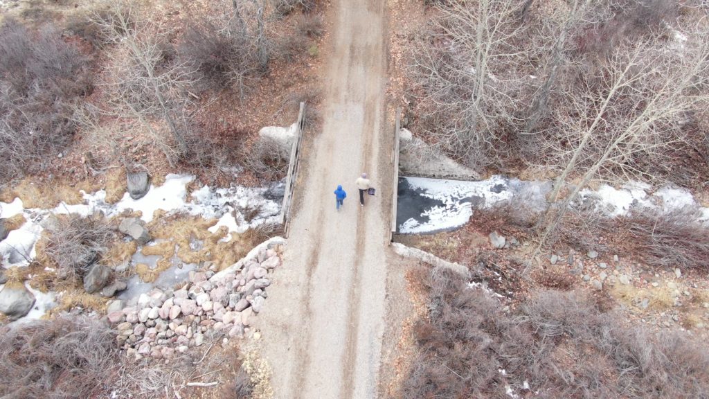
The crossing of Cheney Creek along the Bizz Johnson.Trail—David Bricker
Cheney Creek, which old maps referred to as China Creek, is a small tributary of the Susan River, and flows into that stream just below Devils Corral. About midway along the length of Cheney Creek is a small meadow, though Asa Fairfield referred to it as Cheney Valley. Fairfield stated it was named for E.M. Cheney who in October 1860, filed a claim of 58 acres on the south side of the Susan River, near present day Hobo Camp, some five miles away. Not much is known about Cheney’s short tenure in the region, though he did serve on Lassen County’s first Grand Jury.
By the mid-1860s, Susanville had its own Chinatown. The population had its ebb and flow. On June 10, 1871, Quong Wong and 39 other Chinese filed mining claims along this creek which they named it the Yankee Company. Their activity was not ignored.
The Lassen Advocate reported on September 9, 1871: “There are some forty Chinese mining the vicinity of Stockton’s mill on the Susan River, about nine miles from here. They are making, they say from $1.50 to $2.50 per day to the hand. There are unquestionably good mines in that locality, provided water could be secured to them without too much trouble. Parties are anticipating the construction of a ditch to these mines next spring.”
Cheney Creek shortly before it enters into the Susan River—David Bricker
According to mining claim it is a dry gulch. As the newspaper reported it was near Stockton’s, known today as Bunnells. Where Cheney Creek flows into the Susan River, is a rocky bluff, while where Williams Creek flows into the Susan River at Devils Corral, would be conducive for a ditch.
Whatever the case may be, as late as 1958 Metzker’s Atlas of Lassen County designates Cheney (China) Creek.
While working on a self guided mural walking tour, one item that I want to incorporate is to highlight something about the building they adorn. On the west facing side of the building is the ranching mural.
In 1914, O.M.Doyle constructed a two-story brick building on the southeast corner of Main and Roop Streets, to be known as the Del Mar. It was designed by well known Nevada architect F.J. Delongchamps. It should be noted Delongchamps had previously designed the Lassen County Jail in 1911 and at the same time of the Del Mar Building he also designed the St. Francis Hotel and the Star Hotel. There were several commercial buildings constructed that year, all which had basements. The problem arose what do with all this dirt. Some clever person, we may never know the identity, came with an interesting solution. The area where Piute Creek crossed Main Street was very low, and prone to flooding in the winter. The dirt from the excavated basements used to fill in some of that area.
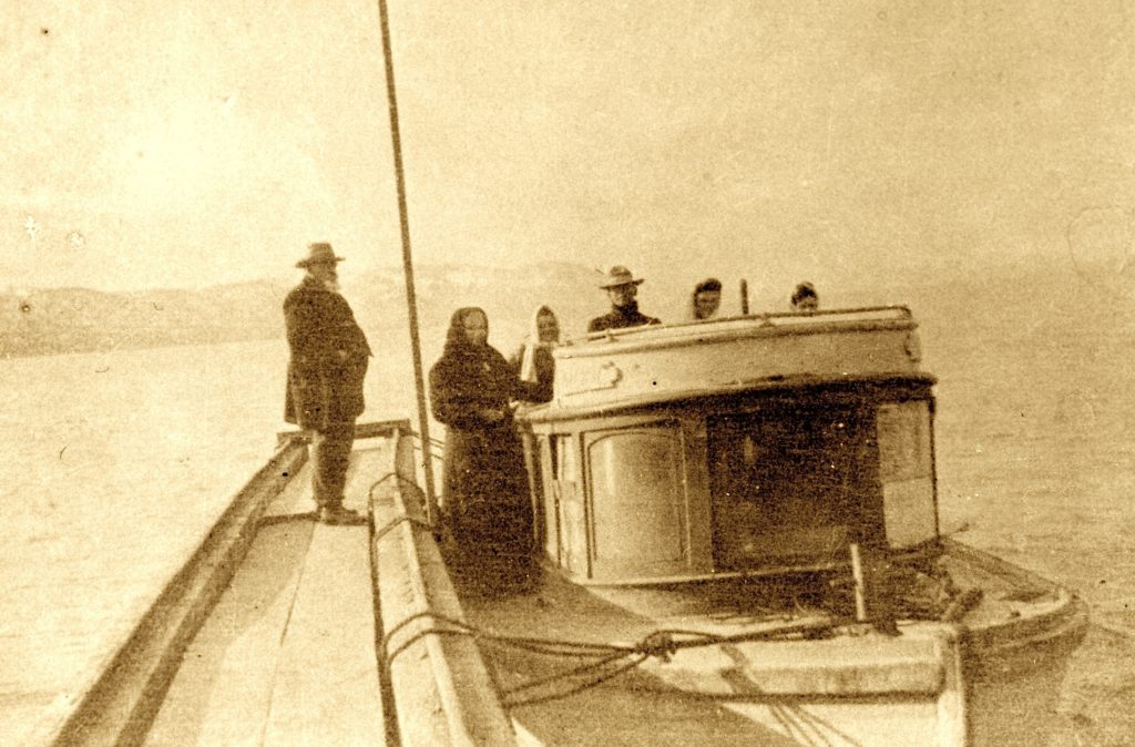
E.C. Brown’s tugboat docked at Amedee—Claude Wemple
While recreational boating on Honey Lake dates back to 1856, commercial boating did not occur until the early 1890s with the establishment of Amedee on the east side of the lake, as the terminus of the N-C-O-Railroad.
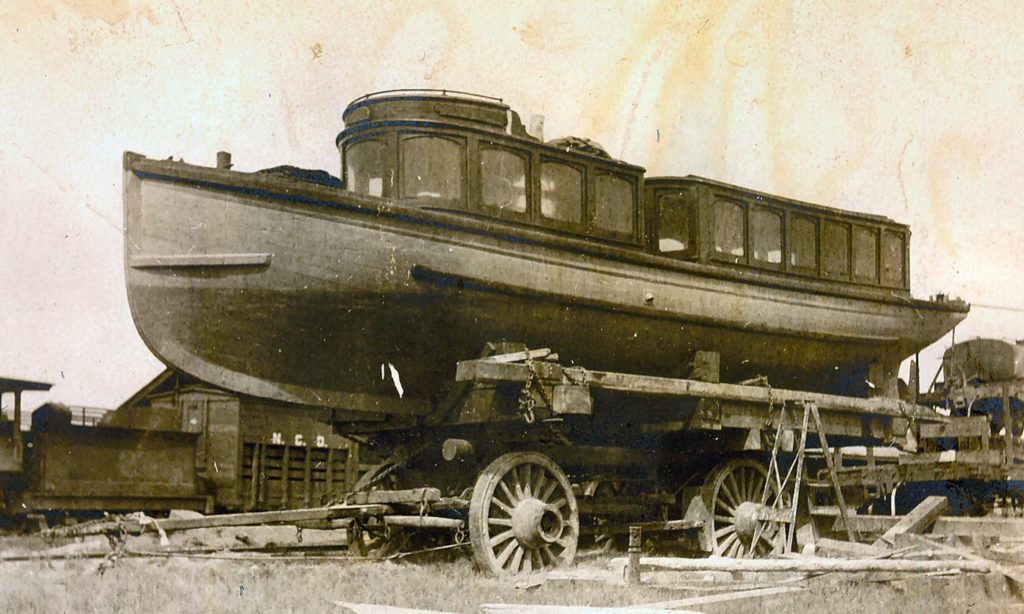
The E.C. Brown’s tugboat at Amedee before being launched, 1907. Courtesy of Marie H. Gould
There were a total of four boat docks. Two on the west shore on the ranches of Decious and Clark. The Barham dock on the northwest corner near where Baxter Creek enters the lake. Of course, the other was at Amedee. Material on them are scarce. In September 1907, E. C. Brown launched his tugboat at Amedee. In 1915, his son, Asa docked the boat for the last time at Barhams. The last time I inspected the remnants of Brown’s boat, there was nothing to indicate a dock along the shore. The same was true when attempting to locate the site of the Amedee boat dock, there was no evidence of a dock. Though unrelated, it is real interesting what washes ashore on the east side of Honey Lake.
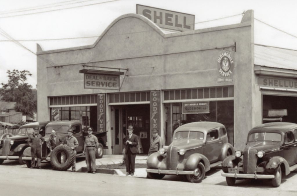
Deal & Davie dealership, the longest lasting of the auto row.
Awhile back, I wrote about Susanville’s Auto Row. The building featured in the photograph was known for decades as Deal & Davie. The structure was built in the fall of 1926 for Felix Poulin & Son—a Dodge Dealership.
Willow Creek School 1886–Alice Fritter Pendergrass
In the spring of 1871, the residents of Willow Creek Valley constructed and operated a private school at the west end of the valley near the Murrer Ranch. Miss Fanny Lovell was employed to teach the first classes. In June 1871, residents petitioned the Lassen County Board of Supervisors for the formation of a school district and that was granted. At that time it was one of the largest school districts, land wise. It included Grasshopper Valley, the Madeline Plains and Horse Lake.
It was not until 1877, when John Dobler donated the land that the school was built on, with a stipulation that the property would revert back to him or his heirs when it was no longer used for a school. That would never happen. Continue reading Willow Creek Valley School District→
Here it is the second day of 2022, and the first Sunday of the New Year. I am bit sluggish so bear with me, while I prod myself to get things up and running.
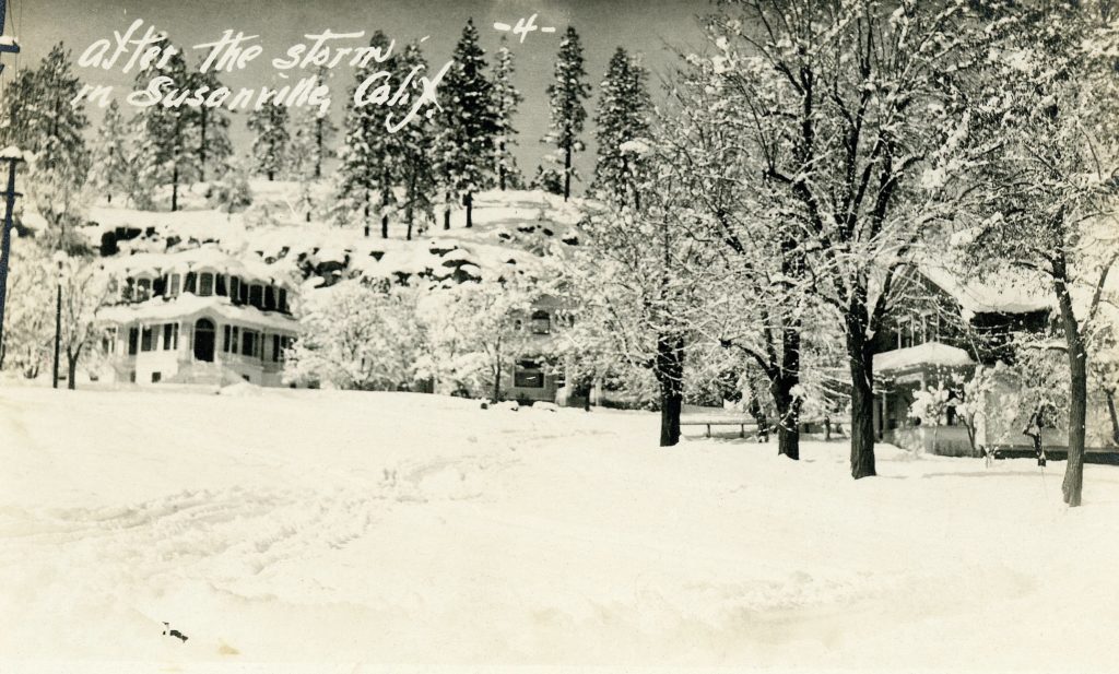
For those who have the 2022 Private Reserve Calendar, you are no doubt familiar with the above photograph. There is not a lot to indicate when it was taken. My hunch is December 1937, which would be the beginning of one of the wettest winters on record. What intrigues me, it is a postcard that I bought on Ebay last spring. In all my years of research, I had never seen this image before. So I bought it. There were red crayon marks, and I was not delighted. Two days later, another one appeared on Ebay, and it was in much better condition. So that is my story.
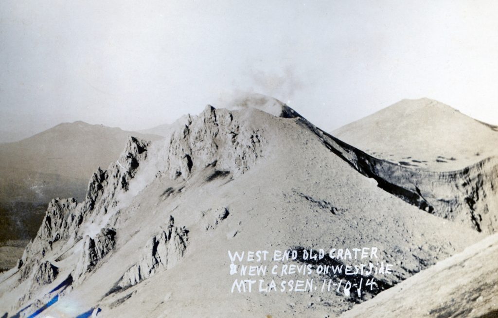
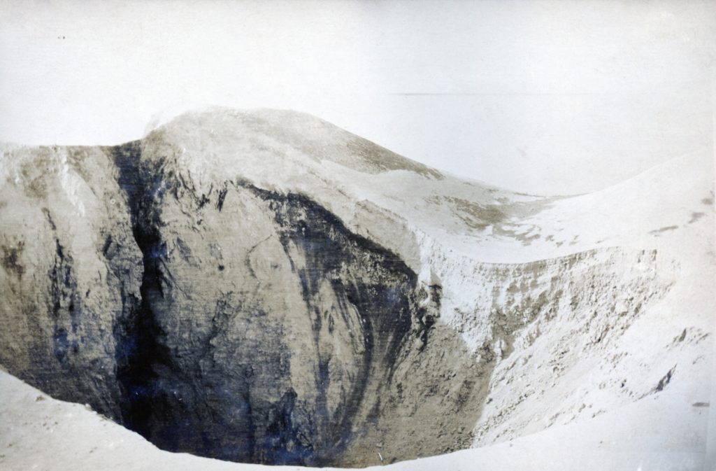
When Lassen Peak had it initial eruptions in the spring of 1914, it created an initial crater 25 feet wide and 44 feet long. For the remainder of the year, there would be over hundred eruptions, constantly reconfiguring the crater. That would change dramatically on May 22, 1915 when the peak had its cataclysmic eruption.