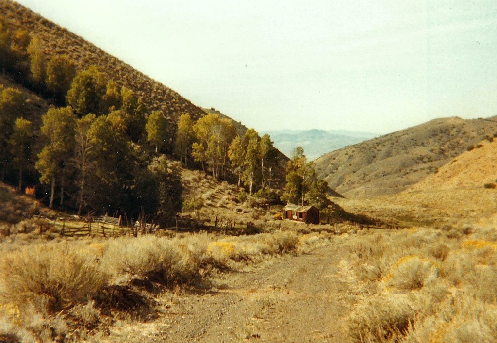
If you recall earlier this year about the mining activity at Rosebud on the eastern edge of the Black Rock Desert, there was also considerable mining activity much closer to the Honey Lake Valley in the nearby Smoke Creek Desert. In 1882, the Cottonwood Mining District was established on the Fox Mountains on the east side of the Smoke Creek Desert. Due to its remoteness and lack of any substantial high grade ore, little mining was development. Continue reading Wild Horse Mine→
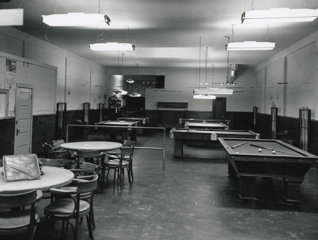
The Bank Club, Susanville. Courtesy of Hank Martinez
It has been some time since I took a day off. As today is my birthday, I am going to tweedle dee and tweedle dum the day away. A regular post resumes tomorrow.
The back room of the Bank Club.
P.S. – For those wondering, I won re-election to the Lassen College Board of Trustees–a real squeaker by 71 votes!
Spread the word, and encourage a friend to subscribe.
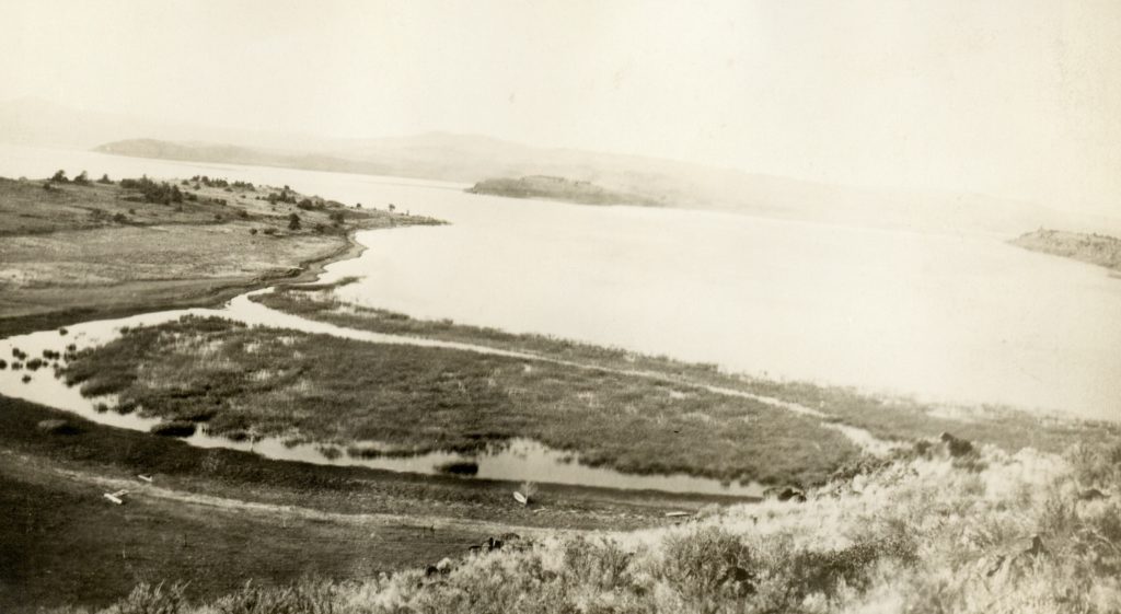
The north shore of Eagle Lake, 1920, where Udell proposed to build a dam. Courtesy of Lola L. Tanner
In 1910, San Francisco attorney Alva Udell came up with a novel approach to tap Eagle Lake without the aid of a tunnel. Udell proposed to tap the lake at the north end, only a mile from then Troxel’s residence (better known to many as Stones). The intention was to build a dam on the lake and a canal leading over to the Willow Creek springs. This route, it should be noted, is the lowest division separating Eagle Lake from the headwaters of Willow Creek. Continue reading Eagle Lake – The Udell Project→
Round Valley Reservoir is located north of Susanville in the Willow Creek Valley region. The private reservoir came about as a fall out of investors of Captain C.A. Merrill’s campaign to construct an Eagle Lake tunnel for irrigation. Two of Merrill’s associates and John L. Davie and Frederick Getchell severed ties with him. On December 3, 1884, Davie and Getchell purchased a ranch in Willow Creek Valley, which included adjoining Round Valley, from Susanville financier, William Greehn for $4,000. The locals dubbed the new enterprise, “The San Francisco Ranch” as the owners were from that fair city. The name stuck, though it would later be known as the Lonkey Ranch and today as Five Dot. Continue reading Where are we? – Round Valley Reservoir→
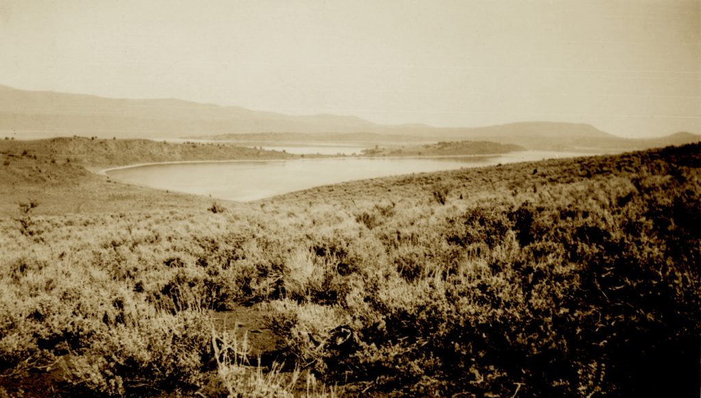
Bucks Bay, Eagle Lake, 1921. Courtesy of Lola L. Tanner
The Eagle Lake we know today was created by fault blocking, so its no wonder that earthquakes occur in the region. On June 19, 1889, a substantial earthquake was felt in the region, which was followed by twenty-eight aftershocks. Initially, it was believed that the quake originated from Mount Lassen, but upon further investigation it was determined the epicenter was at Eagle Lake.
The most remarkable finding of this earthquake was the lake dropped by two feet. Yet, the water flow of Bunnell, Cady and Willow Creek springs experienced increased water flows. The Lassen Advocate noted these springs: “had a soapy appearance, feeling oily to the touch.”
Thomas Ford, editor of Bieber’s Mountain Tribune newspaper traveled to Susanville at the time of the earthquake and wrote: “Arriving at Susanville at six o’clock in the evening, we found things pretty shaky; experienced four shocks that night, and was told that had not been a very good night earthquakes either. . . . Many were the accounts or what happened since the shaky season began–such as Eagle Lake sinking two feet, the waters of Willow Creek being higher than ever before.”
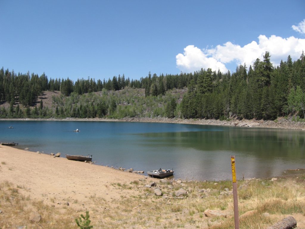
Crater Lake is located seven miles east of the Bogard Rest Area on Highway 44. In 1907, Lassen National Forest Supervisor, Louis A. Barrett, included this lake in his inventory of proposed National Monuments, the other two being Lassen Peak and Cinder Cone. The lake remained inaccessible for years, except for hardy hikers who climbed the mountain. In 1952, the Fruit Growers Supply Company constructed a logging road to the 35-acre lake that is situated in a volcanic crater, on lands owned by the Lassen National Forest. The Forest Service originally proposed to offer summer home sites, but established a campground instead.
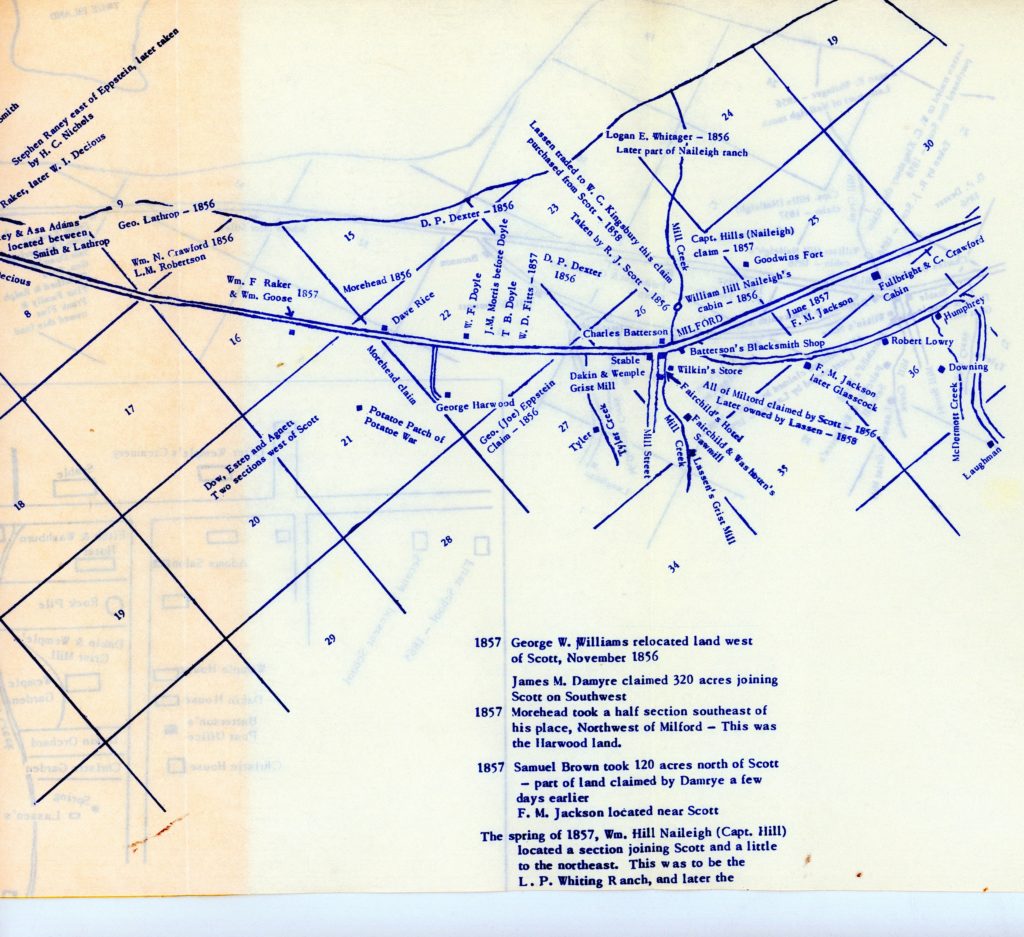
Claude Wemple’s historical map of the Milford region, shows not only the location of the Potato War, but numerous other sites.
Who knew that the almighty spud would be the cause of conflict? It all began in October 1857 when a band of Washo Indians visited William Morehead’s potato patch, some two miles northwest of Milford. When confronted by Morehead and others the Washo became belligerent and this did not go over well with the residents of the Milford district. The locals received re-enforcements from the California state arsenal, volunteer fighters from Sierra Valley, and a band of Piutes. During the skirmish several Washo were killed and many wounded. In the aftermath, the Washo withdrew from the lower end of Honey Lake Valley and never ventured north of Long Valley. Again, the residents petitioned for a permanent military fort after the Potato War, only to be ignored, again and again.
Spread the word, and encourage a friend to subscribe.
A view from the southern end of Grasshopper Valley, August 4, 2016.
Once you pass Eagle Lake north on Highway 139, the next broad expanse you see to your right is Grasshopper Valley. When intrepid explorer J. Goldsborough Bruff in 1850 noted it was lake, who later in 1876 stated it had to be what was later Eagle Lake. In wet years, the lower portion of the valley is flooded, and back in Bruff’s day especially so, since there were no dams at Said Valley or Slate Creek, so even a greater flow of water in the basin. Continue reading Grasshopper Valley→
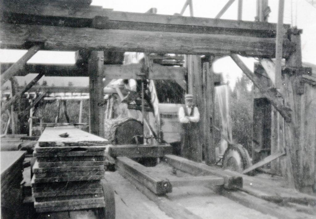
In 1872, Adam Jakobs saw the potential for the lumber market and built a sawmill along Willow Creek, two miles upstream from the Neuhaus Ranch. In 1878, Jakobs sold the mill to P.D. Hurlbut and Jakobs returned to his ranching activities in Willow Creek. Continue reading Hurlbut Sawmill→
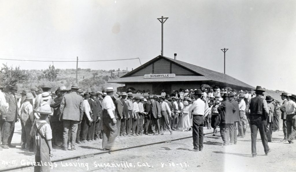
The send off at the Susanville Depot of the first volunteers from Lassen, Modoc and Plumas Counties, August 10, 1917.. Courtesy of Lola L. Tanner
This being Veteran’s Day it is only fitting to acknowledge the fallen soldiers of Lassen County from World War I. Initially, a monument was to be placed at Inspiration Point, but that never materialized. In 1922, the highway entrance into Susanville’s west end was constructed, saw the placement of a bronze plaque with the names of Lassen County men who perished in World War I. In 1966, the highway was realigned and the plaque removed. Continue reading A Remembrance→