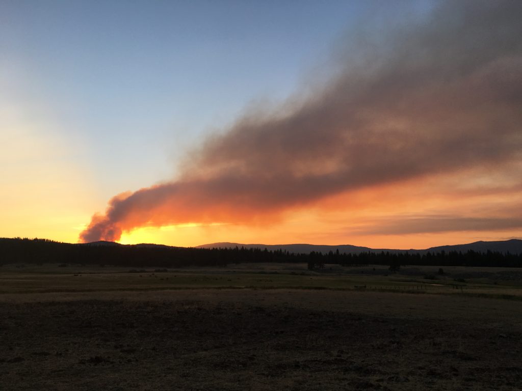
Hog Fire on the evening of July 18, 2020 as seen from the Hulsman Ranch—-Courtesy of Hulsman Ranch
Prior to 1900, a typical forest fire would burn with no one to fight it. The fire would eventually burn itself out, or Mother Nature would step in and douse it with rain. For Honey Lake Valley residents the biggest annoyance was smoke. The Lassen Advocate of September 14, 1899 reported of such fires:
“The atmosphere has been surcharged with smoke the past week, and a fire on the western side of Diamond Mountain range and another in the thick timberland near Eagle Lake are principally responsible for this condition.”
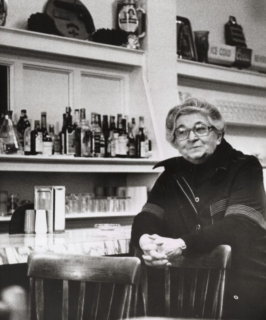
Helen Sargent at the Grand Cafe, 1984, Associated Press Photograph
Note: This Associated Press article was authored by Lisa Levitt and published in February 1984. A few years back the Sargent family sold the Grand Cafe. It going through extensive remodeling. Herewith is the article:
On a certain Main Street in a certain tiny Sierra foothills town, half a century has gone unnoticed. Time paid a visit to the Grand Cafe around 1935, and it hasn’t been back since. Helen Sargent survived The Thirties with the restaurant, and looking at them now, it’s tough to say who did it in the grandest style.
Surley, one would not the be quite so grand without the other.
In 1928, when the dark-haired, blue-eyed 20 year old came here to live with her husband Steve, in the big house at the corner Main and Grand, Susanville had 1,500 people and the Grand Cafe. Today, it has over 7,000 people–and the Grand Cafe.
And it still has Helen Sargent, whose hair has gone soft gray but whose eyes are blue as ever, and who, on any given winter morning, walks slowly down her icy steps with the aid of a cane to a waiting cab that whisks her the four blocks to her restaurant.
There, somewhere between the sidewalk and the beveled glass door, 50 years took the day off.
Perhaps it was the trauma of the wall that collapsed in 1933 during construction on an adjacent building. May be progress just passed the Grand by. Maybe the Sargents never let it in the door.
Excavation of the State Building, next to the Grand Cafe., May 1935. Courtesy of Helen Sargent
Whatever the reason, the Grand Cafe if the Thirties incarnate, from the trio of tall, silver coffee urns to the water pitchers to the table side jukeboxes from the Capehart Music Corp. of Fort Wayne, Ind. Wooden refrigerator units cool drinks behind the 30-foot counter, lined with its 16 high-backed stools. The backbars have inlaid mirrors; the one carved wooden booths were shipped in from San Francisco. “Air-cooled” says one neon sign. “Cocktails” says another.
“Everything in here is 48 years old, except the stools–they’re from the Twenties” says Mrs. Sargent, who happens to be from 1908 herself.
It’s her one day off in a work week of six 14-hour days, but she’s is happy to show off her place that has bee the centerpiece of her life for so long, to switch on the reddish-pink neon in the windows and fire up the monstrous oil-burning stove.
“I didn’t really work too much until the war broke out, and our help went to the defense plants,” Mrs. Sargent says. “One day in 1940, our two waitresses left, and that’s day I came to work I just thought after the war everything’s going to settle downwind be the way it was. But it was never the same again.”
At her home, filled with hand-colored photos and overstuffed furniture that sinks as you sit. Mrs. Sargent keeps a picture of the Grand circa 1931 that shows a cook, busboy, head waiter and her husband–the chef–holding the hand of their eldest three sons.
Two years after that picture was taken, disaster struck.
“The worst year for the Grand was 1933. That was the year the Grand Cafe collapsed,” she says. “It happened at 9:30 a.m., just as two people were going out the door. That took us nine months to rebuild.”
Reconstruction didn’t take faze the Grand, which reopened in 1935. It looks much as it did in the photo, but the staff has been reduced to one most of the time.
It’s Mrs. Sargent who passes out the menus, takes the orders, cooks the meals, clears the table, washes the dishes, orders the food and keeps books in her “office,” as she calls the table at the back of the cafe. A waitress and dishwasher help out at noon, the Grand’sbusiest time.
“I soon found out I had to do more. I couldn’t depend someone else,” Mrs. Sargent says of her working during the war years.
Her workload, which had consisted mostly of planning banquets in the early days, gradually increased until his husband’s death in 1974, when she took over completely.
After her husband died, she embarked on a 10-year plan of renovation. One year, it was a new roof on the Grand; another year, the dining room was painted. Last year, the kitchen walls got a new coat of paint and new linoleum to lay in the kitchen and banquet rooms.
Mrs. Sargent goes in at 8 a.m. every day, except Tuesdays when the Toastmasters have their breakfast in the banquet room behind the kitchen and she get in by 6:15 a.m. to prepare. Recently, banquet business has picked up a bit–a nuclear awareness group has started having lunch every Tuesday and there’s the Republican women every month.
Leg surgery last year forced Mrs. Sargent to take the first vacation of more than week that she had in a decade. The Grand was closed for nine months and she admits some customers thought she wouldn’t be back. But she was.
“The doctor said, ‘I expect you to be active, but don’t overdo it. And don’t park it,” says Mrs. Sargent, who doesn’t seem to know how to park it and doesn’t appear ready to learn.
“I miss my people. I miss my schedule. I have one more year to accomplish all the things I want to do,” Mrs. Sargent says, noting that her sons want to keep the Grand, even if she actually retires.
Hayden Hill School, 1894. Courtesy of Del & Diane Poole
Providing service’s to Lassen County’s largest mining community had its challenges. There were, of course, the boom and bust cycles, so its population was always in state of fluctuation. Due to its elevation and harsh winter conditions, many residents sought refuge elsewhere in the winter months.
Hayden Hill School, 1918. B. Dorsey Collection
Those factors influenced educational opportunities at Hayden Hill. In 1872, Perry Edris opened a private school on the Hill. It was not until 1878 that the public school was created. The school opened in the fall of 1878, with Ida Spalding as the teacher of fifteen students. The school remained in operation until 1925, when it closed for lack of students.
On June 1, 1931, the Board of Supervisors offered the schoolhouse for sale. Fred Bunselmeier and Lloyd Walsh purchased the two-story building for approximately $125.
Amedee during its heydays in 1892. Courtesy of Grant and Lena Trumbull
This well published photograph of Amedee is credited to Eastman Studios. During the early 1960s, with the upcoming Lassen County Centennial, many an old time resident wanted to have a historic photographs duplicated. They went to Mirl Simmons, the owner of Eastman Studios, and he obliged by having a copy negative made, and subsequent prints could be made. Unbeknownst, Simmons have two copy negatives made-one for the customer and one for him. Lo and behold it would be about a month that Simmons’ turned their customer’s historic photograph into a postcard, with out that person’s consent and/or acknowledgement. When Lena Trumbull had her Amedee photograph for reproduced, she was livid when Simmons copied it and made into a postcard.
Tim
Later today, subscribers will receive my personal story, and the photograph involved.
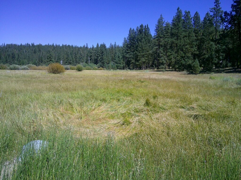
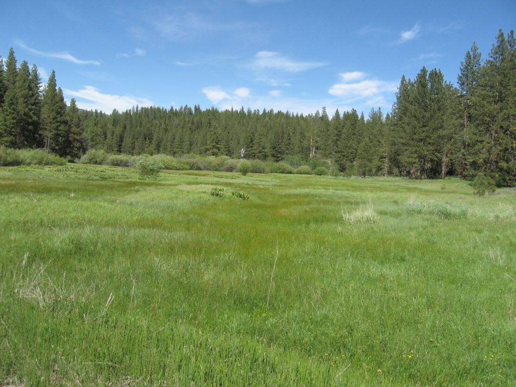
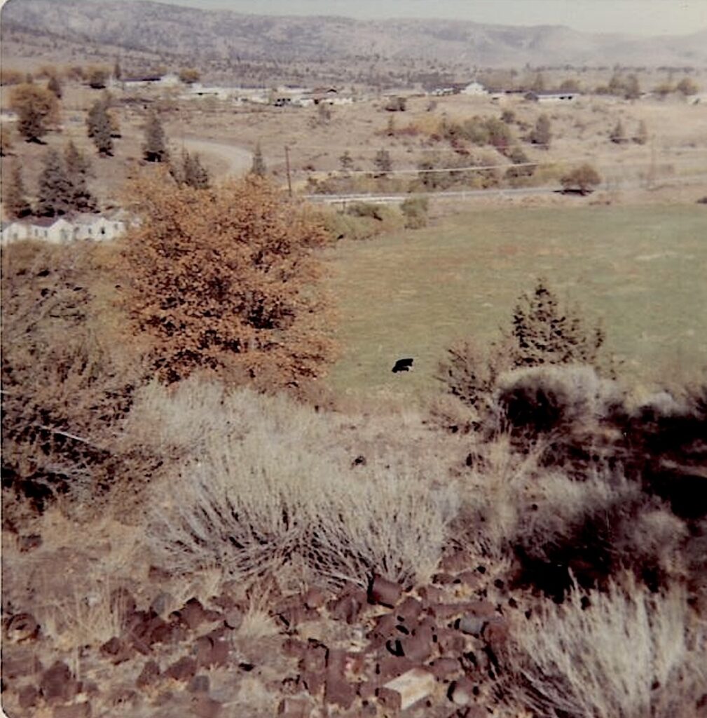
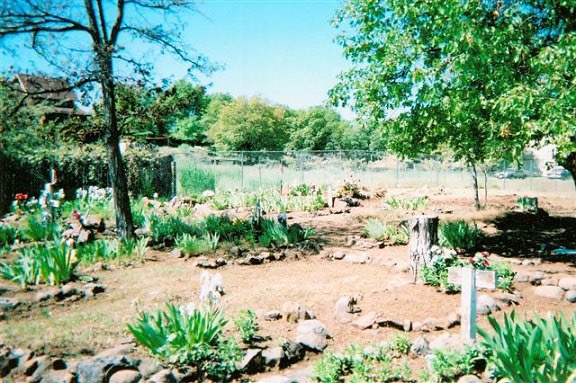
We have explored this once, read the history of Crazy Harry here. The gulch/drainage is an intermittent stream that feeds into the Susan River near Goumaz, west of Devils Corral One must turn off the main road to explore gulch which one encounters a meadow. I had not been there since June 2020, and I was concerned that this area might have been ravaged by the Hog Fire, that occurred in July 2020. Alas, my fears were laid to rest that the forest surrounding of meadow were untouched. Since my excursion there, August 20, it was dry as the photograph reveals, If you go in the spring you will be rewarded with a luscious green meadow.
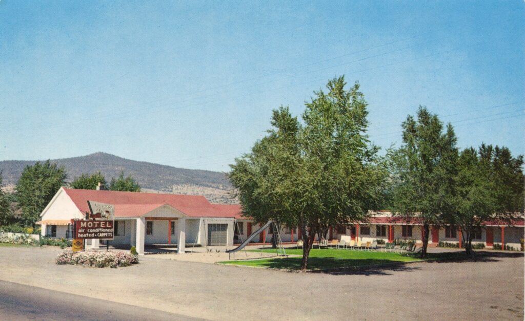
The La Mesa Motel no longer exists. It was located on the corner of Main Street and Russell Avenue in Susanville. The site is the location of O’Reilly’s Auto Parts.
Mark W. Haviland. Courtesy of his great-grandson Allen
Mark W. Haviland was one of the many early Honey Lake Valley settlers of the 1850s who remained awhile, then moved on to the proverbial greener pastures. For him that was Paradise Valley, Nevada where he died in 1894. Continue reading Mark W. Haviland, An Early Honey Lake Settler→
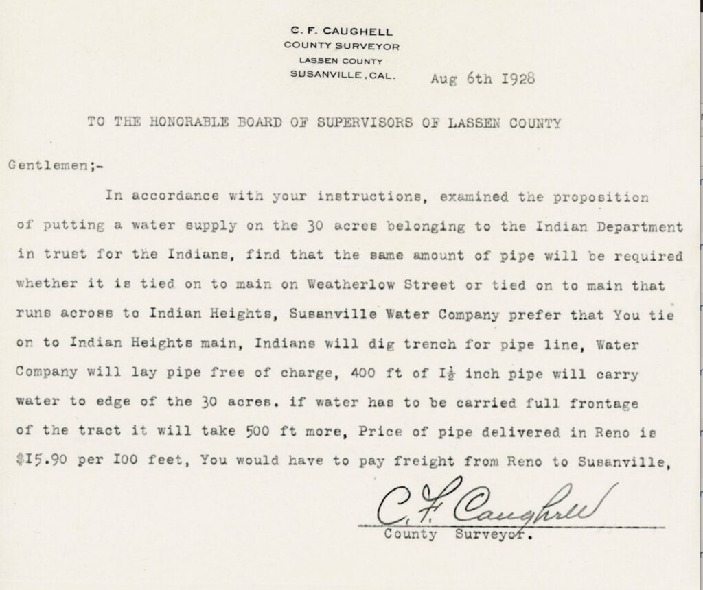
Notice of the pending water pipeline to the Rancheria.
This might be called a trifecta as the last two posts were about the Indian Heights Cemetery and the Indian Heights Subdivision. Adjoining the subdivision to the east is the Susanville Indian Rancheria. The thirty-acre Rancheria was created on August 15, 1923 to serve the Modoc, Paiute, Pit and Washo tribes.
There was a major hinderance that hampered development of the Rancheria, a lack of water. The. few early day hardy Indians obtained their drinking from a small spring located on the hillside above Chestnut Street and between Roop Street and Paiute Lane. Relief came to the Rancheria in 1928 when County of Lassen approved the expenditure to construct a water line to that place.
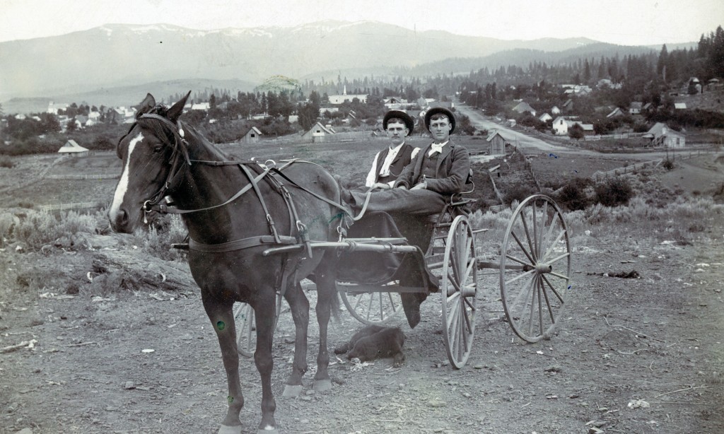
This would been one of the views from Indian Heights. Roop Street in the background from Rooster Hill. Seated, Frank League and Tom Long, circa 1895.
On March 12, 1912, it was formally announced of the construction of the Fernley & Lassen Railroad and Susanville would finally get the benefits of the iron horse. Of course, this set off land speculation and a flurry of subdivisions.
One of the early Susanville subdivision, was Indian Heights, and most peculiar one at that. This 78-acre parcel occupied a rocky hillside and was not even contingent to Susanville proper. This was conceived by Paul Riecker of Oroville, in the summer of 1912. He named it Indian Heights, because it was where the local Indian population chiefly lived. Rieckert offered lots for $100 and a down payment of $25. There were problems, a lack of streets and no water. Riecker disposed of it a year later to local resident Ralph Buckhout, who would end up with buyer’s remorse.
Indian Heights in the background, fall of 1968-Courtesy of Art Porter
It was not until the 1950s, that Indian Heights was developed. In 1953, W. Robert Jennings, a civil engineer for the State of California, re-surveyed it because he deemed it “mathematically impossible to contain this subdivision within lands of original boundary.” It was re-surveyed and renamed Northridge Heights. However, it did in keeping Indian Heights theme, kept intact three streets named for local tribes–Maidu, Paiute and Washo.
Many people do not realize that Susanville has three cemeteries–Indian Heights, Lassen and Susanville.
Indian Heights Cemetery located on Paiute Lane and is a Native American cemetery.,. The earliest known internment is for the wife of George Peconum who died on September 5, 1905 and buried there on September 6, 1905 . This makes its the second oldest cemetery, as Lassen Cemetery on Chestnut Street was not established until 1919.
This cemetery contains numerous graves that do not have the traditional type of Anglo headstone, and provides no indication of the internments. In addition, it should be noted that many Native Americans are buried in the nearby Lassen Cemetery ..
The cemetery was so named as it was in the Indian Heights Subdivision that was created in 1912. It should be noted that the half-acre parcel that the cemetery is located was owned for many years by Clifton and Betty Cramer. On June 6, 1975, the Cramer’s signed Quit Claim to the cemetery to the Bureau of Indian Affairs to hold into trust for the Susanville Indian Rancheria. It should noted that even the oldest of the Anglo cemeteries were located on private property, and that during the late 1890s the County of Lassen began negotiations to acquire them.