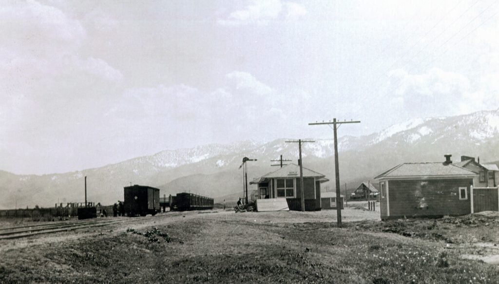
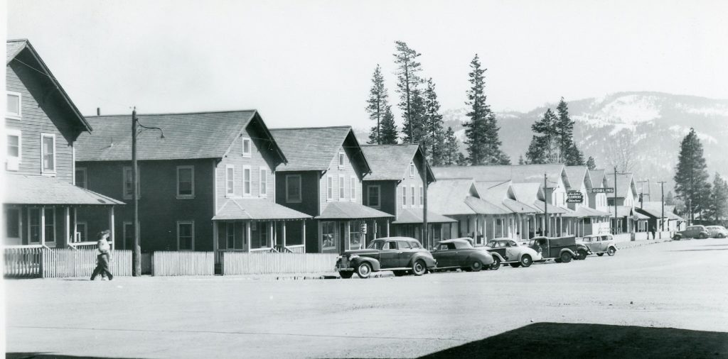
The Western Pacific Depot, Doyle, 1915. Courtesy of Suzanne Pratt
I recently request concerning the Western Pacific Railroad. “Do you have any photos or data about when Long Valley Creek roared and washed out the Western Pacific’s large culvert just north of Doyle during World War II? I remember when it happened, but not the year I remember the trestle built to keep the trains running, while the current structure was being built.” Can anyone help?
In a similar vein, does anyone have photographs of the tracks near Doyle when a portion of the railroad bed was washed away during the floods of January 2017?
In December 1908, the NCO Railroad finally made it all the way north to Alturas. One would think the residents would be thrilled, but with a major increase of frieght rates, it had a chilling effect. Then, when the NCO built its passenger depot on 12th Street, far from everything else in town, the residents complained. To appease the situation, the railroad carefully disassembled the stone depot, numbering each stone, and once dismantled the stones were reassembled at the new location on Fourth Street. The depot closed in 1938, and in 1962, the Alturas Garden Club took over the property and still maintains it.
That was the sideline article that appeared in the Lassen Mail of January 31, 1930. The main headline was the barbaric murder of Robert L. Smith, railroad gang foreman at Karlo. The Mail wrote: “In addition to establishing the record as the most brutal crime in the history of Lassen County, the murder at Karlo last Sunday morning also established a peak of honesty that will stand for some time.
”While Coroner Edenholm was handling the burned body at the scene of the crime, one of the track laborers came up to him and giving him $25, told him that he owed that amount to the dead man.”
Many may not realize that Red River Lumber Company sold bonds with two Minnesota banks to finance the construction of Westwood. After all, the initial cost to construct Westwood was $3,528,300. While sorting through the T.B. Walker papers, there was some interesting correspondence on this topic. Even with T.B. Walker’s wealth—one of wealthiest people in the United States—the banks were leery. There concern was real, especially in family operations such as Red River. Edward Decker of Northwestern National Bank informed T.B., that his concern was with his heirs, that in many causes quarrels and misunderstandings occur and eventually leading to the failure of the enterprise. However, Decker had witnessed T.B.’s five sons working together in harmony and felt confident with approval of $2 million in bonds. However, Decker was no fool, and secured a mortgage to Red River’s timberlands in Shasta and Tehama Counties. Decker’s initial thoughts came true, when shortly after T.B. Walker’s death in 1927, that Red River defaulted on a bond balloon payment, and thus the numerous financial difficulties to be encountered down the road.
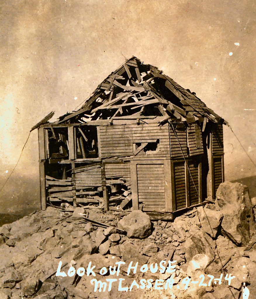
The remains from the first eruptions of September 1914
It is somewhat amazing to the think that fire lookouts more or less ran the course of just little over a century. While there are still manned fire lookouts, they are few and far between.
In 1911, the Lassen National Forest Service implemented its fire lookout program. Lassen Peak, at an elevation of 10,457 feet was the highest point in the forest, and so it was only natural that a lookout be placed there. In 1912, the first attempt was made, it was a crude arrangement that did not function. The following a year, with a new design, a portable structure could be hauled by pack animals. In June 1913, mules were used to pack the lookout building for Lassen, at least to its base. At that point, man was designated the beast of burden. It took four men, two days and sixteen trips to lug all the pieces and the sparse furnishings to the top of Lassen. W.H. Packard, of Woodland would be the only person to man the lookout for two seasons. In the fall of 1914, the lookout was destroyed by numerous volcanic eruptions.
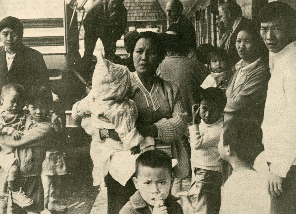
The Laotians waiting for a bus to transport them to San Diego on September 15, 1976.
On the Madeline Plains, one just never knows what to expect, especially if it included well-known rancher, John Casey. Seasoned residents are familiar with his many antics, and this particular episode garnered national attention.
The tale began to unravel when Bill and Florence Anderegg, caretakers of the Dodge Ranch in the eastern section of the Madeline Plains brought 13 Laotians to Lassen Memorial Hospital for medical care. Lassen County Welfare Director Marty Herzog was notified. Herzog in turn contacted the Northern California Emergency Team out of Redding and on September 2, 1976 they visited Dodge Ranch to find 27 Laotian refugees there, who were in dire straits. Fortunately, Vang Song, was the only Laotian that could speak English. The Laotians were bused into Susanville, where they were given additional medical care, clothing, food and shelter. By mid-September the Laotians were transported to a refugee camp near San Diego, so they could find jobs and sponsors. When John Casey was questioned about the Laotians, he pled ignorance, even though according to Vang Song, Casey was their sponsor from Thailand.
One of the problems that stymied development was water, or specifically the lack thereof. Efforts were made to bring water from Willow Creek, but that was fraught with problems—litigation over water rights. Then there was another dilemma, of finding water in all the wrong places. In the tunnels miners experienced a tremendous amount of water seepage, compounding an already difficult task. The author can attest first hand having had explored the Golden Eagle mine with water dripping everywhere.
Westwood millpond, 1915, courtesy of Otto Katzner collection
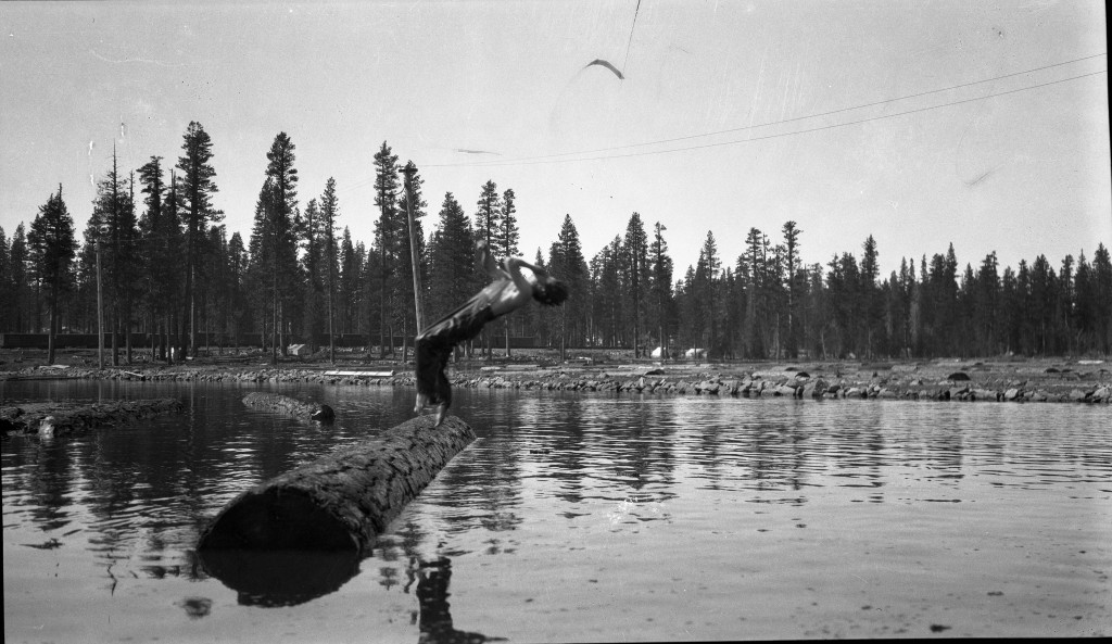
Red River was not only the nation’s largest electrical sawmill, it also built one of the largest millponds, in which several people met an untimely end in it. During the afternoon of July 29, 1914, 19-year-old, Willard Pierce was fishing where Robbers Creek entered the millpond. Others the vicinity were swimming and later left. Later in the day, John Jeffreys discovered Pierce’s body face down in about three inches of water. Jeffreys and Charles Phelan pulled him out of the water, and attempted to resuscitate to no avail. During the Coroner’s Inquest it was revealed that last year Pierce was swimming in the millpond with friends. After swimming, Pierce had a fainting spell and collapsed for no apparent reason. It was presumed that he must have had a spell causing him to fall into the water resulting in an accidental drowning.
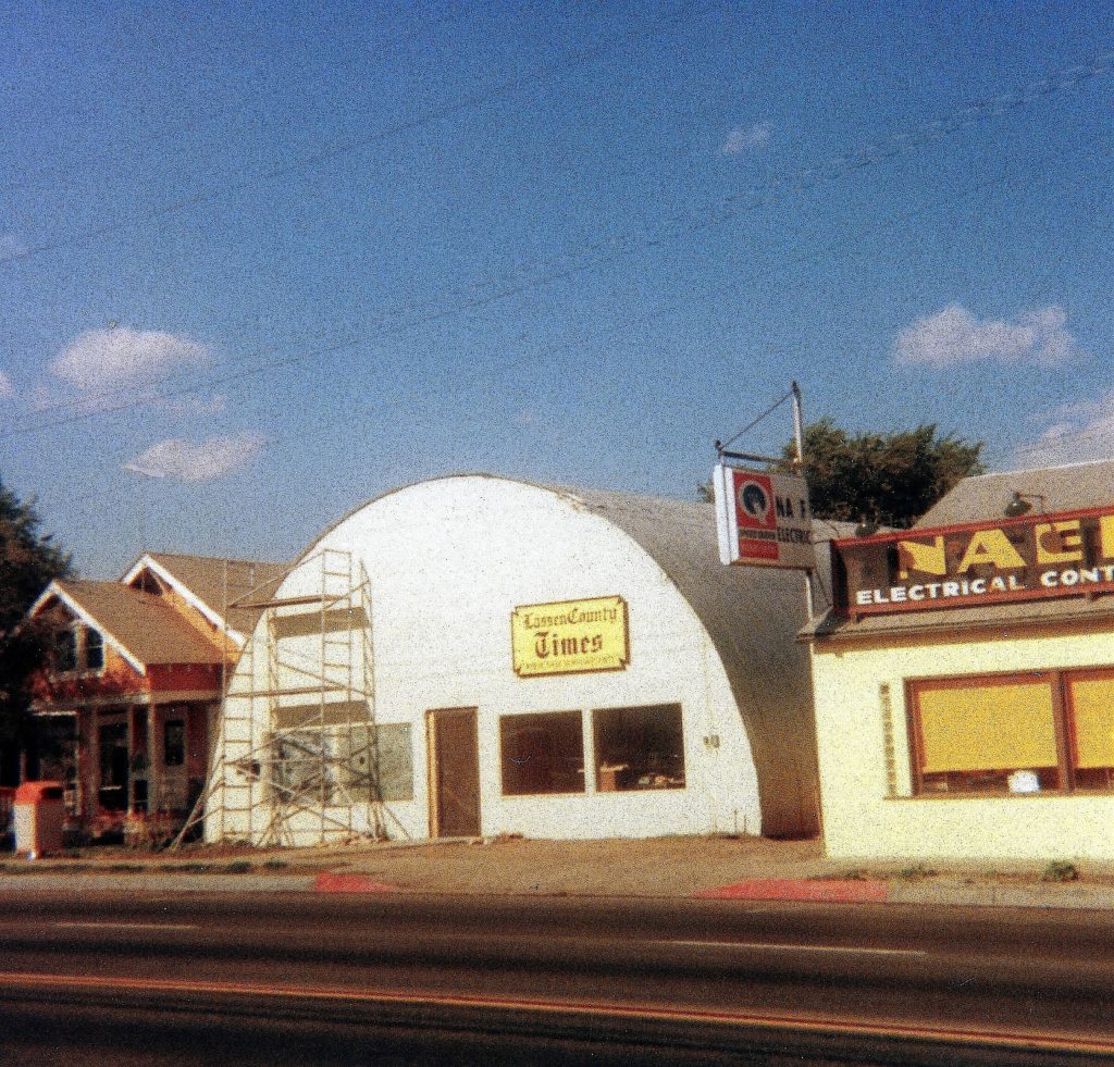
On this date, forty years ago, the Lassen County Times made its debut. At the helm was Martin Hickel, editor, Margie Teeter, city editor and yours truly penned a column entitled “Historic Moments.’
Some of the headline news was the rate hike hearings for CPN, then the local electric company. Congressman Harold “Bizz” Johnson was about to pay the community a visit. Then, there was the ongoing saga over the logging of the Westwood Cemetery.