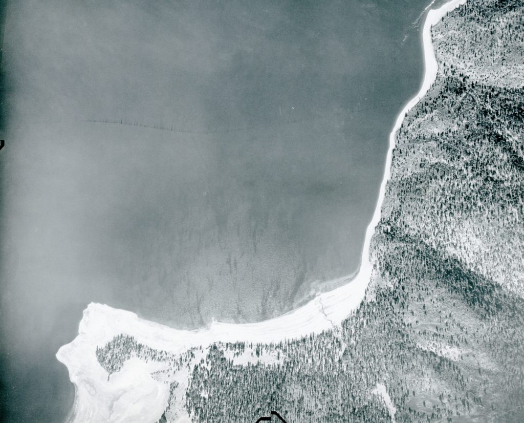
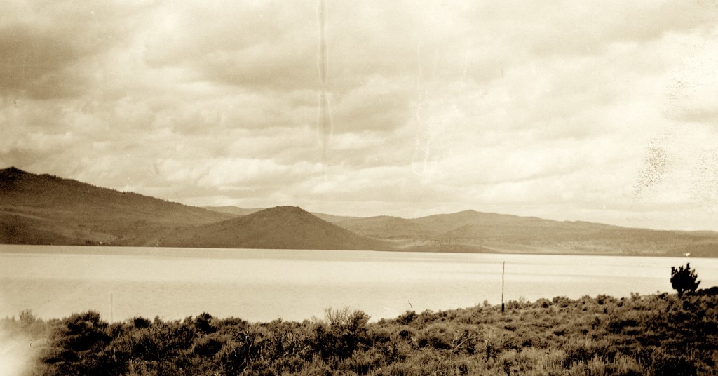
South shore of Eagle Lake, October 8, 1941 – Hank Martinez
Some may recall awhile back about this topic. A little update, since I have since received a better photograph showing the point during the low water era, which as you can tell provides a better understanding. For those you may have just tuned in Pikes Point is located at the south shore of Eagle Lake and most people know the location as the Eagle Lake Marina. The photograph shows all of Gallatin Beach to Eagle’s Next, prior that developments existence.
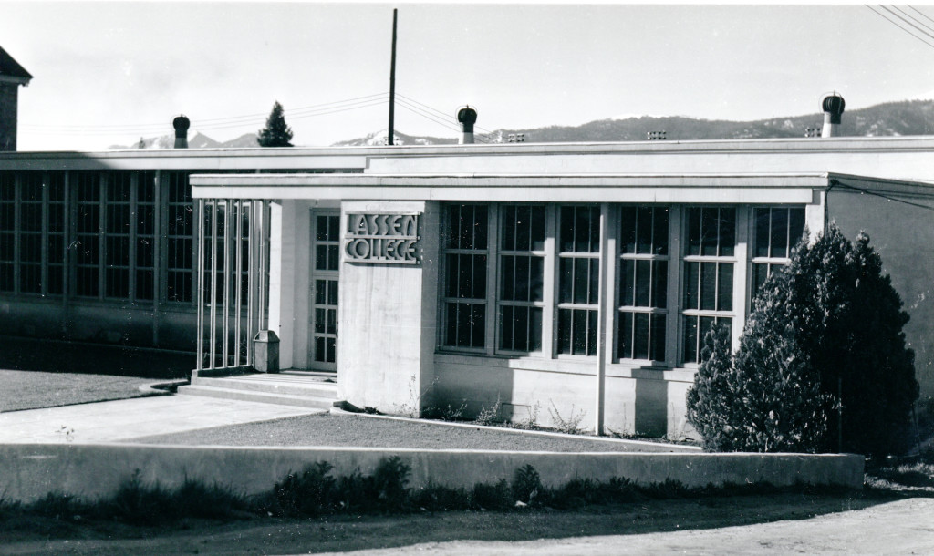
Lassen College on the Lassen Union High School campus.
In 1965, Lassen Community College severed its ties with Lassen Union High School. The college then began the process to locate and build a campus of their own.
During that process college officials decided to expand its territory with neighboring counties of Modoc, Plumas and eastern Sierra. After all, for nearly forty-three years residents of those counties took advantage of the opportunities made available to them at Lassen College.
On June 4, 1968 the voters of those counties, as well as Lassen, would decide if it was to be a four county community college. A college spokesman stated, “We want quality education in this mountain area at a reasonable cost.” The ballot measure ran into trouble with Plumas County, whose residents planned to annex to Peralta College in Alameda County. The major hurdle was the tax issue to fund the costs to build a new campus. While the Lassen voters approved the measure, the neighbors did not.
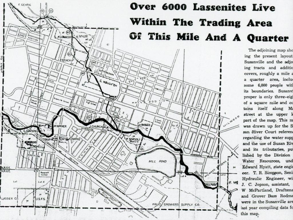
A 1937 promotional feature of the Lassen Mail newspaper.
Nearly since time immemorial Susanville boosters grappled with the town’s population figures. This became quite problematic when the town incorporated in 1900, due to its small boundaries. At that time the western boundary was Inspiration Point, Piute Creek to the north, Susan River to the south and Weatherlow Street was the town’s eastern boundary.
One of the issues the City of Susanville grappled since it was incorporated was its population. To lure business and families, the larger number of inhabitants was an enticing inducement, and still is to this day. After the lumber mills arrived by the early 1920s, there were numerous subdivisions to the east of the City. The City tried its darndest to annex, but large property owners like the Red River Lumber Company which owned the Milwood Tract was a force to be reckoned with and defeated many annexation measures. All the Susanville boosters could do, is at least advertise a Greater Susanville. It should be duly it would take nearly a half of a century before City was able to annex adjoining properties.
However, this concept was not limited to any certain era. For instance in the 1990s, when the City annexed the State Prisons, those incarcerated became city residents. Those 8,000 inmates were reflected on the City Limit signs noting it now had a population of 17,000. As one city official informed me at the time to include the inmate population in the sign, was for marketing purposes hoping to influence more businesses and perspective residents to take a second a look.
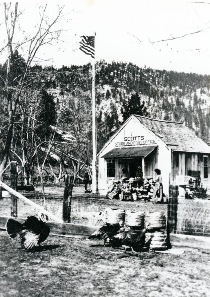
Scotts, a Western Pacific station in Long Valley. Courtesy of the Nevada Historical Society
The Southern Lassen Irrigation District was one of my entities organized to reclaim the sagebrush lands of the southern and eastern portions of Honey Lake Valley. This would be done by damming the waters of Long Valley Creek, capturing especially the winter run-off to hold for the spring and summer irrigation season when it is needed the most.
Enter C.E. Grunsky, consulting engineer for the irrigation district. It was his contention that if the district’s goal was to reclaim 26,000 acres, they would need more water than just Long Valley Creek. In July 1918 he unveiled his plan. Grunsky wanted to divert the flood/surplus water of the Little Truckee River via Dog Valley into Long Valley Creek. At Scotts, along Long Valley Creek, about six miles south of Doyle a dam would be construct to impound those waters. It was his contention this would alleviate the flooding problems of the Truckee Meadows (Reno/Sparks). In addition it was his opinion those flood waters were wasted in Pyramid Lake which he remarked, “did no good to anybody.”
In August 1918, Grunsky organized a meeting of California and Nevada officials to discuss the merits of the project. Most of the attendees were receptive. The project never proceeded any further, especially since everyone’s focus at the time was World War I, rations, etc.
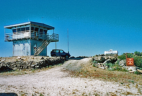
Fire lookouts are slowly becoming a fixture of the past. Landon Lookout is located on Greens Park at an elevation of 7145’ and is southeast of Eagle Lake. This lookout replaced the State Forestry’s lookout on Shaffer Mountain, near Litchfield. It was opened on September 4, 1949 and named in honor of Don Landon, a California State Forester who was killed in World War II. The lookout when opened was considered “ultra modern,” though in reality it was actually a remodeled naval tower.
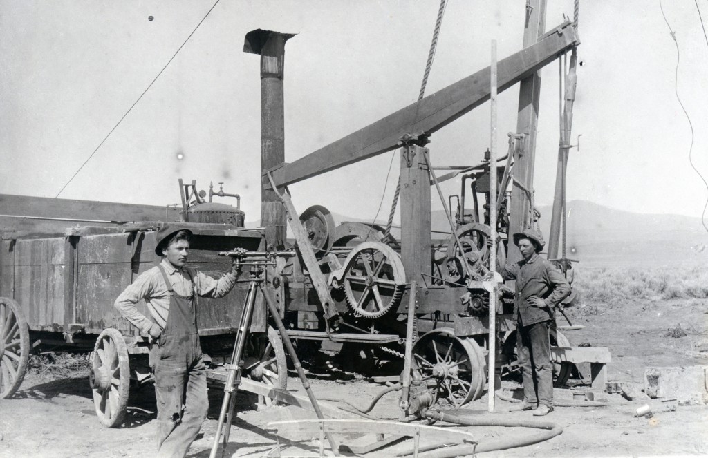
Caudle Brothers well drilling outfit, eastern Honey Lake Valley, 1910. On the left is Fred “Fritz” Zarbock and on the right his brother, Ferdinand Zarbock who had a homestead next to Caudle’s at Stacy.
During the late 1920s, the farmers in the Standish district were frustrated with water woes. Those who hoped to be beneficiary of Bly’s Eagle Lake project were dismayed with an inadequate flow from that body of water. Even those who had water shares with Lassen Irrigation District suffered the same fate due extremely dry conditions. The winter of 1928-29 the area only received 8.38 inches precipitation. In May 1929 the weather was exceedingly warm with temperatures in the 80s and 90s. Irrigation wells were common on the desert east side of the Honey Lake Valley, but not so like Standish that in the past received its water from the Susan River. In June 1929, Standish resident, J.D. Andrews had a well drilled with success. At a depth 210 feet it could provide 300 gallons a minute being pumped for seven hours with a four inch centrifugal pump. Soon others followed suit. On a final note the cost of the Andrews well was $757.
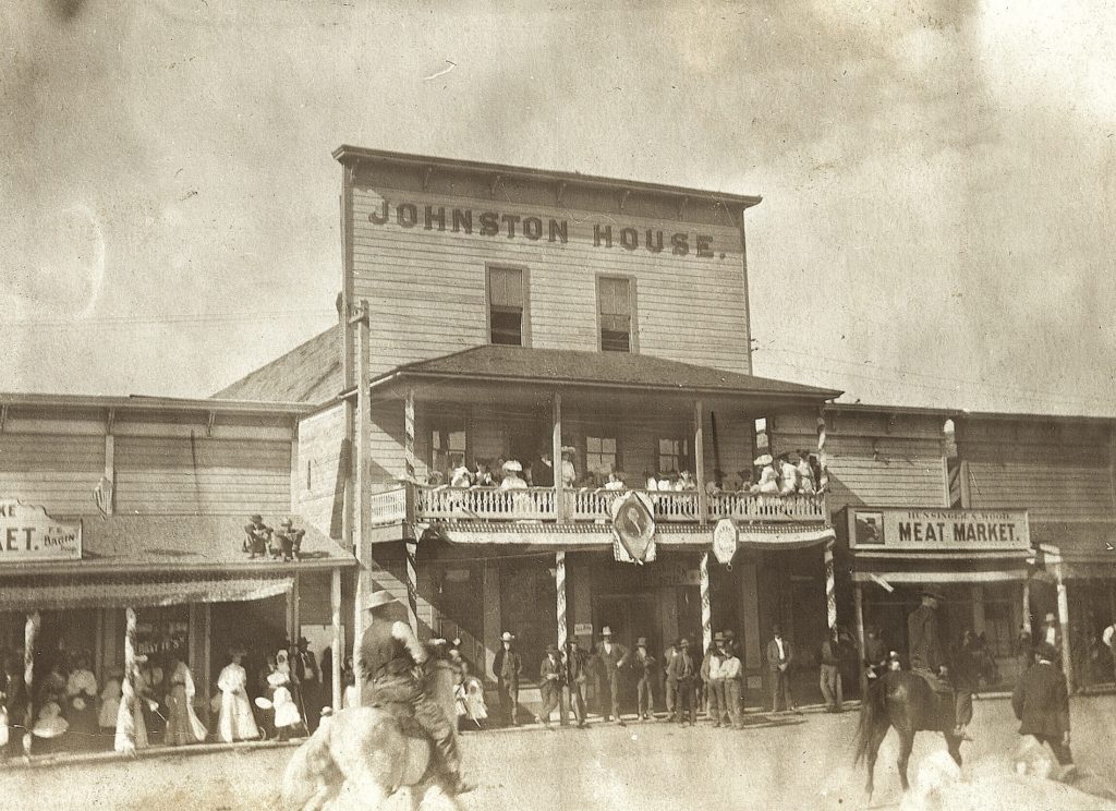
The Johnston House, circa 1909. Courtesy of Betty Barry Deal
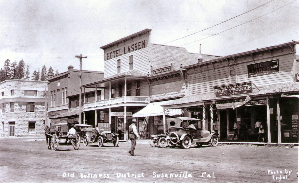
The Johnston House was built in 1893 after a devastating fire that destroyed the north side of Susanville’s Main Street business district. It was so named for its original owner/proprietor Robert Johnston. Until the Emerson Hotel opened in 1901, it was the town’s major hotel. There was the smaller Cottage Street Hotel, which was more like a boarding house. In 1897 Johnston sold the hotel and it changed owners on a frequent basis. In 1916, Henry C. Dobyns purchased and renamed it the Hotel Lassen. It was destroyed by fire in 1919.
Horse Lake located east of Eagle Lake, is a shallow playa lake covering some 3,500 acres. It is similar in nature to Honey Lake, that both go dry in drought cycles.
Horse Lake was first settled in 1868 by B.E. Shumway. Back then the most direct route from Susanville to Surprise Valley, Modoc County was via Horse Lake. It was at Horse Lake where Lassen County’s first billboard appeared, unlike the ones we know today. Susanville’s pharmacist, Dr.R.F.Moody in the 1870s created his patent medicine Sagebrush Liniment. On a boulder along side the road at Horse Lake he carved into it his famed patent medicine. Decades later when the county widened the road, the boulder was turned over, now face down no longer a billboard.
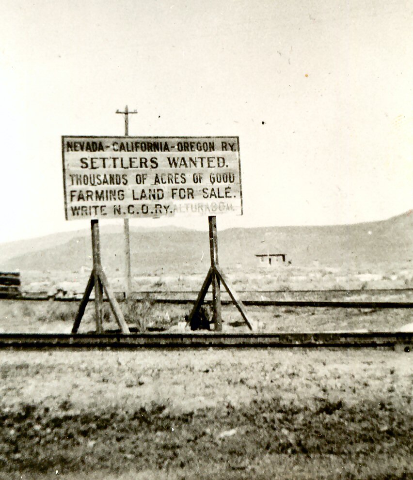
This weathered sign of the NCO at Wendel in 1920, in better days to entice homesteaders. Photograph taken by Lassen County Librarian Lenala Martin.
There is a bit of irony in this tale. In 1923, Merrill’s vision of tapping Eagle Lake for irrigation became a reality. Nobody used his Lassen County Desert Land Act which it was designed for. Of note, it was David Watson of Big Valley who was the first person to use Merrill’s Act in 1887 when he received a federal land patent for 480 acres, located thirty-five miles north of Eagle Lake. At least, in 1891, Merrill did receive title to 160 acres near Belfast, which was to be his dream city of 25,000 inhabitants in the Honey Lake Valley under his Act.
The majority of the federal land patent acts have been revoked, though the Desert Land Act, as far as I know, is still in existence. The last time it was used in this region was in the 1980s. Franklin Jeans wanted to expand his Fish Springs Ranch in eastern Honey Lake Valley on the Nevada side. To meet the reclamation requirement, he had several deep irrigation wells drilled. Jeans had no intention to reclaim the sagebrush land. His goal and it finally became a reality was the water from these wells are now part of Reno’s water supply via a pipeline.
The Belfast District, 1898. It was to be the center piece of Merrill’s reclamation project.
The federal land patent process often referred as homesteads worked fine until the westward expansion. After crossing the Mississippi River there were dramatic changes in geography and climate. It was President Abraham Lincoln who corrected the situation. In 1862 Lincoln was able to pass three important pieces of legislation since his opposition failed to show up in Congress. These were the creation of the Department of Agricultural, the Pacific Railroad Act and the 1862 Homestead Act. While the Homestead Act did improve matters in the west, it was not a one-size cure all fix. The arid intermountain west presented its own challenges. A unique chain of events occurred when Captain Charles A. Merrill announced in 1873 of his reclamation plan for the Honey Lake Valley by tapping Eagle Lake as its water supply. It should be noted that Merrill was not a novice to land issues. He came to California, in 1864, from his native state of Maine. In 1870, Merrill was involved in a title dispute of a Mexican land grant near Santa Barbara. As a result of that involvement he worked ardently as a land agent for individuals who had capital to invest.
For Merrill to move forward on his Eagle Lake project he would need federal legislation for an easier method to homestead arid lands. Merrill recruited California Congressman J.K. Lutrell to craft such legislation. On March 3, 1875 Congress approved Lutrell’s bill, the Lassen County Desert Land Act. In essence, an individual could claim up to 640 acres of government land, versus the standard 160-acre limit. A person then had two years time to reclaim the land by irrigation and they could purchase the land from the government at $1.25 per acre. The last provision was unique in that one did not have to reside on the land as a requirement. The Lassen County Desert Land Act gave birth to the much more famous Desert Land Act of 1877. The two Acts were nearly identical; expect of course the latter applied to all arid regions of the American west. There was one other major change in the fee structure. Under the Desert Land Act, “the settlers pay twenty-five cents per acre at the time of application, to have three years (versus two) for the purpose of irrigation and to pay one dollar per acre upon making the final proof, i.e. being issued a land patent to the property. The Desert Land Act was immensely popular and large swaths of land in the West were obtained under this Act.
It should be noted there was a dark side to it. This was from the Lassen County Desert Land Act’s non-residence provision that was included in the Desert Land Act. In the first decade there was a significant amount of fraud. It enabled land speculation companies to acquire thousands of acres of land by hiring dummy entry men to file on said land. Locally, this was particularly the case in eastern Honey Lake Valley and the Madeline Plains. Later amendments to the Act reduced the fraudulent activity.