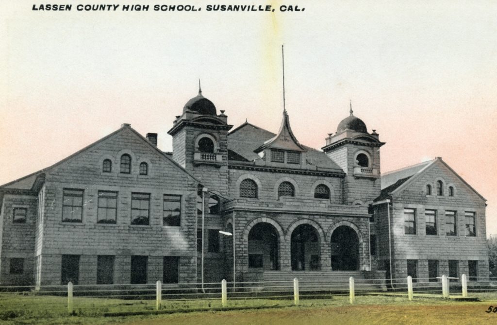
In the summer of 2019, the offices inside the courthouse were relocated. Initial work began with Phase I and later II. At the Lassen County Board of Supervisors’ meeting of March 28, 2023 a contract was awarded for the final phase. It has been relayed to me, that if all goes well the project should be completed by the end of the year, with the offices moved back in the building.
Susanville Branch, Lassen County Free Library,1920
The establishment of a library was a slow, tedious process. In 1906, one of the earliest attempts to form a library came about when some civic minded people formed the Susanville Library Association. Their initial goal was to establish a Reading Room. Through the generosity of Charles Emerson he donated a room in his hotel for this worthy enterprise. However, the organization struggled and by 1908 it had been disbanded.
There was hope on the horizon when in 1912 a group of civic minded women formed the Monticola Club. In the fall of 1914, Lottie Cahlan of the Monticola Club reported that preparations were being made for. Reading Room in the newly constructed Del Mar building on the corner of Main & Roop Streets. They would have the expense of rent at $40 per month, in addition to lighting costs. The city agreed to assist with some of the expenditures. Members donated furniture and books. Each member donated one day a month to volunteer in the Reading Room to assist patrons, who could examine a newspaper, magazines or books. The Monticola was not finished. With their momentum by the fall of 1915 they had convinced the Lassen County Board of Supervisors to form the Lassen County Free Library.
Note: This originally appeared on June 28, 2019. There are several new subscribers who would be quite interested on this topic. Also, unfortunately I have not located any additional information.
This short-lived ski resort was the brain child of Ernest “Ernie” Forbes, an Austrian skier. Forbes established Eagle’s Peak in 1971, in one of the more peculiar places, near Doyle. As the late Paul Herman informed me that Forbes always wanted his own ski hill. In a 1972 interview Forbes stated “Started a dream that is becoming more and more a reality everday.” He designed the entire operation with the first slope for beginner and intermediate skiers that according to Forbes to accommodate 150-200 skiers at a time. Of course, Forbes offered skiing lessons, since he had been a ski instructor at various resorts in the west. Other amenities included a snack bar, ski rentals and even a free shuttle service on weekends and holidays. Of course, Forbes had grandiose plans of a modern lodge, advanced ski runs and so forth, none ever materialized. Records are rather sketchy but it remained in operation until the early 1980s.
Since it is April Fool’s Day, I thought I would pass on an interesting piece of geographic trivia—one I had won many bets. Years ago, there a a syndicated newspaper columnist, L.M. Boyd, whose columns were filled with all kinds of interesting trivia. One of these caught my attention, since it was somewhat local in nature. Boyd dutifully noted that Reno, Nevada was west of Los Angeles, California. It does sound strange, but when one examines the curvature of the California coastline it becomes apparent. Or more scientifically, Reno’s Longitude is 119.29725 West and Los Angeles is 118.29122 West.
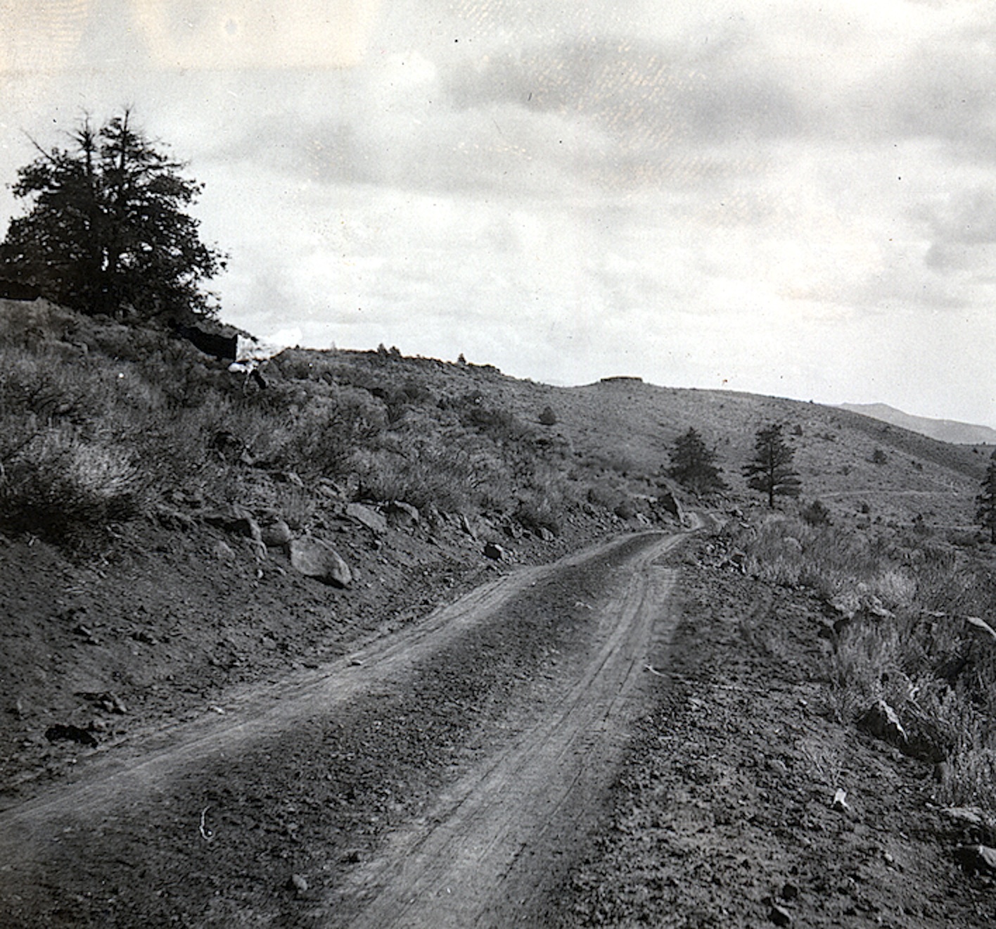
The road to Reno through Long Valley, 1925—-Lola Tanner
In 1919, California approved yet another large highway construction bond for $40 million. For Lassen County, the next highway project was from Susanville to the Nevada State Line—the forerunner of Highway 395. The Lassen Boulevard District was created to carry out the goal. The terminus location in Nevada at that time was known as Purdy (no relation) and is known today as Bordertown. Throughout the 1920s, the route was referred to as the Purdy Highway.
Of course, there were issues between Lassen County officials and the State Highway Department. In the fall of 1919, Lassen asked for an appropriation of $360,000–the amount needed for grading, draining and surfacing with gravel for the entire length of the road. The State, on the other hand, thought it would be better to do it 20 mile increments of grading and paving. The State was victor and the highway was built in segments.
The 1926 Antelope Fire as seen from Willow Creek Valley. Courtesy of Lola L. Tanner
In the late 1800s and early 1900s forest fires did not cause a great deal of alarm or concern. Most of the fires were small in size—twenty acres or less. Some times they were fought and most often left to burn to extinguish themselves. The following is an interesting example from the Lassen Advocate of July 26, 1907:
“The forest fires are late in starting this season. There was a blaze up the river, west of Susanville Thursday and smoke and resinous odor of burning pine were very percipible. Whether extinguished or burnt out, the atmosphere is clear and smokeless today.”
What happened. Locally, saw the establishment of large timber companies and their subsequent sawmills. This produced industrial l scale logging, unknown to the region. Some of the mechanical equipment were known to spark fires, and in some cases large fires were created in logged off areas. At the same time, the national forest service gained prominence and one of its main objectives was fire prevention. Another consideration—weather. From 1860-1916 was an extremely wet weather cycle, followed by a twenty year dry cycle.
With all the effort put in during 1928 with work on the Bly Tunnel inlet, it did not make that much difference during the 1929 irrigation season. As a matter of fact to make things worse the districts doubled their rates for water from $2 to $4 per acre-foot.
For the next few years, the districts hired C.F. Staheli, a contractor to deepen the cuts and extend the inlet. It was an exercise in futility. Compounding matters was the lake in 1932, had dropped twenty-four feet since the tunnel had opened. Another tragic part of the story, the system was designed to irrigate 25,000 acres, when in reality in a good year only provided water for 5,000 acres. At the conclusion of 1934, that the project be abandoned. However, the districts engineer Harry Riddell came up with a last ditch effort to salvage the operation and account on that next week.
Round Valley Reservoir, 1958. Grabel’s Hole is located in this regoon.
On Sunday, the feature article was on Miners Spring and a broken link to Grabel’s Hole. I had a difficult time trying to locate the article. While most people in region associate mining with Diamond Mountain and Hayden Hill there were other pockets of activity.
In the mid-1870s there was considerable gold mining done just north of Susanville in the vicinity of Round Valley, including nearby Gallatin Peak. One of those miners, was J.L Grabel. One of the peculiar oddities, is that Grabel never filed a mining claim, yet his activities were reported in the Lassen Advocate. According to folklore, it was a rich mine, but for reasons unknown became one of those lost mine stories. My grandmother, Lola (Murrer) Tanner (1899-1973) was born and raised in this area. She, too, knew of the story and gave me some clues about the proximity of where it might be located. All these years later, it is have never been something that I have never seriously undertaken to attempt to locate. May be this, is as good as any time to mount an expedition.
Collapse of the Said Valley Dam, May 8, 1938. Courtesy of Betty Barry Deal
In September 1885, James W. Shanklin constructed the first Said Valley reservoir for irrigation and stock purposes for his ranch in Grasshopper Valley. That dam was 25 feet high and 300 feet across. Over the years it had numerous owners. In 1934, it was purchased by George Heath, who also became the owner of the nearby Slate Creek reservoir. As early as 1929, the State Department of Water Resources stated neither dam was in compliance and requested that spillways be constructed for each reservoir. The winter of 1937-38 was one of the wettest on record for the 20th century and, in Susanville, 33.68 inches of precipitation was measured. On May 8, 1938, the dam at Said Valley breached and caused considerable flood damage. On August 24, 1939, Heath sued Percy L. Castro for $50,000 in damages that were caused by dam failures. It was Heath’s contention that, since Castro leased the reservoirs and his Grasshopper Ranch, it was his duty to install the spillways that the Department of Resources requested. However, during the Department of Water Resources investigation, it was noted that even if the proper spillway had been installed at Said Valley, it would still have failed because of defects in the dam’s original foundation. The court ruled in favor of Castro and stated it was Heath’s responsibility and ordered Heath to pay Castro’s court costs. The dam was rebuilt, albeit on a smaller scale.
Locally, most people think that all the mining activity was along Diamond Mountain, south of Susanville, However, there was mining activity to the town’s north. See Grabel’s hole..
Starting in the 1890s, for some odd reason, considerable prospecting was done on Antelope Mountain. If one looks closely on Highway 139, one can see small mine tailing piles. At a place call “the spires” there is a small spring. that was a popular rest stop back in the horse and buggy days, to stop and give the horses a rest. Charley Carpenter thought it was the perfect place to call home, and built a small cabin there, while he was search of the next mother lode—hence Miner’s Spring.
In 1907, due to an extremely wet March, there was considerable flooding and erosion, that was bringing to surface gold among other things. This was especially true to places not known gold such as Antelope, Shaffer and Skedaddle Mountains. The local populace had a terrible case of gold fever, but by fall that fever broke, when dashed dreams of a new Comstock was just not in the cards.