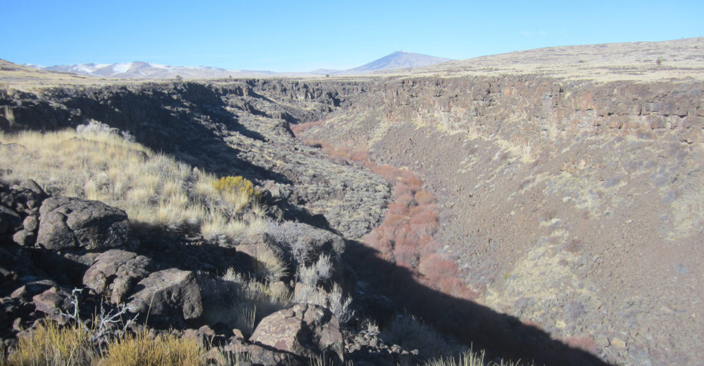
Smoke Creek is a desert stream that is approximately twenty-six miles in length with an equal portion in California and Nevada. Its headwaters is Big Springs at the southern base of Observation Mountain. The creek descends into a small canyon that early day explorer J. Goldsborough Bruff in 1850 dubbed as Hierioglyphic Creek, due to the numerous petroglyphs on the canyon walls. From there the stream enters a much larger deeper canyon.
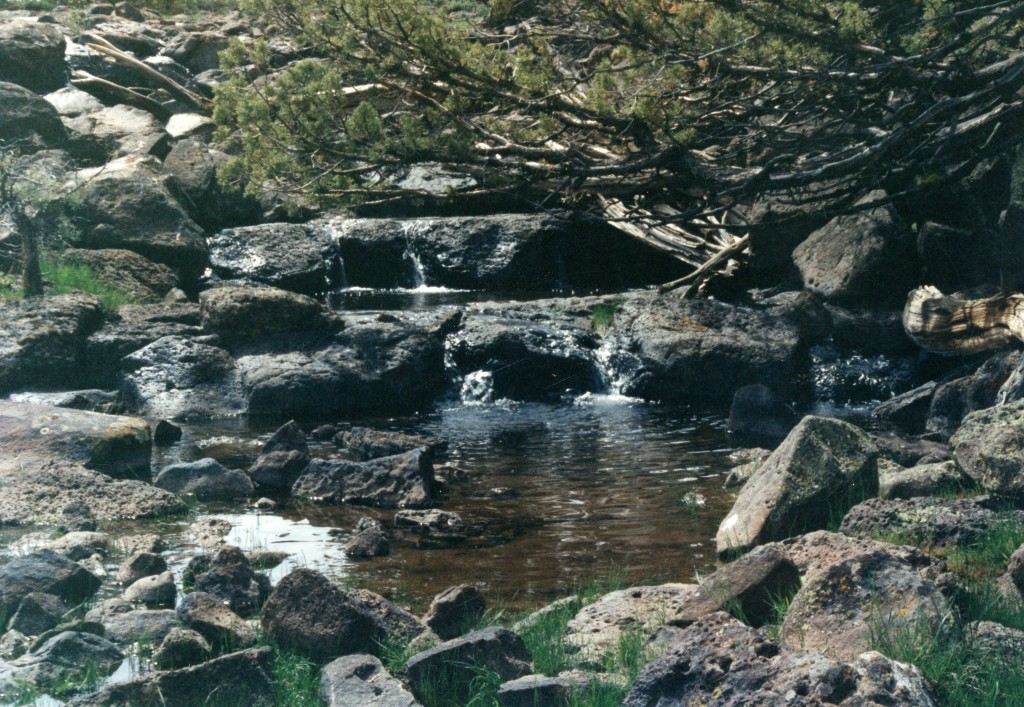
Smoke Creek Canyon, January 2020—Greg Johnso
On the Nevada side, the lower end of the creek was a welcomed sight for weary travelers of the 1850s and 1860s on the Nobles Emigrant Trail. The water flow decreases the closer one gets to the Smoke Creek Desert.
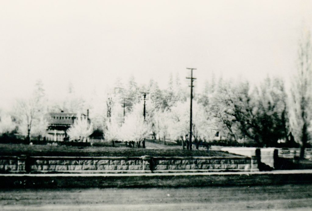
June 26, 2023Smoke Creek Golf Course, 1996
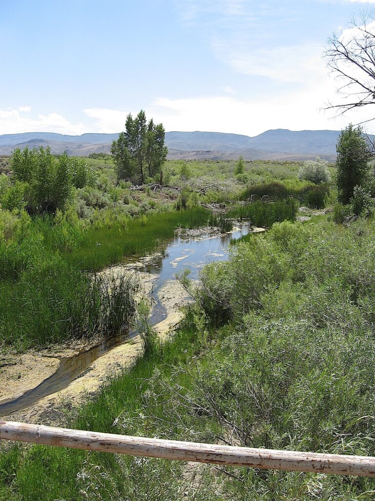
The terminus of the creek varies as to the kind of water year. It can spread over the scrub brush terrain. I can attest since I played at a golf tourney there over Labor Day Weekend. One of the course’s many hazards were the mosquitos, and they were a hungry lot.
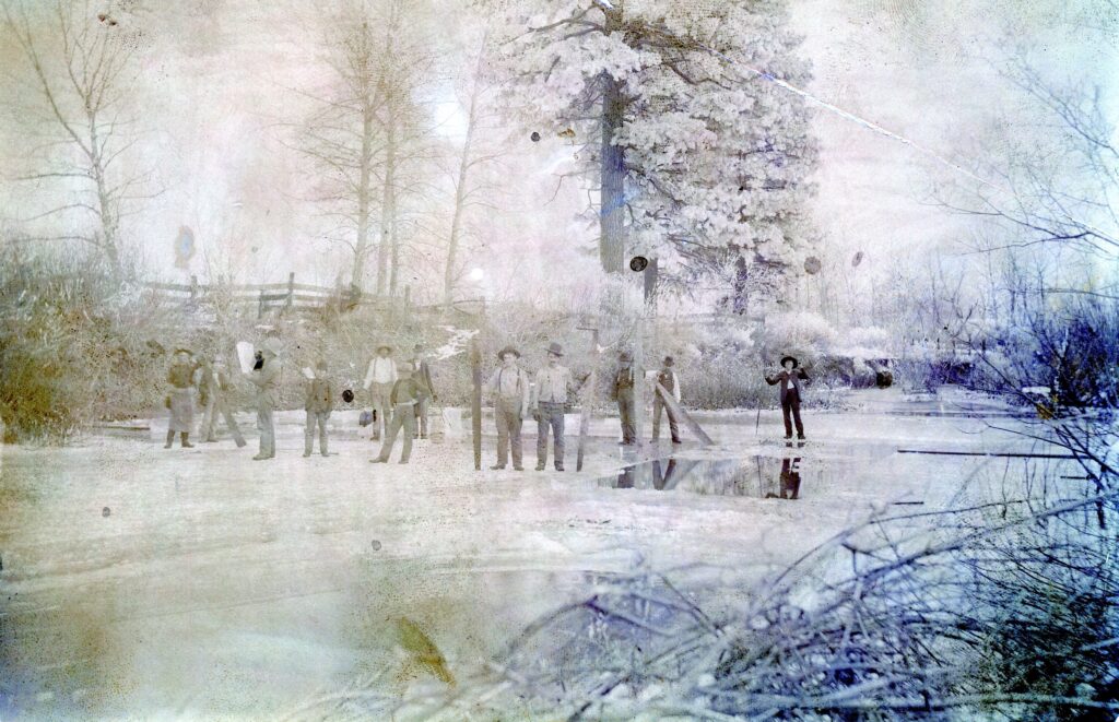
Ice Harvesting on the Susan River, early 1900s—Philip S. Hall
Yesterday’s post was about the Westwood frozen millpond when temperatures dropped to -30. Below zero temperatures used to occur on a regular basis during the winter months in this part of California. Over a century ago, it was an important fact of life, as the frigid temperatures were needed. The following is from an old post that explains why:
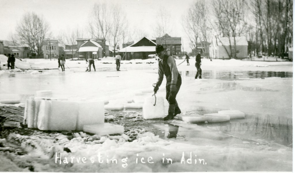
Ice harvesting at Adin, 1911
Way before the day of refrigeration, in colder climates ice was harvested, whether from a stream, pond or lake. Though by the 1920s, the practice slowly began to fade away with the advent of refrigeration. Locally, ice was harvested from the Susan River, and two focal points were the Bremner dam in the Susan River canyon and the other at Dawson dam near Johnstonville that provided power for the Lassen Flour Mill. Roy Sifford, born in 1893 and raised in Susanville, recounts in his memoirs that in 1910: “I hauled ice from the ponds at Johnstonville to the stores and bars in Susanville–$2.00 a load delivered. In twelve hours I could haul four loads receiving $8.00 a day, paid in cash!”
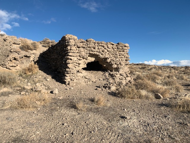
An astute reader, asked an astute question. Why the kiln, and where did the lime come from? Very good questions, indeed. Lime is found in rock deposits of calcium carbonate, which the rock has to be heated to extract the lime.
It should be noted, there is an interesting lime kiln remnant near the Wendel Hot Springs, but as it is on private property not accessible to the public.
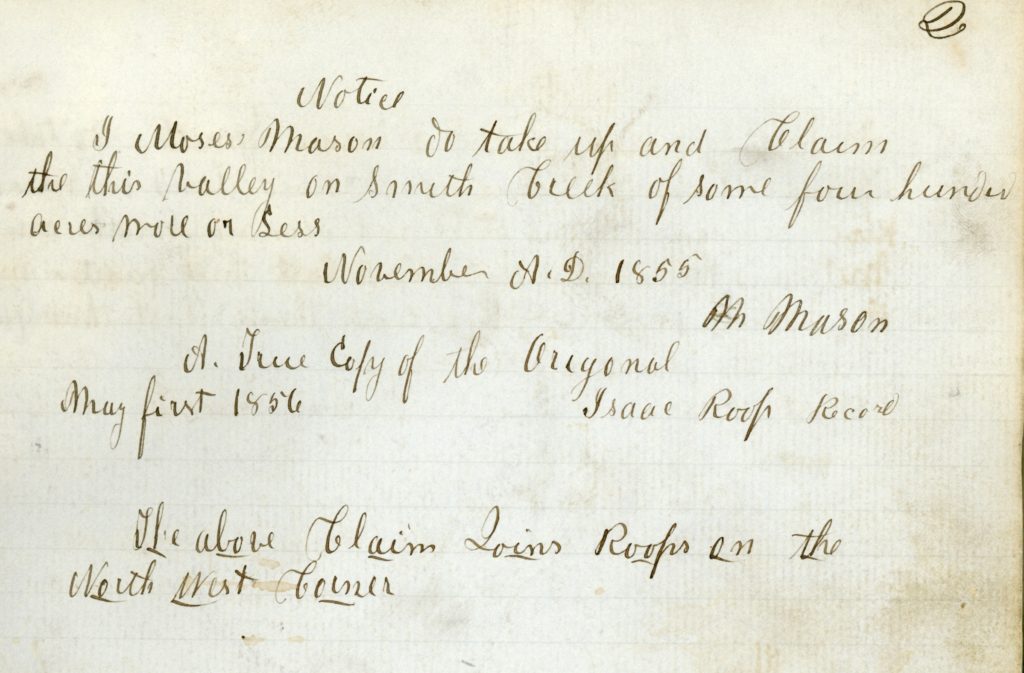
M. Moses was the second claim recorded in Roop’s Land Register. He settled on present day Susanville Ranch Park and referred to Piute Creek as Smith’s Creek.
This small stream a tributary to Susan River is approximately ten miles in length. For a brief period it was originally known as Smith’s Creek, who and why it was so named such we may never be known.
Another peculiarity is the spelling of Piute. Back in the 1850s and 1860s that was how the Anglo settlers of the western Great Basin spelt the name for the Native American tribe now referred to as Paiute.
Piute Creek was also the source for the original water supply for Susanville. It would be replaced with what is now known as Cady Springs in the Susan River Canyon.
Flood waters from breached earthen fill trestle, April 1938. Courtesy of Betty B. Deal
In 1935, the Red River Lumber Company completed its railroad logging line known as the Piute that traversed a portion of the canyon the creek flows through. Just above Desmond Meadows, the Piute line crossed Piute Creek. In an effort to save money, Red River decided to forgo a wooden trestle, and substitute an earthen fill. It was a rather substantial one at that, being over twenty-five feet tall. The winter of 1937-38, was one for the record books. By the end of March, 1938, the spring run-off was in earnest. The earthen fill at Desmond Meadows was equipped with a culvert to handle the stream flow. It was no match for this type of heavy water flow and then the culvert became blocked with debris, creating a substantial reservoir. As one eyewitness observed, this newly created lake extended back 300 feet from the fill with an estimated depth over twenty feet. On April 9, the fill breached, sending a wall of water downstream creating havoc in its path and washing away segments of the Piute railroad tracks into the fields of its dairy property now known as Susanville Ranch Park. In the aftermath, Red River decided not to repair the destroyed trackage. Red River took its time salvaging the line, since the company had given consideration to abandon railroad logging. In the 1940s, the abandoned railroad grade was converted into the Paul Bunyan Logging road.
William K. Medlin’s book published in 1997 is an interesting tome about Lassen Volcanic National Park. It is a combination of the park’s history and his philosophical belief. In his Preface, Medlin writes, “The reader is invited to trace this thread, and weighing the evidence scattered across its pages, to decide whether the story is telling the truth.” However, when writing about the events leading to the creation of the park, Medlin writes: “Armed with this advantage, Raker finally gained top political support in Washington for his national park proposal. On August 9, 1916, President Woodrow Wilson signed the bill creating Lassen Volcanic National Park. Raker, who died that same year, had garnered strong support both in Washington and in Northern California for final effort.” It should be duly noted for the record that Congressman Raker died a decade later in 1926, and not 1916
When it comes to Lynne Walker Collins, Lassen’s first ranger and later its first park superintendent, Medlin writes disparaging about him. However, in Acknowledgements Medlin heaps praise on Collins hard work. There is no doubt that Collins was very dedicated and worked tirelessly for the park. Collins also had the difficult task dealing with the private land owners in park—Sifford, Snell, Supan. In 1935, in a srange turn of events, Collins was abruptly terminated, thus ending his career.
Since we have had a taste of fog lately, is there more to come? Late December can be notorious, partially. due to short. daylight hours and valley inversions.
In 1859 residents of the Honey Lake Valley experienced one of the most dreaded winter weather conditions, a pogonip—the Indians term for an ice fog. The term loosely translates into “white death,” for many Indians caught pneumonia and died. This fog settles in the mountain valleys. One can ascend a few hundred feet above the valley floor, bask in sunny temperatures and overlook a sea of clouds. Pogonips vary in severity. A mild one will consist of persistent endless fog with sub-freezing temperatures. The worst variety is when it turns into a literal ice fog, coating everything. The first day can be spectacular with ice crystal formations on everything. After several successive days of those bone chilling temperatures, it quickly loses its appeal. The pogonip of 1859 was one of severest on record. The heavy cold fog lasted six weeks. So much frost accumulated on the grasses that cattle could not eat it. In addition, since the first settlers had been accustomed to mild winters, very little hay was put up, and a great many cattle starved to death that winter.
A 1920 pogonip scene on the north side of the Lassen County Courthouse.
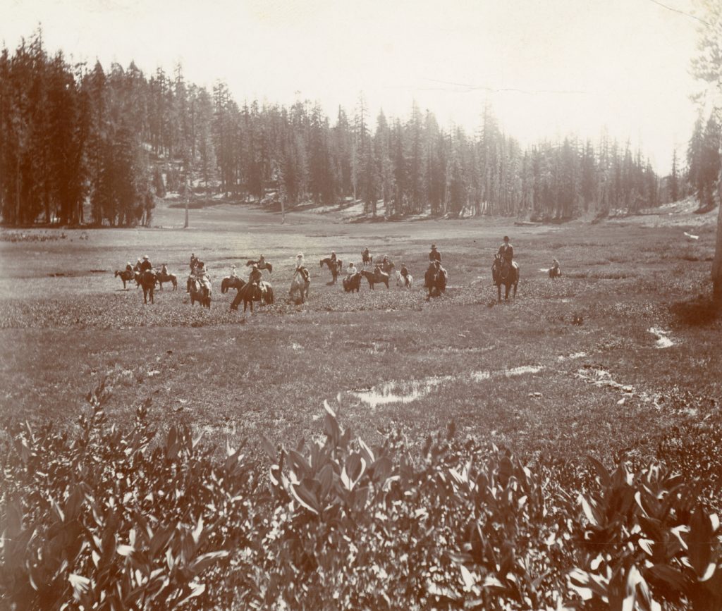
Desmond Meadows, 1906. Courtesy of Betty Barry Deal
On January 22, 1859, Malcolm S. Scott claimed the meadows along Piute Creek, west of Susanville, that he named Spring Valley. Scott later abandoned his claim and the claim was taken over by Emanuel Brannon during the following year. Interest in the meadows fell by the wayside until 1873, when Robert M. Bean took possession of the meadows. Somewhere along the banks of Piute Creek, between Desmond Meadows and Susanville, Bean established the first brick kiln yard in Lassen County. In the year 1878, Bean manufactured 130,000 bricks. Hard times quickly fell upon him. Because of his creditors and the death of his wife, Alice, Bean sold the meadows to Jonathon Lovell, a Susanville blacksmith. Ownership of the meadows changed hands numerous times during the early 1880s. In 1886, it was purchased by John and Hannah Desmond from M. C. Bishop for $1,500. Married life for the Desmonds was not pleasant. In 1890, the couple separated and Hannah remained at the meadows. For the next ten years, to support herself and her family, Hannah operated a firewood business. The County of Lassen was one of her major customers, purchasing eighty cords annually at a $1.50 per cord. On November 19, 1900, Desmond sold the meadows to Anton Bantly for $2,000.
Not all of the CCC projects required a substantial workforce. Back in 2018 I wrote about the Magpie Menance. In May, 1936, Ray Bowen of the U.S. Biological Survey had a small crew of men working on duck and goose nesting grounds in the Standish-Litchfield area. Another concern was predatory fowl, namely crows and magpies. These birds would attack duck nests and destroy those eggs.
Bowen requested from the CCC for five men to conduct a predatory fowl drive to at least reduce their numbers. In two days 285 crows and 450 magpies were killed, along with their nest. Asa Brown, State Predatory Animal Trapper expressed his belief, based on experience in this field, that the two days work would save approximately five thousand game birds.
Fish planting at Lassen Park, 1930–National Park Service
One of the consequences when President Nixon signed the Lassen Volcanic Wilderness Act of1972 was the elimination of fish planting in two-thirds of the park. The area comprised the national park’s eastern section where the majority of the lakes are located.
One of the earliest known plantings was done prior to the creation of the park. In mid-July 1915, the first planting occurred through the efforts of San Francisco resident E.T. Niebling. The California Department of Fish and Game provided him with 5,000 small rainbow trout, which he planted in Juniper Lake. Beginning in 1927, the park, with the assistance of the Department of Fish and Game, began annual fish plantings in the majority of the lakes, that ceased at the conclusion of 1972.
When Lassen Park was established in 1916, most of it was in a primitive state. There was a lot of internal debate as to what type of development should occur. The initial conclusion was that there would be only one road and the remainder of the park remain in its natural state. This approach did not sit well with the people living around the park, who were under the impression that it would be developed, bringing throngs of tourists, and providing an economic bonanza to them.
One of the problems was the private lands inside the park boundary—especially that of Drakesbad. Any park improvements would increase the value of these private holdings, thus adding to higher cost when the park would be in a position to acquire them. In 1935, it was decided to place the eastern portion of the park under a “primitive” designation for a period of ten years.
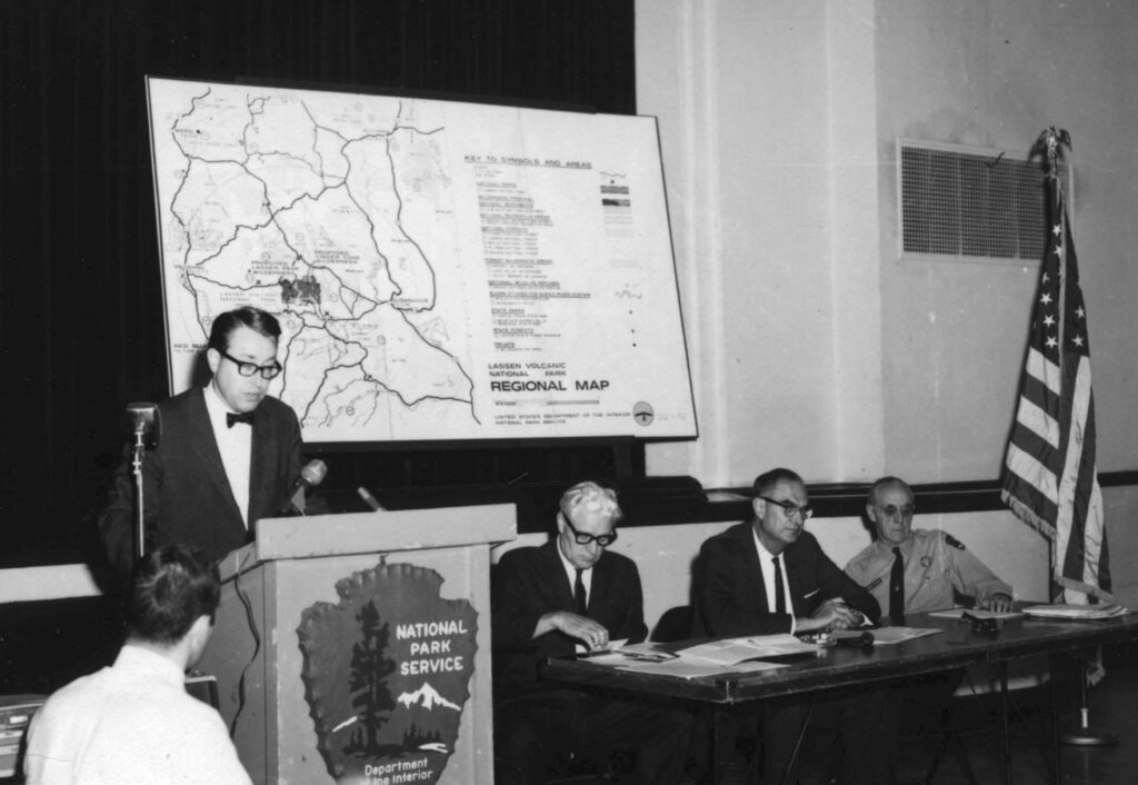
In the 1950s, the movement was growing to a seek a clear definition what a primitive and/or wilderness area consisted. This culminated in the passage of the Wilderness Act of 1964. A large segment of Lassen qualified for this designation. The question park officials had to determine was how much of the park should be designated as wilderness. Of course, individuals and organizations alike had their own opinion.
After numerous public hearings, written statements and other commentary the park recommended that 73,333 acres be designated as wilderness—nearly two-thirds of the park. Of course, not everyone was pleased with this decision. Organizations such as the Sierra Club and the Wilderness Society had urged for more land —101,000 acres, almost the entire park. Their proposals would encompass all the land in the park with the exception of the corridor of the loop highway and a few other improved properties. Ultimately, a compromise was reached. On October 19, 1972, President Richard Nixon signed the Lassen Volcanic Wilderness Act, involving 78,982 acres.