Okay, folks, I am playing hooky today after 126 straight days of postings. After all, it is Sunday of 4th of July weekend.
For those adventurous folks Upper Smoke Creek is a fun, but out of the way destination. Not only is there Bruff’s “Hieroglyphic Canyon,” but the historic Shinn Ranch. Alas, all the times I have been out there, I never took a photograph or two, of the cottonwood grove. I am almost a little leery to head out that way, since the devastating Rush Fire of a couple years ago.
Leon Bly sounding Eagle Lake. Courtesy of Wyn Wachhorst
It is only fitting to note that today’s marks the 100th anniversary when Leon Bly embarked on sounding Eagle Lake to determine the feasibility of an Eagle Lake irrigation project. Since the 1870s, there had been numerous failed attempts. No one knew the true depth of the lake, though many presumed it had depths ranging from 300 to 1,000 feet. Bly spent the summer sounding the lake in Oscar Rankin’s The Pelican and determined the lake’s deepest point at 105 feet, but felt the lake had potential as an adequate water supply for an irrigation project.
Of note, up until the 1980s, this boat was undergoing restoration at Janesville, but since it is not known what became of the project.
Piute Creek, April 9, 1938. Courtesy of Betty Barry Deal
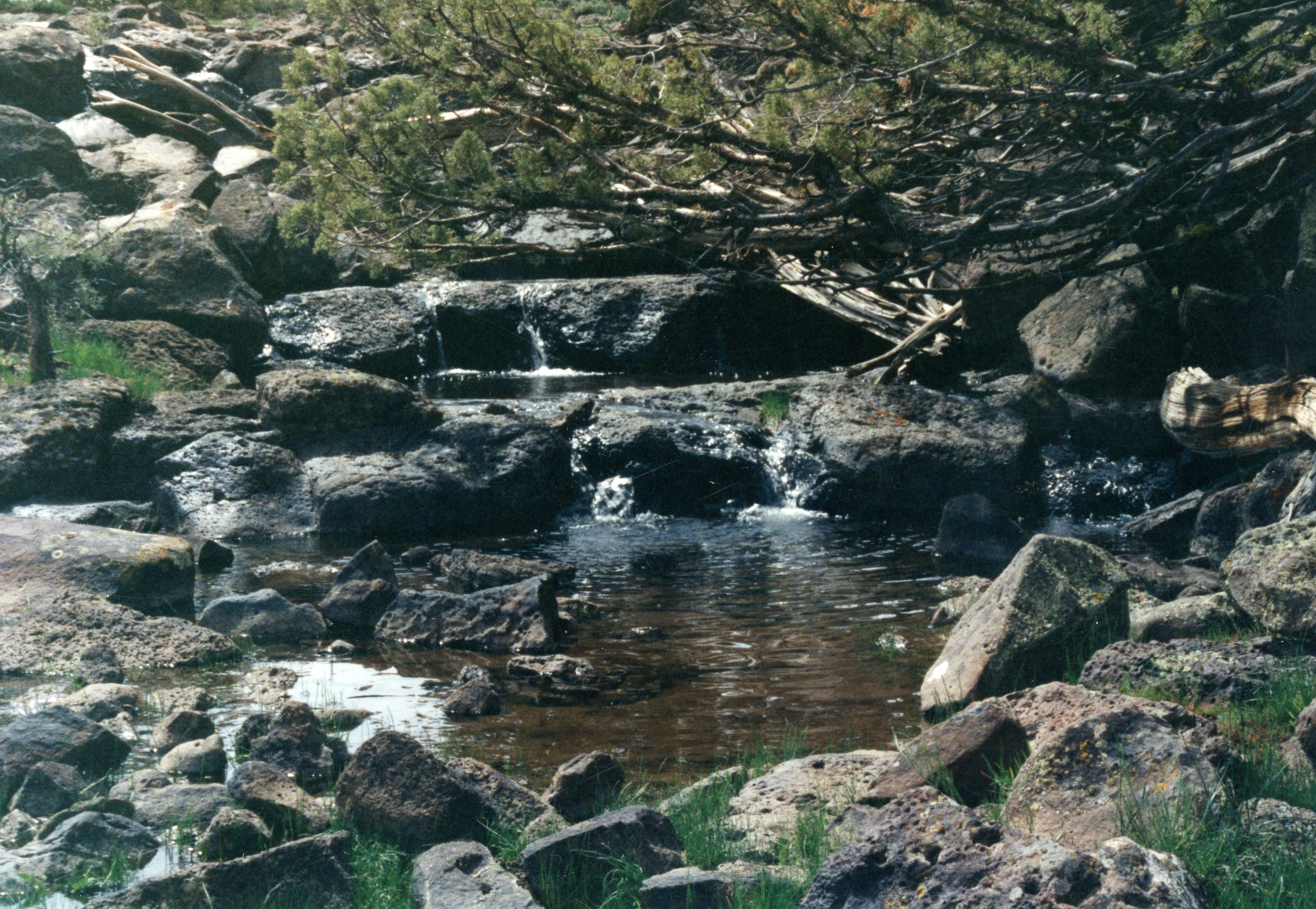
It was originally named Smith Creek. In August 1854, Isaac Roop called it by that name, when he claimed the water rights to it and began construction of a ditch to divert its water. The Roop ditch was the original water supply for Susanville. In 1872, it was replaced by the Susanville Water Company’s ditch from Cady Springs. In November 1855, Moses Mason, the second person to file a land claim in the Honey Lake Valley, claimed 400 acres along what he too designated as Smith Creek. On September 12, 1856, Captain William Weatherlow took up Mason’s abandoned claim, noting that the creek there, formerly called Smith Creek, was now called Piute Creek. However, on April 15, 1857, when Atlas Fredonyer filed his claim to Isaac Roop’s property, he referred to the same stream as Smith Fork. Who Smith was is not known.
The site looking towards the sunrise chamber, June 2, 2015
On Sunday morning [June 21, 2015] about a dozen subscribers were determined to rise early to witness the summer solstice at Belfast—best known for its petroglyphs. However, it is known internationally among those in archeoastronomy field. Upon our arrival, were a group of three from San Francisco who had the same intentions. Continue reading 2015 Summer Solstice Update→
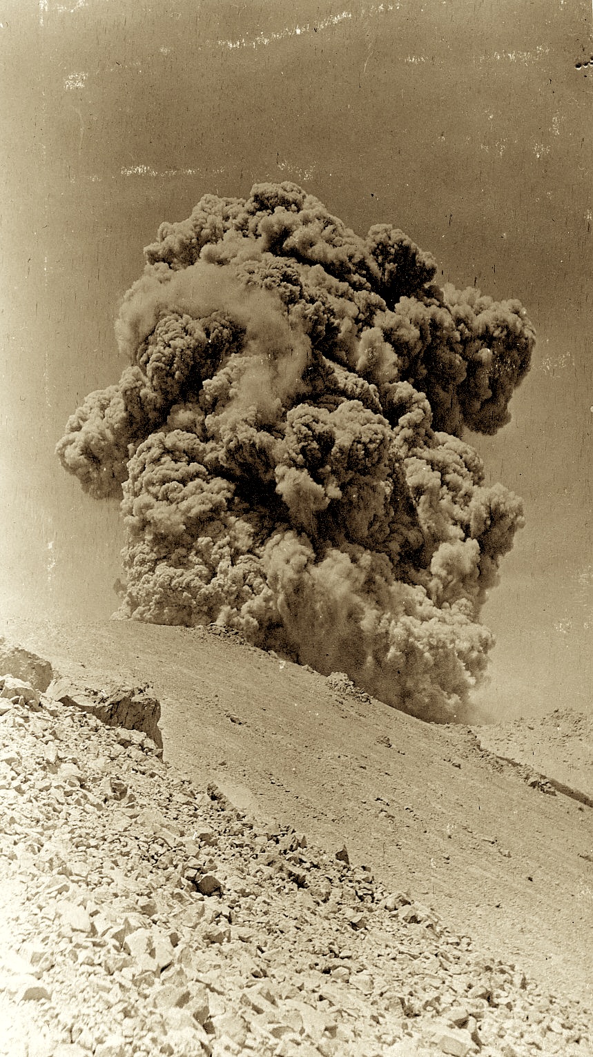
On May 30, 1914, Lassen Peak awoke with its first volcanic eruption causing quite a commotion. In one sense for the locals, it was not a total surprise, as there had been many signs indicating that one day it would happen. What no one was prepared for how many times the peak would continue erupting or how violent they might be.
For the so-called “looky-loos” this was an exciting time. The adventerous and curious could not stay away, and a number of thrill seekers climbed the peak to get a closer look. While the forest service, (the park had not been created), attempted to stop them, but to no avail. What truly was remarkable, that Lance Graham was the only person to sustain injuries while on the peak during an eruption. There was a related fatality when Thomas Roseberry was making the descent from the peak and died from a heart attack. Roseberry is a perfect example of the kinds of obstacles one encounters while conducting research. His death occurred in Shasta County. However, his death certificate used the nearest populated place of Drakesbad, which is in Plumas County. Yet, that document was recorded in Lassen County where he resided.
To learn more about the eruptions and the park history, you might want to get a copy of Lassen Volcanic, as it will soon be out of print, with less than 20 copies in stock.
On Thursday May 28, 2015 at 1:30 p.m. in the Lassen County Board of Supervisors room at 707 Nevada Street, Susanville the Eagle Lake Interagency Board will be holding one of their regular meetings.
I will do a presentation on historic weather patterns. Some of the interesting events will be the drought of the 1850s; the devastating floods of 1861-62; the extreme wet cycle of 1907-1916, which was followed by the 20-year drought of 1917-1937. The meeting, of course, is open to the public.
Attention Subscribers: You will be receiving the text of the presentation, as another special bonus for your support.
Gallatin Beach has certainly evolved over the years. During the 1910s, the beach did not exist, due to the high water levels of Eagle Lake. By 1917, Eagle Lake reached its peak high water mark, and on the south shore, considerable timber was flooded, killing trees some hundreds of years old.
In the 1920s, the water level of lake began to recede, in part by Bly’s Tunnel and equally important the region was in the midst of a 20-year drought. Dead trees were now a part of the beach’s landscape. Local water enthusiasts made the most of the situation, and incorporated them into photo ops
Susan River Canyon, looking towards Pigeon Cliffs, 1899
Can anyone enlighten me how Pigeon Cliffs, located in the Susan River Canyon, just west of Susanville received its name? A good portion of my childhood during the 1960s was spent exploring the Susan River Canyon. In all my years, I never seen any pigeons there. Some of the rock debris below the cliffs came from when Highway 36 was being constructed into Susanville in 1921, and the contractor pushed the rocks over the cliffs to make the current roadway.