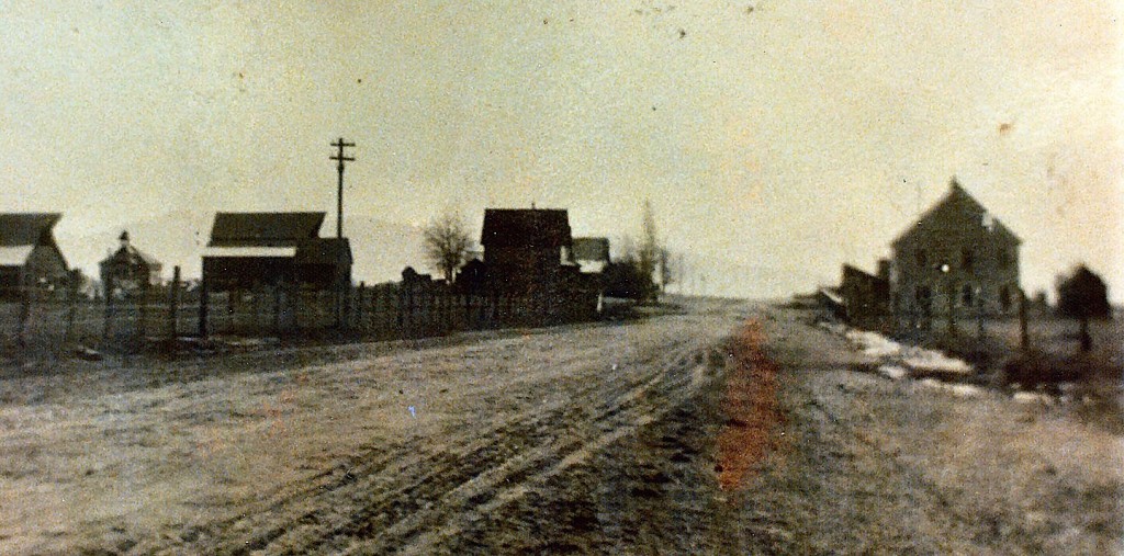
Unfortunately, not the best photograph of Spoonville, back in its heyday. Courtesy of Spoonville native, M. E. “Mul” Mulroney.
This district some three miles or so east of Janesville was orginally known as Missouri Bend, due to the fact that a large percentage of the original settlers came from that state. The community has seen better days, and now falls under the proverbial category of a “wide spot in the middle of the road.” The town once boasted a two-story hotel, two stores, blacksmith shop, creamery and a school. The only original buildings is the residence of E.C. Brown and the Missouri Bend Schoolhouse. For those who want to do a drive through, it is located today near the intersection of County Road A-3 and Cummings Road.
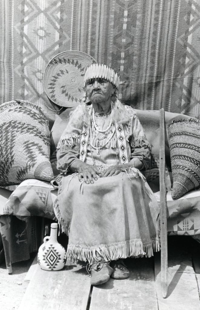
The Peconom family is one of the better known Maidu families. If you noticed that I highlighted the name in bold, there is a reason. The family name has been misspelled for years with a um instead of the proper om. Of course, the name spelling was brought to light, during the proposed name change of the first branch of Willard Creek to Roxie Peconum Creek to commemorate Roxie Yoanna Peconum (1851-1958), well-known member of the Maidu tribe, who gathered roots and berries in the region. However, some thought the name should be for the Peconom family, and not an individual family member. If it was to be the latter, the name should be Yoanna Creek for Roxie. Whatever the case may be, on February 11, 1993 U.S. Board of Geographic Names approved the name change to Roxie Peconum Creek.
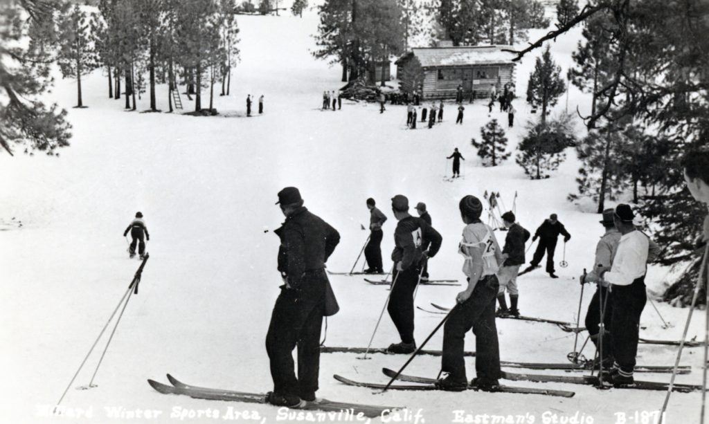
Willard Hill located some six miles west of Susanville was a popular winter sports venue. Its initial development came about through Lassen College’s Forestry Program inconjunction with the National Youth Administration. The latter provided each forestry student with not only academic training but to work in related forestry jobs. For their part-time work the students were paid $30 a month, however $20 a month was deducted for room and board in the converted Alpine Hotel dormitory. Continue reading Willard Hill→
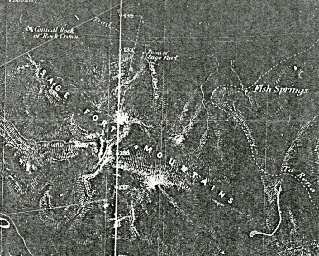
A military encampment located in the eastern portion of Honey Lake Valley on the Nevada side. “Fort” is a misnomer since it was actually a military camp and not a fort. Military records refer to it as Camp Sage, but provide no dates of operation or an exact location, only township and range. The camp served as a rest stop on the military supply route from Reno, Nevada to Fort Bidwell, California. In June 1872, Perry Jocelyn was in charge of Company D, Nevada Calvary, marched the troops on foot from Reno to Fort Bidwell—a distance of 250 miles. The route went north and east of Reno over the Fort Sage Mountains, to the west side of the Smoke Creek Desert and then criss-crossing the California-Nevada border until it reached Surprise Valley. It was a difficult journey. Jocelyn found that out first hand, on the first day of the seventeen-day march, five soldiers deserted in the middle of the night. An attempt was made to locate them, but they were never apprehended. Unfortunately, Jocelyn’s diary only contained the following notation about the place: “June 2, 1872 – Rev. at 3. First wagon mired within one hundred yards of camp. At 8 o’clock train has not advanced more than one half mile. Cross large hill where it is necessary to double the teams. Newcomb’s ranch just on the other side with lake nearby. Four miles further with still heavier hills, Fort Sage is reached. The whole distance eight miles.”Continue reading Fort Sage→
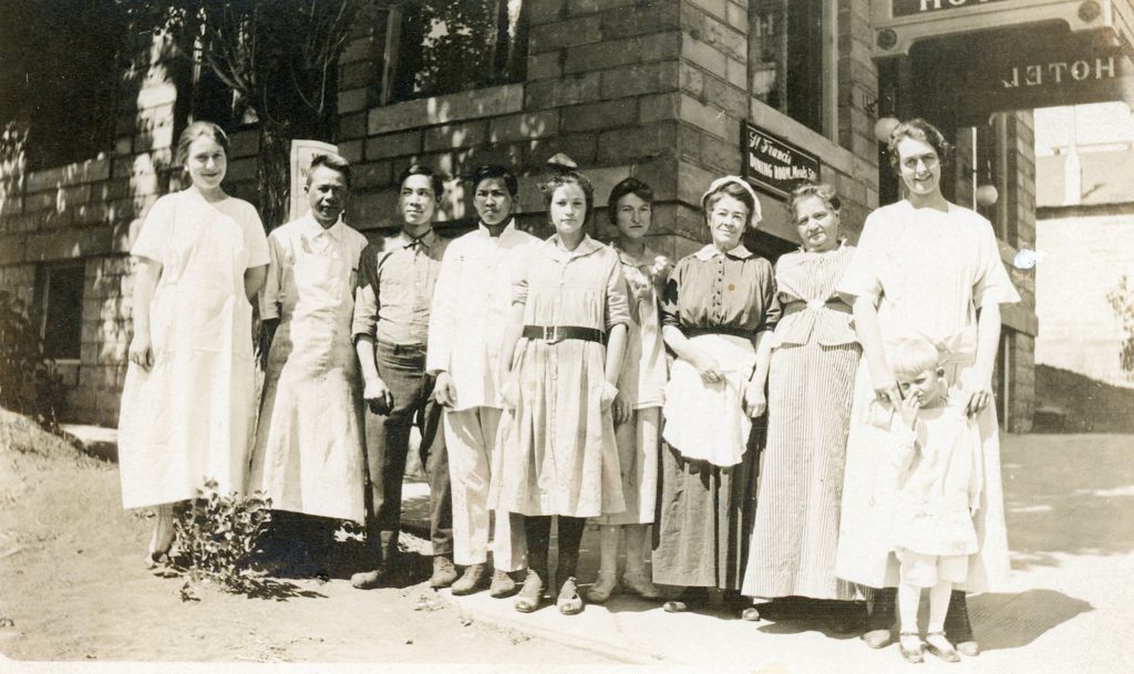
The staff of the St. Francis Hotel, 1915. When it first opened its door for business in 1914 and for many years, they hired Chinese to manage the restaurant, though they advertised the menu as American cuisine. Courtesy of Leona F. Byars
Back in the mid-1970s, I was part of the Chinese American Survey Project. The goal at that time was perform a record search, public and private, concerning the Chinese in every county of California. Not only did I do the search for Lassen County, but that of Modoc, Plumas and Tehama Counties.
Of course, I learned a lot about the historic Chinese population of Lassen County. Take for instance the earliest land record dated September 14, 1864 wherein Chew Henry sold a lot in Susanville to fellow countryman Hoa for $266. This particular lot, it should be noted is the current site of Susanville’s Elk Lodge. This same parcel was sold in November 1865 by Shong Lee to Isaac Roop for $150.
In the future, I will write more about the Chinese historical role in Lassen County history. Take for instance Susanville had two distinct “Chinatown’s.”
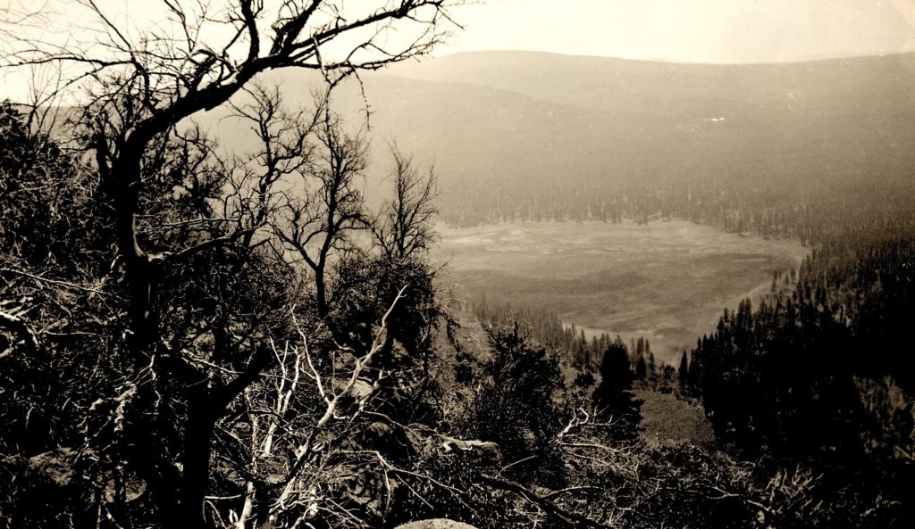
A 1923 view of Papoose Meadows. Courtesy of Lola Murrer Tanner
On September 21, 2016, I ventured to Papoose Meadows near Eagle Lake. It had been a long time since I had been there. This excursion was a bit different than most, and resulted in the proverbial “Pandora Box” of so many issues. So not only in the near future, there were will be a few posts about the history of Papoose Meadows, but an interesting perspective about Leon Bly, whose Eagle Lake’s irrigation project had a major impact on the region. Stay tuned, as there is some interesting new material to be revealed.
When Westwood was established, its Catholic community was a part of the Sacred Heart Parish—it had only been created in 1912 and covered the territory of Lassen and Modoc counties. The first pastor was Father P.J. O’Reilly. There seems to be some confusion as to when the first Mass was celebrated in Westwood. On December 12, 1913, it was reported in the Lassen Weekly Mail: “Father P.J. O’Reilly made the trip to Westwood to attend to spiritual wants of the Catholic Church in the new lumber town.” However, under the heading of Remarks in the Parish Death Register, Father O’Reilly wrote, “Mass was celebrated in Westwood for the first time by Rev. P.J. O’Reilly on 19 April 1914 in the school house situated near the present fire department. Mass is now said in the school situated on the hill facing Delwood Street.” Father also wrote, “The first Catholic funeral that was held in Westwood was on July 24, 1914. The internment was made in the new cemetery, portion of which viz the North East section is devoted to the use of the Catholics who die in and around Westwood for Catholics only. This cemetery is 3 1/2 miles from Westwood.” That internment was for Jose Alvarez, a 22 year-old millworker who died from typhoid fever. Continue reading Our Lady of the Snows→
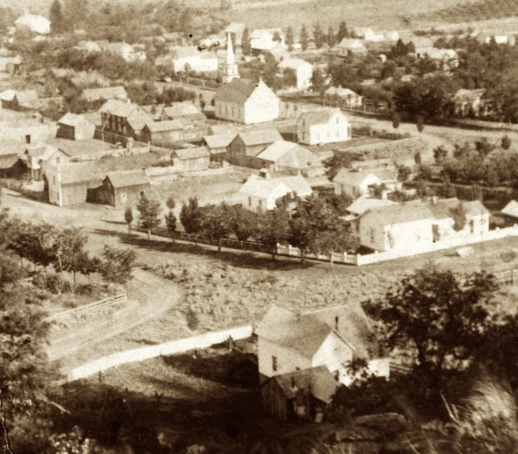
An 1886 view and the developing triangle. Courtesy of Bud Lesser
Not quite like the Bermuda Triangle, but it is an interesting piece of real estate, that really belongs to no one. Actually, the owner is the federal government, due to Roop’s carelessness. The Lassen County Assessor does not even recognize its existence.
The property in question, is located at the west end of Susanville’s Main Street, which people are familiar is the triangle piece of property in front of the Elk’s Lodge, with the diverging Pine Streets going in different directions, creating kind of like a “fork in the road.” Located there is the community Christmas Tree, and in previous years numerous Christmas displays were placed there.
By the 1890s the local newspapers wrote editorials criticizing that it was an ugly patch of unkept property at the head of Main Street. Relief came in 1902, when the Mountain Echo Band constructed a bandstand there. Four years later, the bandstand had been neglected and received community scorn for it being an eyesore.
The evolution of this plot will continue in future posts. This post is dedicated to Carole Dustin, Senior Assessment GIS Cadastral Drafter of the Lassen County Assessor’s Office who is retiring after 43 years. Carole, of her many duties was the draftsman for assessor parcel maps all these years, but never had to deal with this parcel!
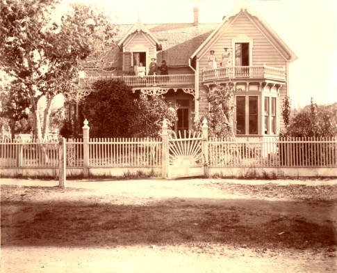
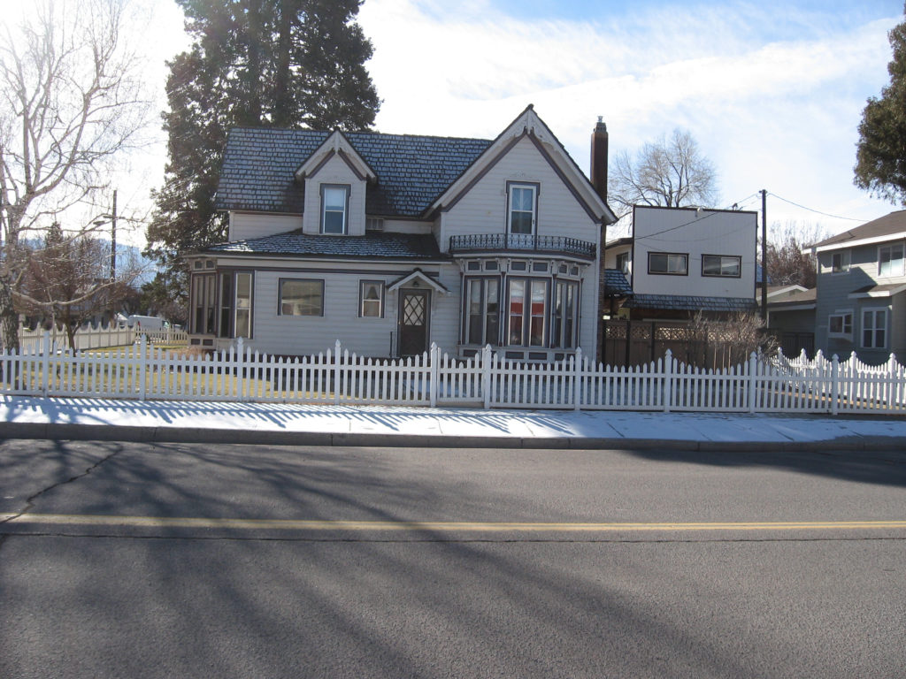
Built in 1877, by Henry Tunison, this home is located at 734 Cottage Street, Susanville. After his death in 1882, it was purchased by William Greehn, a Susanville merchant. His family resided there until his death in 1906. His estate rented the house for a number of years.
One of the side effects of a new railroad was real estate promotion and/or speculation some might say. When the Fernley & Lassen Railroad was being constructed during 1912-13, it witnessed some new towns along its railroad line in the Honey Lake Valley–Stacy, Litchfield and Leavitt. Of course, exisiting railroad communities such as Flanigan, Amedee and Wendel benefitted from the new railroad. In 1913, a town to be named Review was proposed along the Fernley & Lassen Railroad between Flanigan and Stacy, but it was never developed.