Category Archives: History

Murrer’s Upper Meadow

Murrer’s Upper Ranch aka Meadow

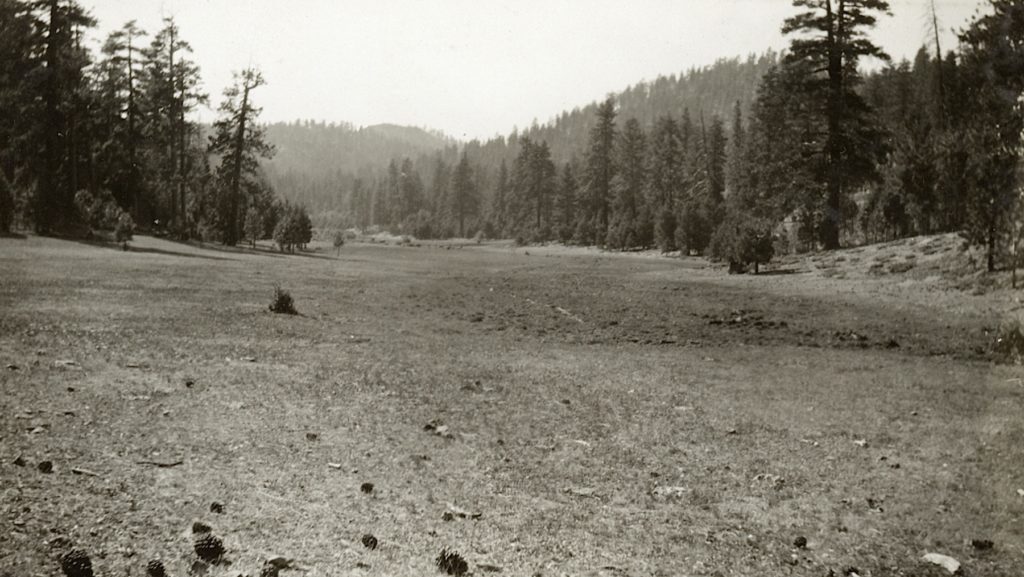
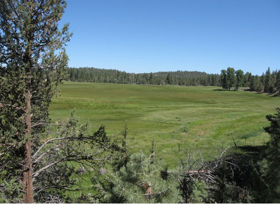
Murrer’s Upper Meadow is an interesting place east of Eagle Lake. On the east side of the meadow is the headwaters of Willow Creek. On the west side is the outlet of Bly Tunnel. Up until the 1930s, the old highway route ran along the east side of the meadows.

About the place. In 1873, the Murrer family located at Round Valley, between Susanville and Willow Creek Valley. In 1876, the Murrer’s moved to their present location in Willow Creek Valley.

In the mid-1890s, the two Murrer Brothers—Jake and Edward began pursuing their own ranching efforts besides the home ranch. An opportunity came along to buy the meadows upstream from the home ranch. On September 24, 1898, the brothers  purchased the meadows from Robert Eddy for $1,200.

Jake resided at the meadows that the family referred to as the Upper Ranch. Jake is best known for an event that occurred there. On September 2, 1907, Jake literally blew up the five-room house he was living in. This feat was accomplished with twenty-five pounds of dynamite. The dynamite had been stored at the nearby Eagle Lake tunnel works of Merrill & Marker. When questioned about the explosion, Jake professed ignorance and stated he was lying on the sofa when the blast occurred. However, this could not be, as nothing remained but shattered pieces of the house with pieces of the fabric from the sofa hanging on the nearby cottonwood trees.
Continue reading Murrer’s Upper Meadow

Chester’s Lover’s Lane

Chester’s Lover’s Lane, circa 1914—Hazel York Moller
With the Fourth of July weekend approaching, Chester will more or less briefly become Plumas County’s largest community. Today’s photograph, however, was back in the day when Chester never witnessed a whole lot of folks at once. The postcard given to my by the late Hazel York Moller was taken circa 1914. Where Chester’s Lover’s Lane was back then is up to speculation, and whether Chester has a Lover’s Lane in 2022, I do not know that either. Its a big holiday weekend, so enjoy, but be careful at the same time. Tim

Fort Sage, Honey Lake Valley, Nevada

Von Schmidt's 1872 Map.
Von Schmidt’s 1872 Map.

This was an entirely different military encampment from its predecessors of the 1860s. It was never a fort, but a military camp. Military records refer to it as Camp Sage, but fails to provide dates of operation or an exact location, only township and range, the latter of which placed it eastern Honey Lake Valley on the Nevada side.  The camp’s sole purpose  was a rest stop on the military supply route from Reno, Nevada to Fort Bidwell, California. In June 1872, Perry Jocelyn was in charge of Company D, Nevada Calvary, marched the troops on foot from Reno to Fort Bidwell—a distance of 250 miles. The route went north and east of Reno over the Fort Sage Mountains, to the west side of the Smoke Creek Desert and then criss-crossing the California-Nevada border until it reached Surprise Valley. It was a difficult journey. Jocelyn found that out first hand, on the first day of the seventeen-day march, five soldiers deserted in the middle of the night. An attempt was made to locate them, but they were never apprehended. Unfortunately, Jocelyn’s diary only contained the following notation about the place: “June 2, 1872 – Rev. at 3. First wagon mired within one hundred yards of camp. At 8 o’clock train has not advanced more than one half mile. Cross large hill where it is necessary to double the teams. Newcomb’s ranch just on the other side with lake nearby. Four miles further with still heavier hills, Fort Sage is reached. The whole distance eight miles.” Continue reading Fort Sage, Honey Lake Valley, Nevada

Where Are We—Willow Creek

August 1, 2016—Annie Henriques Blank

The headwaters of Willow Creek is off the beaten path. Since the inception of tapping Eagle Lake for irrigation in the 1870s, its natural stream channel provided for the perfect conduit for the water flow from a Eagle Lake tunnel to the Honey Lake Valley. The spring located at Murrer’s Upper Meadow, a future post is scheduled on that topic, was just a short distance from Eagle Lake. The biggest obstacle, of course, was the tunnel construction. The original Merrill tunnel outlet was only a mile or so northwest of the headwaters of Willow Creek. When the Bly tunnel was completed, it was due west of the headwaters on the opposite side of the meadows.

Tim

The Legacy of William W. White

May 2, 2022—D. Willis

Far from a household name to Lassenites, William W. White (1919-1970) has an interesting legacy in the annals of Lassen County history. A native of Montana, he came to Susanville in 1953. In 1959, he was hired as Lassen County Planning Director. He saw the potential at Eagle Lake and was committed to the development of the marina and campgrounds. He resigned his position as planning director effective June 30, 1967  to take a new position as the Planning Director for Tehama County. He died suddenly on September 20, 1970 at the age of 51.  At the December 28, 1970 meeting of the Lassen County Board of Supervisors, they passed Resolution 1961 to name harbor at Eagle Lake after White. On June 26, 1971 a plaque dedication at the harbor was held.

Tim

Westwood Hospital For Sale

Westwood Hospital

The other day while looking at real estate listing with Lands of America I came across some interesting properties available in Lassen County. One of which is the old Westwood Hospital. There have been a lot of proposals over the years, but nothing has ever materialized. The asking price is $175,000.  Anyhow, I thought some might enjoy the agent’s property description.

“Don’t miss your chance to own a piece of history! The Historic Westwood Hospital was built in 1914 by the same Red River Logging Company that brought us the stories of Paul Bunyan and Babe the big blue ox. The Hospital features multiple wings of patient rooms, an elevator, a giant kitchen, multiple waiting rooms, large fireplace, a spacious third story apartment, and so many other fascinating features just waiting to be discovered. The hospital operated clear through the 1970s, and is a treasure trove of rich American and logging history. With possible funding available for the restoration of this once glorious building there is so much potential for just about anything you can imagine here. This incredible diamond in the ruff is located in the small town of Westwood California.”

Tim


Map data ©2021 Imagery ©2021 , Maxar Technologies, USDA Farm Service Agency

Directions

Via CA-44 E to LassenContinue to Old StationContinue on CA-44 E to Lassen County48Turn right onto CA-36 W/Volcanic Legacy Scenic BywayContinue on Delwood St. Drive to Elm St.

The NCO’s Troubled Reputation

An NCO train stuck on the Madeline Plains, January 1911—Dorothy Capezzoli

The Nevada-California-Oregon Railroad is a fascinating narrow gauge line that went from Reno, Nevada to Lakeview, Oregon. Its original intent was to The Dalles, Oregon on the Columbia River. The NCO would make a good case study on how not to operate a railroad.

Since its inception in 1879, it was plagued with financial troubles. In 1884, a New York banking firm, the Moran Brothers took over the ownership. The following year it was renamed the Nevada & California. In 1888, it became the Nevada-California-Oregon.  These initials NCO became a target of criticism for its poor service. The NCO received such dreadful titles as the Narrow-Crooked & Ornery, the Northern California Outrage, Never Comes Over and the Nevada-California-Ocasional. The newspapers were quick to report any operating problems. In 1893, J.M. Tremain editor of Susanville’s Lassen Weekly Mail called the NCO a tri-weekly.  “It goes to Reno one week and tries to return the next.”

There were times, however, it would have a reason for being slow and at times non-existent. Along Long Valley Creek, the tracks would receive damage from flooding. Snowstorms were another culprit. In January 1916, the snow was so deep, it would take nearly three weeks for trains started running again.

Donate

Susanville Bans Fireworks

4th of July 1907, Susanville. Courtesy of Lola L. Tanner

Note:  This is a perennial post, because in a rare instant, it is a viewpoint that has merit. After all, in the last two years between the Dixie and Sheep Fires portions of Susanville have experienced evacuation warnings.

In Susanville’s early years as an incorporated city, it was remarkable what the council did. One of their actions, I still support today, and that is the prohibition of fireworks. The first time they banned fireworks was in 1906, following the aftermath of the San Francisco earthquake and fire. It was also a nod to the insurance companies who suffered tremendous loss from that event. It was their belief, as well as many other communities, that this preventive measure would reduce the risk of fires.

In 1912, the City once again banned fireworks. The Lassen Advocate applauded the city and wrote: 21 June 1912 – “No Fireworks on the Fourth. We desire to congratulate our Board of Town Trustees on their action in placing the ban on all kinds of fireworks on July 2, 3, and 4. This action has been taken by large and progressive cities for years past, and we are greatly pleased to note that the smaller places are falling into line. Fireworks do no good and may do a world of harm. Fires may be started that will blot out blocks of cities or towns; little boys and girls all over the United States have lost fingers, hands eyes and in many instances, their lives from the dangerous pinwheel and firecrackers. Let them yell all they will, let them spend their money for ice cream, candy—anything on earth but the fireworks.”

In 1916, the Monticola Club appeared before the Susanville City Council asking for a ban of fireworks for the 4th of July. Their answer was no. The council assured that the utmost care would be done, but they were not going to deprive children of the festivities. In 1926, due to the tinder dry conditions,  the City banned fireworks for fire, health and safety reasons.

Spread the word, and encourage a friend to subscribe

Rongstock Canyon – Lassen County

Rongstock, 1923. Courtesy of Lola L. Tanner

This is a short narrow canyon between Eagle Lake and Willow Creek Valley.  The meadow is not visible from the top sides of the canyon, so it is hidden and rarely frequented. It is also a rough steep descent to the bottom of the canyon.

In the 1890s, Joseph Rongstock had a 200-acre homestead there. In 1899, Charles E. Emerson, Lassen  County Assessor, appraised it for $620. Rongstock objected and stated it was only worth $420 and requested his taxes be reduced. The County rejected his claim. Rongstock’s taxes for that year were $10.92. On May 2, 1907, Rongstock, then residing at Lake County, Oregon, sold his property to Adam Jakobs for $300.

Never miss a story, click here to subscribe.