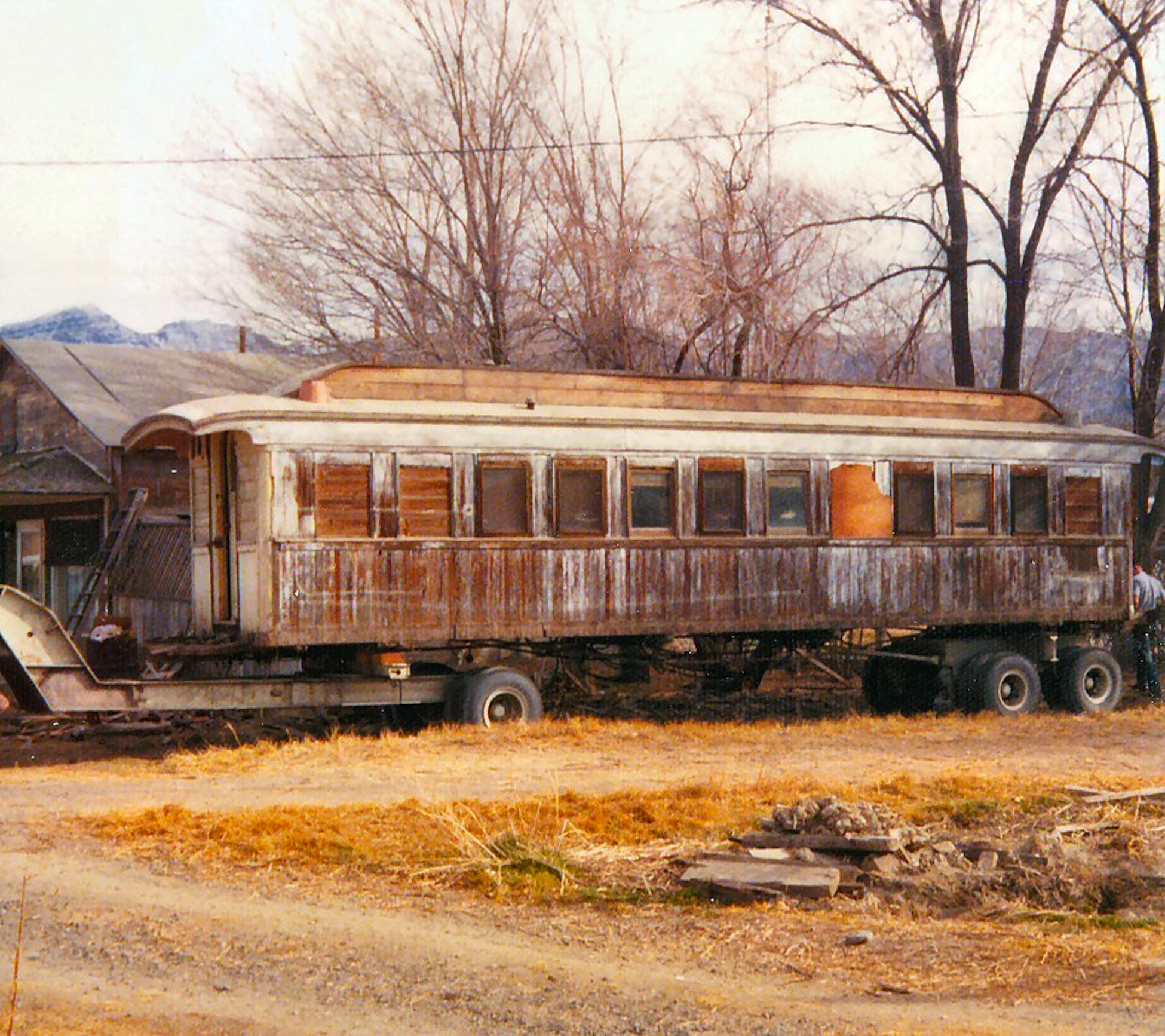
An NCO passenger car at Wendel being prepared to move, 1974—Tom Armstrong
If you recall a Tuesday tidbit of two weeks ago, I wrote about the
NCO private car the Lakeview. In this instance, like the earlier, the handy notes are not handy on this railroad car . In November 1974 Tom Armstrong took this photograph. The defacto mayor of Wendel for many decades was the grand dame, Aldah Reisenman. Aldah had many rentals in Wendel and for a time this old NCO passenger car, was one, which she sold and was being hauled away when Tom captured the moment.
I have received some new information about the Lakeview which I will post in an update in the near future.
This Eastman postcard I purchased awhile back on Ebay, the price in my range of $5.79. There were several items after reviewing allowed me to figure out when it was taken. The Christian Science Church on the corner of Mill and South Lassen Streets was constructed in 1938. Also built that year, was the Purity Grocery Store on South Lassen Street across from the Methodist Church. Both buildings, by the way, still exist, just under different ownership.
On South Roop Street, where the current Lassen Municipal Utility District building is located, appears as a vacant lot. Work on the construction of that building started in the fall of 1939. It should be noted that building was originally constructed for Safeway.
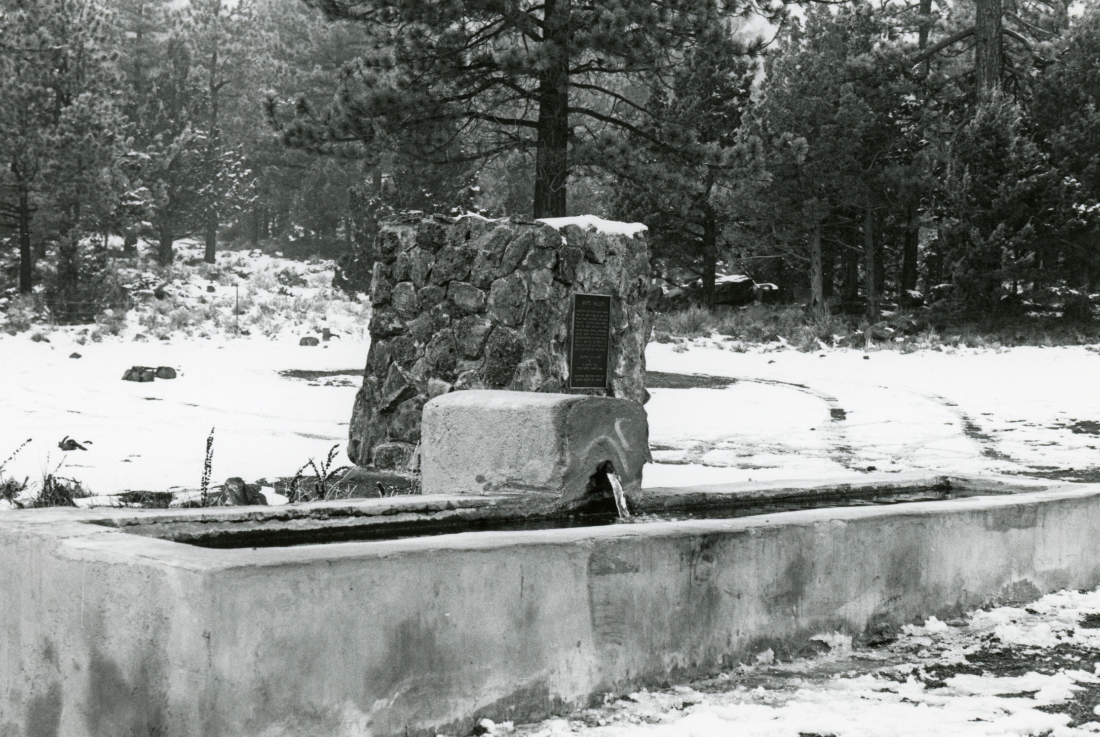
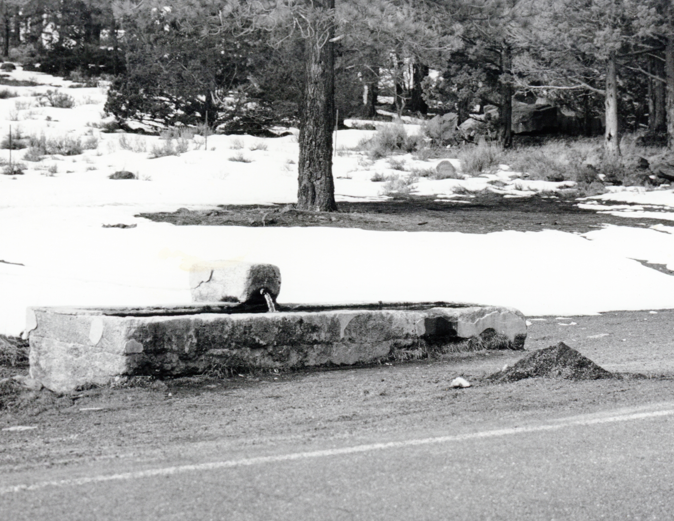
This year will mark the 40th anniversary of the placement of this monument, located ten miles north of Susanville along Highway 139. In past I have had posts about the the history of Jacks Valley, but this is a tale about how the monument came to be. By 1980, the fraternal organization known as E Clampus Vitus was having a influence among some rag-tag population of the Honey Lake Valley. They were an ambitious lot, and lo and behold began the process to form a chapter for Lassen-Modoc, which territory was under control of Las Plumas Del Oro, Chapter No. 8 somewhat headquartered in Quincy. To make a long story short, they succeeded with the formation of the Sagebrush Posse, a provisional step to become a full-fledged chapter to be known as the Never Sweats.
A major undertaking of the Sagebrush Posse was to recognize a historical landmark with a plaque/monument. The site selected was a cement water trough north of Susanville that was constructed in 1913 to aid travelers whether by horse or an automobile, especially those traveling from the north provided a respite after traversing the Antelope Grade.
It was a learning experience for the posse. Researching the history of the site revealed a rich, but hardly known history. With knowledge in hand, it was decided to register it through the State of California Point of Historical Interest program. It was an interesting hurdle, but accomplished and became the first Lassen County landmark registered. Next step the monument. Caltrans refused the proposed monument location in there right-of-way citing proposed plans for a four lane highway. This baffled the posse, after all this was in 1983!
Not to be undeterred, a strange loop hole was found. Adjacent to the trough was a four-acre plot that the highway dissected, that belonged to the Lassen-Modoc Joint Highway District No. 14. That district formed in 1929 was responsible for the construction of Highway139, which was finally completed in 1959. To appease Caltrans, the posse needed to get permission from the special highway dormant district. Fortunately, one of few living board members of district, and long time Lassen County Board of Supervisor, Pete Gerig signed a letter of permission.
For posterity a photograph before the monument.
The moment of truth to construct the monument. When it was nearly complete it was time to install the brass plaque. Opps! It turns out the foundry made a typo and a new plaque had to be remade. When all was said and done a plaque dedication was held on July 9, 1983.
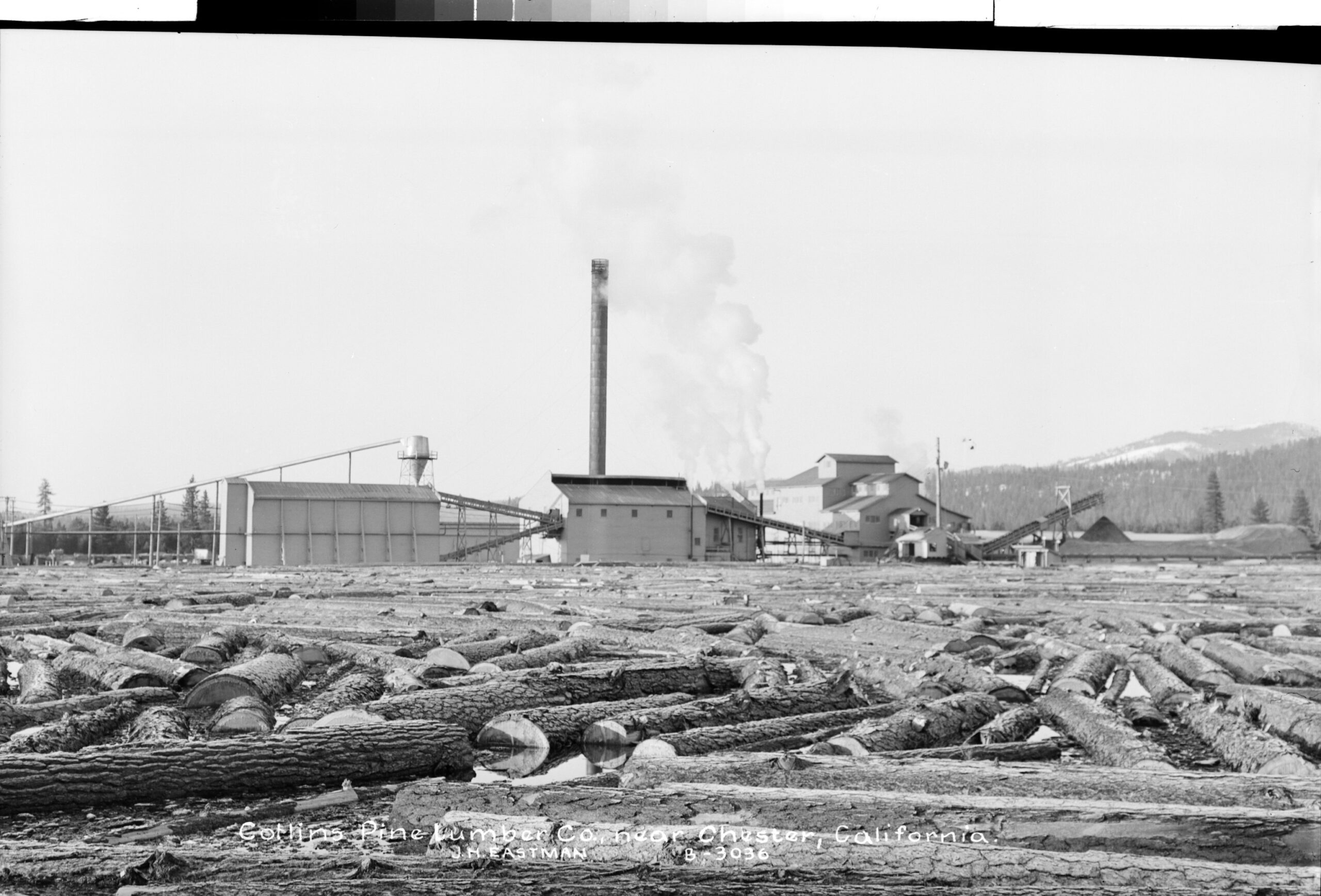
One of the most dramatic transformation for Chester came in 1941 with the announcement by the Collins Pine Company that it intend to construct a mill at Chester. This was going to be a radical departure for Chester from its peaceful existence as a summer getaway, and in the fall hunters briefly replaced the summer visitors. Once winter approached, many of Chester’s citizens boarded up their homes and moved to warmer climates, then to return in the spring.
Collins Pine changed all that, providing an industry to stabilize a year-round community. It should be noted Collins Pine was not a stranger to the region. As a matter of fact, in 1902 the company had purchased 18,000 acres of timberland in the region. In 1940, the nearby Red River Lumber Company at Westwood offered to rent their mill. Collins was not interested. However, Collins in 1941 purchased the millsite near Chester and thirteen miles of railroad from Chester to Clear Creek Junction from Red River. It was a slow process for the construction of Collins mill due to World War II and the scarcity of machinery. Even with those adversities, on March 31, 1943 the first board was sawed at the new mill.
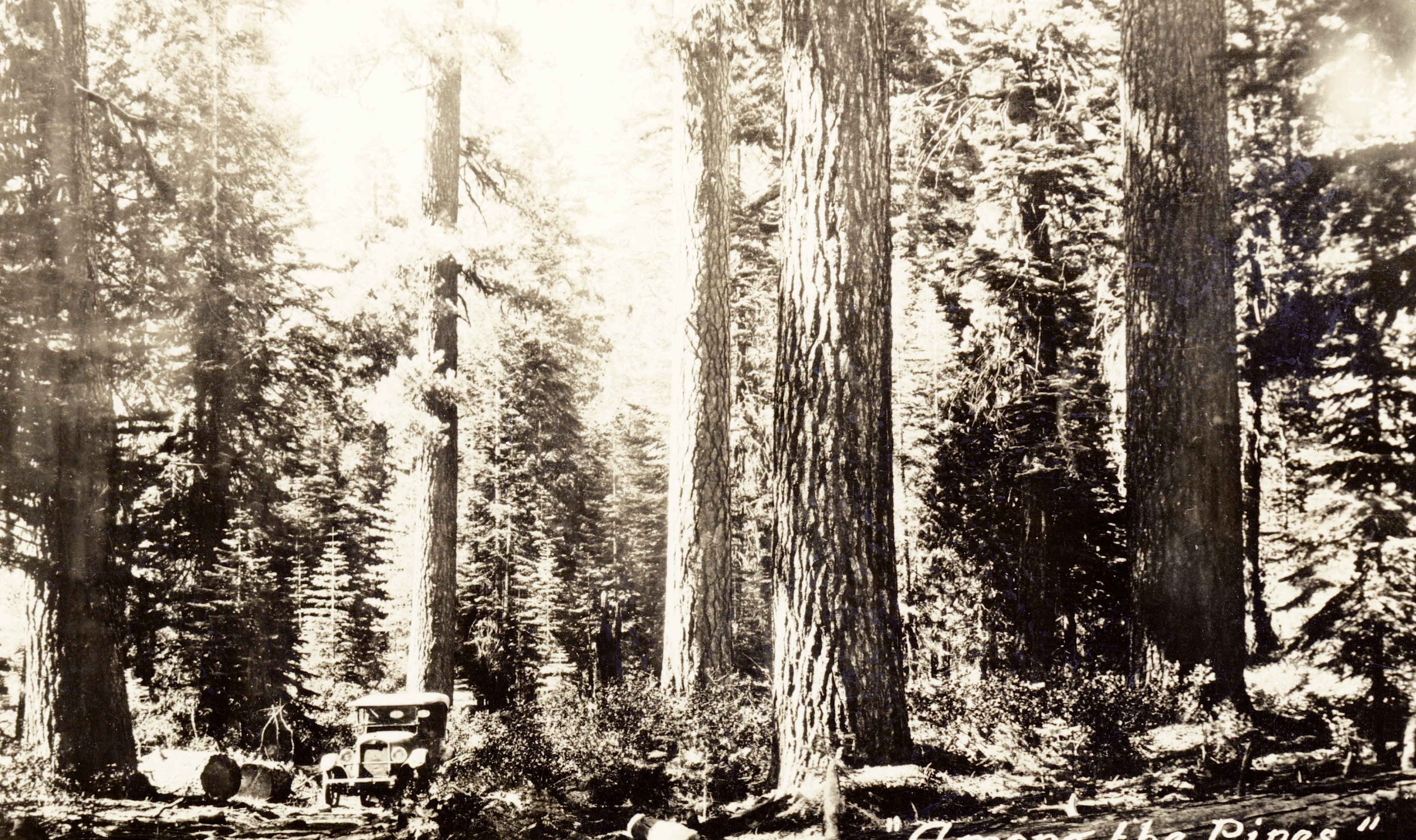
In the fall of 1928, Lassen National Forest Supervisor W.G. Durbin came up with an ingenious plan for fire trails. He spent considerable examining old livestock trails and abandoned early day roads which could be put to another use as fire trails. Work began making improvements to these old routes that Durbin thought would be ideal in transporting fire fighters and equipment. There was the added benefit once the trails were cleared they would also act as fire breaks.
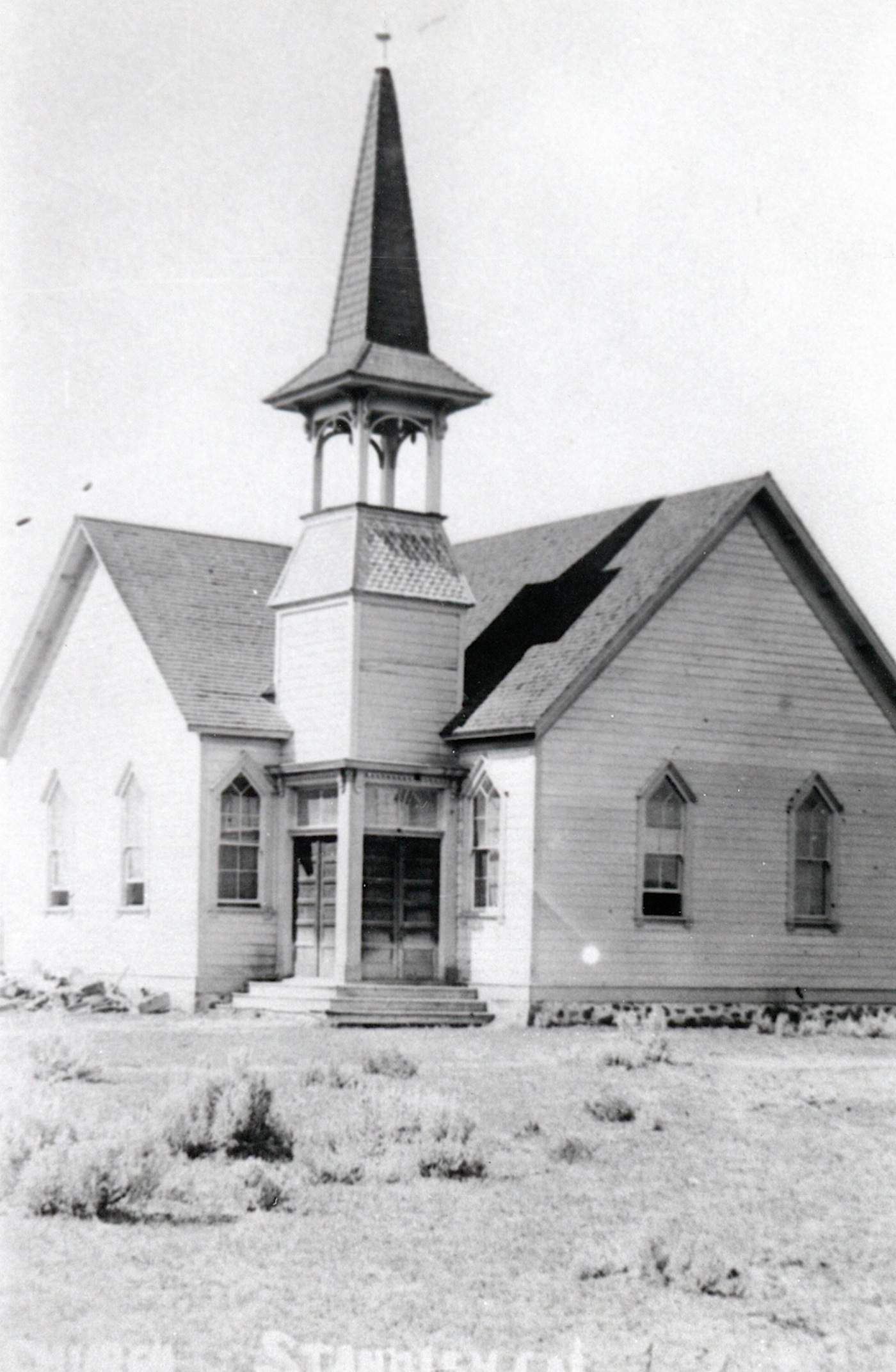
During the early years of Standish religious services were held in Pringle Hall, By 1903, the Methodist wanted a church for Standish. Frankie Coffin remembers her mother, Mrs. Eva (Hartson) Cain and Mrs.H.R.T. Coffin went to house to house in that part of the valley to raise money for the church.By September 1903 enough subscriptions had been raised to build the church. It was constructed by James Pringle and John Hamilton and completed in the spring of 1904.
On June 12, 1904, dedication ceremonies were held for the new Methodist Church at Standish. A sermon was given by Rev. E.W. VanDeventer, Superintendent of the Nevada Mission. A fund raiser was held afterwards and raised enough to money pay all debts associated with the construction and extra $30 paid for chairs for the church. The Rev. C.G. Lucas was the first pastor, who was stationed at Janesville. He would do a circuit holding services at Standish, Milford and Doyle.
By the late 1920s, church membership declined and for a number of years no services were held. In 1938, saw revival and the Methodist Church at Standish was back in operation. How much longer it remained I do not know. Today, it is known as the Standish Bible Church.
Survey crew to enlarge the Buggytown ditch near Johnstonville, 1889. Courtesy of Betty Barry Deal
No doubt you never heard of it. It was not named for pesky insects or pushy people either. An irrigation ditch was named as such, too. Buggytown, in its unique way was not even a town, but more like a sprawling affluent neighborhood in the late 1800s, located to the west of Leavitt Lake.It was so named as one of the first settlers possessed a buggy when such luxuries were rare on the frontier. It would later become known as Clinton, which consisted of a store, post office and the Riverside School. In 1973, it was transformed when the first phase of the Leavitt Lake Subdivision began.
Tim
P.S. – Some where in my files is a photograph of Ben Leavitt, in his buggy, who was Buggytown’s most prominent resident. I am not sure which category/topic I filed it under.
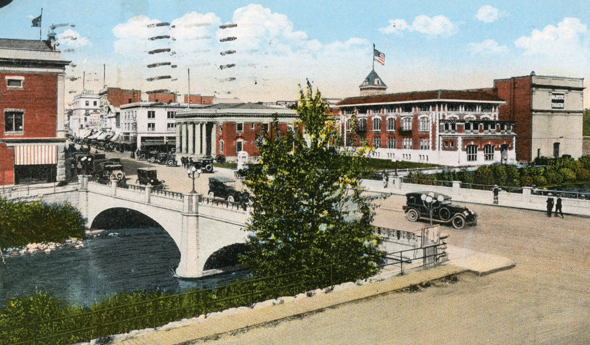
This Tuesday tidbit has little substance. However, one can see the difference a century can make to downtown Reno. One of the last existing landmarks, that many may be familiar with is the Viriginia Street bridge, which was replaced several years ago.
Recently, I received this comment: “Reading this from Australia, doing family history. Thank you for remembering what went on in these places. Kindest regards Pauline”
This is a two-fold commentary. This is a prime example, and there are many more, why there is no paywall on this site. A UNR fishery biologist was impressed that on this site, was the only photograph he was able to find of High Rock Springs near the border of California and Nevada in eastern Honey Lake Valley. Another came from an elderly woman battling cancer, wanted to use a image of the Westwood Hospital where she was born, as her grandchildren urged her to write her memoirs.
This is where I want to thank you the subscribers that makes this all possible.
In the spring of 1922, with the anticipation of the completion of the Bly Tunnel brought Belfast back to the forefront. Captain C.A. Merrill one of the original instigators of the tapping of Eagle Lake spent twenty-five years on the project that in hopes one day it would be transformed into a major agricultural center. So nearly fifty years later, Charles Emerson and D.G. Beale planned to resurrect Merrill’s dream by acquiring 4,360 acres at Belfast from the B.F. Porter Estate. It was their intention to form a “colony” and sell 40-acre tracts. The two men formed the Belfast Land Company to orchestrate their goal. The major obstacle, of course, was financing. The Porter Estate wanted $100,000 for the property and the Belfast Land Company could not arrange financial backing. Thus, another land development project went bust.