A view of Prospect Peak from Swains Hole, October 22, 2019
Between the discovery of gold at Coloma, California in 1848 and the Comstock in 1859 in Nevada, mining prospectors scoured the west looking for the next “El Dorado.” According to Lassen Park naturalist Paul E. Schulz in 1849 Major Pierson B. Reading, the first person to settle in Shasta County, explored what would later become Lassen Volcanic National Park. He was one of many prospectors at Lassen and that is how this peak became known. Schulz noted: “A 2,000 peak of gentle and symmetrical contour. It is a rather good example of a Hawaiian-type volcano, and is composed of countless Prospect Peak Basaltic lava flows.”
Initial work on the Bly Tunnel, Willow Creek side, December 1921—Lola L. Tanner
This being Memorial Day Weekend, it only seemed fitting for an Eagle Lake topic, since there is a lot of activity around the lake that weekend.
Leon Bly spent five years to put together a project to tap Eagle Lake to irrigate land in Honey Lake Valley. He had a lot of obstacles to contend with. First there was the initial study of lake to see if it was feasible. Then he had to convince the farmers of the Honey Lake Valley that it was indeed worthy. This was not an easy task since there had been attempts to tap the lake since 1875. Then public irrigation districts had to be formed to be able to put together a $1.25 million bond measure to finance it. Then there was all the detail work to obtain rights-of-way for the necessary canals and ditches, that would also have to be surveyed. One would of thought when the initial work began in the fall of 1921, there would be some kind of celebration, but it started off quietly with no fanfare.
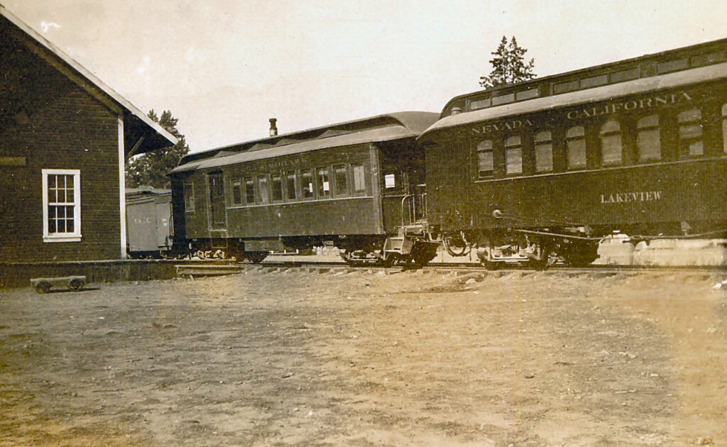
Back in early February was a Tuesday tidbit about the Nevada California Oregon Railroad’s Lakeview car. At the time, I noted my notes were not handy, and they still are not. I am just not mentally prepared to sift through my extensive NCO file that date backs to the 1970s.
Anyhow, the following was relayed to me. The Lakeview was originally a narrow gauge car owned by the Union Pacific which was used as a business car. The Union Pacific converted it to standard gauge. When the NCO purchased it from the Union Pacific, at the NCO’s Reno shop the Lakeview was once converted back again to narrow gauge.
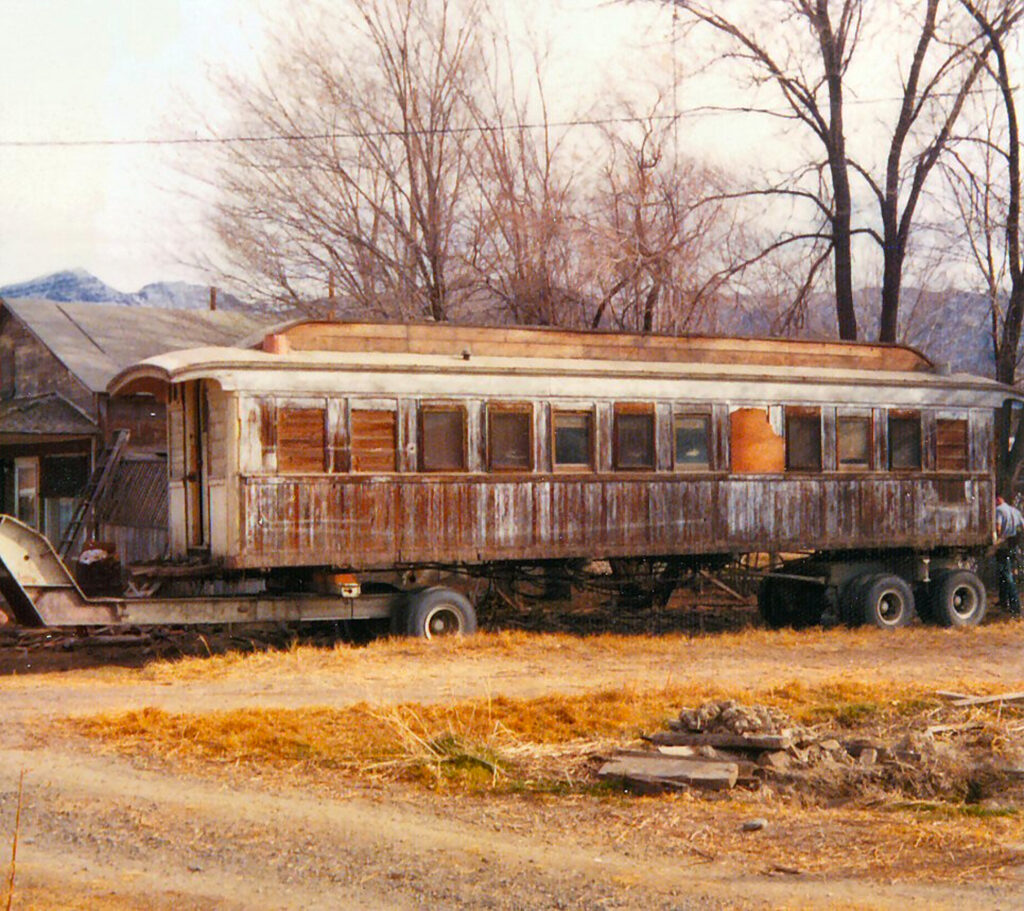
An NCO passenger car at Wendel being prepared to move, 1974—Tom Armstrong
As to the above passenger car it was sold to the Huckleberry Railroad, a narrow gauge railroad near Flint, Michigan where it was restored and put into use. This is a tourist railroad that operates in summer months.
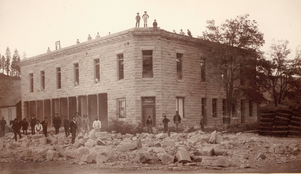
Construction of the $20,000 Masonic Hall in 1893 from the stone from the Susanville Quarry—Philip S. Hall
Located at the west end of Susanville is Quarry Street, so named for a stone quarry there that was discovered in 1860. The bluff at that part of town, better known as Inspiration Point, is fault block caused by volcanic upheaval. That upheaval created a deposit of rhyolite tuff. It is an ideal building material, because it is light weight, and can easily be sculptured. In 1862, H.F. Thompson began the development of a quarry, Some of its first uses was for headstones, the largest being for the grave of Captain William Weatherlow who died in 1864. In 1863, Miller & Kingsley had the first stone building constructed from the quarry. The last major use of the quarry was in the 1930s to construct the Spalding home on Quarry Street.
Lassen County Courthouse and Hall of Records, 1907. Courtesy of Gil Morrill
Here is an interesting tidbit. On July 3, 1883, W.P. Hall sold for $700 to Lassen County rights to the quarry for the needs of the county. In 1887, the county built a small stone building adjacent to the courthouse for a Hall of Records. When the new courthouse was completed in 1917, the Hall of Records building was dismantled and the stone was used to build the Susanville City Jail. By the 1950s, the jail was no longer used and it was converted into a garage and subsequently torn down in 2000.
This is a tale of two Susans—Susan Parker Nobles and Susan Roop Arnold. While the two women never met, one has a river named for one Susan and the other a town, i.e. Susan River and Susanville.
First we begin with Susan River. During the years 1851-1852, William H. Nobles located a new emigrant road from Shasta, California to Lassen’s Meadows, Nevada. This road passed through the Honey Lake Valley. Nobles named the Susan River for his wife, Susan Parker Nobles. Very little is known about Susan Nobles. She resided in Minnesota for the majority of her married life, only moving to California when her husband, Nobles, died in 1876.
Susan Roop Arnold and Anna Hall at Constantia, 1905–Philip S. Hall
Susanville was officially named on March 17, 1859 when the Susanville Post Office was established with Isaac Roop the first postmaster. It was so named after Roop’s daughter, Susan. When her father came to California in 1850, she was left in care of her maternal grandparents. In 1862, at the age of nineteen, Susan left her grandparents home in Ohio and moved to California to be with her father. On December 27, 1864, Susan married Alexander T. Arnold and spent the rest of her life in the community that was named after her. She passed away on July 22, 1921, at the age of 79.
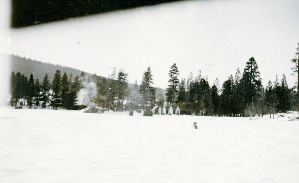
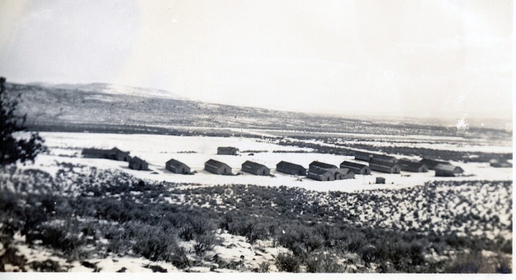
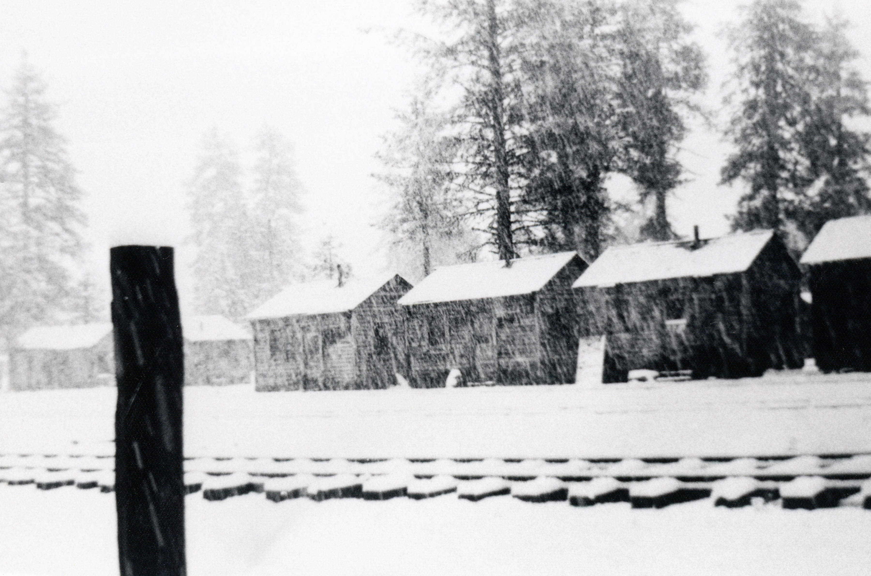
Secret Valley CCC Camp,January 1938—C.H. Bennett Collection
I am slowly scanning the photographs of Company Clerk C.H. Bennett who was stationed at Secret Valley from January 1936 to January 1938. If all goes well, in about a month, I will be posting the photographs and various work undertaken by the CCC and there is a lot. In the always learning something new category, the California Division of Forestry enlisted the aid of the Secret Valley Camp to build the road and fire lookout on Fredonyer Peak.
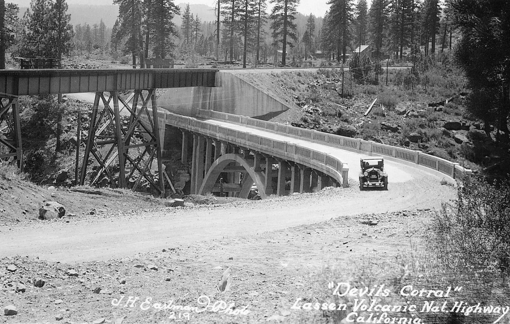
Devil’s Corral is an interesting spot along the Susan River some five miles or so west of Susanville. The circumstances leading to its name are not known. There are two possible explanations. In 1865, San Francisco journalist Lisle Lester wrote: “Late in the afternoon we crossed a weird looking place of a rock wall enclosing a little flat meadow land called Devil’s Corral. The place is historical, for in the early days a band of emigrants stopped here to feed their stock and were overtaken by disease which covered the little nook with the bones of their cattle, and added to its soil many a way-worn form. For years the bones of the cattle bleached here in rude piles.”
In 1923, when the first highway bridge to span Devil’s Corral was completed, this published version made its debut: “The name was given the curious lava rock formation on the banks of the Susan River at this point by early day wagon trains who sought to reach the Sacramento Valley by following the course of the Susan River. At this point the perpendicular rock walls of the canyon made further progress impossible and they were forced to turn back, hence the name Devils Corral.”
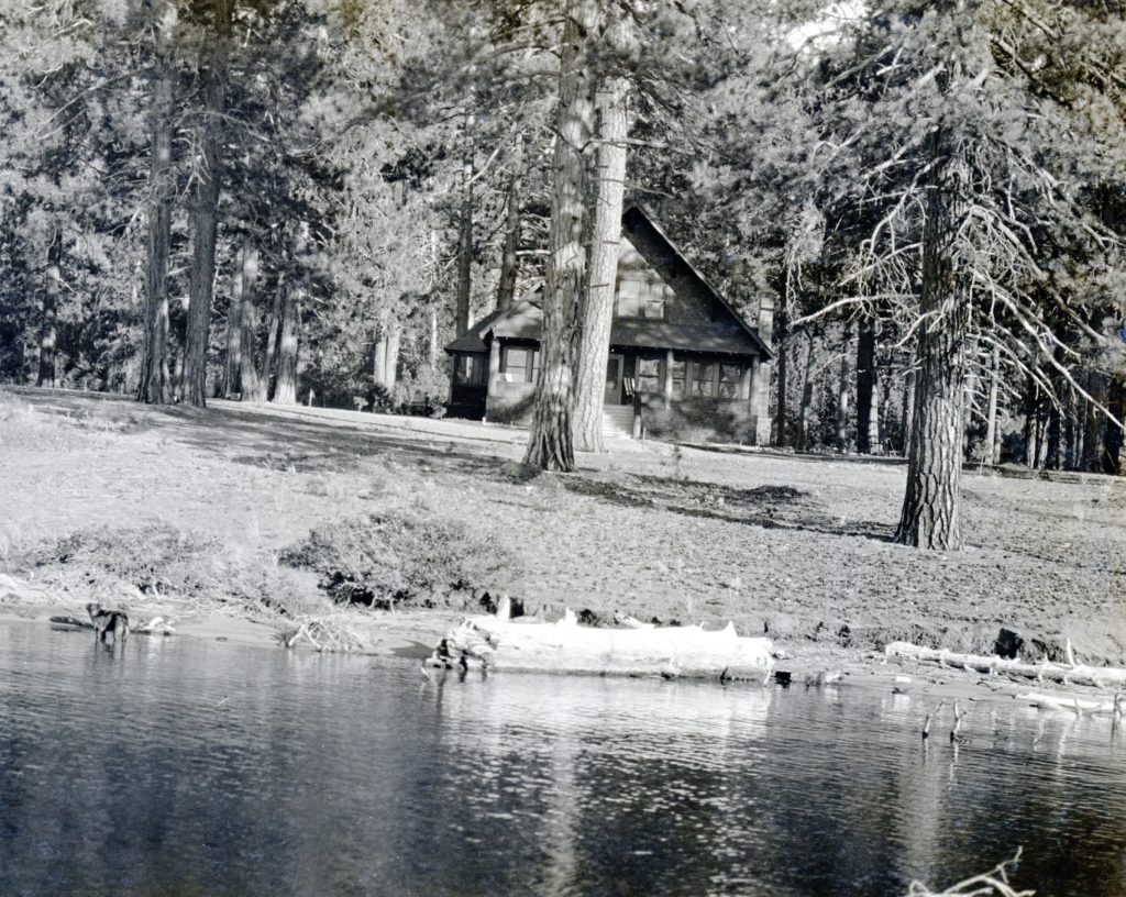
For those headed out to Eagle Lake for Memorial Day Wekend, don’t forget about Camp Ronald McDonald’s Annual Memorial Day Pancake Breakfast. From 7 a.m. to 11 a.m. Saturday May 27, and Sunday May 28, the public can enjoy an all you can eat breakfast; including pancakes, sausages and hot and cold beverages! The price is $5 per person. The camp located at the south shore and adjacent to the Gallatin House.
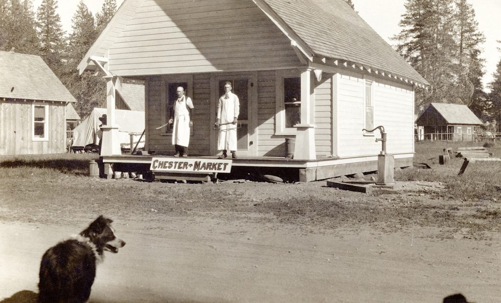
Chester Market, circa 1915. Courtesy of Hazel York Moller
Chester located near the northwest shore of Lake Almanor slowly evolved over the years. The townsite was not surveyed until 1911. In the early years, it was typical mountain summer resort town, and its population shrank during the winter season.
Camp 57, of the ed River Lumber Company courtesy of Roy Rea
In the spring of 1922, changes were on the horizon and Chester witnessed its first unofficial subdivision. The Red River Lumber Company was extending its main logging line westerly and not far from Chester proper the company established a logging camp there known as Camp 57. It was definite boost to the town’s population as the camp was home to over 200 men. The two communities did share one thing in common. Both Chester and Camp 57’s population dramatically declined in the winter.
Smoke Creek Desert looking towards Sheepshead, fall, 1977
Just across the California border lies this most interesting desert. It is a favorite of mine, so rich in history. It received its name back in 1844 when John C. Fremont explored the region. His party noted the dust storms created on the playa there cast a smokey hue.
Fremont was not the only explorer to the desert, as he was followed by William H. Nobles who created a new emigrant road that traversed Smoke Creek—it was a direct route to the Northern California mines. In 1865, the military established Fort Bidwell in Surprise Valley. The military plotted an unusual supply route that went along the west side of the Smoke Creek Desert and then followed Smoke Creek in a haphazard manner to Surprise Valley. This route was far from ideal, which was replaced by route through Buffalo Meadows. Traffic would diminish significantly when in 1890 Fort Bidwell was closed.
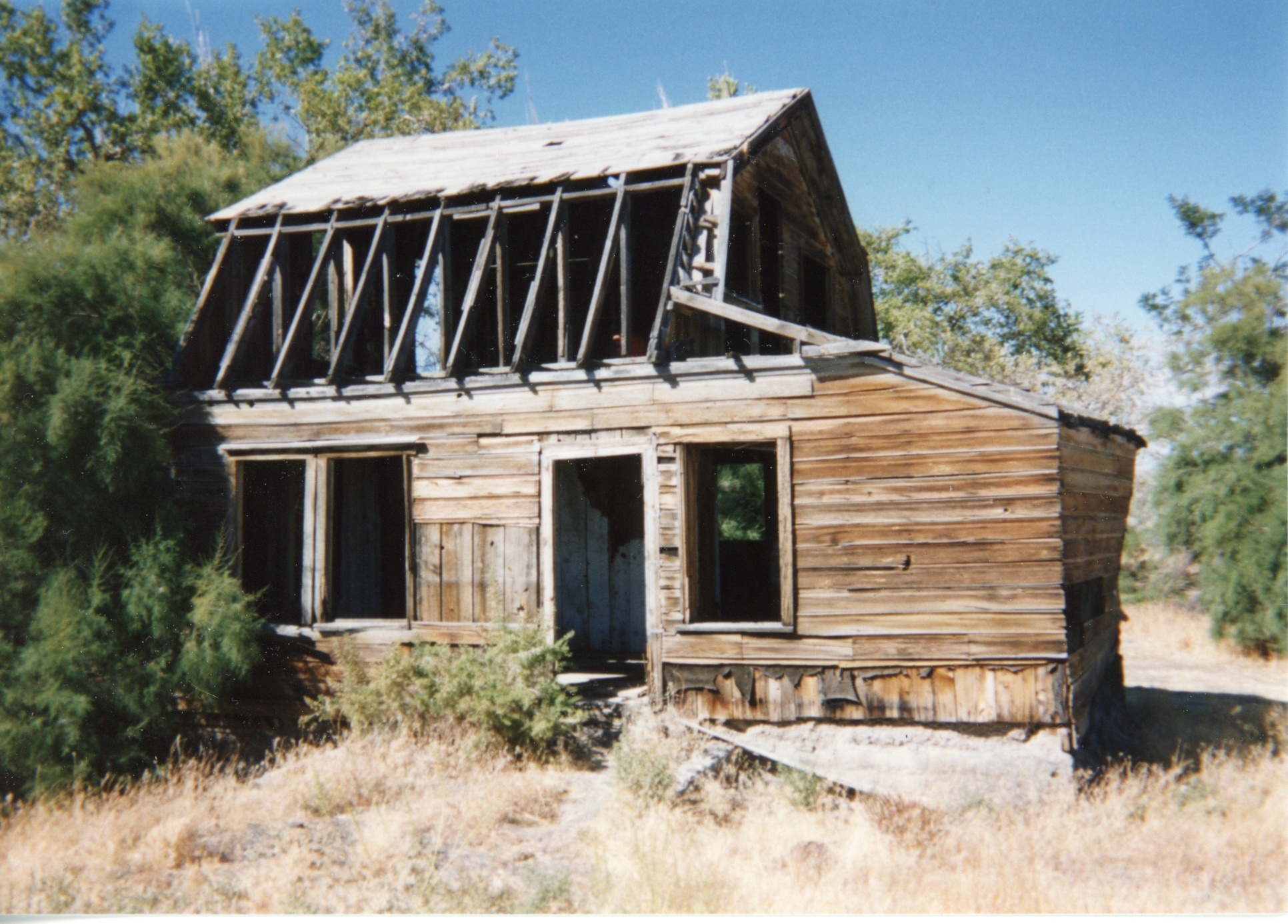
An abandoned homestead in the Smoke Creek Desert.
By the early 1900s, Smoke Creek was dotted with desert homesteaders during the dry farming experience that did not work so well to many.