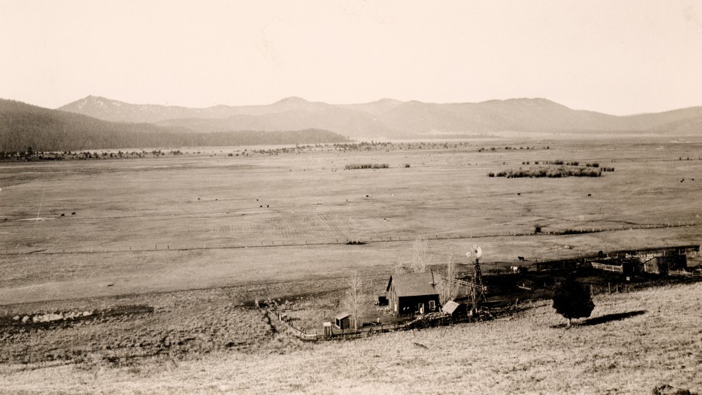
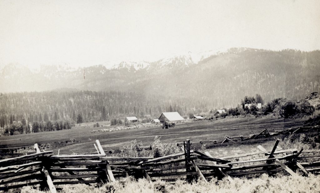
Lower portion of Willow Creek Valley, 1926. Courtesy of Lola L. Tanner
The Civilian Conservation Corp camps generally had a population of roughly 200 men. For some outposts, such as one of Secret Valley, they encompassed a lot of territory. It was not uncommon to establish a seasonal spike camp, comprising between 40-50 men. In In May, 1936, one of these spike camps was located in the Willow Creek Valley, some twelve miles north of Susanville.
This Willow Creek Camp had three main objectives—rebuild the existing telephone line, 20 miles road work and spring development. Work was done on three springs, Hagata, Morgan and Pete’s. They. noted that Hagata Spring had a flow of seven to ten gallons per minute. Of a somewhat interesting footnote, woodpeckers caused great damage to the telephone poles.
Thompson Peak, 1911. It should be noted that Thompson Peak, and the Diamond Mountain Range is a part of the Honey Lake Fault Zone.
During the 1860s and 1870s earthquakes in the Honey Lake Valley were a common occurrence. In 1874, Sylvester Daniels arrived from Iowa and spent time with his sister, Polly Parks, who resided just east of Buntingville. He kept a journal of his experiences that he wrote specifically for his daughter, Viroqua and the rest of his family who remained in Iowa. The following is his account of the first earthquake he experienced.
“Sunday, January 24, 1875 – Well, we are all alive yet. Now, I will tell you why I started as I did. You have heard of earthquakes I suppose. Well, I will tell on the sly that there was a live one came along here this morning early about 4 o’clock. It awoke me very suddenly, then such a crash. I thought the house was all breaking to pieces and it seemed to roll back and forth in bed. At any rate it shook things up pretty lively, while it lasted. But it was not near as long as I have written about. It seemed to roll back and forth and jar terribly. It seemed to pass towards the Mountain from the Valley.
Sylvester Daniels. Courtesy of Jean Gorzell
“The hens flew and cackled and the pigs squealed. Polly Parks said it shook every bottle and everything in the house. She said the cream was disturbed on every pan. So you see there was quite a commotion for a time. All the damage that I have heard of as of yet, is some chimneys are slightly rent and some were frightened. I have not heard anyone express themselves to wish it repeated. Polly and Elisha Parks say they are not as near as afraid of them as they used to be of thunderstorms and tornadoes in the East.”
Cramer Reservoir, though USGS maps misspell it as Craemer, is located a short distance to the southwest side of Horse Lake. Charles Cramer came to Lassen County in 1864. In time, Cramer would assemble several large ranches in Lassen County. On September 5, 1874 Cramer purchased 160 acres at Horse Lake from Joe Hale, co-owner of Susanville’s Pioneer Saloon, for $600 and would continue to acquire more property there. On May 21, 1900, his son, Daniel F. Cramer obtained the rights to construct the reservoir. On July 18, 1939 the Cramer family transferred the Horse Lake property to California Lands Incorporated.
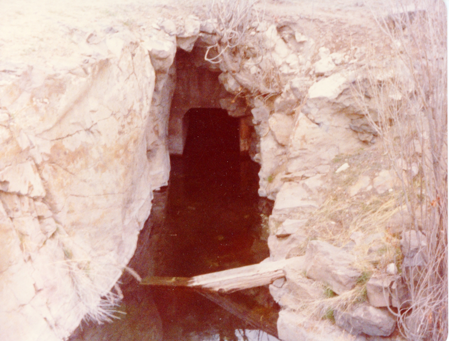
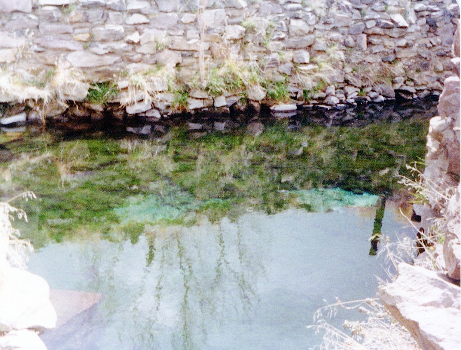
These springs in eastern Honey Lake Valley and near the Nevada border are quite unique. They are an ancient, dating back to the time when the area was covered by Lake Lahontan in the Pleistocene epoch.
The second reason is it is a warm water spring with a constant temperature of 86F. The springs supports two kinds of fish. First is the Lahontan tui chubs. This, of course, is rather remarkable that the fish have adapted over the years to thrive in constant warm water in a confined space. Water from the spring then goes underground and re-surfaces 100 yards distant, maintaining a constant cooler temperature at 76F. At this point, again, which is also unusual, is found the Lahontan speckle dace. However, it has been relayed to me the fish no longer exist, due to an introduction of an exotic fish species in the early 2000s that wiped the tui chub and dace.
A portion of the tunnel outlet of High Rock Springs. April, 1975
It should be noted that in the 1920s, William Dicting was hired by the Rees Jenkins to develop the springs. He spent eight years to hand drill through the rock to develop the water tunnel to increase water flow.
A view of Prospect Peak from Swains Hole, October 22, 2019
Between the discovery of gold at Coloma, California in 1848 and the Comstock in 1859 in Nevada, mining prospectors scoured the west looking for the next “El Dorado.” According to Lassen Park naturalist Paul E. Schulz in 1849 Major Pierson B. Reading, the first person to settle in Shasta County, explored what would later become Lassen Volcanic National Park. He was one of many prospectors at Lassen and that is how this peak became known. Schulz noted: “A 2,000 peak of gentle and symmetrical contour. It is a rather good example of a Hawaiian-type volcano, and is composed of countless Prospect Peak Basaltic lava flows.”
Gallatin Beach has certainly evolved over the years. During the 1910s, the beach did not exist, due to the high water levels of Eagle Lake. By 1917, Eagle Lake reached its peak high water mark, and on the south shore, considerable timber was flooded, killing trees some hundreds of years old. In the 1920s, the water level of lake began to recede, in part by Bly’s Tunnel and equally important the region was in the midst of a 20-year drought.
The result was what some referred to as a stub forest of dead trees that were now a part of the beach’s landscape. Visitors to the area used them for photo ops.
In 1915, Professor S.T. Harding began studies of the water variations at Eagle Lake. Harding examined the stub forest to obtain data on the lake’s elevation. Harding studied the tree rings and the elevation of a number of trees. That provided him information concerning the levels of the lake dating back to 1420! By taking the lowest submerged trees (the oldest one was found to be a 245-year old stump at the elevation of 5,116, that was submerged in 1895), he determined the lake level had to be at 5,115 feet or less from 1650 until the time it was submerged. Another stump examined placed its initial growth between 1420 and 1520, and during that time period the lake had to be at an elevation below 5,099 continuously from 1420 to 1520. In addition, Harding also examined trees at the 5,126 foot elevation that were found to be over 400 years old that substantiated the fact that the 1917 level of 5,125.2 was the lake’s highest level.
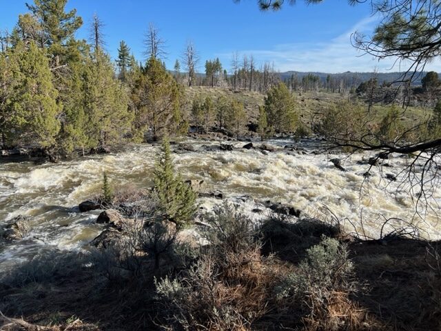
Pine Creek, April 28, 2023
As of May 1, 2023 the lake’s elevation was at 5093.62. At the time of that reading, Pine Creek was a raging torrent, so lake should see significant rise during the month of May.
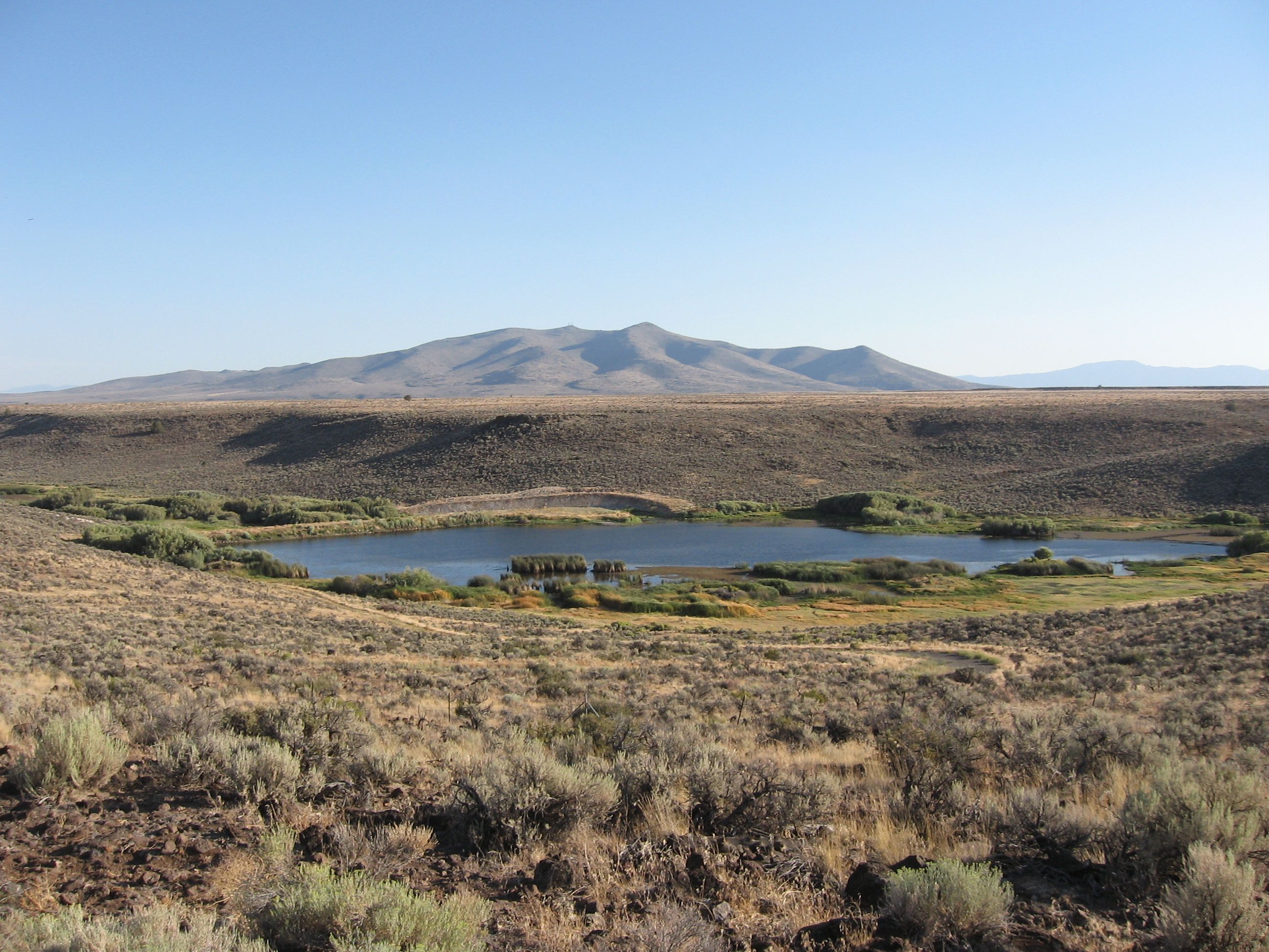
Pierre “Pete” Biscar (1881-1947), a native of France, came to Secret Valley in 1904. In 1909, he constructed the first reservoir at the mouth of Snowstorm Canyon. In 1915, it was washed out by a flood and subsequently rebuilt. Today, there are two small reservoirs that are part of the 550-acre Biscar Wildlife Area.
I am always learning something new, which I suppose is a good thing. I never knew the word “run” can be construed as a small creek or stream, as in the case locally Gold Run. It happens to be more common term in the Eastern United States. If you were like me, and been in the dark all this time, you have been enlightened, too.
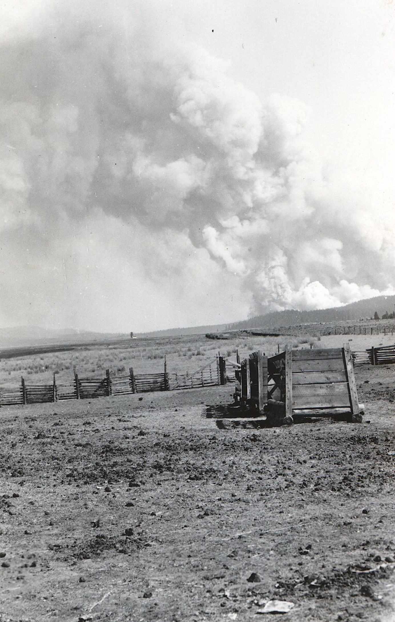
The 1926 Antelope Fire as seen from Willow Creek Valley. Courtesy of Lola L. Tanner
In the late 1800s and early 1900s forest fires did not cause a great deal of alarm or concern. Most of the fires were small in size—twenty acres or less. Some times they were fought and most often left to burn to extinguish themselves. The following is an interesting example from the Lassen Advocate of July 26, 1907:
“The forest fires are late in starting this season. There was a blaze up the river, west of Susanville Thursday and smoke and resinous odor of burning pine were very percipible. Whether extinguished or burnt out, the atmosphere is clear and smokeless today.”
What happened. Locally, saw the establishment of large timber companies and their subsequent sawmills. This produced industrial l scale logging, unknown to the region. Some of the mechanical equipment were known to spark fires, and in some cases large fires were created in logged off areas. At the same time, the national forest service gained prominence and one of its main objectives was fire prevention. Another consideration—weather. From 1860-1916 was an extremely wet weather cycle, followed by a twenty year dry cycle.
Notice the lime deposits on the rocks at Gallatin boat ramp, October 31, 2022–D. Willis
One of the interesting issues to surface in 1928 regarding the inlet problem of Bly Tunnel was the alkalinity effects of water used from Eagle Lake on lands in the Honey Lake Valley. There had been lots of speculation but no scientific proof. In the fall of 1928 Professor P.H. Hibbard of the University of California, Berkeley well versed in soil and water analysis arrived on the scene to examine the situation.
In Hibbard’s findings the Eagle Lake water was not a detriment to the irrigated lands in Honey Lake Valley. The lands affected there already had alkali in the soil, and the issue from irrigation was compounded by the fact of poor drainage on those lands. Hibbard noted that lakes without outlets tend to have a higher mineral content. He went on to state that the rocks along the shoreline at Eagle Lake that had a white layer on them when the lake receded were lime deposits.