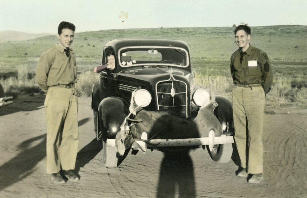
Showing off the trophy deer, Secret Valley CCC camp—-C.H. Bennett Collection
Since it happens to be deer season in Northeastern California. This photograph was taken at the Secret Valley CCC Camp. Let’s just say this is not an ideal way to haul a deer carcass, unless you have no intention to consume the venison.
Some times a picture is worth a thousand words, and some times a picture need a thousand words of explanation. What is interesting in this scenario, the apparent hunters are is dress uniform. Of course, usually the commander is the only person with an automobile. Finally, who is the passenger in the car?
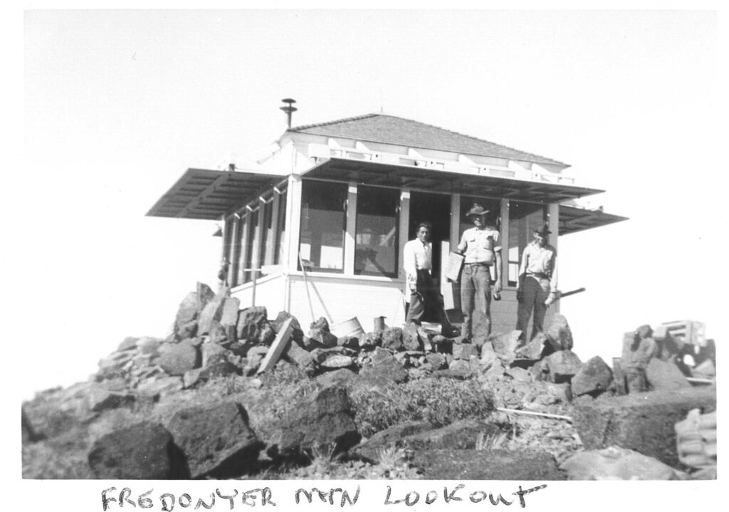
Courtesy of California Division of Forestry, Lassen-Modoc Unit
In the spring of 1937, the Lassen County Board of Supervisors were in communication with the California Division of Forestry to have a fire lookout placed on Fredonyer Peak, just north of Eagle Lake. While, M.B. Pratt of the forestry was supportive and deemed it a worthwhile project, they did not have the funds. However, as a possible alternative, Pratt contacted Chester Hunt, Regional Manager of the Emergency Conservation Work. Thus, the wheels were moving in a cooperative effort to make the Fredonyer Peak Lookout a reality. Hunt stated if the State Forestry and Lassen National Forest would provide the building materials, the Secret Valley CCC Camp would provide the labor. Everyone agreed. The CCC men had a lot of work to accomplish. First, they had a build a road from Horse Lake to the summit. (This is not the road used today.) A telephone line from Long Ranch at Horse Lake would also be extended to the summit. Finally, there was the construction of the lookout itself. Needless to say, the job got done.
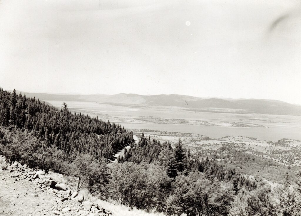
View of Eagle Lake from Fredonyer Peak, circa 1960
This lookout is still manned. At an elevation of 7943’ provides stunning views of the region.
For those who have hiked to the top of Lassen Peak, it can be a spectacular view. Personally, however, the first time I made the ascent it was disappointing. This was, and showing my age, was in the fall when they used to burn the rice fields in the Sacramento Valley, so when I made that initial ascent there was layer of brown smoke over the Sacramento Valley. Enough of that.
Who the first Anglo to climb Lassen Peak, we may never know. There is a dispute. However, we do know that in the summer of 1851, a prospecting party of ten men headed north from Onion Valley, Plumas County, in search of another fabled gold tale, the “lone cabin mine.” Once they reached Big Meadows (now Lake Almanor), they decided to forge ahead and climb Lassen Peak—-possibly the first to do so. One of those men, Grover K. Godfrey, a twenty-six year old New Yorker, observed from his vantage point at the top, “The sight is unrivaled in beauty and magnificence. It is like the vision of some dream land. I fancied I could see all the kingdoms of this world at one glance.”
The next group to climb the peak did so on official business. In the fall of 1863, as part of the geological reconnaissance survey of Northern California, Josiah D. Whitney of the California State Geological Survey sent four men to conduct field work—William H. Brewer, Clarence King, James T. Gardiner and Richard Cotter. It took the party two attempts to climb the mountain. On September 26, when King reached the summit, the wind was so fierce that he had to retreat. Beside the wind, another problem was encountered in the form of cloudy weather that obscured the view. This condition would not allow the men to make observations of lava flows and other remnants of volcanic activity. The windy weather brought snow, so they had to wait a few extra days to make the second attempt.
On September 29, at 1 a.m. with the aid of moonlight they began their second climb. King was again the first to reach the summit. The four men watched the sun rise from their perch. Brewer, like Godfrey, was in awe of the view. Years later he exclaimed, “Although I have often reached greater altitudes, that days stand out in my memory as one of the most impressive in my life.”
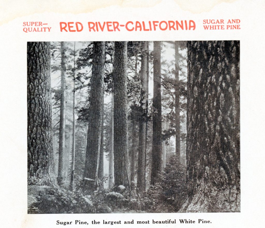
An early promotional brochure of the Red River Lumber Company
The sugar pine was highly sought by lumbermen, and especially for the manufacture of wooden boxes. The pine is noted for its straight grain and another feature was manufacture into lumber has no odor. The latter was desired by fruit and vegetable growers.
The sugar pine was so named for its surgary pitch. Noted naturalist, John Muir wrote: “The sugar, from which the common name is derived, is to my taste the best of sweets, better than maple sugar. It exudes from the heartwood, where wounds have been made, either by forest fires or the ax, in the shape. of irregular, crisp, candy-like kernels, which are crowded together in masses of considerable size, like cluster of resin beads . . . Indians are fond of it, but on account of its laxative properties only small quantities may be eaten.”
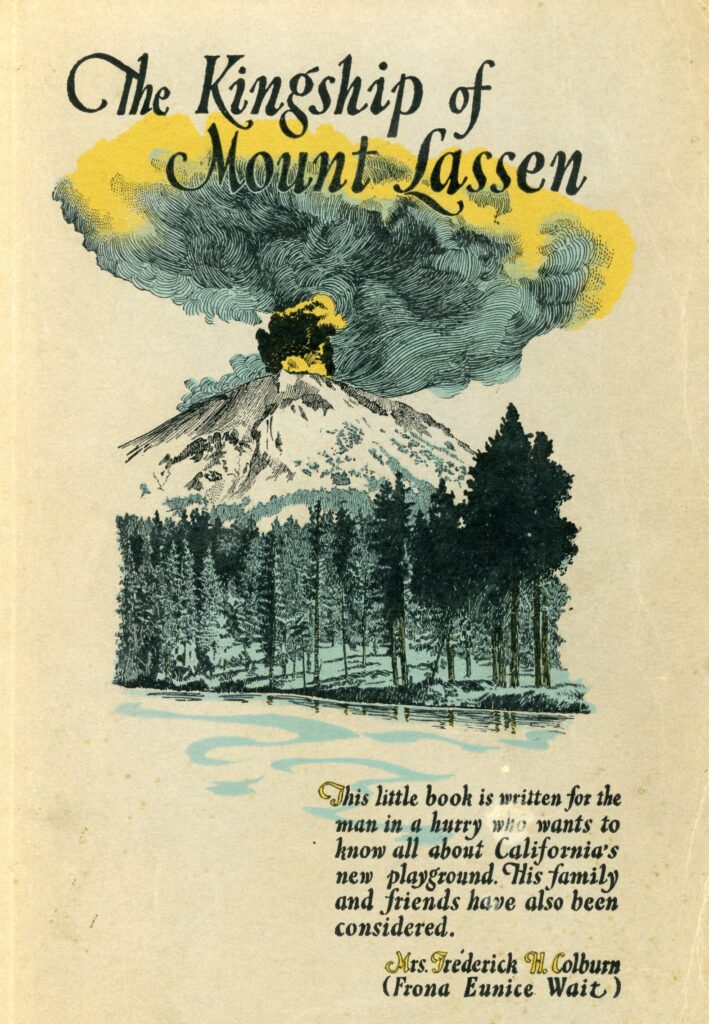
This is Mrs. Frederick Coburn’s (nee Frona Eunice Wait)1922 book about Lassen Volcanic National Park, which she dubbed as “California’s Newest Playground.” It is a somewhat whimsical account about the Lassen Peak region, while interspersed with some dubious historical claims, it is an interesting read nevertheless.
While writing about Peter Lassen she raises the age old question, “Who killed Lassen?” She includes some interesting citations on that topic. In 1917, she was also a participant at the new Lassen Monument dedication that she provides an interesting account of that event, not found elsewhere.
Towards the end of the book, she provides her experience as a visitor to Westwood. That excerpt will appear in a week or so.
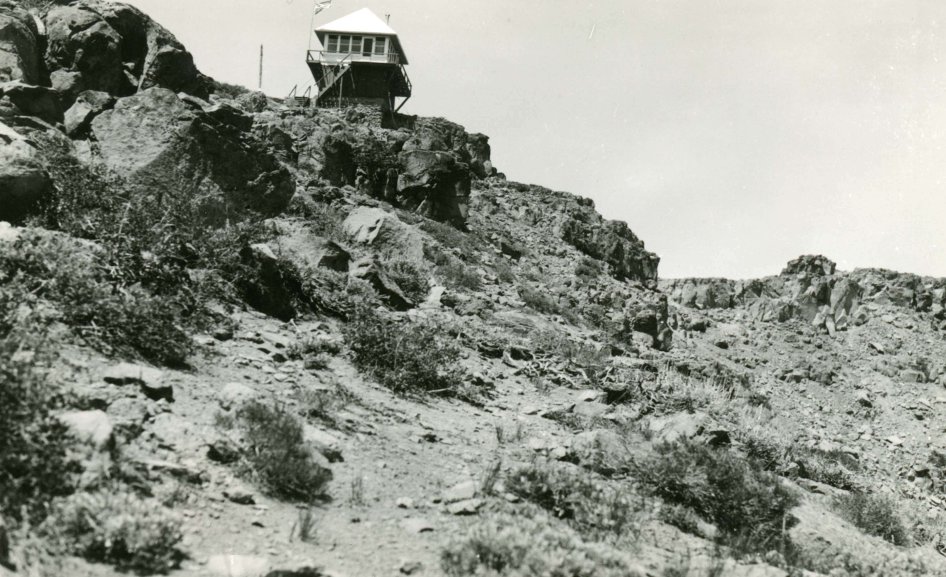
Thompson Peak, is a well known landmark of the Honey Lake Valley, which straddles the Lassen/Plumas County line. At an elevation of 7795’ it is the second highest point of the Diamond Mountain Range.
It was so named for Manly Thompson who located near the base of the mountain in December 1856, Thompson was one the first settlers in that locale. Thompson opted out for greener pastures and on October 27, 1875, sold his 276-acre ranch to James P. Sharp for $6,000 and moved to Elko, Nevada. The property is known today as Bailey Ranch near Buntingville.
Thompson Peak Fire Lookout, circa 1950–Courtesy of Margaret Purdy
Some may want to check out this most interesting website concerning Thompson Peak. It is worth the gander. For me it brought back some interesting memories when I contemplated climbing the peak.
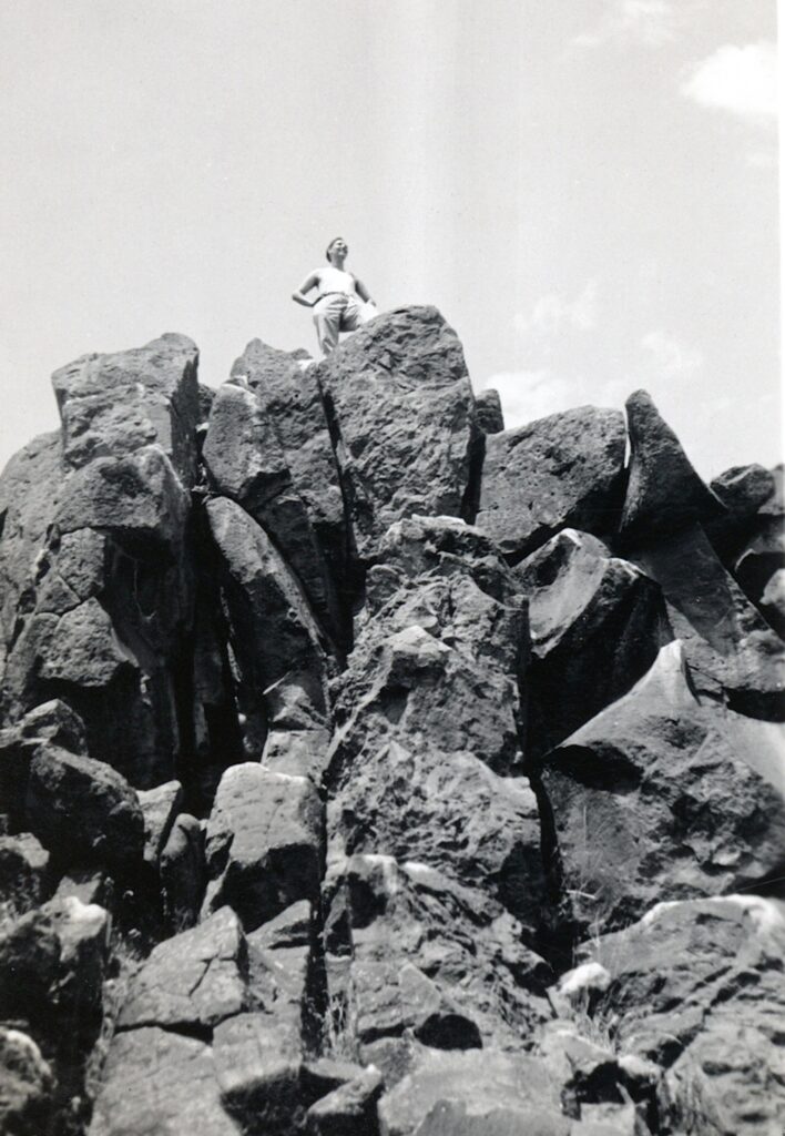
Secret Valley CCC Company Clerk on top of Three Sisters, August 1936—C.H. Bennett Collection
While you probably never heard of Shinn Peaks referred to as the Three Sisters, the men stationed at the Secret Valley CCC camp gave it that name. After all these young men, were from the Midwest, so all the region was foreign to them, and Secret Valley so remote where there was not even a small village or outpost to glean local knowledge. Their view of Shinn Peaks shows three distinct peaks, hence the Three Sisters. Of course, some of the men were so intrigued by the mountain that they climbed to the top.
Another landmark Turtle Mountain, at the lower end of the Honey Lake Valley, which is a prominent extension to Fort Sage Mountain never had a name attached to it for many years. According to Philip Hall (1909-1996), who spent most of his life in nearby Long Valley stated it was “new comers” who arrived when the Sierra Army Depot at Herlong that was established in the early 1940s, when the point was named.
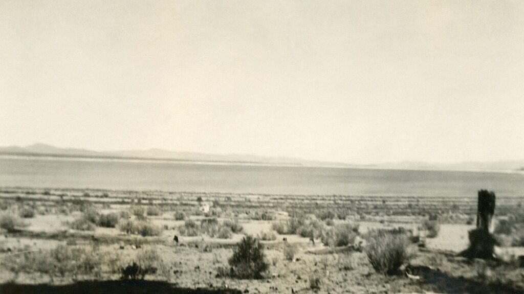
In 1937, twenty years after Eagle Lake reached its historic high of 5125 feet it witnessed its historic low of 5091. That low water level happened again in 1950. Then, many may not realize but in December 2015 the lake reached a new historic low of 5090.54 and was repeated again in December 2022. What is interesting in each of these instances they were followed extremely wet winters.
South shore Eagle Lake, August 7, 1936—C.H. Bennett Collection
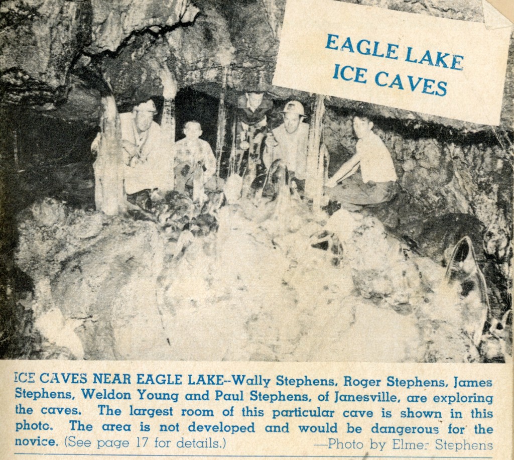
The ice caves was featured on the cover of Susanville’s weekly TV guide, August, 1965
Well, it is the middle of summer, and there have been a lot of searches about the ice caves at Eagle Lake. Without further ado, here is a prior post on that topic for your Tuesday Tidbit.
Exploring lava beds, which there is plenty around Northeastern California, there is no telling what a person might find. The Brockman Flat Lava Beds on the west side of Eagle Lake is no exception.
In the early 1950s the Chico State Biological field study set up operations at Spaulding Tract, Eagle Lake. It was in the summer of 1951, that several students explored the lava beds to the south of Spauldings and made their initial discovery of a ice/lava cave.
In 1954, John Wesley Noble penned an article in Collier’s Magazine, The Lake That Time Forgot. The article featured many peculiarities found at Eagle Lake. Noble wrote: A group of Chico graduate students were exploring a huge shore side cavern where Indian tribes hid from avenging white men. Suddenly the biologists’ flashlights flickered on a buff colored insect crawling over the icy black rocks. They captured it, but neither their biology professor nor local 0ld-timers could tell what it is.
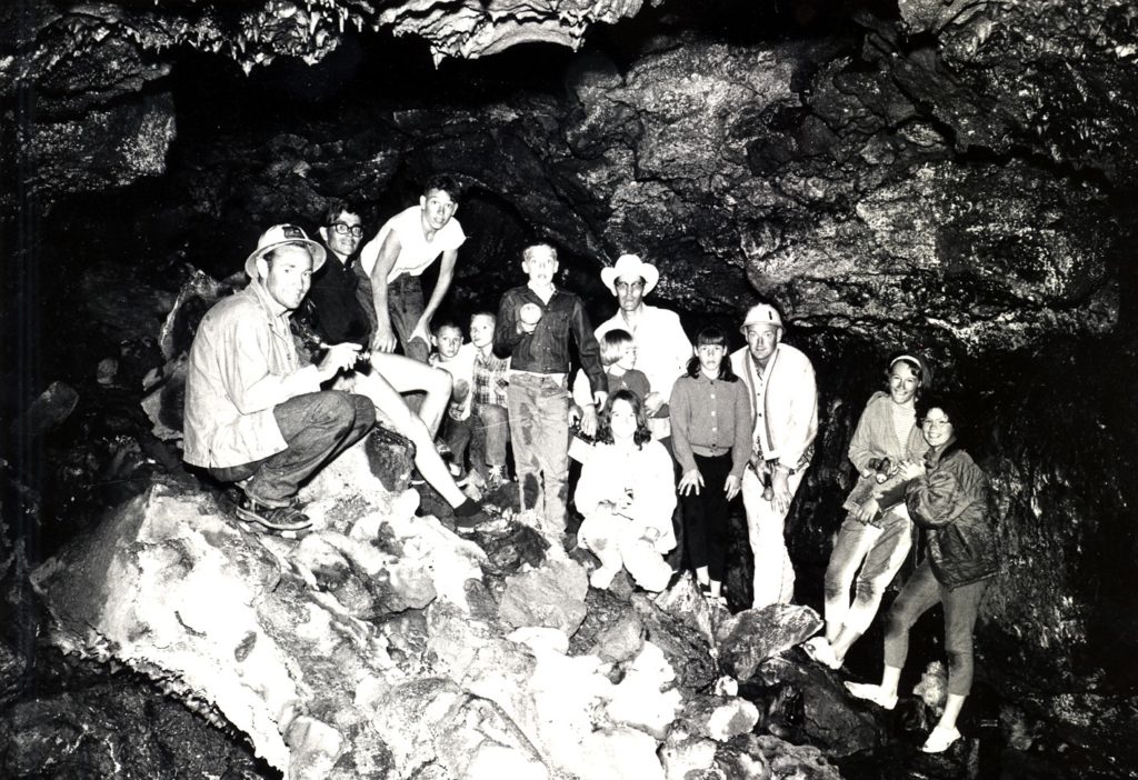
Interior view of an Eagle Lake ice cave, 1966.
“Weeks of research finally identified the insect a member of gryllobottoda, a rare ice age cricket-cockroach which lived in America when Pleistocene ice sheets covered more than half the continent. No one seems to know what the insects eat in the icy dark caverns. They should have been sensible and departed when the glaciers receded 20,000 years ago. But here they are, living their refrigerated lives in the caves near the lake.”
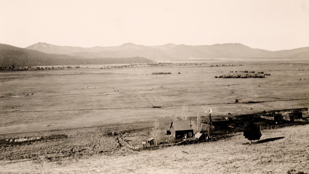
Lower portion of Willow Creek Valley, 1926. Courtesy of Lola L. Tanner
The Civilian Conservation Corp camps generally had a population of roughly 200 men. For some outposts, such as one of Secret Valley, they encompassed a lot of territory. It was not uncommon to establish a seasonal spike camp, comprising between 40-50 men. In In May, 1936, one of these spike camps was located in the Willow Creek Valley, some twelve miles north of Susanville.
This Willow Creek Camp had three main objectives—rebuild the existing telephone line, 20 miles road work and spring development. Work was done on three springs, Hagata, Morgan and Pete’s. They. noted that Hagata Spring had a flow of seven to ten gallons per minute. Of a somewhat interesting footnote, woodpeckers caused great damage to the telephone poles.