Tag Archives: Natural History

Lassen County – Willow Creeks

Upper Willow Creek, 2013. It was this creek that the various promoters of Eagle Lake project were to use the natural channel to deliver water to the Honey Lake Valley.

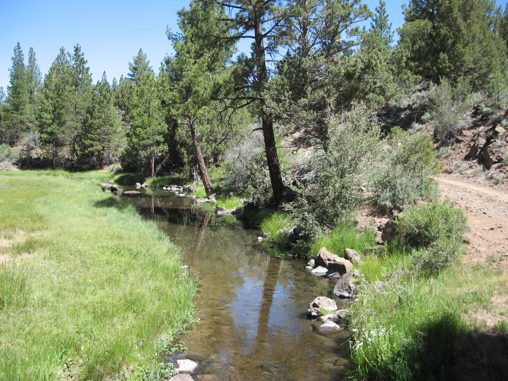
No, it is not a typo, but just to point out that in Lassen County there are three Willow Creeks, and over 200 in the State of California. It is also interesting all three Lassen County Willow Creeks flow in a different direction.  First you have Willow Creek in the northern portion of the county, with its headwaters near Hayden Hill as a reference point and flows in a northerly direction. The second Willow Creek begins on the east side of Eagle Lake and flows in a southeasterly direction. The third Willow Creek, the shortest of the the three is located near Doyle and flows in a easterly direction.  This creek, though of late, has been dubbed Willow Ranch Creek, to distinguish it from other Willow Creeks, and so named from the historic Willow Ranch, which is another story.

Never miss a tale, click here.

Eagle Lake – Pelican Point

Pelican Island, 1916, D.m. Durst

Depending upon the water level of Eagle Lake, it can be an island. The pelicans at the lake were a popular early day attraction, though others perceived them and the cormorants (sometimes referred to as shags) detrimental to the lake’s fishery. At sundry times the birds were slaughtered, their nests and eggs destroyed. A prime example is found in the columns of the Lassen Weekly Mail of June 11, 1892: “In Eagle Lake there are two islands (Pelican and Shag) on which large numbers of fowl, known as Pelican and Shag, build their nests and rear their young. The consequences are that vast numbers of fish from the lake are destroyed each year for food for the young birds. Recently a party visited these islands and killed the young birds and a good many of the old ones, hoping by means, if continued persistently for a number of years, to prevent the yearly destruction of the fish of the lake.”

Shag Island, 1916. D.M. Durst

P.S. Some may be interested in the May issue of the Northern California Traveler is my story about the Eagle Lake Bass.

Never miss a story, click here.

Inspiration Point Tour

Inspiration Point
Inspiration Point, 1930s.

The long delayed tour of Susanville’s first park is scheduled for Wednesday, May 18, so save the date!For those wishing to attend, please leave a comment below or contact me.  Details about time, etc. will be emailed to the attendees. If there is enough interest, a second tour could be scheduled during the summer on a Saturday morning.

Yours truly conducting a preliminary tour at Inspiration Point, April 1, 2016. Photograph courtesy of Annie Henriques Blank

Inspiration Point provides a great vista to discuss the region’s natural history ranging from Lake Lahontan to the region’s earthquake past which had affects of mining on Diamond Mountain to the local stone quarry.  Of course, let us not forget about the city park movement, though at one time back in the 1940s the city gave consideration to subdivide Inspiration Point for homesites.

Never miss a story, click here.

Skedaddle Dam

The dam site, 1916. Courtesy of Betty Barry Deal

The remnants of this dam straddle the California-Nevada border, and it is an impressive historical site. On May 25, 1889, William A. Clark filed a claim to all the water of Skedaddle Creek to irrigate the sagebrush lands of eastern Honey Lake Valley. To accomplish this, Clark proposed to dam the creek at the “narrows.” The dam would span the canyon some two hundred feet and be 126 feet in height. To fund the project, Clark formed the Honey Lake Water Company, and it was incorporated on June 17, 1889. It was estimated that the dam would cost $30,000. Construction of the dam began in October 1889, and it was anticipated that the dam would be complete by the following spring. In November, Company Engineer, Alexander Center, reported that construction had progressed better than expected and that the dam’s height would be raised an additional fourteen feet. It was during that month of November that one of the severest winters on record began. The November and December snows made work difficult and by January work came to a complete halt. Blizzards blanketed the countryside and then followed bitter cold temperatures that sent the thermometer to –30  degrees. Snowstorms continued and by the end of January it was estimated that on the higher slopes of Skedaddle, the snow depths surpassed ten feet! (Normal annual precipitation at the dam site is 7 inches a year, in 1889-90 it received 22 inches). Continue reading Skedaddle Dam

Eagle Lake Water Levels

Pine Creek, April 2, 2016. Courtesy of Annie Henriques Blank

Remember last fall how the weather gurus were predicting a “Godzilla” like El Nino? While the water flows into Shasta and Oroville lakes have been spectacular, the same does not hold true Eagle Lake. You may recall, last October I attended the Eagle Lake Interagency Board meeting, and of course, water levels were discussed. You can review that post here. While the water flow in Pine Creek has been impressive, the lake level has not risen that much. The current lake level as of April 1, 2016 stood at 5092.56. When it reached its historic low last October the level was 5090.60. There you have it the level of the lake so far has only risen two feet.

Never miss a story, click here to subscribe and support.

Coyote Scalps

Coyote Scalp418
rec

In 1880s and 1890s, California began offering a bounty on coyotes at the insistence of the livestock industry. By 1894, the price per scalp was five dollars. The whole procedure was handled through the county clerk’s office.  For some individuals it was a lucrative deal, and could actually make a living at it. Many Native Americans partook in the program, instead of working as a laborer for a rancher. Once the county clerk received reimbursement from the state, the clerk would take the scalps and burn them.

Never miss a story, click here.

n

Skedaddle Creek

Skedaddle Creek, 1922. Carl R. Caudle Collection

This is an interesting stream which has a small drainage area of 32.1 square miles. In times of very wet years, it can be a raging to torrent. There were several proposals to dam the creek, which will be explored in a future column.

Skedaddle Dam, 1992. Courtesy of Ginger Martinez

In 1994, the abandoned Skedaddle dam found a new use. It was used as tee-off for an unusual golf tournament. The one-hole course ended at Chalk Bluffs.  This is one those tales, that needs no further details, but a good time was had by all.

Never miss a story, click here.

Tufa Formations

Tufa formations, Wendel Hot Springs, February 7, 2016

When you start exploring the countryside from Wendel and beyond, one can see a lot of interesting objects. One of the more interesting items are tufa formations. Actually, the Pyramid Lake region has some most spectacular tufa deposits to be found anywhere.

The tufa is composed of calcium carbonate that accumulates from a underwater spring, for an extended period of time. In this case, it was the ancient Lake Lahontan that allowed for the perfect condition for the tufa to form. When the lake receded, then the deposits were revealed.

Never miss a story, click here, and support this site.

Lassen County’s First Zoo

Elk, with the Wingfield residence in the background. Courtesy of Alphozene Terrill

In 1910, George Wingfield established a summer residence south of Susanville, and more about that in a future article. He had a special interest in wildlife and established his own little preserve. That fall, he fenced off eighty acres for an elk and deer park. In 1914, he added four buffalo to his collection. This became a major attraction to local residents to view these creatures.

Wingfield also brought in such “exotic” species as peacocks and mammoth size frogs imported from New Orleans. He had two small lakes constructed on the property to plant with a wide variety of fish.

Where the buffalo and elk roam at Wingfield Ranch. Courtesy of Lola L. Tanner

In 1923 Wingfield sold the property to the Lassen Lumber & Box Company who were primarily interested in the timberland he owned there. The buffalo were shipped to Wingfield Park in Reno where they were on display for many years. The fenced enclosure to keep the elk in was no longer maintained and the animals began to roam the region, with spottings from nearby Bald Mountain to Willow Creek Valley. The elk were poached by hunters over the years, and were wiped out by the early 1940s.

Never miss a story and support this site, click here.

Honey Lake Depths

Honey Lake Regatta, 1987

One of the perennial questions concerning Honey Lake, when it has water,  is its depth. It is a relatively shallow lake, known to go dry for extended periods. There are a number of variables about the depth, due to the fluctuation of the level of the lake. The east side of the lake is the shallowest. Carl Caudle a civil engineer who resided near the lake’s eastern shore from 1909 to 1942 monitored the lake level there. On an average he recorded a depth of two feet. However, in the spring of 1914 and 1938, both years of record breaking precipitation, the east shore had a depth of six feet. The west side of the lake has the deepest points up to twenty-five feet during years of heavy precipitation.

In late December, 1940  Asa Brown and Jack Sawyer, state fish and game employees conducted a sounding of the lake. They started at the northwest corner, using a measuring pole took measurements every 300 to 400 yards. They recorded a maximum depth of 10.8 feet, and the shallowest at two feet. The lake on the average varied between four and ten feet. In the spring of 1987, Mark Totten and several others participated in an informal sailboat regatta on the lake. Using a depth finder, the areas traversed on the lake averaged seven feet.

Never miss a story, click here.