Tag Archives: Honey Lake Valley

Nataqua Territory

Fredonyer’s Claim to what would become Susanville.

On April 26, 1856, twenty settlers in the Honey Lake Valley gathered at Roops cabin and held a “mass convention” to establish a territory of their own.  After all, the group concurred, they were not residents of California and they did not want to be under Mormon domination of the Utah Territory whose boundaries extended to the eastern boundary of California.  They named their new government Nataqua Territory.  Nataqua, or Natauga as it is sometimes spelt, purportedly, was a Paiute word for woman.  Their land grab was grand to say they least.  They carved out a territory, 240 miles long and 155 miles wide, almost two-thirds the size of the State of Nevada.  Ironically, the legal description of their new sovereign state, excluded themselves. Roop’s home, for instance, was located 35 miles west, outside the their western boundary.  The Nataqua Territory, in essence, served as a form of local government to provide an avenue to protect their rights and to handle local land affairs.  The territory served as a foundation until a more formal government was established. In 1857, the Nataqua Territory was abandoned when an attempt was made to form the Territory of Sierra Nevada.
Subscribe

The Island

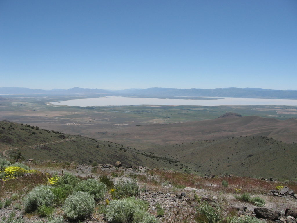
A view of Honey Lake and the “Island.” June 13, 2018

Actually, it is somewhat of a misnomer, as it is actually more like a peninsula. What I am referring to is a large area that encompasses approximately 13,000 acres that is surrounded on three sides by Honey Lake. Between 1905 through 1919, there were numerous homesteads there. In 1911, the Honey Lake Irrigation Company constructed a water pumping plant and several miles of irrigation ditches on the east side of the Island to reclaim the sagebrush lands using water from Honey Lake. The project failed for several reasons. There was a federal court injunction that prohibited the Company from using governmenrt lands as right-of-ways to convey the water. This was a matter that first had to be resolved at the State level. California law had never addressed this issue—how water from a lake with no outlet could be appropriated for irrigation. It took the State two years to render a decision. By the time the legal issues had been settled, interest in the project had waned. Additionally, in 1917, Honey Lake went completely dry.

Donate

Cromwell, Lassen County

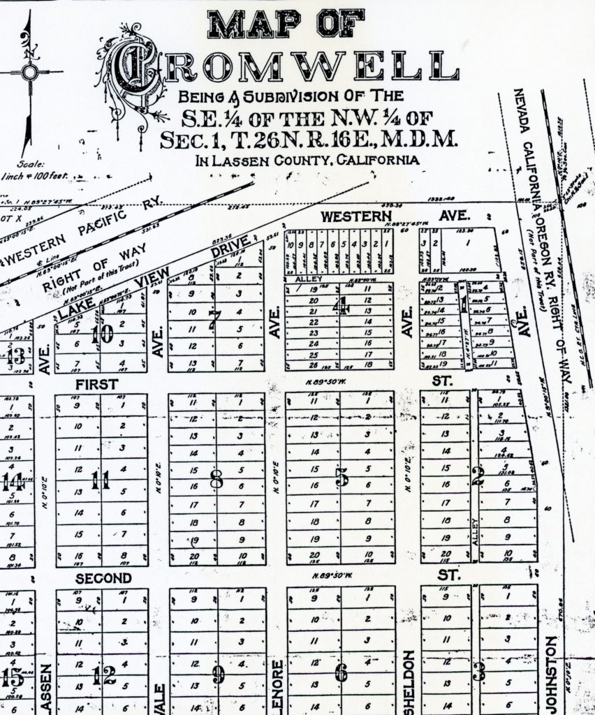
The Cromwell subdivision.

Nearly twenty years after the planned community of Honey Lake City had fallen, another real estate speculator arrived on the scene. In 1909, the place became the junction of the Nevada-California-Oregon (NCO) and Western Pacific (WP) railroads, and that enhanced the site. A location with access to two railroads had appeal for development.  But this place had one drawback—water, or more specifically, the lack of it. Continue reading Cromwell, Lassen County

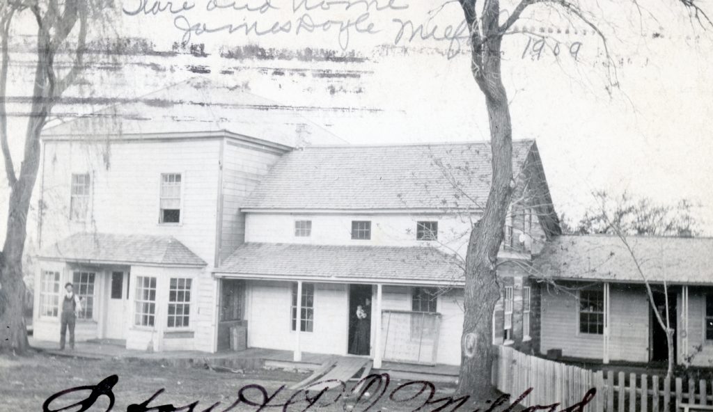
Milford, 1908

The Milford Post Office and Store, 1909. Courtesy of Betty Barry Deal

In 1908, G. Yoell Parkhurst compiled a Lassen County booklet as part of Sunset Magazine’s Homesteader’s Bureau operation. Parkhurst made the following observation about Milford:

“Milford is quaint little village a few miles from the west shore of Honey Lake, and is the post office for some fine orchard and farm lands. The best way to show what may be done here is to tell about James Doyle, one of Lassen County’s oldest and prosperous citizens. He came to California in the early sixties [1860s] by way of the plain route. Arriving in Lassen County in the vicinity of Milford, he saw the possibilities in the land around him, so went no farther, taking up a section of land plowing the soil. Altogether he accumulated a mile and a quarter square of land between Honey Lake and the mountains, all of it being overgrown with sagebrush. This was nearly sixty years ago and today he is one of the wealthiest men in the County, made so by the power of his own energy exerted upon fertile land.

Subscribe

Zarbock Homestead: Then & Now

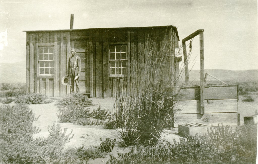
The Zarbock homestead. Carl R. Caudle Collection

It has been awhile since I have done one of these topics. In 1915 Frederick Zarbock filed on a 160 acres of desert land in the eastern Honey Lake Valley, near Stacy. Zarbock, like so many others were lured, that between the dry farming experience, along with assured water supply from the Standish Water Company, the sagebrush plain would be transformed into productive agricultural land. Zarbock would never see the final result as he was drafted to serve in World War I and when he was discharged returned to Minnesota.  Somewhat surprising, while his old cabin is no longer there, the sagebrush did not reclaim his old homestead.

A 2018 sideview.

Those Little Things

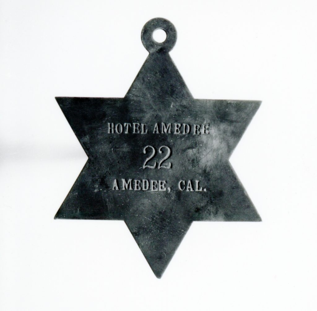
Amedee Hotel Door Room Number

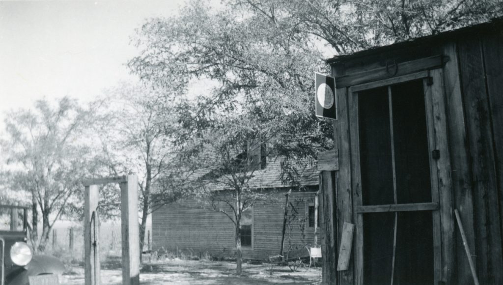
One just never knows what will rise to the surface. This brass marker was used to indicate the room number at the Amedee Hotel.  The hotel had twenty-seven guest rooms, a bar and billiard room, two dining rooms and two kitchens.  The expansive second floor balcony afforded not only views of the Honey Lake Valley, but that of Lassen Peak.

Donate!

Wendel Hot Springs

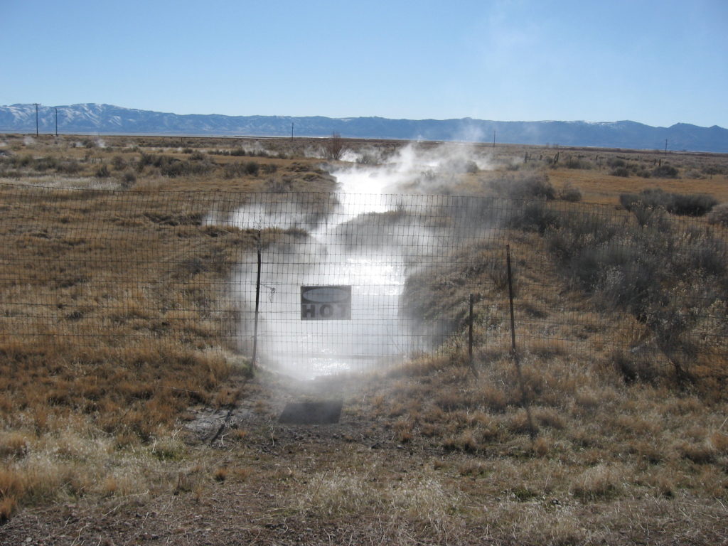
Wendel Hot Springs, February 15, 2018

This is just one of those short musings. Whenever I go out exploring looking for one site, I seem to always stumble something of interest along the way. On the return from an excursion to Stacy, we came back via Wendel. What caught our attention was to see the flow of the Wendel Hot Springs. This had been dry for some years. It turns out one of the turbines using the hot springs is back in operation, and hence the discharge. If anyone can enlighten us about the current operations, I would certainly like to know.

Subscribe!

Fort Sage School District

The Calneva Branch of the Lassen County Free Library, 1920.

In January 1915, the residents of Calneva, a Western Pacific Railroad station in eastern Honey Lake Valley desired the break away from the Fairview School District and form their own. In their petition, they stated nineteen scholars resided in the proposed district. Their request was granted on February 2, 1915 by the Lassen County Board of Supervisors. The new district was named Fort Sage. The school was located in a small one-room building on the Harry Hill homestead. It was later moved to the Aldrich House, a larger building, located in the center of the district. In the summer of 1918, the school was on the verge of being suspended, as enrollment declined to four. The trustees persuaded County Superintendent of Schools, Julia A. Norwood, to keep the school open, as they promised an additional four students would attend in September. The request was granted. The school’s existence was brief and it was closed in 1924. In 1926, the furniture from the school was purchased by the Janesville School District.

Subscribe or Donate

Honey Lake Dumping Grounds

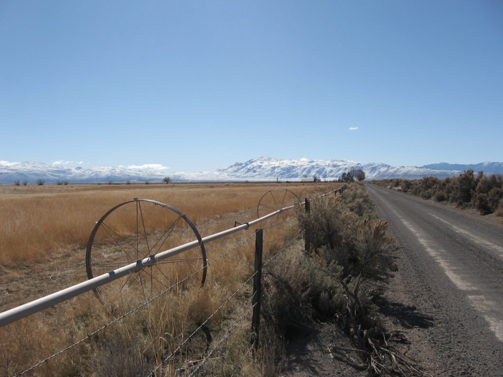
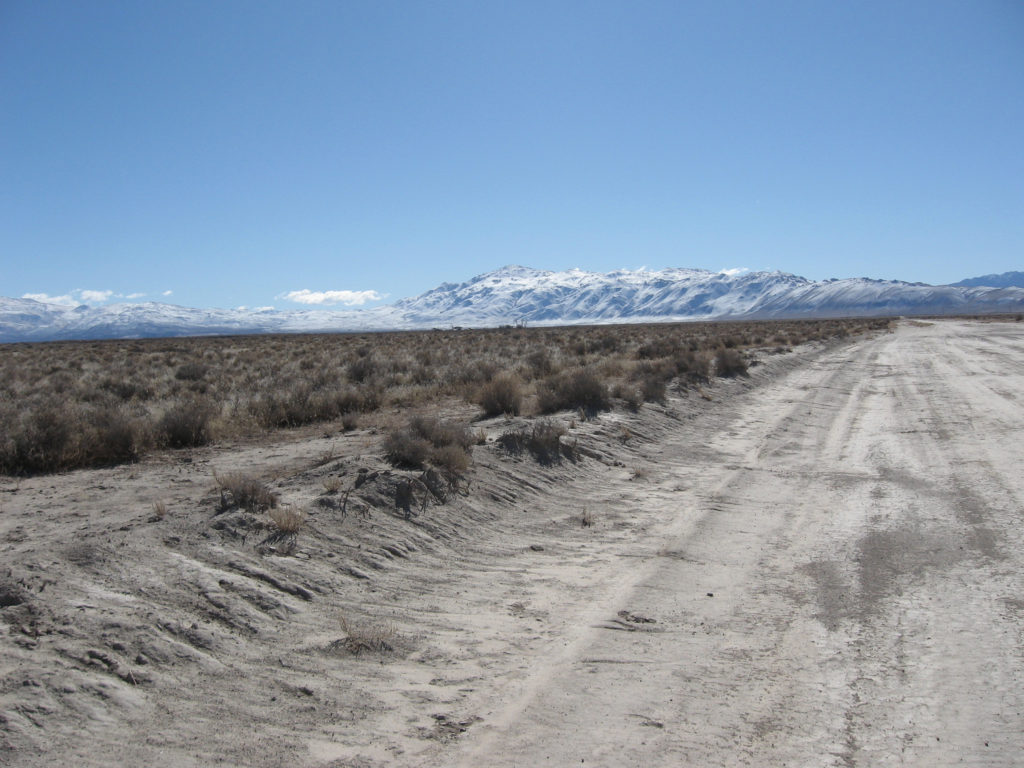
Eastern Honey Lake Valley, February 15, 2018

There have been a lot of things proposed for the Honey Lake Valley, some good and some well not so desirable. In the late 1960s, the City of San Francisco chose the Honey Lake Valley as ideal place to send their garbage. One reasons why Honey Lake Valley was that the garbage  could shipped by rail making it economical.

Of course the locals were not amused and opposition mounted. The debate lasted nearly a decade. In letter to Lassen Advocate’s Open Forum, an incensed Milford resident, Audrey Stevens wrote:

”Lassen County should be declared a disaster area with every citizen joining in a mass to protest the greedy senseless plan to buy 4,500 acres of land east of Herlong for $100,000 (our money) to be used as a dumping ground for San Francisco garbage, which includes rats, disease, smell and ugliness for as long as this earth survives.”

Subscribe.

Rosendale – Lassen County

Amedee, 1913. Courtesy of Tom Armstrong

While today, the east side of Honey Lake may look bleak and barren, it was not always the case and there were numerous attempts to develop it. In 1915, Rosendal Minster envisioned a Scandinavian settlement south of Amedee. Minster had a lease/option to purchase the lands and the pumping plant of the Standish Water Company. He then formed the Farmer’s Land Company to operate the holdings.. The properties were split into 40-acre tracts with a price range of $45 to $65 per acre. The new settlement was named Rosendale. While Minster vigorously promoted the project, but due to debts he quickly accrued, he abandoned it the following year.

Subscribe!