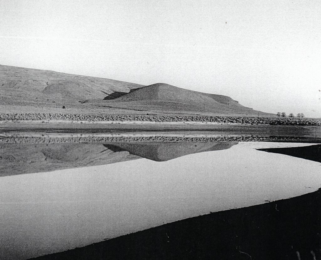
Ward Lake, located about two miles northwest of Litchfield is a man made creation. It was built to store the storm waters of Secret Creek. The first dam was washed out in 1890. A second dam was built two years later. In January 1892, work began using Fresno scrapers to move the earth. In doing so an skeleton was exhumed and believed to be an Indian medicine man. It had been well preserved. It was noted there was a necklace, balls of war paint, beads, a spear head an a knife shaped flint. In addition, what appeared to be two pieces of a deer’s leg with numerous notches. What made this unique were the items found with the skeleton. There had been reports from time to time from farmers while plowing fields to come across skeletal remains, and nothing else.
This article, originally appeared two years ago. However with current coronavirus pandemic, I thought it would be worthwhile to bring, after all for some readers this will be a new material, thus a special Tuesday feature, with an end note not in the original article.
One hundred years ago witnessed the worldwide flu pandemic. It caught many by surprise, and Lassen County, like so many others were not prepared how quickly it spread, nor how deadly it was. In early October 1918 the flu made its presence in the communities of Susanville and Westwood. On October 10, forty-year-old Lassen County Surveyor, Thad McKay, became the first victim. A week later, Dr. F.H. Shanks, Lassen County Health Officer issued a statement that yes, the flu was prominent, but a mild one, and citizens to take the necessary precautions of any health crisis. Everything changed quickly with the death of Stephen F. Watson on October 17, shortly followed by two more members of the Watson family. By early November there were over 300 cases of flu in Susanville, roughly one-third of the town’s population. On November 11, 1918, the City held a special session and ordered the closure of the town’s saloons and other public gathering places. The ban was not lifted until November 20, after a decrease in new flu cases.
It is difficult to determine how many Lassen County residents died from the flu. This is due in part many deaths were not recorded with the Lassen County Recorder. If pressed, I would estimate that nearly 100 deaths occurred in Lassen County that were attributed to the flu during 1918-19.
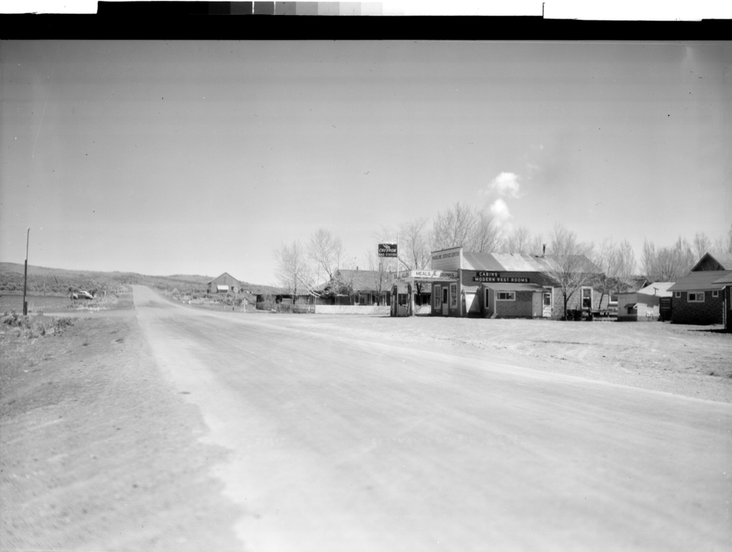
Madeline, Lassen County, 1948–Eastman Collection, U.C. Davis
In the late 1920s, the Southern Pacific Railroad was in a disarray locally, while they fought against the Western Pacific/Great Northern’s Inside Gateway link between Keddie and Klamath Falls. The Southern Pacific had a monopoly on the region and were in a constant flux to combat its proposed competition.
Take for instance in 1929, Southern Pacific greatly reduced its freight rates on timber products. In November 1929, Southern Pacific sent a survey crew out east of the town of Madeline. The surveyors job was to locate a possible line from Madeline eastward through Red Rock Valley and Tuledad Canyon with the ultimate goal towards Gerlach. This officials concluded that this 72 mile route, would save 120 miles to the Klamath Basin. Of course, it was never built, and in 1930 the ICC approved the competitor’s route.
A view of Susanville’s Memorial Park from Main Street, 1947
The creation of a municipal park was fraught with numerous hurdles. Actually, the park movement began long before the creation of the City of Susanville.
By the 1920s, the ideal location for a park was the meadow land east of Weatherlow Street to Grand Avenue with Main and North Streets rounding out the boundaries. This was problematic for the City of Susanville, since it was outside the city limits. A proposed City and Lassen County Park District seemed a like a solution. Besides the city, the district would encompass subdivisions to the east such as Halltown, Milwood Tract and Lassen Townsite. It was met with fierce opposition by county officials. At the December 1929 Lassen County Board of Supervisors, the matter went to a sound defeat of 4 to 1.
The City never gave up, and when the property was annexed to the City in 1947, the park became a reality.
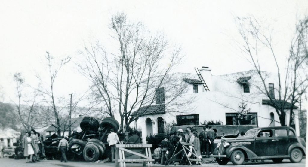
The wreck of April 24, 1944 at Pine and Cottage Streets.
One never know how scenarios may turn out. A perfect example was when an oil truck over turned at the west entrance of Susanville near noon time on April 24, 1944. Fortunately, the driver, 27 year-old Hayward resident, Donald Fedick, escaped without injuries. The truck and fuel tank were totaled, a loss estimated at $12,000. The fuel tank spewed forth 6,000 gallons of fuel oil down the gutters of Susanville. Consider it a miracle, especially when one takes into consideration how prevalent smoking was then, that a stray match or cigarette was not tossed into the gutter setting off a massive blaze.
Established in 1917, Sacred Heart Church’s St. Patrick’s Dinner is the longest continuous event in Lassen County. Of course, anything that has staying power for over a century has undergone changes. A case point is that a number of different church organizations that has sponsored it over the years. In 1955, it was the Catholic Ladies Altar Society who were in charge. That year, it was held on Sunday March 13 at the Lassen County Fairgrounds. The menu was a Italian style dinner, as in previous years, that included appetizers, salami, Italian peppers, olives—a dinner of spaghetti, roast beef, tossed salad, cake and ice cream.
Harvey Valley is located in the north central part of Lassen County about half way between McCoy Flat Reservoir, to the south, and Big Valley to the north. It was so named after various members of the Harvey family—George, James, Mary, Nettie, Samuel, Silas and Thomas—who were residents of Adin and Hayden Hill and in 1906 filed timberland locations which a mountain and valley were named for after them.
One of the very first ranger stations on the Lassen National Forest was located there. R.H. Abbey, the first ranger to occupy the station wrote in his diary: “This station house was a cheaply constructed 1 large room house, 14 x 16, with 2 windows. It was built out of thin shiplap lumber with roof of same material. It was equipped with a very small cook stove and homemade bunk for a bedstead.”
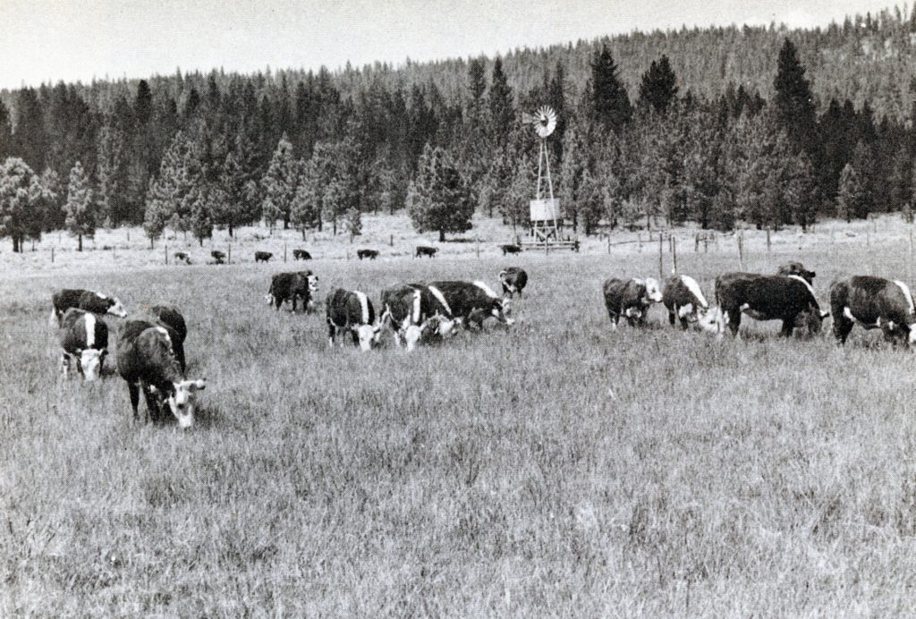
In 1936, Harvey Valley became a focal point in a government study to improve and maintain grazing capacity. Noted range scientist, August L. Hormey, conducted his experiments on livestock grazing. This was where the rest-rotation grazing system was developed.
Yet, there is more to the story of this remote locale. In 1948, the Lassen National Forest and California Department of Corrections established Inmate Camp No. 21. The camp consisted of 58 inmates from Folsom Prison who were supervised by ten forest service personnel and four state guards. The inmates were trained as a “Hot Shot” firefighting crew. When not fighting fires, the inmates worked on various conservation projects from soil erosion to improving timber stands. It operated for sixteen years.
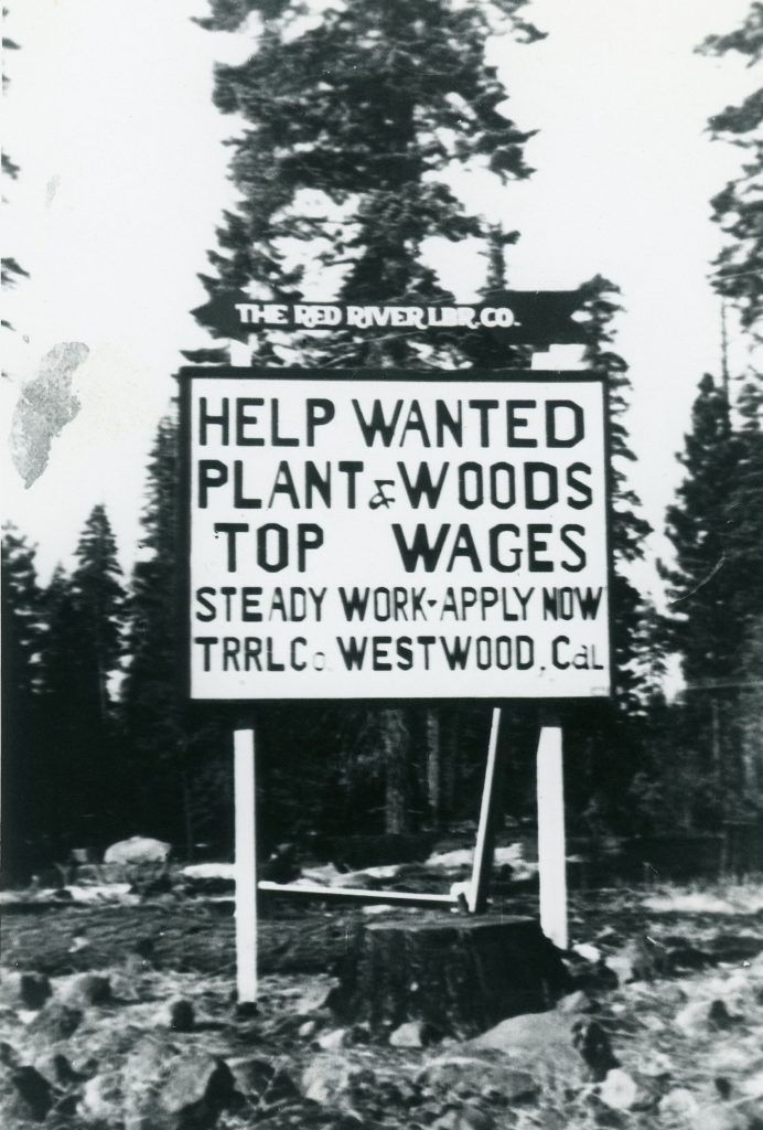
Red River Lumber Company had a large employee turnover.
The Industrial Workers of the World (IWW) and sometimes referred to as the “wobblies,” is a labor organization that formed in 1905. As a matter of fact, certain Starbucks shops are affiliated with it. The IWW had an image problem in its early years. Some considered it radical in its thinking for the time. Others considered it a communist organization. It gained notoriety for its strikes that were marred with violence.
The biggest problem IWW faced in Lassen County was that all three big lumber companies paid the prevailing wage, if not above, and provided better housing than found in other regions on the west coast. The employees had few grievances, so there was no incentive to be a part of the labor movement. It was because of these conditions that Lassen County sawmills remained union free during the 1920s.
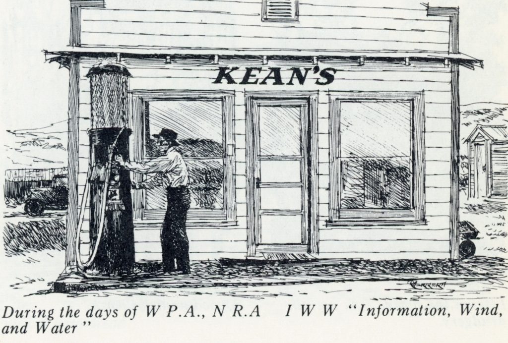
A sketch by R. Herrera from the early days of the Madeline Plains
In the 1930s witnessed Franklin Roosevelt’s economic recovery program for the nation, which brought about with it a whole new terminology. It could actually be called alphabet soup, with such acronyms as the Civilian Conservation Corps (CCC), National Recovery Administration (NRA) and the Works Projects Administration (WPA). In Margaret “Peg” Woodrich’s small booklet about the history of the Madeline Plains, she added the whimsical non-existent program Information, Wind and Water (IWW).
A view of Diamond Mountain, from Lassen High School’s agriculture fields, 1916. Courtesy of D.M. Durst Collection
Early in the history of Lassen Union High School did stress an emphasis on agricultural, after many of its students were part of the ag community. In the 1930s, it had expanded the program. On Wednesday, April 29, 1936, E.F. McCarthy, the high school’s agricultural instructor held a visiting day for the public to the student’s experimental farm.
In a statement by McCarthy: “Irrigating of alfalfa has occupied the attention of the students during the past several days. Work at the farm had progressed rapidly and various projects have reached the stage where those who inspect the farm on visiting day will obtain a clear insight into the work being done.
“Seven hundred chickens including 250 New Hampshire Reds and 450 White Leghorns were recently received and the study of poultry has now been added to other subjects included in farm experimentation and demonstration. The farm already has been stocked with hogs and calves for study purposes.”
Back in November when I was at Rosewood Rehabilitation in Reno, I did have access to a computer. Not to be accused of a being slacker, with my “down time” I carried on the best I could do with the daily post.
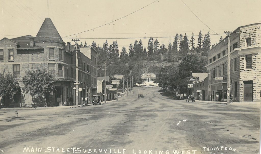
Lo and behold I came across this interesting postcard of Main Street, Susanville, 1915, even though it has a 1920 postmark. It is a P. J. Thompson photograph, and I have always enjoyed his photographic work.
The reason why I know the photograph was taken in 1915, is that the Emerson Hotel was destroyed on August 5, 1915. Across the street from the Emerson is the Knoch Building. It was not until the fall of1914, when the third story of Knoch Building was added. With that structure saw the installation of the town’s first elevator. In addition, it had to be taken some time in the spring or summer of 1915 as there is foilage on the trees.