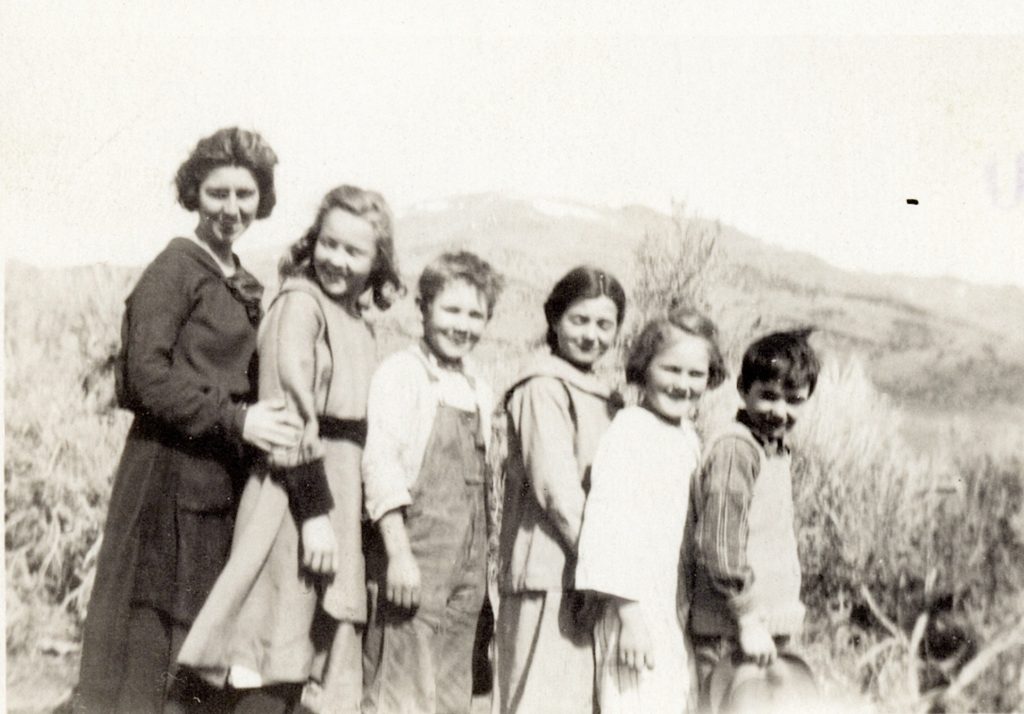
Tule Mountain School-Left to Right: Teacher from Winnemucca Ranch, Leslis Olds, Albert Olds, Jennie Guichu, Martha Olds and Steve Guichi—Caudle Collection
This is an introduction to tomorrow’s post. The Pyramid School District in Washoe County was for a simple way to describe its location was between Constantia and Pyramid Lake. Tule Mountain a natural dividing barrier separating the two families that had children—Benoist and Olds.
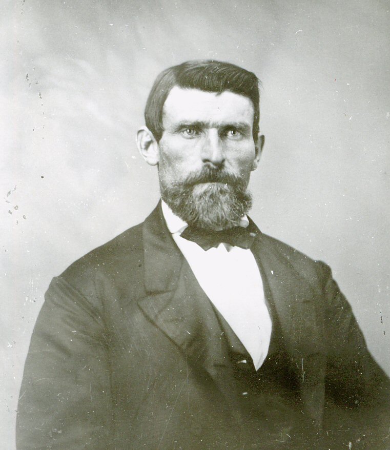
When A.J. & Sarah Olds took up a homestead there with a brood of five young children, a school was going to be a necessity. However, the nearest the school was on the other side of Tule Mountain at the Benoist Ranch and Mrs. Benoist was not going to budge about relocating the school.
I can not do the story justice as to how Benoist and Olds came to terms. Sarah Olds in her book Twenty Miles From A Match provides such an entertaining account. Tomorrow, I will provide an introduction to this delightful book.
Back in the mid-1990s, Don Manuel, the BLM archeologist and myself as a historian, conducted tours involving prehistoric and historic sites. It all began during Archeology Week during the month of May. The first one was so popular, we did several throughout the summer. For the next several years we did multiple tours—even a special east side Eagle Lake tour, though that was not with Don, but Stan Bales.
The tours had several purposes. One to introduce people to BLM lands and the opportunities of the various places to explore on their own. Equally important was to educate individuals about the importance of preservation of sites. Stops at archaeological sites that had been disturbed/vandalized provided was an opportunity to highlight the message.
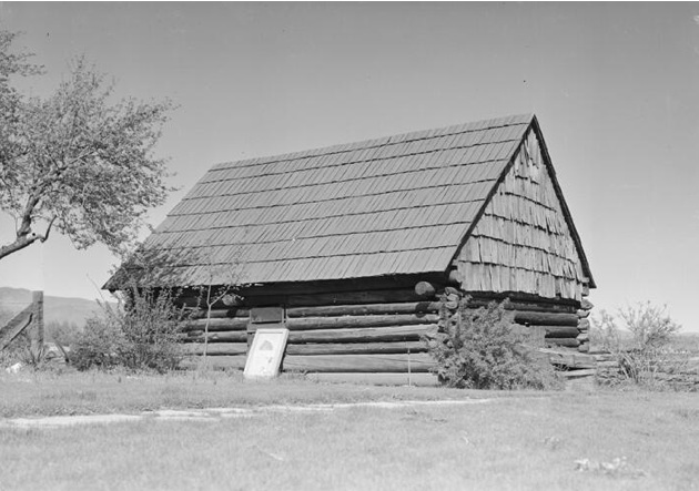
An abandoned homestead near Sheepshead in the Smoke Creek Desert, 1996.
Historical sites as well are subjected to vandals and such. One year I pushed to include Great Basin Architecture of abandoned homesteads, knowing full well the elements of Mother Nature would reclaim the property, so it was a rare opportunity to be included. BLM said no, and now the buildings are gone. To be quite honest this ticked me off. The BLM personnel involved in the tours were paid, I received no compensation, but I was half of the tour composition. Enough of my ranting.
From time to time I am asked if the tours can be revived. Those inquiries I relayed to BLM, while receptive, they were non-commital, and the last time was three years ago, but I never heard back.
Virginia Street Bridge, Reno—Nevada Historical Society
For over a century the crossing of the Truckee River at the approximate location of the Virginia Street Bridge had always been attributed to Myron Lake back in 1861. Tucked away in the archives of Lassen County, would require the earliest history of Reno to be revised.
In the fall of 1859, Charles William Fuller built a toll bridge and small hotel at the approximate sight of today’s Virginia Street’s bridge in what would become the nucleus of Reno. Fuller saw the opportunity as the farmers/ranchers of Honey Lake & Sierra Valleys were eager to feed the miners of the newly discovered Comstock. On September 28, 1861, Fuller traded this property for a ranch in the Honey Lake Valley with Myron Lake. In 1868, Fuller filed for bankruptcy. In Schedule A of that proceeding provided all his activities until that time. The trading of the property is recorded in Book A, Page 27, Deeds of Lassen County.
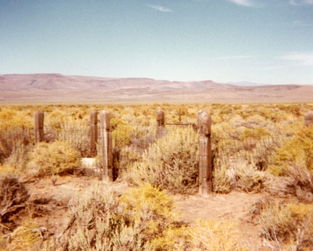
Buffalo Meadows Cemetery, Smoke Creek Desert, Nevada, 1984
After reading yesterday’s post, I realized that I neglected a third Susan for whom some thought Susan River was named for. According Asa M. Fairfield he noted that an immigrant girl by the name of Susan DeWitt died near the Buffalo Meadows Salt Marsh in the Smoke Creek Desert. She was buried near there, but whether her grave was incorporated into the Buffalo Meadows Cemetery, I do not know. Fairfield went on that some thought that it was this Susan for whom the Susan Riverwas named for. By the way, if anyone has information on this particular cemetery, I would certainly appreciate it.
This was a short-lived station on the Nobles Emigrant Trail. It was located a few miles east of present day Gerlach, Nevada. During the 1850s, stations/trading post along Nobles were few and far between. This was particularly the case through the Smoke Creek and Black Rock Deserts. A lot of this was attributed to hostilities between the Indians and Anglos, which culminated into the Pyramid Lake War of 1860.
This changed in the early 1860s with the discovery of the Humboldt mines that created such towns as Star City and Unionville. With the increased traffic on the route, Lucius Arcularius and Andrew Litch saw a lucrative opportunity to establish an outpost at Granite Creek in 1862.
In early March 1865, Arcularius left Granite Creek for a trip to Susanville. He did not make it very far, being ambushed by Indians only several miles to west of Granite Creek. When he was a no show in Susanville, a posse went in search and found his body covered by brush, his clothing removed. Arcularius’ body was brought back to Susanville for burial.
A few weeks later, Litch needed to leave the Granite Creek Station to handle some of his late partner’s affairs. Litch recruited A.J. Curry, Cyrus Creele and Al Simmons. Some time around April 1, 1865 witnessed what was referred to as the “Granite Creek Butchery”. All three men stationed at Granite Creek were slain by the Indians and the station burned down. A complete account can be found in Asa Fairfield’s Pioneer History of Lassen County. Litch would relocate in the Honey Lake Valley, where he remained until 1883, when he moved to Reno, though he retained his ranch, where his daughter and son-in-law Clara and B.F. Gibson would reside.
From time to time, I am asked about the Sagebrush War. While there are various accounts that go into great detail—even one person wrote a thesis about it—I will provide a simple version. The conflict also known as the Boundary War which was the result of John C. Fremont’s selection in 1850 of the 120th Meridian for California’s eastern boundary. The problem was no one knew where that was, and assumed it followed the crest of the Sierra Nevada Mountains. In the late 1850s, with the settlement of the Honey Lake Valley, officials of both California and the Nevada Territory, saw the uncollected tax dollars waiting to be had. Tensions escalated wherein an armed conflict on February 15, 1863 from the two states took place at Roop’s old trading post, in Susanville, which became dubbed as Roop’s Fort, but also known as Fort Defiance. In the end a truce was called when both sides agreed to conduct a boundary line survey to locate the 120th Meridian, in which it was determined the majority of the Honey Lake Valley was located in California. The outcome for the Honey Lakers was a draw, while they failed to become a part of Nevada, they at least prevailed with the creation of Lassen County.
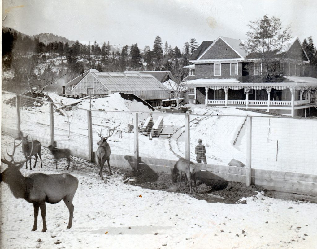
George Wingfield (1876-1959) for whom Wingfield Road is named for, was very prominent in the affairs of Nevada. He made his fortune in the early 1900s in the Goldfield, Nevada mines. By 1907 he had an estimated worth of $25 million. What distinguish Wingfield from his counterparts who met with incredible wealth from Nevada mines, is Wingfield remained in Nevada and made considerable investments in the state. He was also a formidable power player in Nevada politics. Wingfield also established a banking empire in Nevada, though he would nearly loose everything in the Great Depression. Wingfield would make a second comeback with the Getchell mine near Winnemucca.
In 1910, Wingfield purchased the Clint DeForest property at the base of Diamond Mountain for a summer home. It is known today as Mountain Meadows Ranch. It was an elaborate estate complete with a wildlife preserve. What is interesting when one considers the amount of money spent developing the property, and enormous cost of yearly maintenance, he did not spend that much time there. In 1923, Wingfield sold the property to the Lassen Lumber & Box Company.
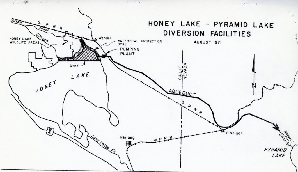
In 1969, the Pyramid Lake Task Force was established to seek solutions concerning the shrinkage of Nevada’s famous desert lake. In 1971, the Task Force submitted a proposal to Lassen County officials for their consideration. They obliged. The plan called for the exportation of 50,000 acre-feet of Honey Lake water to Pyramid Lake. The two lakes, both remnants of Lake Lahontan, are relatively close, though Honey Lake is 190 feet higher in elevation. It was their intention to dry up Honey Lake, except in the northeast corner. There a 4,700-acre freshwater reservoir would be created for a wildlife sanctuary. Adjoining it would be a holding reservoir with a capacity of 27,000 acres. A pumping plant would be built near Amedee, where the water would flow through a twenty-four mile long aqueduct to Pyramid Lake. The Task Force considered this plan the most feasible of all considered. Construction cost was estimated at $12 million, with an annual operating cost of $200,000. This did not include any litigation fees with affected properties for rights-of-way or damage payments to lakeshore owners. The adverse effects of Honey Lake being permanently dry drew heavy criticism from the local residents. The lake is enjoyed for its aesthetic beauty when full. When the lake is dry, it is a scene of numerous dust storms. Opponents were also concerned with the loss of humidity and its effects on agricultural crops. At a November 8, 1971 public hearing the Lassen County Board of Supervisors passed a resolution opposing the project. After all these years later, the problems with Pyramid Lake’s water level still has not been solved.
A portion of Marith Reheis 1999 U.S.G.S. Map of Lake Lahontan
Maybe you are aware of the Lahontan Regional Water Quality Board that has a lot of influence on water issues in Lassen County. If you are more Nevada oriented, you might be familiar with Lake Lahontan, a reservoir near Fallon, Nevada. Continue reading Lake Lahontan Explained→
This is brought to you by Greg Johnson, who made the expedition to Shinn Ranch on January 9, 2021. He was not only kind enough to share the photographs he took, but was gracious to give me permission to share. Thank you, Greg!
Shinn Ranch is located in a remote part of eastern Lassen County—you either know it or never heard of it. Believe me, it is not place where one would make a casual Sunday drive to visit. Shinn Ranch is not far from the Nevada border and upper Smoke Creek. It was so named for fifty-year-old Oliver Shinn who located there with his family in 1870. This is a very remote location and how Shinn found it, and why he settled there remains a mystery. As Johnson, during his visit, pondered while he accessed the ranch on a ATV, the Shinn family had no such luxury. To obtain provisions required a trek to Susanville via horseback and/or wagon.
Shinn Ranch, January 9, 2021—Greg Johnson
In 1884, Oliver Shinn died there and later that year, his widow, Louise sold the ranch to the Winters family, who had extensive ranch properties in western Nevada. In 1889, George Winters planted a grove of Cottonwood trees that has had been a stand out feature of Shinn Ranch.
Portion of the Cottonwood grove at Shinn Ranch, January 9, 2021—Greg Johnson.