This small man-made lake is located approximately two miles east of the Eagle Lake Summit. In the late 1940s, the Paul Bunyan Lumber Company began logging operations in the region including Gallatin Peak and Round Valley. One of the company’s employees, Jim Coleman constructed a small dam on Piute Creek, near its headwaters. The small lake supplied the water used to wet down the logging roads, controlling the dust. It should be noted some maps have it spelled as Colman Lake.
Awhile back I received an interesting question about Honey Lake and the latest theory why the lake goes dry. More on that later.
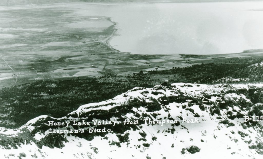
In 1859, the settlers of Honey Lake were taken back when Honey Lake went dry. After all, in 1856, Isidore Meyerwitz and his Indian wife drowned in the lake while boating. Of course, various folks came up with theories as how this natural event came to be. One was a mythical creature Guyas Cutas that swallowed up the lake. The Quincy newspaper the Plumas Argus stated it was remarkable a lake 20 miles wide and 40 miles long should disappear in such a “inexpressibly short time.” Many agreed that the most logical one was the water sunk into vast fissure under the lake caused by an earthquake. It is interesting to note that no earthquakes had been reported in the area.
Honey Lake, June 26, 2021—Larry Plaster
This brings us full circle as to the latest theory I was told.by a former Herlong resident of the 1960s who was told the eruption of Mt. Lassen sucked Honey Lake dry. This is a new one for me.It should be noted that during the eruptions of 1914-1917 Honey Lake remained full. Then, of course, Chester residents believed that the filling up of Lake Almanor caused Mt. Lassen to erupt in the first place.
In reality, in wet years the lake is full and dry years, well the lake goes dry.
An Eagle Lake ice cave, circa 1916. Courtesy of Wyn Wachhorst
With this current hot spell, I decided on a cool topic. In 1915, the Lucky Land of Lassen was a pamphlet that produced and distributed at the Panama Pacific International Exposition that was held in San Francisco. Of course it extolled all the wonderful virtues that Lassen County had to offer.. Of notable hightlight, it contained one of the earliest accounts concerning the lava beds and ice caves of Eagle Lake. This what the brochure contained:
“To the west of Spalding lies what is known as the ‘Lava Bed country’ about seven miles long and three or four miles wide. This is the wildest region in this section, and excepting the vegetation, it is almost as when the lava first cooled. It is full of caverns, wells and cracks, one of the latter being five miles long and three to twenty feet wide. In one place it has been sounded to a depth of 160 feet and no bottom found. In this crack there is an ice cave where plenty of ice may be obtained any year until August and some years throughout the entire summer.”
Many may not know Leavitt Lake was natural water basin. In 1863, when Government Land Office surveyors came across it, they dubbed it Alkali Lake. The following year, Ben Leavitt located to the west of it. Many consider Leavitt the father of the Susan River Irrigation System. A portion of it still survives as the Lassen Irrigation District.
In 1875, Benjamin H. Leavitt transformed Alkali Lake into a small reservoir by diverting water from the Susan River to that place. In 1889, the reservoir was enlarged. When construction was underway, Victor E. Perry, Leavitt’s son-in-law, worked on the dam. Perry planted a gold nugget there and when it was discovered it caused great excitement with the other workers. Leavitt informed the construction workers that they could keep whatever gold they might find, as long as it did not interfer with the construction. With that incentive, the men worked twice as fast to build the reservoir, in hopes of locating more gold, that unbeknownst to them would never be found. It should be noted that also in 1889, Leavitt was instrumental in the construction of Hogs Flat and McCoy reservoirs.
An interesting footnote, in times of extremely wet winters. it has been documented that the Leavitt Lake receives enough run off from Bald Mountain to fill it.
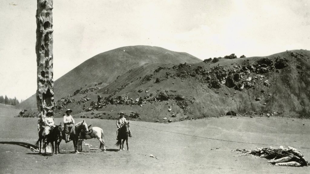
Long before the Lassen Peak eruptions of 1914-15 there were reports of other volcanic activity in the region. It was said that Cinder Cone, ten miles east of Mount Lassen, had erupted during the winter of 1850-51.
These purported eruptions caught the attention of San Francisco physician Harvey W. Harkness, who had a keen interest in scientific matters. In the summer of 1874, he visited Plumas County. While there he heard the story of a recent volcanic eruption located in a far northern portion of the county known as Cinder Cone. Since he was already in the territory, he decided to examine Cinder Cone. In the fall Harkness addressed the California Academy of Sciences and told of his observations. He informed the Academy that the eruption there was indeed of recent origin. After his presentation, he came in contact with four men who had seen the eruptions from afar. One of these men was Oliver Wozencraft, who lived near Red Bluff during the winter of 1850-51. He informed Harkness that he saw a great fire east of Lassen that continued for many nights but never changed its position.
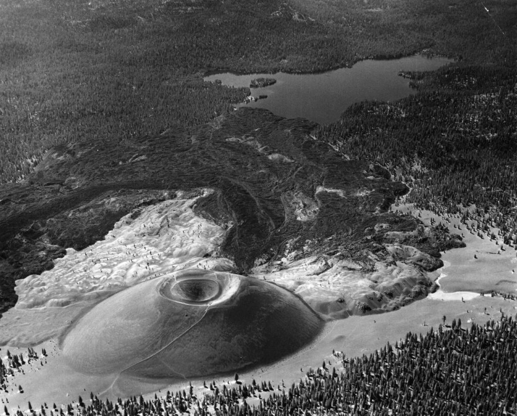
Cinder Cone, 1967–National Park Service
After Harkness’ findings were published, it served as a reminder to many that a volcanic eruption could be impending. It was not for decades that Harkness’ theory was challenged. The whole issue has been resolved only within the last decade by the United Stated Geologic Survey, which determined that Cinder Cone’s last eruption occurred sometime around 1666, not 1850.
Bass fishermen at the south shore of Eagle Lake, 1914.
Having been a long time observer of local politics, I am past the stage of shock and awe. Every now and then in my research I come across some things that leave, well just plain dumfounded. Today’s topic is one them.
For unknown reasons on April 28, 1924 the Lassen County Board of Supervisors held a special session—the agenda item to ban fishing. The supervisors gave no rhyme or reason why such action was needed. It did not stop them from proceeding. They drafted an ordinance and they would adopt it at their regular meeting on May 5.
Camp 38, Red River Lumber Company at Lake Almanor circa 1925—Hank Martinez
The California Division of Fish and Wildlife was not amused. They informed the county supervisors the matter was unconstitutional. In addition, their local game wardens were told not to enforce it. The local nimrods were not pleased either and they let their voices heard. Needless to say when the board of supervisors held their regular meeting, the matter was tabled.
Note: In 2011, the first appearance of a gray wolf was reported in California. Prior to then, the last gray wolf in California was trapped in Lassen County in 1924.
At first I was going to do a condensed version of the account, but the Lassen Advocate had such a compelling story that I decided to transcribe it.
Lassen Advocate, Susanville, California, June 13, 1924 1;4 “Frank Koehler Gets Large Gray Wolf, June 12 – Frank W. Koehler, United States hunter and trapper had a thrilling experience yesterday afternoon when he encountered what is now almost an extinct species of animal in the United States, especially in this part of the country.
“June 2, Koehler had been called by G.E. Seeber at Litchfield to help him out as the coyotes had killed 50 of his young turkeys. That day Koehler set out seven settings of three traps each and returning to his settings on June 7 found that he had caught a coyote but he had broken away and escaped. He set his traps in the same place and yesterday afternoon returned to see what had been happening.
Horse Lake, 1916, photograph taken by William Wales
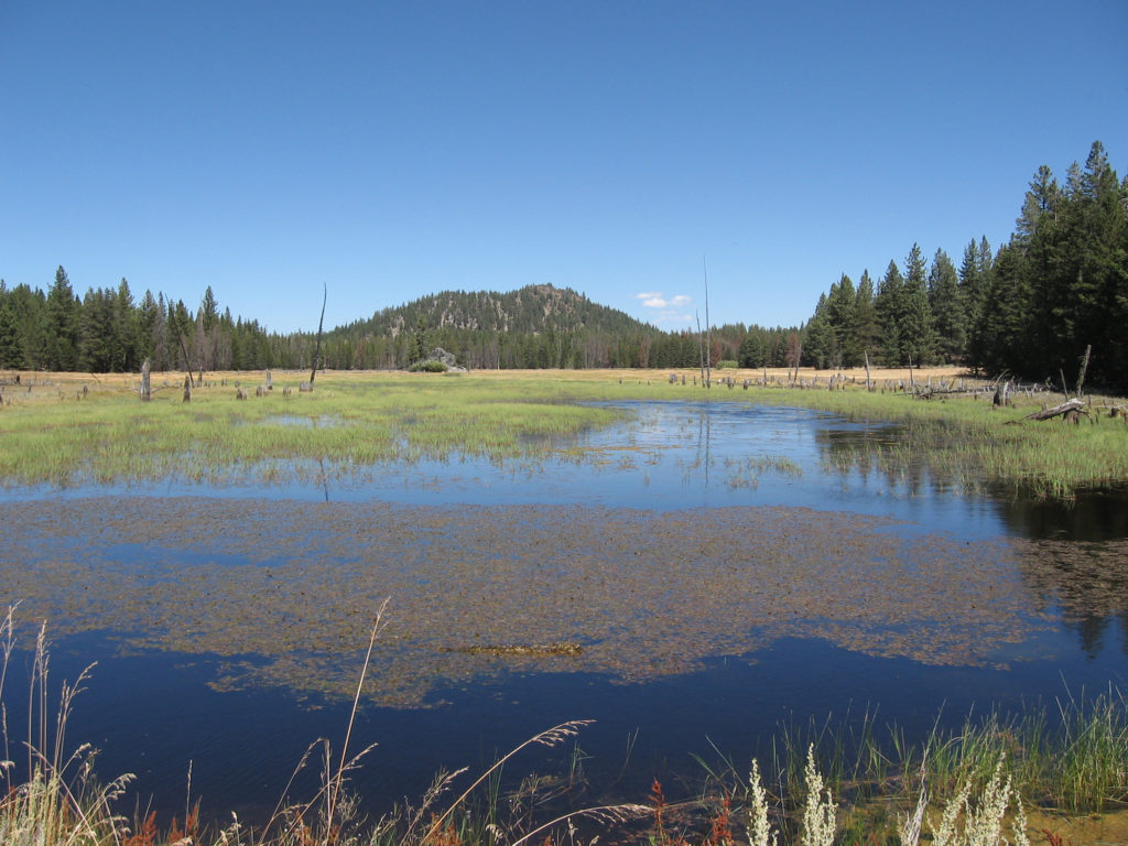
For those not that familiar with the region, Horse Lake is somewhat north and east of Eagle Lake depending on one’s perspective which part of that body of water they have in mind. This is an intermittent lake, like, Honey, during wet precipitation years remains full, and in drought years, goes dry.
In my research one can come across the so-called devil in the details. While a lot of research one views a lots of dry material. Every now then, there is that hidden gem. Case in point, while researching Pete’s Creek, I came across one such gem.
Horse Lake, June 21, 2019
In 1916, the newly formed Honey Lake Valley Irrigation District hired William Wales, a civil engineer, to do a thorough investigation of all water supplies of the region that the district might be able to tap into. Wales was very thorough and their was not a drop water he did not examine—even Butte Lake in far western Lassen County that he believed could be diverted all the way to eastern Honey Lake Valley.
Wales proposed a Petes Valley Reservoir. It was his opinion to drain Horse Lake for additional source of water. It should be noted that in 1893, William Harrison had dug a ditch to divert overflow water into Petes Creek, as he owned a ranch at Petes Valley. Wales noted Harrison’s previous work, but a more substantial and deeper channel would need to be done. Wales duly noted the water at Horse Lake was more or less wasted due to evaporation. He estimated the water rights to Horse Lake was worth $4,000.
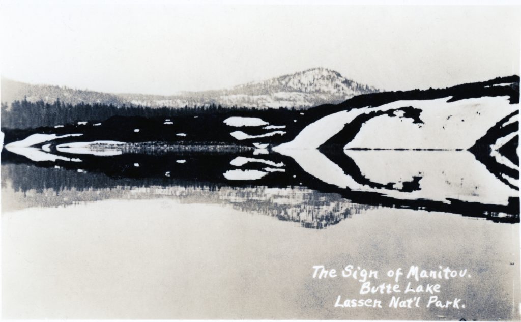
Butte Lake, circa 1920. Roy Sifford, of Drakesbad fame wrote: “The sign of the Manitou which means the sign of God. The shadows in the water made a long arrows which the Indians thought that was a sign of the Great Spirit (Manitou) or God gave them. Courtesy of the Sifford Collection.
Butte Lake in the eastern portion of Lassen Volcanic National Park is worthy of a trip. Because of its location and access is from a dirt road off of Highway 44 tends to be crowd free. This lake was originally referred as to Black Butte Lake and later Lake Bidwell. J.S. Diller named it Lake Bidwell in honor of General John Bidwell who came to California in 1841 and founded the town of Chico. The official name dates back to 1883 and no doubt received its name from two surrounding landmarks, Cinder Butte and Black Butte.
The French Canadian trappers of the Hudson Bay Company introduced the term “butte” to Western Americana. It was used to designate a landmark for an isolated peak, but not high or large enough to be a mountain.
In the 1840s, Hudson Bay fur trappers referred to the Honey Lake Valley as Hot Springs Valley. This was due to hot springs on the east side of Honey Lake.
The springs were originally referred to as Upper and Lower Hot Springs. In the 1880s the Lower Hot Springs were also known as Brubeck Springs, for the owner of the property, L.W. Brubeck. The name was changed to Amedee with the establishment of the town. A unique feature of the springs was a geyser. In 1854, Lt. E.G. Beckwith, during his exploration of a transcontinental railroad route visited the hot springs and noted that the geyser consisted of a column of water twenty inches in diameter.
The hot springs came into prominence when NCO Railroad extended its line and established the town of Amedee. As previously mentioned, the geyser became quite an attraction when the town was established. Amos Lane, bartender and inventor, devised a clock to measure spurts of the geyser that rose and fell at intervals of 38 seconds. At times the geyser would shoot as high as eight feet. The geyser ceased to exist in May 1893, as the ground around the springs cracked and allowed the steam to escape. The town’s newspaper was aptly named the Amedee Geyser.
The springs were heralded for their curative properties and the first public bathhouse opened in 1892. In 1900, Arthur Holland appeared on the scene to transform Amedee into a health resort. Holland dubbed his enterprise the “Karlsbad of America,” a bold attempt to associate it with the famed Czech resort. Holland’s venture never materialized in the grandeur he desired and he abandoned the project within a years’ time. Yet, people would still come to Amedee for the specific purpose to take mineral bath. This practice continued through most of the 1930s.
Amedee Bath House courtesy of Tom Armstrong
In 1984, Matti Ripatti and California Hydro Systems recognized the geothermal potential of the springs. They applied to the Lassen County Planning Department for a permit to construct a geothermal plant there. The permit was granted and in 1988 the power plant was constructed.