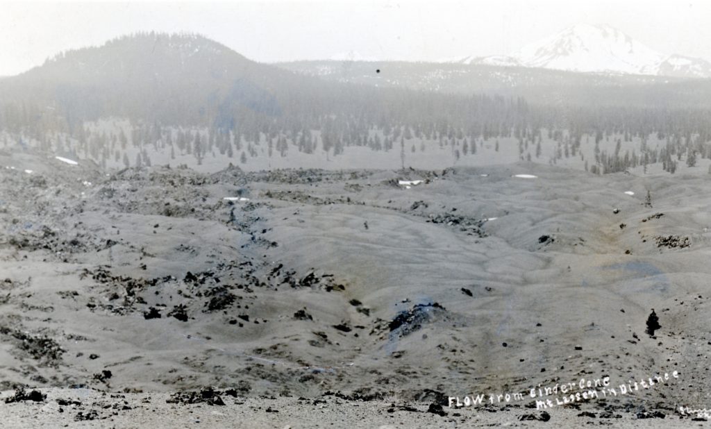
The view of Fantastic Lava Beds from Cinder Cone, circa 1911. Courtesy of the B.R. Zimmerman Collection
This historic photograph does not do justice to these lava beds located in the eastern section of Lassen Volcanic National Park. A color photograph would be preferred. This basaltic lava flow is a recent creation within the last 250 years and is adjacent to Cinder Cone. The view from the top of Cinder Cone looking over the lava beds and to Lassen Peak is worth the climb. After all, spring is trying to arrive here, though Mother Nature can be tempermental.
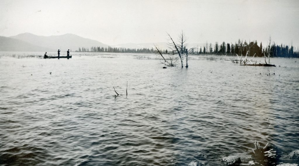
A view of Eagle Lake, looking towards Spaldings, 1921. Courtesy of Lola L. Tanner
While there are numerous citations that Eagle Lake had reached its highest level at 5,125.2 feet in 1917, though what is peculiar was that this benchmark occurred in late March. One would think that a final observation would have been made in May, after the spring run-off. Then again, no one knew what the future had in store. First of all, 1917 marked the beginning of a twenty-year drought. That would be a rude awakening for many as nothing like that had happened since the Anglo settlement of the region. Then there would be another culprit to greatly affect the dropping of the lake’s level to historic lows. In 1923, water started to flow out of Eagle Lake to the Honey Lake Valley for irrigation through the Bly Tunnel.
To provide a better comprehension just how high the lake was in 1917, is that of March 1, 2019 the level of the lake is pegged at 5095, that is a difference of some thirty feet!
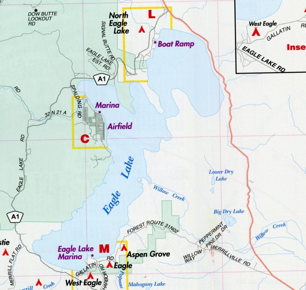
It is amazing by doing these daily posts, I am always learning something new. New discoveries sometimes arrive in mysterious ways. In a discussion about future walks and hikes I was provided the latest map of the region distributed by the Lassen County Chamber of Commerce. It should be noted I am map affeciando, so no GPS stuff for me. Anyhow, back to the story at hand. According to this, which you can see from the above illustration, that Willow Creek’s origins is Eagle Lake, and not from the springs at Murrer’s Upper Ranch.
In a discussion with USGS in 2017, that prior to some 125,000 years ago, Pine Creek and Willow Creek were probably just the same stream. Once the Brockman Flat Lava Beds occured it blocked the flow of Pine Creek to Willow Creek. In doing so, it helped create the Eagle Lake that we know today.
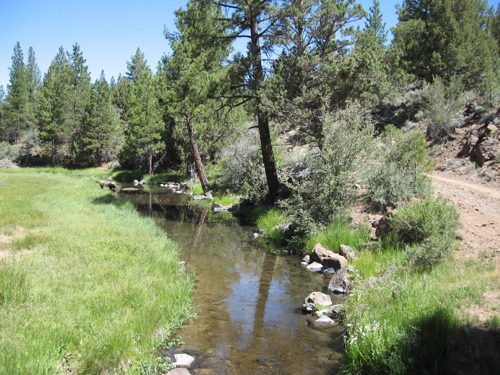
Upper Willow Creek, 2013. It was this creek that the various promoters of the Eagle Lake project that used the natural channel to deliver water to the Honey Lake Valley.
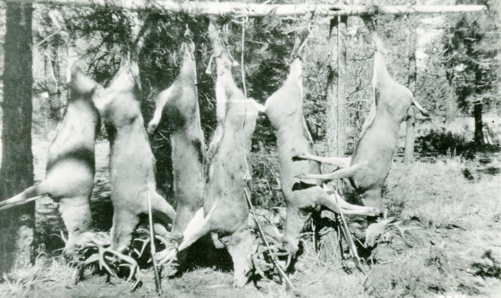
While outdoor recreation of this region has been promoted from nearly time immemorial, the kinds of activities has evolved over the years. One of those aspects highlighted was hunting—especially deer. This was after all prior to the late 1970s when the California Department of Fish & Game overhauled the hunting seasons, limits and zones. In a 1961, Lassen County pamphlet with the lead in “Lassen County – Where your vacation begins, but never ends.” One of the first sentences: “Hunting is a paradise in Lassen County, where a total of 5,348 deer were taken in 1959, more than any other county in the state.”
In a sign of changing times, while several decades ago it was a rarity to see deer inside the Susanville City Limits. Today, one sees more deer inside the City of Susanville, than to be found in the country side.
The recent snowstorm did not live up to my or the National Weather Service expectations. I do have to admit at my abode, its an ideal snow for skiing, etc. It would have been nice if Mother Nature was a bit more generous.
One of the annual challenges at Lassen Volcanic National Park each spring is snow removal on the park’s highway. The 1941 road opening provides a glimpse of the work involved. On May 19, work started on the snow removal where the crew literally worked around the clock until the job was completed. In this instance, due to heavy snows, the job was not done until July 9. During those eight weeks, 21 million cubic feet of snow was moved.
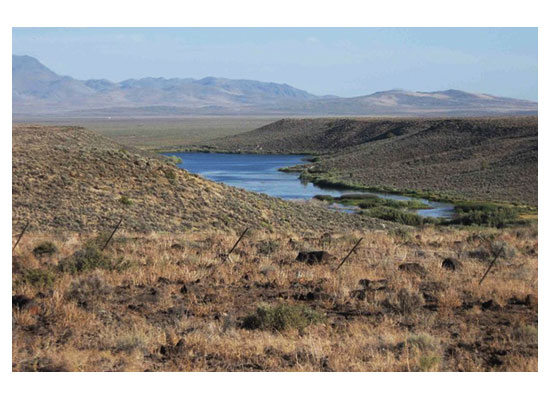
Last week, we featured the Horse Lake Siding on the abandoned Modoc Line, now a recreational trail. One of the favorite segments of the Modoc Line is that from Karlo to Snowstorm. One of the many interesting features along the route is Biscar Reservoir, as this water oasis standouts among the high desert countryside.
The reservoir was so named for Secret Valley rancher, Pierre “Pete” Biscar, (1881-1947) a native of France who settled there in 1904. In 1909, he constructed the first reservoir at the mouth of Snowstorm Canyon. In 1915, it was washed out by a flood and subsequently rebuilt. Today there are two reservoirs that are a part of the 550-acre Biscar Wildlife Area. It was initially purchased in the late 1940s by the California Department of Fish and Game as part of a long range plan to obtain water for the department’s Honey Lake Wildlife Area.
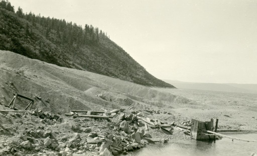
My grandmother, Lola Murrer Tanner, 1899-1973, referred to this east side landmark as Cove Point, which is just south of Bly Tunnel. While, it has no official designation as such, it is not unusual for some one to give a prominent spot a name for reference. This is more a photographic essay of the fluctuation of the water level at this particular spot over a span of nearly a century. The above photograph not only shows the point submerged but the tailing pile of the Bly Tunnel.
Cove Point, 1925
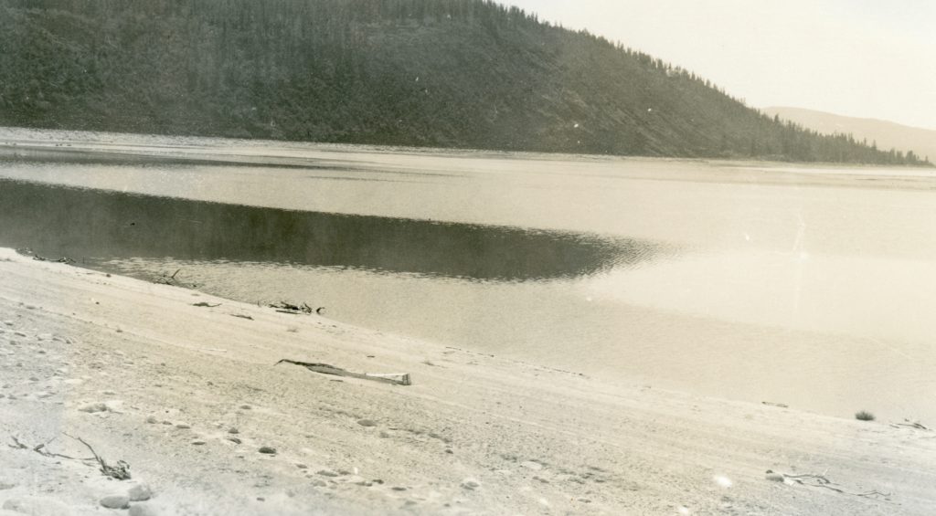
While not taken at the same angle, what a difference four years make with the drop of the lake level.
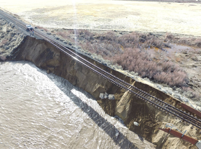
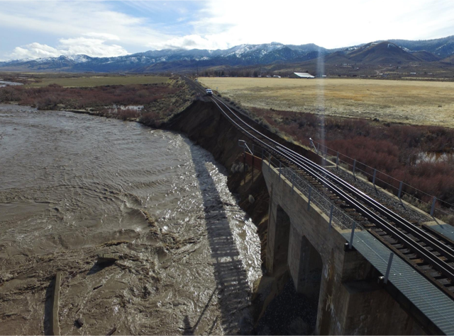
Any one who has ever been involved in a major water right battle that resulted in state intervention witnessed the production of an adjudication report. In the front of the report is a section called the “Duty of Water.” In certain ways the foregoing is not entirely relevant to the topic at hand. However, state never makes reference to the “Power of Water,” and when it strikes, what to do about it.
Long Valley Creek, January 2017
This post after all has a focus on Long Valley Creek, per a request of a flood during the early 1940s, though the particular date and/or other information is still being sought. For the most part it is hard to fathom that Long Valley Creek can be transformed into a raging torrent of water, when to the casual observer during the summer months, at time its flow can be a mere trickle. Yet, as one can see from the photographs shown, what kind of havoc this small stream is capable of. Tomorrow, we explore a proposed dam develop that was to harness the stream to provide water for irrigation.
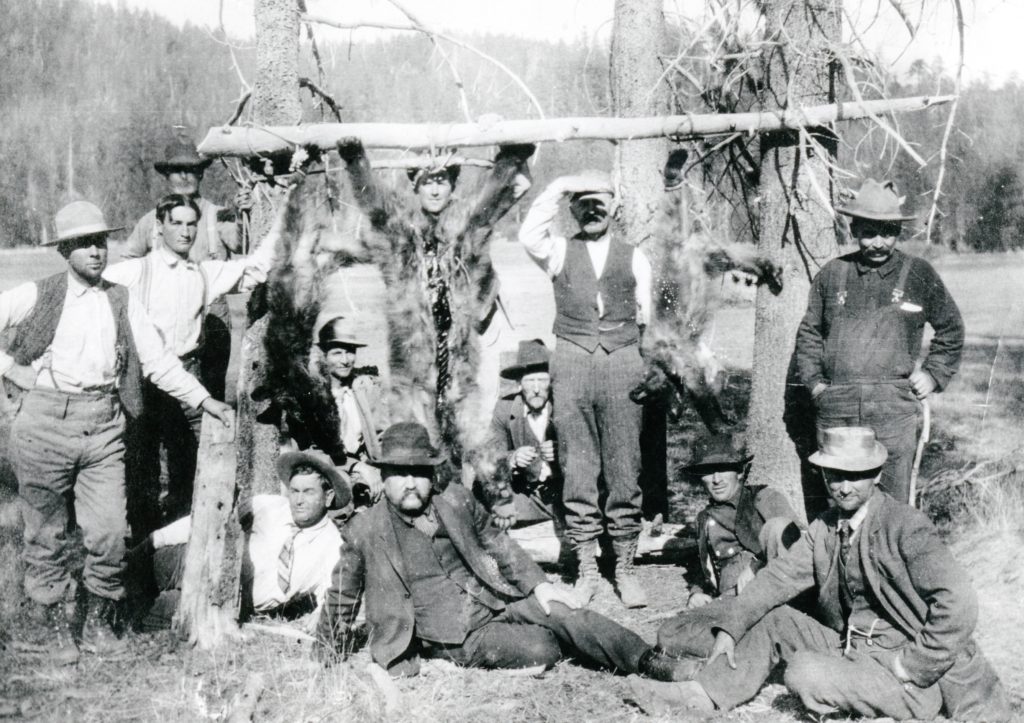
Pacific Coast Bear Club at Grizzly Valley, 1907. Courtesy of Ted Johnson
Lassen County over the years has witnessed an interesting array of organizations. How about the Order of Camels? The Loafer’s Society? The Pacific Coast Bear Club, headquartered at Spoonville, east of Janesville, would be considered an elite men’s club of the early 1900s. The founder, Captain E.C. “Ben” Brown had a colorful past, who experienced good and bad times with business ventures. Timing can be everything, and Brown was at the right place at the right time during the early discovery of gold at Goldfield, Nevada. He was not alone, which began the careers of many influential people in Nevada, including George Wingfield.
In 1906, Brown organized the club, with Nevada Governor John Sparks as its first president. For the next few years bear hunts were conducted at Grizzly Valley, Plumas County. One year they boasted a kill of nine bears—credit to Brown and his hound dogs.
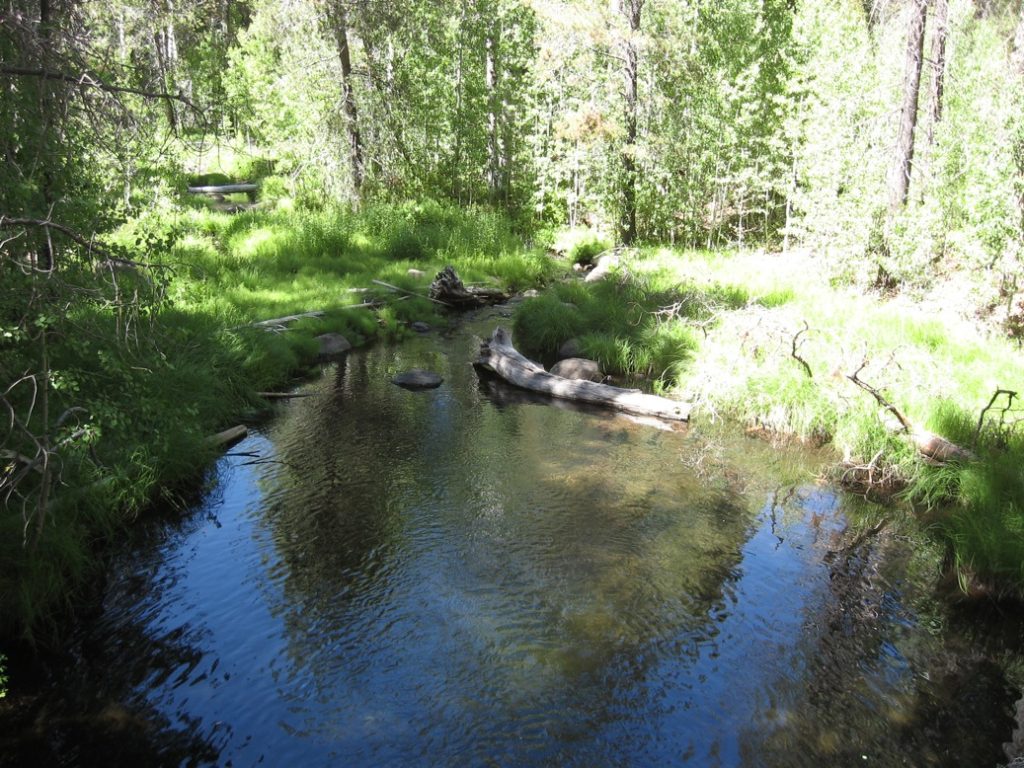
Upper Pine Creek flows year round. Eagle Lake Trout are known to make the journey upstream to spawn. It is my understanding, and I could be wrong, is the brook trout feast upon the eggs of the Eagle Lake trout—hence why some want to eradicate the brook trout.