In 1985, the Neversweat Chapter #1863, E Clampus Vitus restored the Viewland monument.
Viewland is the low summit between Mud Flat and the Honey Lake Valley. From this vantage point, emigrants in the 1850s, who had finally traversed the Nevada desert, obtained their first view of the Honey Lake Valley and the Sierra Nevada Mountains. The Nevada-California-Oregon Railroad established a station there named Murray, but when the line was broad gauged by the Southern Pacific Railroad it became their Viewland. The siding was important for sheep growers who, after shearing, would haul the wool there to be shipped out by rail.
Spread the word, and encourage a friend to subscribe.
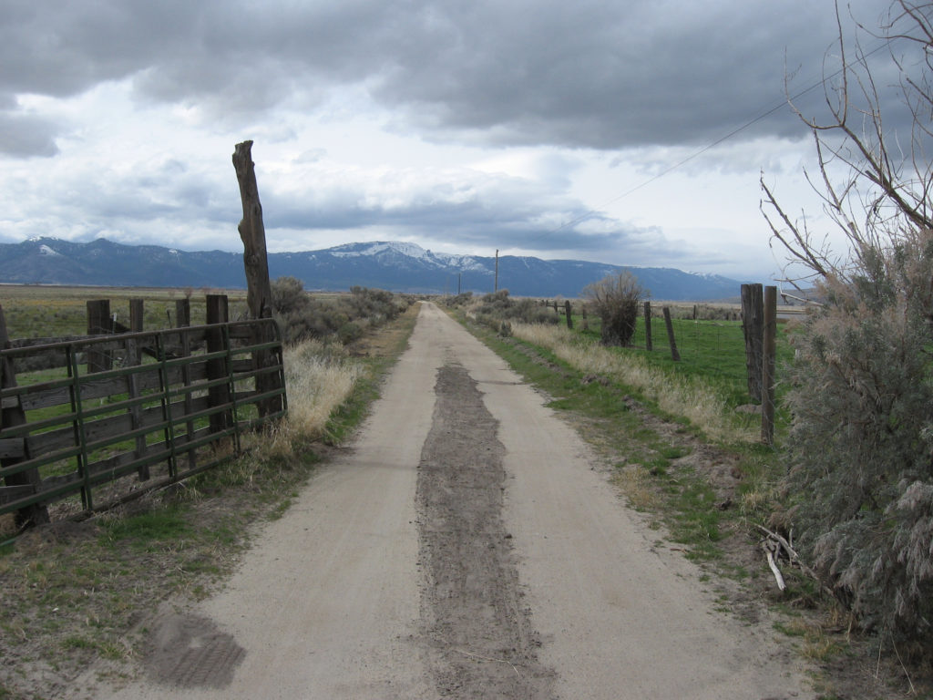
Tanner Ranch, with Skedaddle Mountain in the background
On July 25, 2024, Mary Rea, the last of the three Tanner sisters (Ardene Purdy and Joyce Cunha) passed away. In 1973, when their mother, Lola Tanner passed away, the three sisters formed the Tanner Ranch partnership to continue with the family ranch operations.
In 1870, William Martin Tanner located near Soldier Bridge along the Susan River about half way between present day Standish and. Litchfield. In 1882, he sold 40 acres to Andrew Litch which would be the future site of Litchfield. Tanner died unexpectedly in 1890 leaving behind his wife Jane and four small children-Maude, William, John and Charley. The three brothers would eventually homestead property on their own in the Standish District. In 1927, John married Lola Murrer. The following year the Capezolli family offered to trade ranches with John and Lola and that they did.
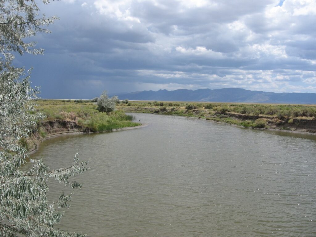
Whitehead Slough on Tanner Ranch
Over the years, John and Lola purchased neighboring homesteads-Whitehead, Stampfli and Hartson. In 1945, when John passed away the ranch consisted of some 1550 acres which has not changed over the years. The only major change occurred was also in the 1940s. The Tanners had new neighbors with the establishment of State Wildlife Honey Lake Refuge.The Fleming Unit borders the east side of Tanner Ranch, while the Dakin Unit on the west side.
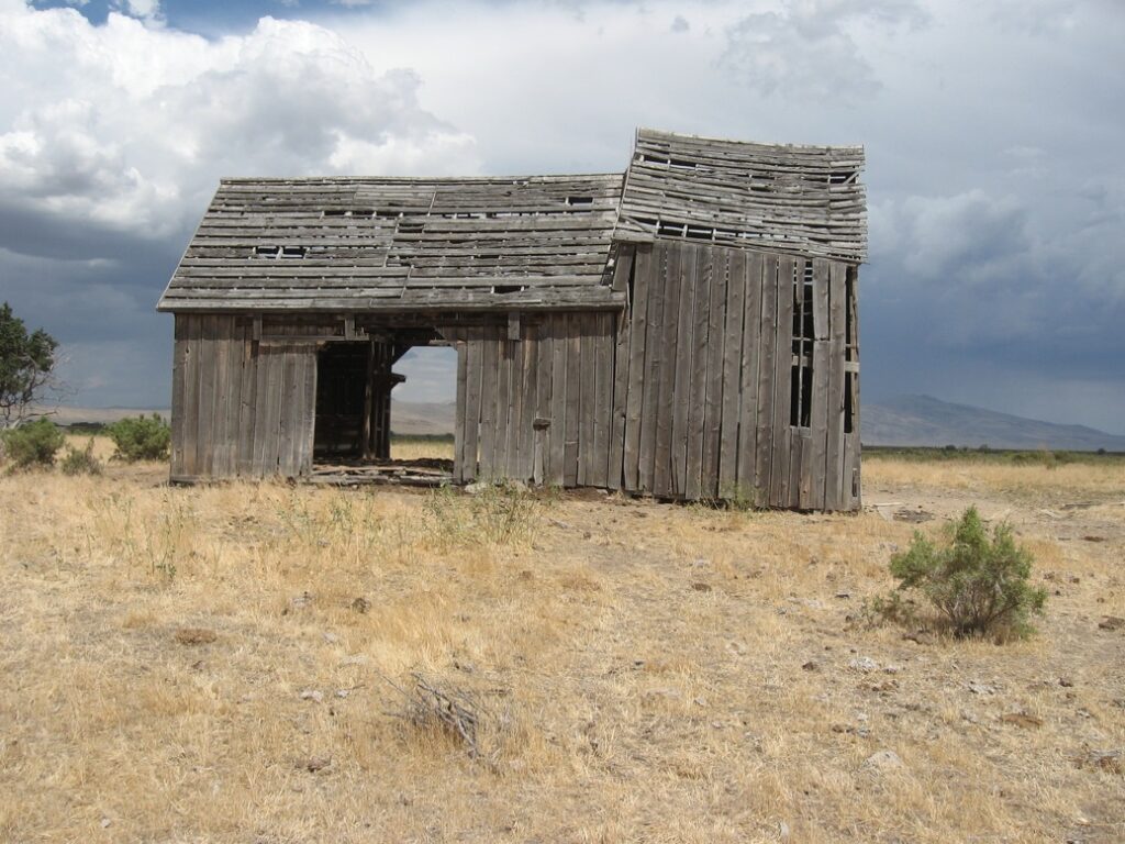
Hartson Barn on Tanner Ranch.
The heirs of Tanner Ranch will in do time place the property for sale and end of era for the family spanning 150 plus years in the Honey Lake Valley in the agricultural community.
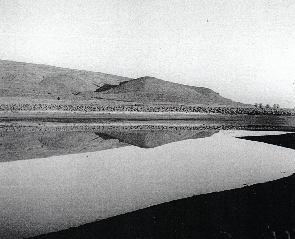
Many may not know Leavitt Lake was natural water basin. In 1863, when Government Land Office surveyors came across it, they dubbed it Alkali Lake. The following year, Ben Leavitt located to the west of it. Many consider Leavitt the father of the Susan River Irrigation System. A portion of it still survives as the Lassen Irrigation District.
In 1875, Benjamin H. Leavitt transformed Alkali Lake into a small reservoir by diverting water from the Susan River to that place. In 1889, the reservoir was enlarged. When construction was underway, Victor E. Perry, Leavitt’s son-in-law, worked on the dam. Perry planted a gold nugget there and when it was discovered it caused great excitement with the other workers. Leavitt informed the construction workers that they could keep whatever gold they might find, as long as it did not interfer with the construction. With that incentive, the men worked twice as fast to build the reservoir, in hopes of locating more gold, that unbeknownst to them would never be found. It should be noted that also in 1889, Leavitt was instrumental in the construction of Hogs Flat and McCoy reservoirs.
An interesting footnote, in times of extremely wet winters. it has been documented that the Leavitt Lake receives enough run off from Bald Mountain to fill it.
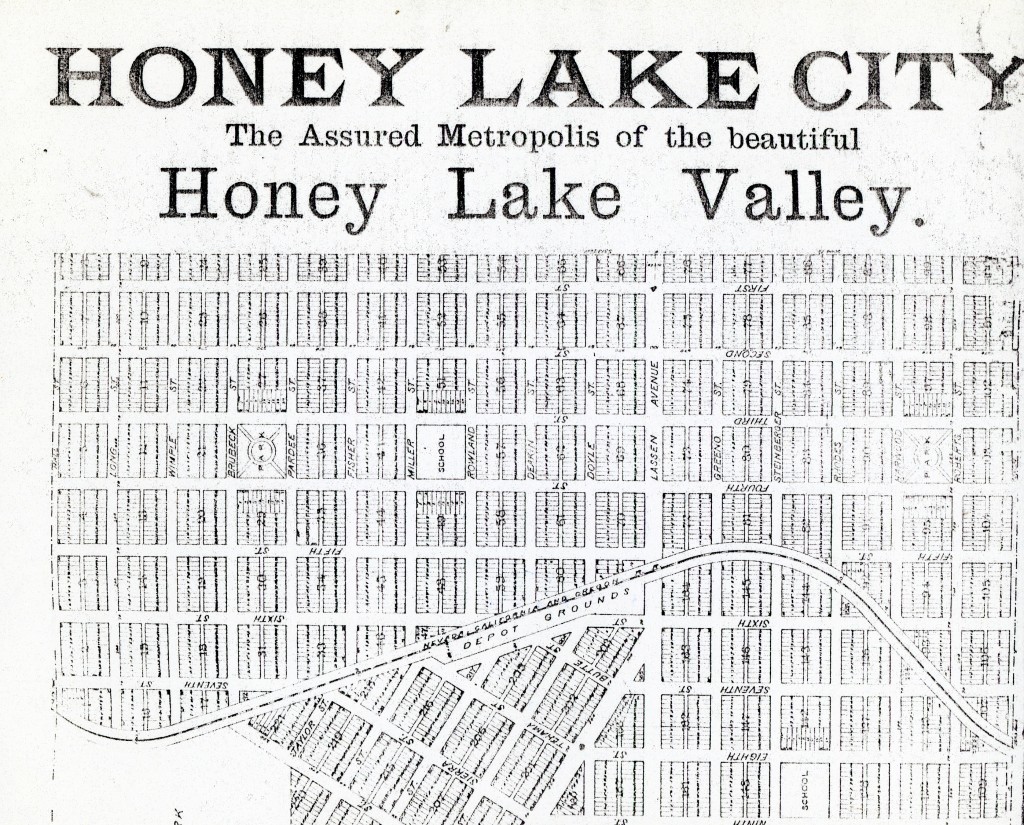
This was the planned metropolis of the Honey Lake Valley Land & Water Company, established in 1891. The company was involved in a major reclamation project for the eastern portion of Honey Lake Valley. The main water supply would be that of their reservoir, Lake Greeno, constructed on Long Valley Creek.
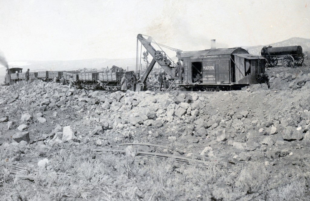
Davis Cut near Susanville of the Fernley & Lassen Railroad, 1912
Thousands of people drive by this landmark, and ,many are probably oblivious. Located a short distance north of Johnstonville on Center Road, is a railroad cut—named Davis. It really is somewhat insignificant as railroad construction goes, but it was the first in the Honey Lake Valley when the Fernley & Lassen Railroad was under construction.
In April 1912, the Southern Pacific Railroad announced construction of the Fernley & Lassen Railroad, and awarded the contract to the Utah Construction Company. That company hired a numbered of sub-contractors, the most prominent of which was J.H. Maxey Construction Company. No time was wasted on construction as there was a deadline to reach Westwood by March 1, 1914. In the fall of 1912, a construction train reached Davis Cut, near Johnstonville. There were several fatalities associated with the construction of the railroad, and one of them occurred at Davis Cut. On April 13, 1913, James Cook, a powderman for the J.H. Maxey Construction Company, was killed there in an explosion to blast the rock.
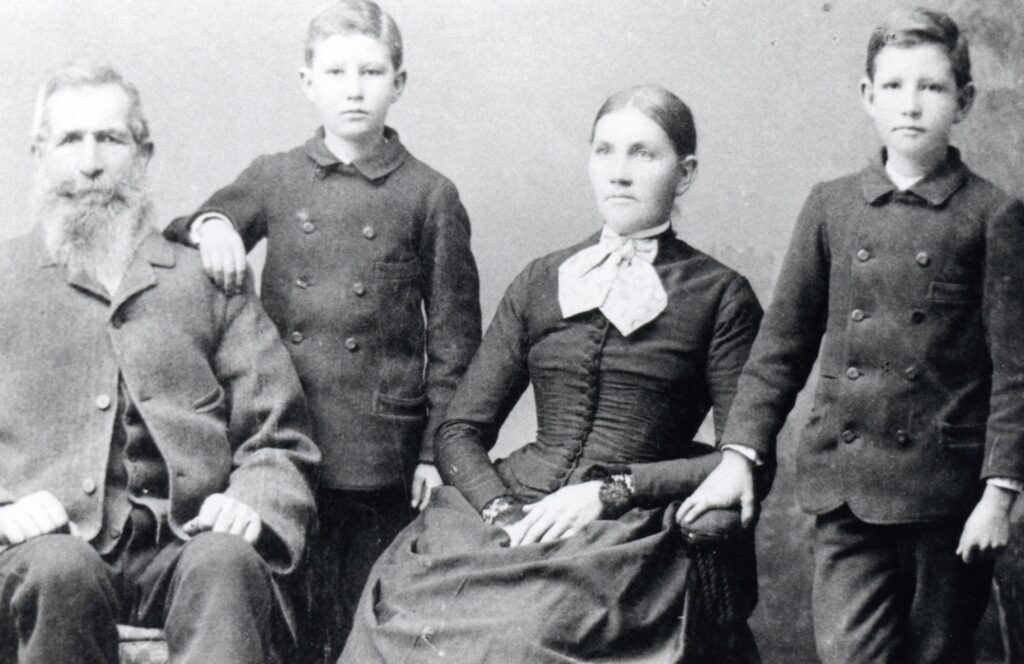
John C. Davis family, circa 1890–Courtesy of Robert and Eulalee Trussell
The cut was so named for the John C. Davis family. Davis, a native of Germany, came to California in 1850. In February 1858, he made his home in the Honey Lake Valley. In 1866, Davis purchased property just north of Johnstonville where he lived until his passing in 1894.
A unique view of Litchfield, 1936–C.H. Bennett Collection
In the past we have explored the origins of Litchfield. For those just tuning in, here is a brief overview. With the approaching Fernley & Lassen Railroad traversing the Honey Lake Valley in 1912,, the survey route went north of Standish through the Gibson Ranch. B.F. Gibson plotted a new townsite on his property that he initially dubbed “New Standish.” He had hope to lure Standish residents and businesses to the new townsite, since it would have the benefit of the railroad. It should be noted Standish was only three miles away. In 1913, Gibson’s townsite was recorded and named Litchfield, after his late father-in-law Andrew Litch, which Gibson acquired his ranch.
While Litchfield did not become the major commercial hub envisioned, it was still a busy place. The Litchfield Depot was the major shipping point for the agricultural community for decades to come. In 1923, a huge barbecue was held at Litchfield as part the dedication ceremony of the Bly Tunnel at Eagle Lake that would provide water for reclamation in the Honey Lake Valley. It was estimated that some 5,000 people attended. Yet, for all the activity at Litchfield I rarely come across any photographic record of activities at Litchfield.
By 1889, there was a dam building craze, like the region has never seen before or after. The Union Land & Stock Company proposed five reservoirs for the Madeline Plains. On the Susan River three dams were proposed, two were built—Hog Flat and McCoy Flat. There was the proposed Lake Greeno on Long Valley Creek and Skedaddle Dam on Skedaddle Creek. In addition, the tapping of Eagle Lake was still a work in progress.
In 1889, the Balls Canyon Reservoir Company was formed to build a dam on Secret Creek where it enters the Honey Lake Valley, about five miles west of Litchfield. The company employed surveyor, Frank Gates Ward (1857-1895), to survey a dam and reservoir site. In 1889-90, the first reservoir was constructed. In February 1890, a flood washed out that dam. As one observer noted, the waters of Secret Creek began rising at a rate of two feet an hour and within three hours the 27 foot high structure, that measured 150 feet in length, was swept away. The company planned to rebuild but never did. In 1895, Edward T. Purser took over the project and a new reservoir was constructed, along with a twenty-mile ditch to his property near Wendel.
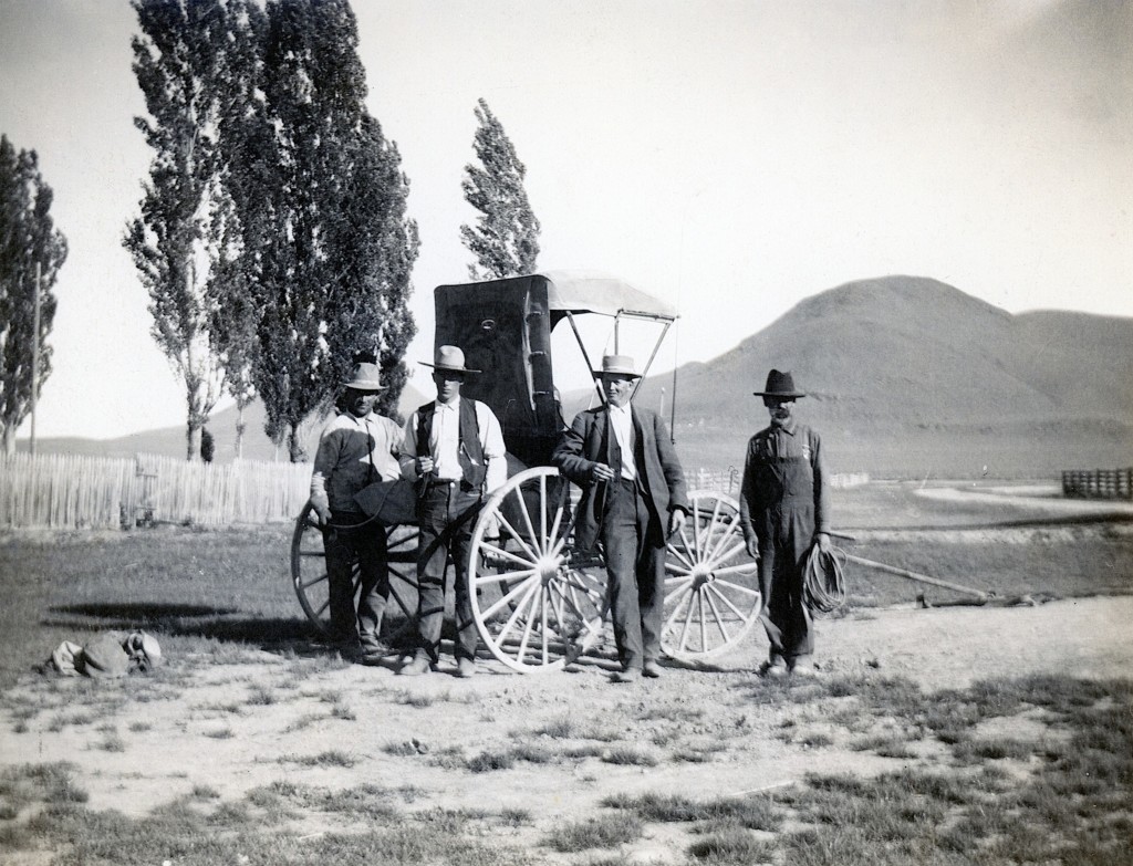
Mapes Ranch, with Shaffer Mountain in the background, 1906. Courtesy of Madelyn Mapes Dahlstrom
You probably never heard of it. Guess what, most people in the Honey Lake Valley during the 1860s, never heard of it either. Today, it is known today as the Mapes Ranch, located four miles east of Litchfield.
In June 1859, George W. Lathrop and Thomas J. Harvey claimed 1,280 acres there. Located adjacent to the Susan River and the Nobles Emigrant Trail, it quickly developed into a station for travelers. On September 8, 1862, Lathrop sold this place to Uriah and James Shaffer for $4,250 and then the place was called either Lathrops or Shaffers Station. By 1863, it consisted of Shaffers station/trading post, Henry Lomas’ cabin and blacksmith shop, and a house belonging to Wilmans & Bass. At this same time, traffic along the emigrant trail increased dramatically as it was the shortest route to the mining discoveries in Idaho and Northwestern Nevada. With bright prospects, the residents plotted out a town and a name was needed. The place was best known as Lathrops. It was decided to name it Lathrop City. Henry Lomas, the “city’s” blacksmith recalled years later that the name was “Just too much for the town and it died a natural death.”
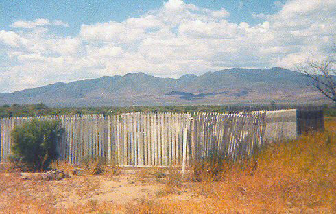
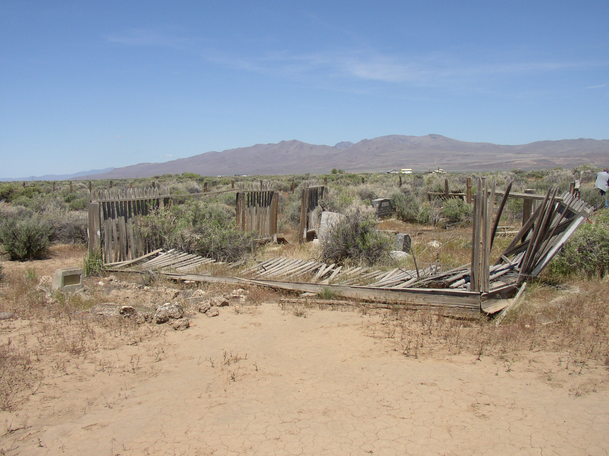
Most people never heard of this cemetery, and even fewer have ever been there. It is a remnant of the homestead era of eastern Honey Lake Valley. Known today as the Honey Lake Cemetery, it was originally named Restdale Cemetery.
In October 1914, Stacy resident Charles Baker died on his homestead and was buried near there on property owned by Mary Caudle. On November 3, 1914, Mary Caudle donated the property (1.1 acres) to Lassen County. At the same time, residents of the area presented a petition to the Lassen County Board of Supervisors to make it a public cemetery. The petitioned was signed by 16 residents of Stacy, 10 from Calneva and two from Amedee. The petition stated: “We deem the establishment of said cemetery for the best interests of the public well-fare, and absolutely necessary. The nearest public cemetery for the residents of this district is days drive away.” Later in November, the Lassen County Board of Supervisors approved the creation of the cemetery.
Honey Lake, Cemetery, 2018
An item of note included in the deed was the covenant that if the property was no longer used as a burial ground the property would revert back to Caudle.
Theodore Ranch, 1892, located in the heart of the Tule Confederacy,. The property in 2023 is known as the Dow Ranch.
The Tule District of the Honey Lake Valley is the very lower end of the Susan River, where the river splits up into various sloughs.
In 1859, John Kelley of Missouri settled in this region. All was fine until 1863 when the United States Government surveyed the region. Under federal law, the most a person could file was 160 acres. Kelley had already claimed nearly 1,000 acres. Kelley concerned that he could lose his holdings wrote back home and encouraged fellow southerners to come out and join and settle on property he had claimed. Those who initially did were William Brashear, Robert Briggs, Chappell Kelley and John Saling. In 1864, when Lassen County Surveyor E.R. Nichols who was doing work in the region, noted a number of residents had served in the Confederate Army and he dubbed the district the Tule Confederacy.
Not all the residents were southerners and there were conflicts between the neighbors. In the spring of 1864, John Purcell set fire to DeWitt Chandler’s house and claimed it a victory for Confederate States.
It is never too late, subscribe and never miss out on the region’s history.