Tag Archives: Eagle Lake

Eagle Lake’s High Water Level

A view of Eagle Lake, looking towards Spaldings, 1921. Courtesy of Lola L. Tanner

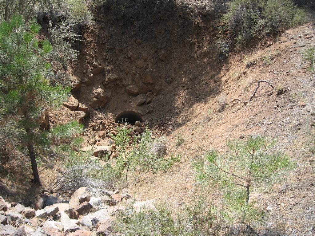
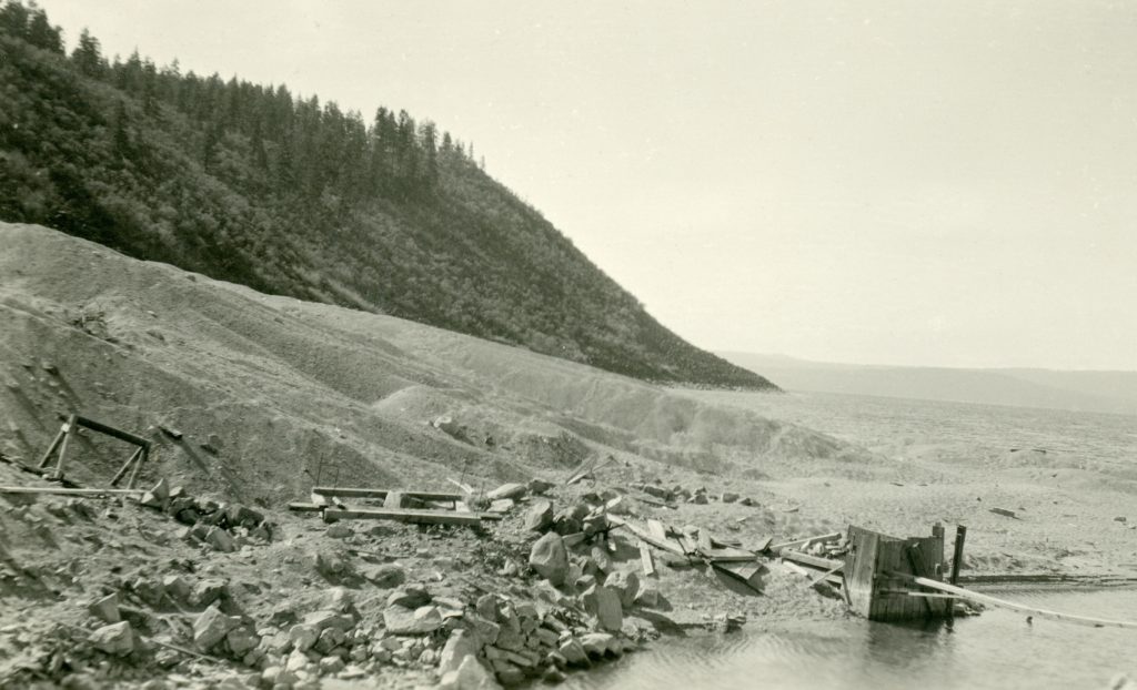
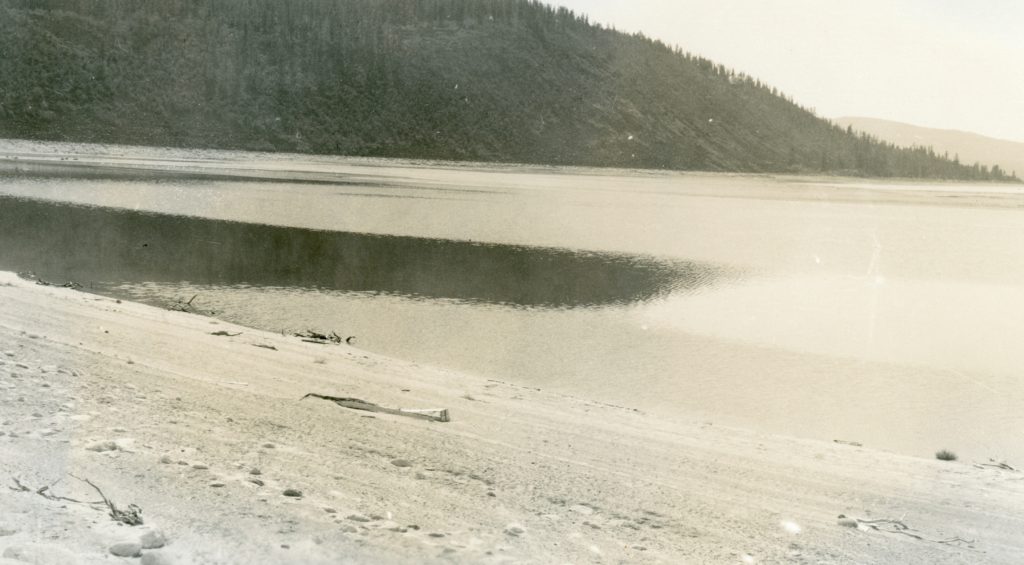
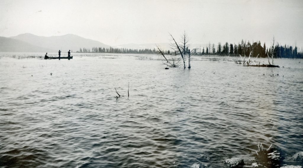
While there are numerous citations that Eagle Lake had reached its highest level at 5,125.2 feet in 1917, though what is peculiar was that this benchmark occurred in late March. One would think that a final observation would have been made in May, after the spring run-off. Then again, no one knew what the future had in store. First of all, 1917 marked the beginning of a twenty-year drought. That would be a rude awakening for many as nothing like that had happened since the Anglo settlement of the region. Then there would be another culprit to greatly affect the dropping of the lake’s level to historic lows. In 1923, water started to flow out of Eagle Lake to the Honey Lake Valley for irrigation through the Bly Tunnel.

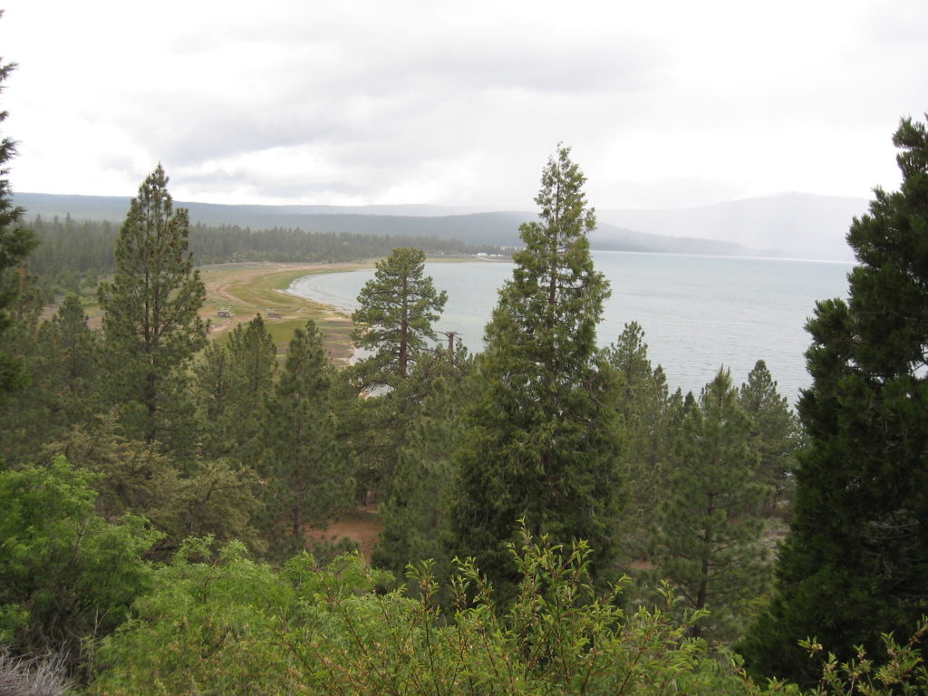
To provide a better comprehension just how high the lake was in 1917, is that of March 1, 2019 the level of the lake is pegged at 5095, that is a difference of some thirty feet!

Support

Spalding vs. Spaulding

Pine Creek
Pine Creek, circa 1914. It sholuld be noted that John Spalding’s original homestead was on the north side of Pine Creek. Courtesy of Wyn Wachhorst

From time to time, I am asked about the spelling of Spaulding Tract, as the Spalding name does not contain a “u.” This no doubt is an issue of property title. There were two separate Spalding subdivisions. First one done in 1914, and the second the Spaulding Tract we know today was subdivided in 1924. A portion of the two subdivisions are identical, hence the need for clarification.

Support

Eagle Lake Cabin Site Company

An artist’s rendering of the proposed hotel

After the failed first Spalding subdivision, it was brought back to life as Spaulding Tract, The story of the inserted “u” for another time. In 1924, this time around, the Spalding family with a new subdivision on the west shore of Eagle Lake, hired real estate developers to promote it. This gave birth to the Eagle Lake Cabin Site Company.

Promote they did. These folks were shrewd, and knew first hand the local residents were not their market, because they knew there was nothing there to get excited about or invest in. The Eagle Lake Cabin Site Company produced a brochure to entice folks primarily in Southern California of this hidden gem, more spectacular than Lake Tahoe. To lure people to buy lots, as an enticement was the proposed grand hotel to be built, similar to the famed El Tovar Inn at the Grand Canyon.

The lots initially sold for $50 each. When the company began selling lots in the spring of 1925, they were confident that the entire tract of 5,964 lots would be sold out in six months. While they did not reach that goal, they did sell over 3,000 lots.

In 1926 sales dramatically taped off. This was due in part of the new lot owners when came to inspect Spaulding Tract. First they encountered poor roads and when they finally arrived there were not any visible signs that gave the slightest hint the place was a resort community. So digusted many of the lot owners refused to pay property tax for a non-existant resort community. Thus, the Eagle Lake Cabin Site Company faded into oblivion.

Support

Town of Spalding, 1914-1924

John S. Spalding’s second homestead at Eagle Lake, circa 1919. Courtesy of Wyn Wachhorst

On July 6, 1914, the Lassen County Board of Supervisors approved John S. Spalding’s subdivision for the Town of Spalding, on the west side of Eagle Lake. It was Spalding’s intent to develop a summer resort. The Susanville newspapers had extolled wonderful praise for the project.

Yet, momentum was difficult. First, there was competition of other developments taking place—the volcanic eruptions of Lassen Peak, the construction of Lake Almanor and the newly built company town of Westwood. Yet, one of Spalding’s biggest obstacles was access, or in this case, lack thereof. Even since 1900, considerable pressure was applied to the Lassen County Board of Supervisors to make road improvements to Eagle Lake, though very little materialized. The resort town was a failure. Only one lot was sold, of note it was a purchase by a retired Lassen County school teacher, Asa M. Fairfield.

In September 1924 the Spalding family petitioned the Lassen County Superior Court to dissolve the townsite and was granted.

Where are we – the answer

This is a portal midway through Bly Tunnel near Eagle Lake. The fenced off enclosure is easily seen from the road going up to the Eagle Lake Youth Camp. There are still numerous ditches, cement diversions of the canal system, extending all the way to the Sunnyside District near Janesville to past Wendel in another direction from the failed Tule & Baxter Creek Irrigation District’s Bly Tunnel project.

The outlet as it appeared in 2012. Courtesy of Barbara White

Subscribe

Headwaters of Willow Creek

It is amazing by doing these daily posts, I am always learning something new. New discoveries sometimes arrive in mysterious ways. In a discussion about future walks and hikes I was provided the latest map of the region distributed by the Lassen County Chamber of Commerce. It should be noted I am map affeciando, so no GPS stuff for me. Anyhow, back to the story at hand. According to this, which you can see from the above illustration, that Willow Creek’s origins is Eagle Lake, and not from the springs at Murrer’s Upper Ranch.

In a discussion with USGS in 2017, that prior to some 125,000 years ago, Pine Creek and Willow Creek were probably just the same stream. Once the Brockman Flat Lava Beds occured it blocked the flow of Pine Creek to Willow Creek. In doing so, it helped create the Eagle Lake that we know today.

Upper Willow Creek, 2013. It was this creek that the various promoters of the  Eagle Lake project that  used the natural channel to deliver water to the Honey Lake Valley.

Subscribe

Cove Point, Eagle Lake

Cove Point, 1921

My grandmother, Lola Murrer Tanner, 1899-1973, referred to this east side landmark as Cove Point, which is just south of Bly Tunnel. While, it has no official designation as such, it is not unusual for some one to give a prominent spot a name for reference. This is more a photographic essay of the fluctuation of the water level at this particular spot over a span of nearly a century. The above photograph not only shows the point submerged but the tailing pile of the Bly Tunnel.

Cove Point, 1925

While not taken at the same angle, what a difference four years make with the drop of the lake level.

Cove Point, August 9, 2018

Finally, this is how it looked last summer.

Subscribe

The Eagle Lake Golf Course

South shore, June 9, 2017

Last summer I had good intentions to visit various sites to take photographs of what they look like today. The Eagle Lake Golf Course of the late 1920s was one of them, but I never made it. However, the Whaleback Fire did hinder some expeditions. John “Burt” Christie, one of the early operaters of the Eagle Lake Resort, was an interesting figure at the lake’s south shore. Besides the resort, he eventually became the caretaker of Gallatin House and the Gallatin properties at the lake. Continue reading The Eagle Lake Golf Course

Where are we – Eagle’s Nest

August 9, 2018

Eagle’s Nest is located in a small cove on the east side of the lake, about three miles north of Gallatin House. In 1956, the Lassen National Forest opened a small subdivision for summer home development. There are forty-two lots with long term leases with the forest service. In September 1956 the forest service held a random draw as the selection process to allocate the lots, as they had received 226 applications.

Donate