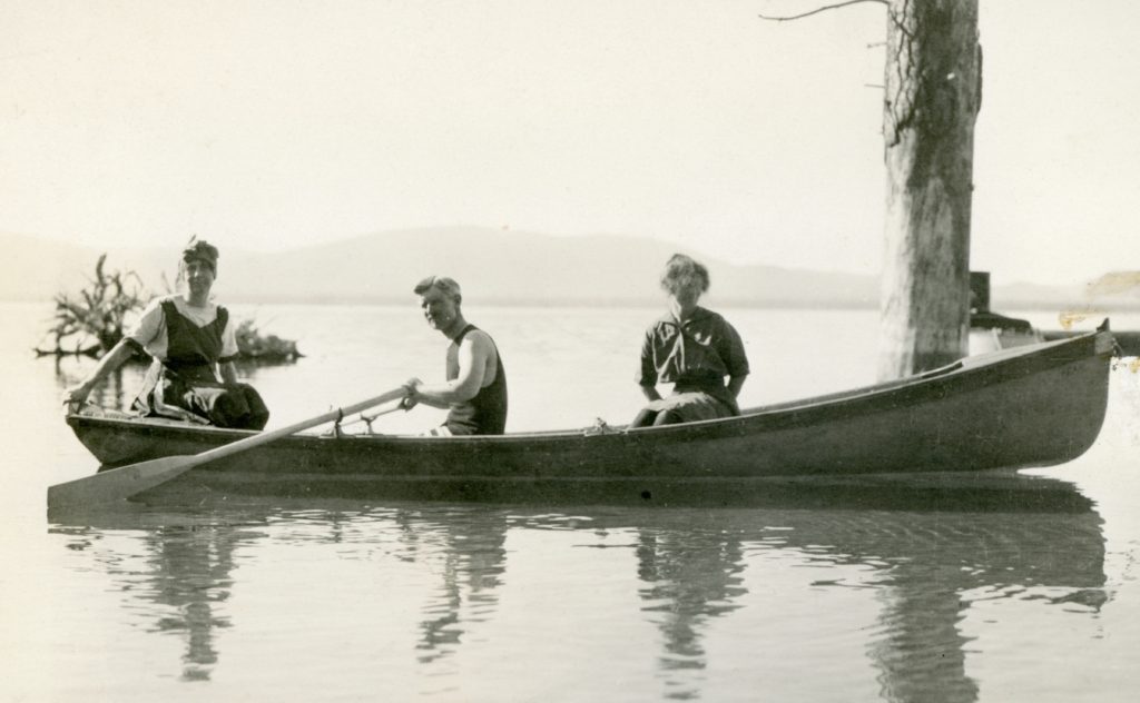
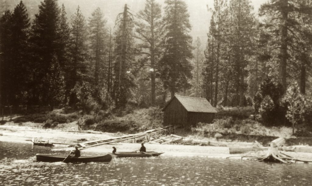
Slowly, but surely I am getting around to the Gallatin photographs. The family sure did like their boats. It was interesting that boat dock and the boat house were not side by side. More about that later.
Tim
Slowly, but surely I am getting around to the Gallatin photographs. The family sure did like their boats. It was interesting that boat dock and the boat house were not side by side. More about that later.
Tim
The geology of Eagle Lake is unique. It is a mixture of Sierra Nevada spillover (Gallatin Peak) and the Cascades that flanked Gallatin on both sides. One can see transition from the tailing pile remnants of Bly Tunnel. The inlet consisted of decomposed granite (Sierra) while the outlet tailings is red volcanic cinder (Cascade).
In 2017 U.S.G.S. released Age of the Youngest Volcanism at Eagle Lake, Northeastern California. It is only a 34 page document which I can hopefully one can access it this way. If not please email and I will send you the pdf file.
Clynne etal USGS OFR 2017-1027 Eagle Lake
Tim
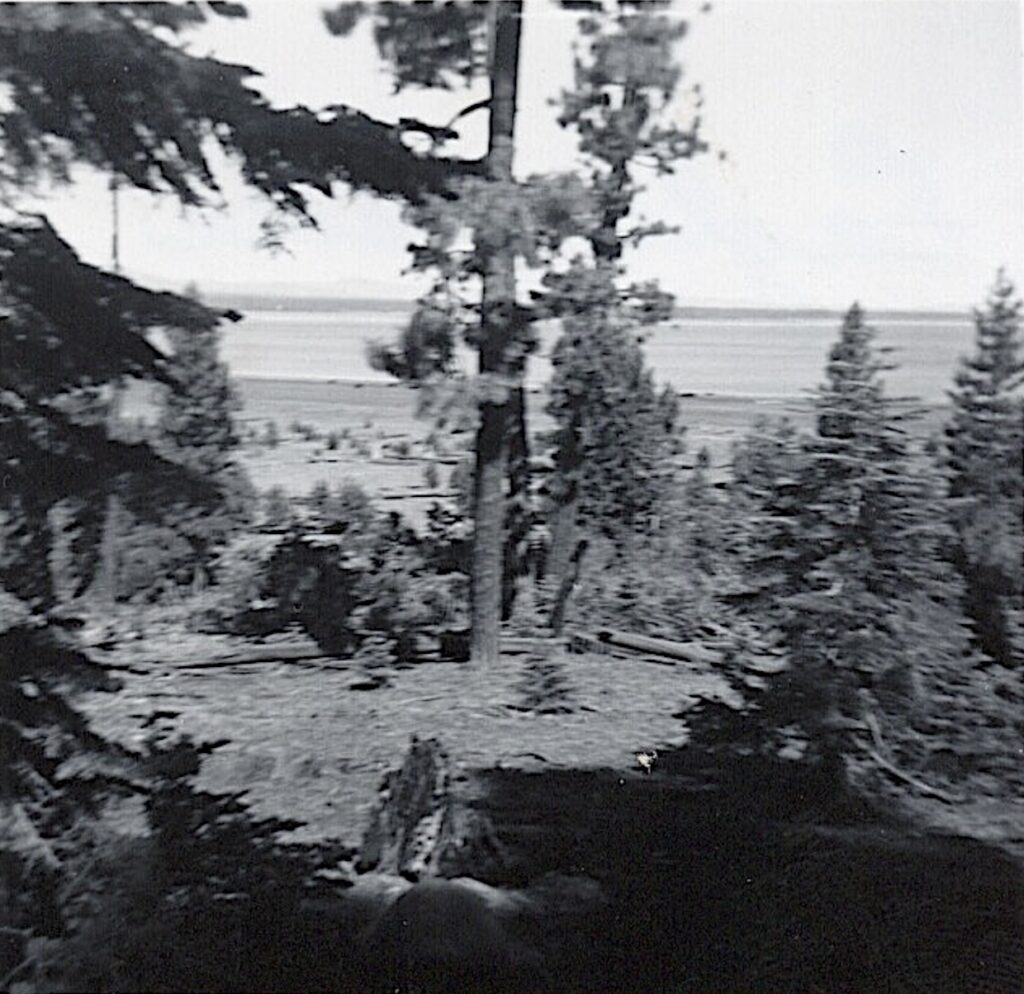
In 1913, Malvena Gallatin built the first summer home at Eagle Lake. For the next ten years her family, especially her granddaughter Norma Virginia, spent the summers there. The bulk of these photos were taken between 1917 and 1920, when Eagle Lake reached its historic high levels. I recently scanned few and I can post various scenes if there is an interest. It should be noted that there are some 200 photographs.
Tim
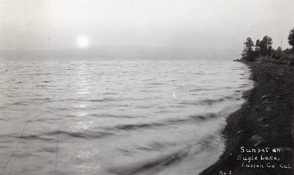
During the 1910s there were only a handful postcards produced featuring Eagle Lake. First and foremost, there was no market. After all the majority of the south shore was privately owned, and there was one small seasonal resort. In all my years of research and I have come across two of the above pictured Sunset at Eagle Lake, circa 1916.
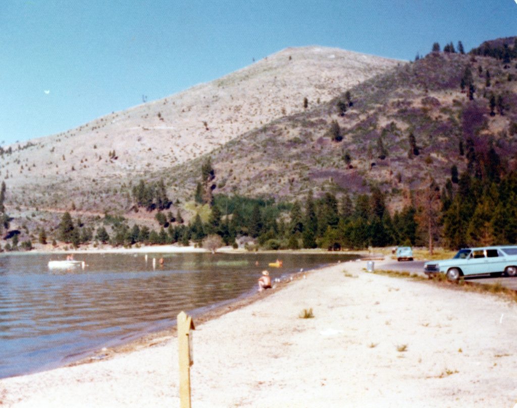
It was not until the early 1960s with development of forest service campgrounds and marina, that there were be quite of few Eagle Lake postcards produced. Those images are noteworthy reflecting on the change of the lake level elevation.
Tim

On Sunday, December 28, 2025 at 4:41 p.m. a 4.7 magnitude earthquake centered at Round Valley struck. For those not familiar with Round Valley, it is due north of Susanville, as the crow flies about nine miles and is privately owned. Then on Tuesday night, December 30 at 9:49 p.m. a second 4.9 earthquake occurred there.
It should be noted that east side of Eagle Lake a consist of fault blocks namely Mahogany and Blacks Mountain. You can read about the 1889 Eagle Lake earthquake here. There was a notable quake in 1921, though not as strong.
Personally, I really felt the first one (2025) since, I was preparing dinner (garlic noodles) when it struck. My milk bottle collection rattled and my mantle clock stopped. The second one, I was in bed, but I heard things rattle.
Tim
In 1947, the Baxter Creek Irrigation District, along with its counterpart the Tule Irrigation District filed for bankruptcy. On October 16, 1952, Baxter Creek was dissolved. Tule would have suffered the same fate, but last minute legal strategy was saved by W. Cobun Cook*
For Baxter Creek its origins began in 1911, with the creation of the Baxter Creek Irrigation Company. While it looked good on paper, it never materialized.The saga did not end there.
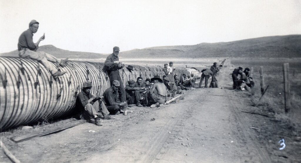
On February 8, 1917, the Baxter Creek Irrigation District was created, a public district, not private entity. While similar in scope of the irrigation company, the district proposed comprised of 9700 acres. When they went to secure a bond measure, the State Engineer’s Office intervened, citing the district’s main water supply was insufficient.
The neighboring Tule Irrigation District was encountering a similar problem to secure bonds for Leon Bly’s Eagle Lake irrigation system. A solution was found where the two districts agreed to pro-rate the costs and secure the bonds for Bly’s irrigation system.

For those in the Baxter Creek system, it required a series of canals and siphons to transport the Eagle Lake water to the west side of the valley. However, the theory of a reliable water supply proved wrong. In 1935, Bly’s Eagle Lake Tunnel was abandoned. For the next decade the two irrigation districts sought solutions, but bankruptcy prevailed.
*Tule Irrigation District is a dormant state. Former Lassen County Counsel Dawson Arnold did not want to abolish it. It was his reasoning if the County wanted an irrigation district, they could simply revive Tule, thus bypassing a formal process to establish one from scratch.
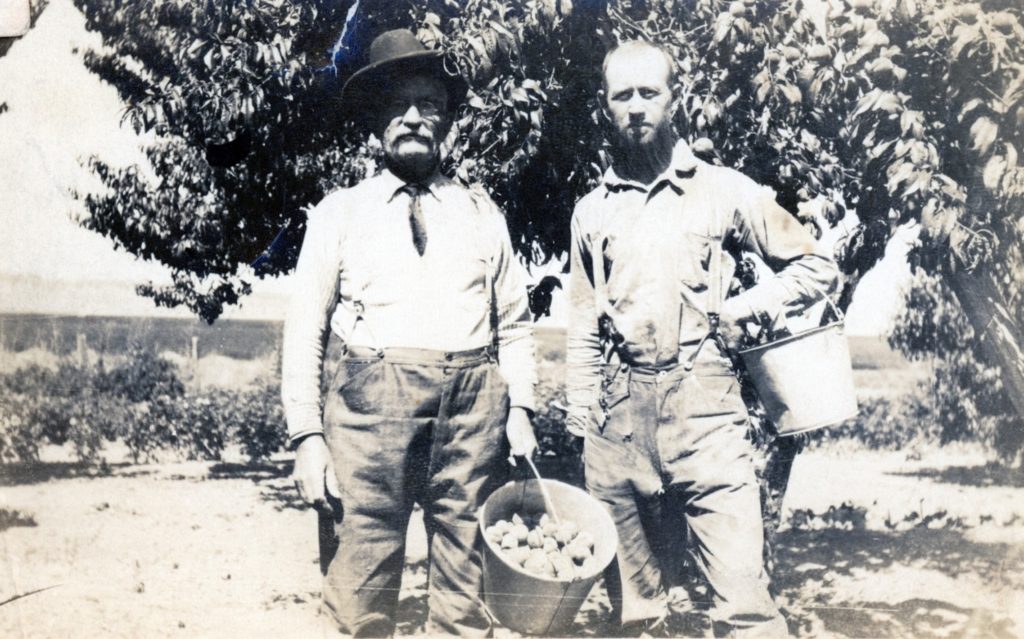
In 1884, J.W. Fritter located on a 160-acre homestead on the northeast end of Eagle Lake. In 1903, he planted an apple and peach orchard. Whether growing fruit or vegetables, Eagle Lake’s elevation and short growing season present a challenge. Fritter’s orchard was a sought after commodity.
The Lassen Advocate of September 1914 reported: “Fine Apples From Eagle Lake. The Advocate is pleased to acknowledge receipt of some fine apples on the Fritter place at Eagle Lake. J.S. Hamilton has the placed leased and brought the apples in a few days ago. They are of the Bellflower family, one of them is known as the Summer Bellflower and other as the Red Bellflower. They are large and beautiful specimens of the fruit grown on the Fritter place, over five thousand feet above sea level. Such apples have the prime requisites, color, flavor and keeping qualities.”
Tim
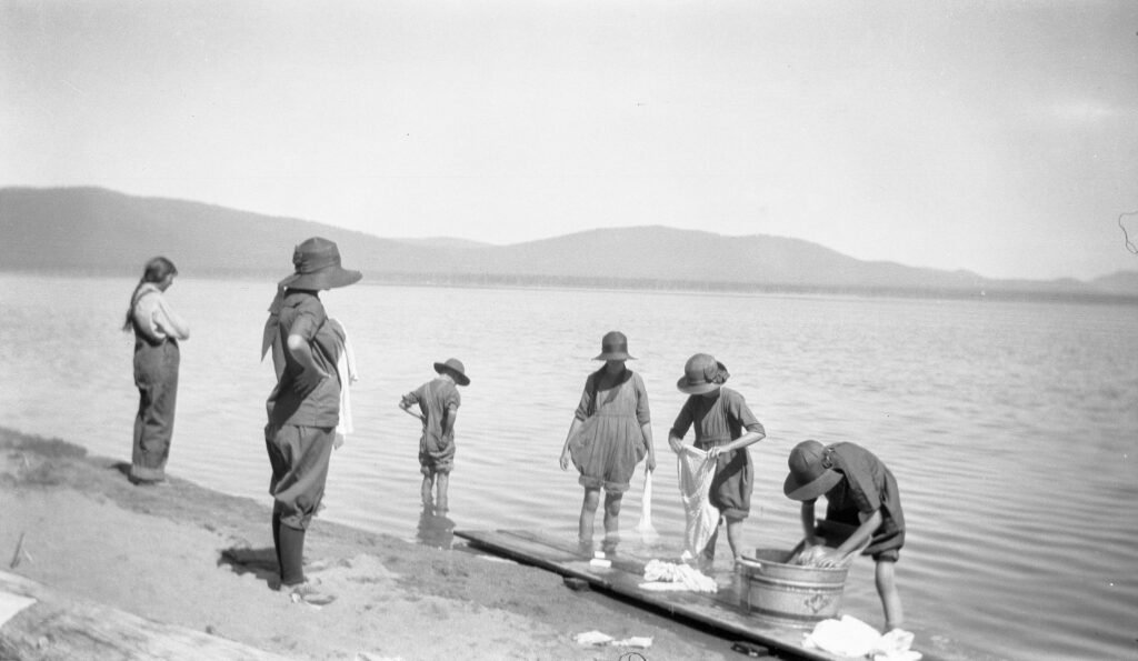
It is mid-August and because schools start earlier these days the summer camping season starts to wane. While camping may be the perfect opportunity to get away from it all, one can not escape from mundane tasks. This was especially true in the pre-RV era. Take for example, in the 1920s families would camp for a week or maybe two. It took a lot go work to prepare, pack and then navigate unknown road conditions.
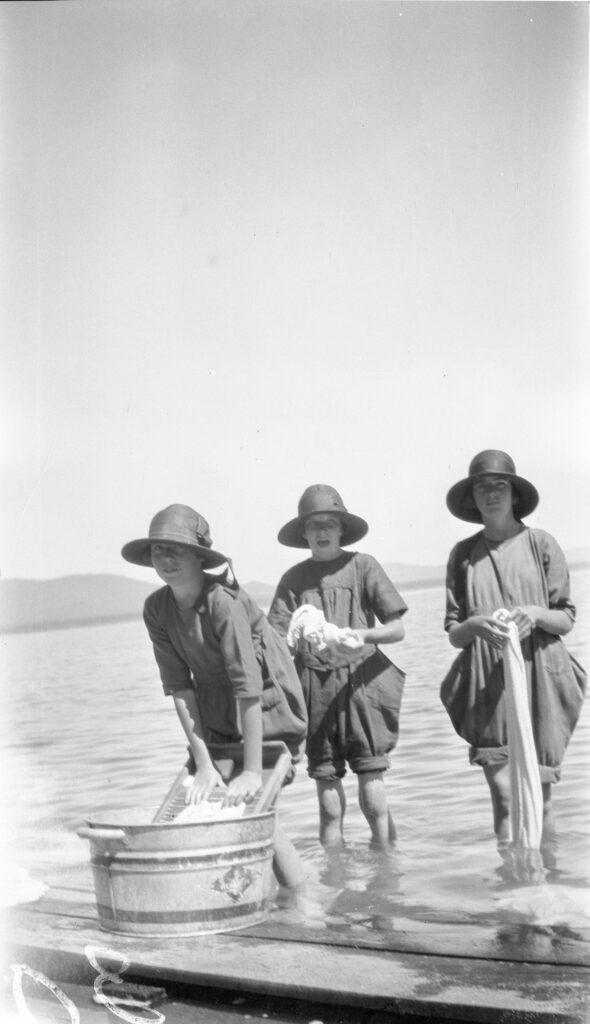
These images of a wash day at the south shore of Eagle Lake were taken by Susanville resident Mary Fern (Long) Nutting (1896-1957) Alas, I do not the particular story behind them, but I did want to share them.
Tim
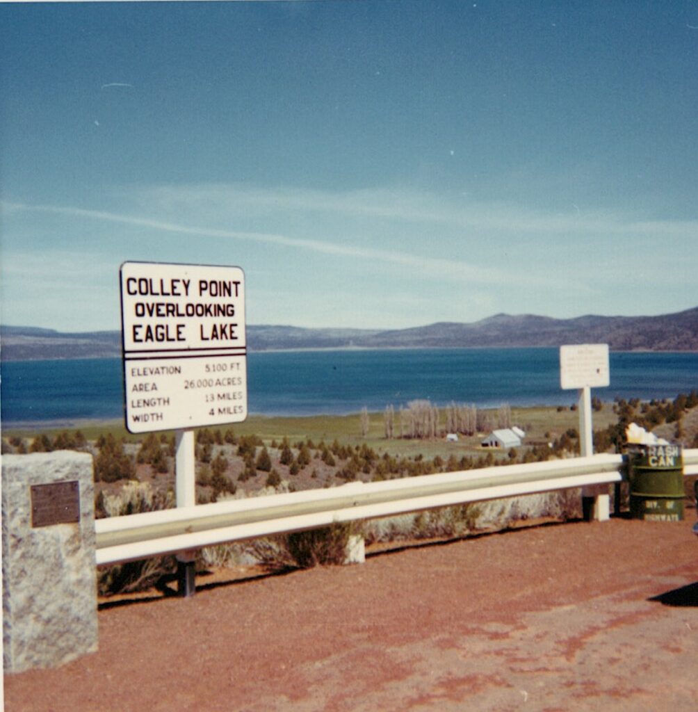
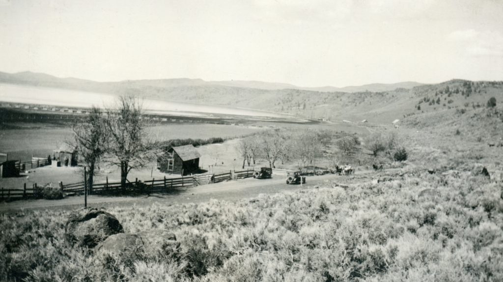
It should be noted that this is not a natural feature of the lake, like Troxel Point. It is man-made modest overlook on Highway 139, above the old Stone Ranch. In 1929, the Lassen-Modoc Joint Highway District No. 14 was formed to construct a highway from Susanville to Big Valley and the ultimate goal to the Oregon border. Due to lack of funding the highway was constructed in segments. In 1930, W.C. Colley was hired to construct the 8.37 mile segment leaving Willow Creek Valley to the Stone Ranch at Eagle Lake at a cost of $165.598.
It was only fitting that the first segment of highway, would be the last to be completed. In 1956, the last phase to necessary to complete Joint Highway District No. 14 was paving of the road between between Willow Creek Valley to the Stone Ranch. On this section of road, at Colley Point, overlooking Eagle Lake, a plaque was erected as part of the dedication ceremonies held on August 26, 1956. In December 1959, Joint Highway No. 14 was designated as State Highway Route 139.